Montezuma, Iowa

Last updated

Montezuma, Iowa
W. Emslie Block.jpeg
Poweshiek County Iowa Incorporated and Unincorporated areas Montezuma Highlighted.svg
Location of Montezuma, Iowa
Coordinates: 41°35′5″N92°31′31″W / 41.58472°N 92.52528°W / 41.58472; -92.52528
Country Flag of the United States (23px).png  United States
State Flag of Iowa.svg  Iowa
County Poweshiek
Government
  MayorColin Watts
   Iowa House Dean Fisher (R)
   Iowa Senate Annette Sweeney (R)
   U.S. Congress Ashley Hinson (R)
Area
[1]
  Total2.48 sq mi (6.44 km2)
  Land2.47 sq mi (6.40 km2)
  Water0.01 sq mi (0.04 km2)
Elevation
951 ft (290 m)
Population
 (2020)
  Total1,442
  Density583.81/sq mi (225.37/km2)
Time zone UTC-6 (Central (CST))
  Summer (DST) UTC-5 (CDT)
ZIP code
50171
Area code 641
FIPS code 19-53490
GNIS feature ID0459191
Website montezumaiowa.org

Montezuma is a city in Poweshiek County, Iowa, United States. The population was 1,442 at the time of the 2020 census. [2] It is the county seat of Poweshiek County. [3]

Contents

Geography

Montezuma's longitude and latitude coordinates in decimal form are 41.584737, -92.525258. [4]

According to the United States Census Bureau, the city has a total area of 2.49 square miles (6.45 km2), of which 2.48 square miles (6.42 km2) is land and 0.01 square miles (0.03 km2) is water. [5]

History

Montezuma was first established in 1848, when local veterans of the Mexican–American War named the city after Monteuczomah, the last Aztec emperor of Mexico. Once a hub of regional railroad transport, Montezuma has continued to evolve and grow in a variety of ways. Montezuma was also a major stop on the stagecoach line between Iowa City and Des Moines on the original Diamond Trail.

Located on the southwest corner of Montezuma's square is the Poweshiek County Historical and Genealogical Society, located in the historic Carnegie library. Housed in the former Poweshiek County Jail is the Poweshiek County History Museum.

The Scott Township School No. 7, also known as the Fitzsimmons School was moved from the original country landscape to the campus of the Poweshiek County Historical Society.

During the summer of 1934, Pentecostal evangelist Morris Plotts [6] held tent revivals throughout south central Iowa, establishing churches in Oskaloosa, New Sharon, Grinnell, Montezuma, and Lynnville. While in Montezuma, Plotts was cited with public disturbance and jailed. He continued to minister from his cell and revival broke out in the jail. Plotts' six-month sentence was suspended for good behavior.

Demographics

Historical populations
YearPop.±%
1860 564    
1870 555−1.6%
1880 921+65.9%
1890 1,062+15.3%
1900 1,210+13.9%
1910 1,172−3.1%
1920 1,273+8.6%
1930 1,257−1.3%
1940 1,477+17.5%
1950 1,460−1.2%
1960 1,416−3.0%
1970 1,353−4.4%
1980 1,485+9.8%
1990 1,651+11.2%
2000 1,440−12.8%
2010 1,462+1.5%
2020 1,442−1.4%
Source: "U.S. Census website". United States Census Bureau . Retrieved March 29, 2020. and Iowa Data Center
Source:
U.S. Decennial Census [7] [2]

2010 census

As of the census [8] of 2010, there were 1,462 people, 632 households, and 399 families living in the city. The population density was 589.5 inhabitants per square mile (227.6/km2). There were 692 housing units at an average density of 279.0 per square mile (107.7/km2). The racial makeup of the city was 98.2% White, 0.4% African American, 0.3% Native American, 0.1% Asian, 0.3% from other races, and 0.8% from two or more races. Hispanic or Latino of any race were 1.4% of the population.

There were 632 households, of which 29.4% had children under the age of 18 living with them, 48.4% were married couples living together, 10.0% had a female householder with no husband present, 4.7% had a male householder with no wife present, and 36.9% were non-families. 32.0% of all households were made up of individuals, and 14.9% had someone living alone who was 65 years of age or older. The average household size was 2.26 and the average family size was 2.83.

The median age in the city was 42.5 years. 23.5% of residents were under the age of 18; 7.3% were between the ages of 18 and 24; 23% were from 25 to 44; 26.4% were from 45 to 64; and 19.8% were 65 years of age or older. The gender makeup of the city was 47.4% male and 52.6% female.

2000 census

As of the census [9] of 2000, there were 1,440 people, 601 households, and 390 families living in the city. The population density was 586.9 inhabitants per square mile (226.6/km2). There were 641 housing units at an average density of 261.3 per square mile (100.9/km2). The racial makeup of the city was 98.75% White, 0.28% African American, 0.07% Native American, 0.35% Asian, and 0.56% from two or more races. Hispanic or Latino of any race were 0.42% of the population.

There were 601 households, out of which 28.3% had children under the age of 18 living with them, 53.7% were married couples living together, 7.8% had a female householder with no husband present, and 35.1% were non-families. 31.1% of all households were made up of individuals, and 16.1% had someone living alone who was 65 years of age or older. The average household size was 2.31 and the average family size was 2.91.

23.6% were under the age of 18, 8.9% from 18 to 24, 24.3% from 25 to 44, 20.8% from 45 to 64, and 22.4% were 65 years of age or older. The median age was 40 years. For every 100 females, there were 91.0 males. For every 100 females age 18 and over, there were 83.9 males.

The median income for a household in the city was $35,820, and the median income for a family was $43,083. Males had a median income of $31,483 versus $21,450 for females. The per capita income for the city was $17,806. About 3.8% of families and 6.4% of the population were below the poverty line, including 7.8% of those under age 18 and 5.8% of those age 65 or over.

Education

Montezuma is home to the Montezuma Community School District, a K-12 school district. The mascots are the Braves and Bravettes and the school colors are blue and white.

Girls State Basketball Champions: 1969, 1970

Boys State Basketball Champions: 1971, 1990, 2021 [10]

Attractions

Montezuma's agricultural heritage is celebrated in barn quilt art and renewed interest in local preservation has inspired many to continue living out that history. Montezuma is the inaugural home to the first town square Bill of Rights monument in the United States.

Poweshiek County Freedom Rock

Freedom Rock painter Raymond “Bubba” Sorensen II of Greenfield finished the Poweshiek County Freedom Rock in 2016, and is located on the southeast corner of the courthouse square.

Recreational and residential lakes

The development of Diamond Lake, Lake Ponderosa, and Lake Silverado add to the recreational options of the area.[ citation needed ] Green spaces and wildlife areas like Fox Forest offer hiking and equestrian trails, as well as observation of native vegetation and wildflowers.[ citation needed ] Nearby Fleming Woods State Preserve offers sanctuary to several species of other indigenous plant life and animals.[ citation needed ] It is believed that Chief Poweshiek and other Native Americans once lived in these areas.[ citation needed ]

Churches and denominations

Montezuma is home to several churches. These include the Community Hope Assembly of God, First Evangelical Presbyterian, United Methodist Church, Jackson Church of Christ, Faith Christian Center and West Liberty Church. [11] [12] [13] [14]

Several of these congregations offer Sunday and mid-week services as well as weekly Bible study groups, children's education programs, youth group activities, and missions work opportunities.[ citation needed ]

Infrastructure

Self-Sustaining Municipalities

Montezuma has its own Water Department [15] , with water sourced by nearby Diamond Lake.

In February 2024, Montezuma was selected as the nation's first microgrid community [16] , in conjunction with the U.S. Department of Energy and Iowa State University.

Transportation

Montezuma is located approximately 8 miles south of the exit 191 on Interstate 80 on U.S. Route 63. The city is also serviced by Iowa Highway 85 and county road F57. [17]

Healthcare

Montezuma residents have access to UnityPoint Health - Grinnell Montezuma Medical Clinic, located at 101 West Washington. When hospitalization is required the closest and most convenient hospital for residents is Grinnell Regional Medical Center, located at 210 4th Avenue in Grinnell, Iowa.

Notable people

See also

Related Research Articles

<span class="mw-page-title-main">Poweshiek County, Iowa</span> County in Iowa, United States

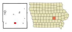
Poweshiek County is a county in the southeastern part of the U.S. state of Iowa. As of the 2020 census, the population was 18,662. The county seat is Montezuma. The county is named for the chief of the Fox tribe who signed the treaty ending the Black Hawk War. It lies along Interstate 80 between Des Moines and Iowa City. Poweshiek County's largest city is Grinnell.

<span class="mw-page-title-main">Jasper County, Iowa</span> County in Iowa, United States

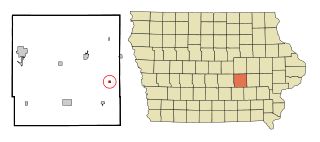
Jasper County is a county in the U.S. state of Iowa. As of the 2020 census, the population was 37,813. The county seat is Newton. The county was organized in 1846 and is named after Sergeant William Jasper, a Revolutionary War hero.

<span class="mw-page-title-main">Harpers Ferry, Iowa</span> City in Iowa, United States

Harpers Ferry is a city in Taylor Township, Allamakee County, Iowa, United States. The population was 262 at the time of the 2020 census.

<span class="mw-page-title-main">St. Olaf, Iowa</span> City in Iowa, United States

St. Olaf is a large village in Clayton County, Iowa, United States. The population was 106 at the time of the 2020 census, down from 136 in 2000. Swiss Valley has a large cheese packaging plant in St. Olaf. There is also a large feed granary, a post office, and a tavern.

<span class="mw-page-title-main">Maynard, Iowa</span> City in Iowa, United States

Maynard is a city in Fayette County, Iowa, United States. The population was 476 at the time of the 2020 census.

<span class="mw-page-title-main">Millersburg, Iowa</span> City in Iowa, United States

Millersburg is a city in Iowa County, Iowa, United States. The population was 135 at the time of the 2020 census.

<span class="mw-page-title-main">Lynnville, Iowa</span> City in Iowa, United States

Lynnville is a city in Jasper County, Iowa, United States. The population was 380 at the time of the 2020 census.

<span class="mw-page-title-main">Oakland Acres, Iowa</span> City in Iowa, United States

Oakland Acres is a city in Jasper County, Iowa, United States. The population was 176 at the time of the 2020 census.

<span class="mw-page-title-main">Sully, Iowa</span> City in Iowa, United States

Sully is a city located in Jasper County, Iowa, United States, named after railroad man Alfred Sully. The population was 881 at the time of the 2020 census.

<span class="mw-page-title-main">Thornburg, Iowa</span> City in Iowa, United States

Thornburg is a village in Keokuk County, Iowa, United States. The population was 45 at the time of the 2020 census. Its sole enterprise is the Tri-County Community School, a public school serving grades K-12.

<span class="mw-page-title-main">Brooklyn, Iowa</span> City in Iowa, United States

Brooklyn is a city in Poweshiek County, Iowa, United States. The population was 1,502 at the 2020 census. It is located just off U.S. Route 6 and a few miles north of Interstate 80. Near the center of town, Brooklyn boasts a large display of flags from each of the fifty states, branches of the military, and a smattering of other sources. The city bills itself as "Brooklyn: Community of Flags."

<span class="mw-page-title-main">Deep River, Iowa</span> City in Iowa, United States

Deep River is a city in Poweshiek County, Iowa, United States. It is also the name of the township which includes the city. The city population was 249 at the time of the 2020 census.

<span class="mw-page-title-main">Grinnell, Iowa</span> City in Iowa, United States

Grinnell is a city in Poweshiek County, Iowa, United States. The population was 9,564 at the time of the 2020 census. It is best known for being the home of Grinnell College, as well as being the location of the Merchants' National Bank building, designed by famous architect Louis Sullivan.

<span class="mw-page-title-main">Guernsey, Iowa</span> City in Iowa, United States

Guernsey is a town in Poweshiek County, Iowa, United States. The population was 63 at the time of the 2020 census.

<span class="mw-page-title-main">Hartwick, Iowa</span> City in Iowa, United States

Hartwick is a city in Poweshiek County, Iowa, United States. The population was 92 at the time of the 2020 census.

<span class="mw-page-title-main">Malcom, Iowa</span> City in Iowa, United States

Malcom is a city in Poweshiek County, Iowa, United States. The population was 270 at the time of the 2020 census. The city was named for an early settler. The town's major businesses include BASF, a restaurant, and Dayton Meat Products.

<span class="mw-page-title-main">Searsboro, Iowa</span> Unincorporated community in Iowa, United States

Searsboro in an unincorporated community in Poweshiek County, Iowa, United States. The population was 148 at the 2010 census. The city attempted to disincorporate in 2011, but the move failed when Poweshiek County refused to take control of the city's infrastructure.

<span class="mw-page-title-main">Tama, Iowa</span> City in Iowa, United States

Tama is a city in Tama County, Iowa, United States. The population was 3,130 at the time of the 2020 census.

<span class="mw-page-title-main">Montezuma, Kansas</span> City in Gray County, Kansas

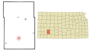
Montezuma is a city in Gray County, Kansas, United States. As of the 2020 census, the population of the city was 975.

<span class="mw-page-title-main">Barnes City, Iowa</span> City in Iowa, United States

Barnes City is a city in Mahaska and Poweshiek counties in the U.S. state of Iowa. The population was 156 at the 2020 census.

References

  1. "2020 U.S. Gazetteer Files". United States Census Bureau. Retrieved March 16, 2022.
  2. 1 2 "2020 Census State Redistricting Data". census.gov. United states Census Bureau. Retrieved August 12, 2021.
  3. "Find a County". National Association of Counties. Retrieved June 7, 2011.
  4. "US Gazetteer files: 2010, 2000, and 1990". United States Census Bureau. February 12, 2011. Retrieved April 23, 2011.
  5. "US Gazetteer files 2010". United States Census Bureau. Archived from the original on July 2, 2012. Retrieved May 11, 2012.
  6. "Morris Plotts' revival in Montezuma". Assemblies of God Heritage.
  7. "Census of Population and Housing". Census.gov. Retrieved June 4, 2015.
  8. "U.S. Census website". United States Census Bureau . Retrieved May 11, 2012.
  9. "U.S. Census website". United States Census Bureau . Retrieved January 31, 2008.
  10. https://www.iahsaa.org/wp-content/uploads/2020/12/2020-21-Basketball-Stat-Book-12.4.20.pdf
  11. Community Hope Assembly of God
  12. First Evangelical Presbyterian
  13. United Methodist Church
  14. Faith Christian Center
  15. "Water Department". City of Montezuma.
  16. "Advisory: US Department of Energy selects ISU-led project to build rural Iowa's first 'microgrid' • News Service • Iowa State University". Iowa State News.
  17. "Montezuma, Iowa". mapquest. Retrieved May 16, 2011.
  18. "Brown Robin". Minnesota Legislative Reference Library. Retrieved May 16, 2011.
  19. "CEO of Iowa-based Brownells elected NRA president". The Gazette. Folience. May 10, 2017. Archived from the original on October 6, 2023. Retrieved October 6, 2023.
  20. "Thomas Jefferson Cowie". Arlington National Cemetery. Retrieved May 16, 2011.
  21. "CUTTS, Marsena Edgar". Biographical Directory of the United States Congress. Retrieved May 16, 2011.
  22. 'Attorney in Tinker free speech case dies,' Des Moines Register, MacKenzie Elmer, October 21, 2016
  23. Weingroff, Richard F. (1996). "Man of the Century". United States Department of Transportation. Retrieved August 22, 2011.