
Etobicoke is an administrative district and former city within Toronto, Ontario, Canada. Comprising the city's west-end, Etobicoke is bordered on the south by Lake Ontario, on the east by the Humber River, on the west by Etobicoke Creek, the cities of Brampton, and Mississauga, the Toronto Pearson International Airport, and on the north by the city of Vaughan at Steeles Avenue West.

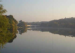
The Humber River is a river in Southern Ontario, Canada. It is in the Great Lakes Basin, is a tributary of Lake Ontario and is one of two major rivers on either side of the city of Toronto, the other being the Don River to the east. It was designated a Canadian Heritage River on September 24, 1999.
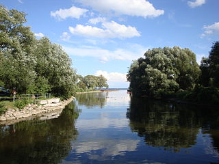
The Otonabee River is a river in Peterborough County in Central Ontario, Canada. The river flows from Katchewanooka Lake, at the north end of the community of Lakefield, through the city of Peterborough to Rice Lake. It is in the Great Lakes Basin and forms part of the Trent-Severn Waterway.
Etobicoke Creek is a river in the Greater Toronto Area of Ontario, Canada. It is a tributary of Lake Ontario and runs from Caledon to southern Etobicoke, part of the City of Toronto. The creek is within the jurisdiction of the Toronto and Region Conservation Authority.

The Toronto waterfront is the lakeshore of Lake Ontario in the city of Toronto, Ontario, Canada. It spans 46 kilometres between the mouth of Etobicoke Creek in the west and the Rouge River in the east.

The Barron River is a river in the Saint Lawrence River drainage basin in Nipissing District and Renfrew County, Ontario, Canada. It flows from Clemow Lake in northern Algonquin Provincial Park and joins the Petawawa River, whose southern branch it forms, in the municipality of Laurentian Hills, near the municipality of Petawawa.

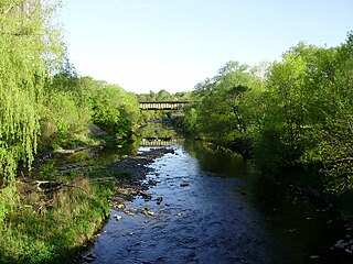
Mimico Creek is a stream that flows through Brampton, Mississauga and Toronto in the Greater Toronto Area of Ontario, Canada. It is 33 kilometres (21 mi) long, is in the Great Lakes Basin, and is a tributary of Lake Ontario.

Garrison Creek was a short stream about 7.7 kilometres (4.8 mi) long that flowed southeast into the west side of Toronto Harbour in Ontario, Canada. It has been largely covered over and filled in, but geographical traces of the creek can still be found, including the natural amphitheatre known as Christie Pits and the off-leash dog "bowl" of Trinity Bellwoods Park. The name "Garrison Creek" was used because Fort York was built near the creek mouth. Volunteers lead popular tours of the course of the old watershed.

The Toronto Purchase was the sale of lands in the Toronto area from the Mississaugas of New Credit to the British crown. An initial, disputed, agreement was made in 1787, in exchange for various items. The agreement was revisited in 1805, intended to clarify the area purchased. The agreement remained in dispute for over 200 years until 2010, when a settlement for the land was made between the Government of Canada and the Mississaugas for the land and other lands in the area.

Islington-City Centre West is a commercial and residential neighbourhood in Toronto, Ontario, Canada. One of four central business districts outside Downtown Toronto, it is bounded by Rathburn Road to the north, Islington Avenue to the east, Bloor Street to the south, Mimico Creek to the west.

The Queensway–Humber Bay, known officially as Stonegate–Queensway, is a neighbourhood in the southwest of Toronto, Ontario, Canada. It is located in the southeast area of the former City of Etobicoke.
The Toronto ravine system is a distinctive feature of the city's geography, consisting of a network of deep ravines, which forms a large urban forest that runs through most of Toronto. The ravine system is the largest in any city in the world, with the Ravine and Natural Feature Protection Bylaw protecting approximately 110 square kilometres (42 sq mi) of public and privately-owned land. The ravine system has been presented as a central characteristic of the city, with the size of the ravine system leading Toronto to be described as "a city within a park".

Long Branch is a neighbourhood and former municipality in the south-west of Toronto, Ontario, Canada. It is located in the south-western corner of the former Township of Etobicoke on the shore of Lake Ontario. The Village of Long Branch was a partially independent municipality from 1930 to 1967. Long Branch is located within a land grant from the government to Colonel Samuel Smith in the late 18th century. After Smith's death, a small portion of it was developed as a summer resort in the late 1800s.
Little Etobicoke Creek is a small river in Mississauga, Regional Municipality of Peel in the Greater Toronto Area of Ontario, Canada. It is in the Great Lakes Basin and is a right tributary of Etobicoke Creek, which flows to Lake Ontario.

Jackson Creek is a watercourse that flows into Lake Ontario near 10th Street, in the New Toronto neighbourhood of Etobicoke, a suburb of Toronto, Ontario, Canada. It is part of the Great Lakes Basin. Its headwaters were approximately five kilometers northwest—north of Bloor Street, near Highway 427. Portions of the watercourse remain above-ground today. The creek is named for Jackson Farm, the historical location of its mouth.
Jackson Creek is a creek in Peterborough, Ontario, Canada. It is part of the Great Lakes Basin, and flows to its mouth at Little Lake as a right tributary of the Otonabee River. The Otonabee flows via the Trent River to Lake Ontario.

Superior Creek was a stream draining into Lake Ontario in the former village of Mimico, Ontario, Canada. It was approximately 3 kilometers long, with headwaters near the present intersection of Kipling Avenue and The Queensway. The lower reaches of the creek had become polluted, and were buried in a sewer in 1915. In 1954, citizens of Mimico living in newly built houses near the upper reaches complained that the creek flooded, and lobbied to have the creek replaced by storm sewers, and a study was prepared. According to HTO: Toronto's water from Lake Iroquois to lost rivers to low-flow toilets, the creek was buried around 1965.

Bonar Creek was a creek in Mimico, Ontario, Canada. It was a tributary of the still-existing Mimico Creek, a watercourse that empties into Lake Ontario. Bonar Creek joined Mimico Creek 130 metres (430 ft) north of Lake Shore Boulevard, in the marsh at the mouth of the Mimico Creek.
Marie Curtis Park is a public park in Toronto, Ontario, Canada. It is located at the mouth of the Etobicoke Creek on Lake Ontario in the Long Branch neighbourhood. Marie Curtis Park was built after the devastating floods of Hurricane Hazel in 1954 destroyed 56 homes and cottages on the site, leaving 1,868 persons homeless and 81 dead. It is named after Marie Curtis, the reeve of Long Branch at the time of its construction. Long Branch at the time was a separate village; it's now amalgamated into the City of Toronto government.

The Toronto waterway system comprises a series of natural and man-made watercourses in the Canadian city of Toronto. The city is dominated by a large river system spanning most of the city including the Don River, Etobicoke Creek, Highland Creek, Humber River, Mimico Creek and Rouge River.

