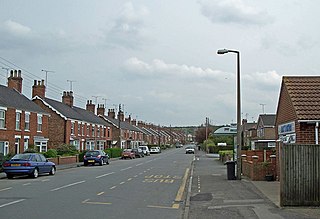
Scunthorpe is an industrial town in the North Lincolnshire district of Lincolnshire, England. It is Lincolnshire's third most populous settlement, after Lincoln and Grimsby, with a population of 81,286 in 2021.
Humberside was a non-metropolitan and ceremonial county in Northern England from 1 April 1974 until 1 April 1996. It was composed of land from either side of the Humber Estuary, created from portions of the East Riding of Yorkshire, West Riding of Yorkshire, and the northern part of Lindsey, Lincolnshire. The county council's headquarters was County Hall at Beverley, inherited from East Riding County Council. Its largest settlement and only city was Kingston upon Hull. Other notable towns included Goole, Beverley, Scunthorpe, Grimsby, Cleethorpes and Bridlington. The county stretched from Wold Newton at its northern tip to a different Wold Newton at its southernmost point.

The M180 is a 25.5-mile (41 km) motorway in eastern England, starting at junction 5 on the M18 motorway in Hatfield, within the Metropolitan Borough of Doncaster, South Yorkshire, and terminating at Barnetby, Lincolnshire, some 10 miles (16 km) from the port of Immingham and 14 miles (23 km) from the port of Grimsby. The A180 road continues to the east for Grimsby, Cleethorpes and Immingham. Scunthorpe, Lincoln, Hull, Brigg, Bawtry and the Isle of Axholme can be accessed using the motorway. Humberside Airport, the now-closed Doncaster Sheffield Airport, and the Killingholme, Humber and Lindsey oil refineries are close to the motorway. The road forms part of the unsigned Euroroute E22 and is the main route along the south bank of the Humber Estuary.

The Parts of Lindsey are a traditional division of Lincolnshire, England, covering the northern part of the county. The Isle of Axholme, which is on the west side of the River Trent, has normally formed part of it. The district's name originated from the Kingdom of Lindsey of Anglo-Saxon times, whose territories were merged with that of Stamford to form Lincolnshire.

Glanford was, from 1974 to 1996, a local government district with borough status in the non-metropolitan county of Humberside, England.

The Isle of Axholme is a geographical area in England: a part of North Lincolnshire that adjoins South Yorkshire. It is located between the towns of Scunthorpe and Gainsborough, both of which are in the traditional West Riding of Lindsey, and Doncaster.
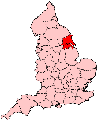
Scunthorpe is a constituency represented in the House of Commons of the UK Parliament since 2019 by Holly Mumby-Croft, a member of the Conservative Party, when she gained the seat from the Labour Party.

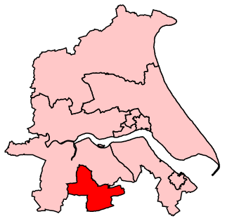
Brigg and Goole is a constituency in Yorkshire and Lincolnshire represented in the House of Commons of the UK Parliament since 2010 by Andrew Percy, a Conservative.
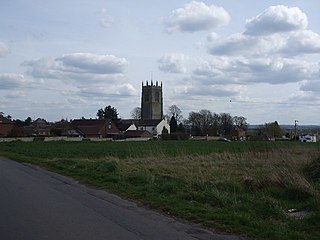
Barnetby le Wold is a village and civil parish in North Lincolnshire, Lincolnshire, England, located between Brigg and Immingham. The village is also near Barton-upon-Humber. The population of the parish in the 2001 census was 1,593. This increased by 148 to 1,741 in the 2011 census.

The Borough of Boothferry was, from 1 April 1974 to 1 April 1996, a local government district with borough status within the non-metropolitan county of Humberside. The district is now split between the East Riding of Yorkshire and North Lincolnshire.

South Humberside is a former postal county of England. It was introduced by the Royal Mail on 1 July 1974, when some addresses were altered in response to the changes in administration brought about under the Local Government Act 1972.

Isle of Axholme was a rural district in Lincolnshire, Parts of Lindsey from 1894 to 1974. It was formed under the Local Government Act 1894 based on the Lincolnshire parts of the Thorne rural sanitary district and two parishes of the Goole RSD.
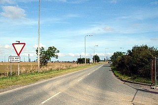
The A1077 road runs through North Lincolnshire, England, between Scunthorpe and South Killingholme.
The Great Grimsby and Sheffield Junction Railway was an early British railway company which existed between 1845 and 1847 with the intention of providing rail services between Grimsby, New Holland and Gainsborough in the county of Lincolnshire. It amalgamated with the Sheffield, Ashton-Under-Lyne and Manchester Railway and the Sheffield and Lincolnshire Junction Railway, the three being renamed the Manchester, Sheffield and Lincolnshire Railway in 1847.
Haxey is a town and civil parish on the Isle of Axholme in the North Lincolnshire unitary authority of Lincolnshire, England. It is directly south of Epworth, south-west of Scunthorpe, north-west of Gainsborough, east of Doncaster and north-north-west of Lincoln, with a population of 4,584 at the 2011 census. The town was regarded as the historic capital of the Isle of Axholme.

The South Humberside Main Line runs from Doncaster on the East Coast Main Line to Thorne where it diverges from the Sheffield to Hull Line. It then runs eastwards to Scunthorpe and the Humber ports of Immingham and Grimsby, with the coastal resort of Cleethorpes as terminus.


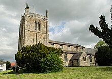
 St. Hybald Church in Hibaldstow, Brigg
 Scunthorpe Steelworks in Scunthorpe
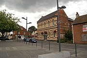 Crowle town centre