Port Hope, Michigan

Last updated

Port Hope, Michigan
PortHope-MI-01s.jpg
Looking south along M-25 (Main Street)
Port Hope, MI location.png
Location within Huron County
USA Michigan location map.svg
Red pog.svg
Port Hope
Location within the state of Michigan
Coordinates: 43°56′27″N82°42′49″W / 43.94083°N 82.71361°W / 43.94083; -82.71361
Country United States
State Michigan
County Huron
Township Rubicon
Established1887
Government
  Type Village council
  PresidentGary Schave
Area
[1]
  Total1.01 sq mi (2.62 km2)
  Land1.01 sq mi (2.62 km2)
  Water0.00 sq mi (0.00 km2)
Elevation
607 ft (185 m)
Population
 (2020)
  Total293
  Density289.81/sq mi (111.85/km2)
Time zone UTC-5 (Eastern (EST))
  Summer (DST) UTC-4 (EDT)
ZIP code(s)
48468
Area code 989
FIPS code 26-65800 [2]
GNIS feature ID0635265 [3]
Website Official website

Port Hope is a village in Huron County of the U.S. state of Michigan. The population was 267 at the 2010 census. The village is within Rubicon Township.

Contents

Geography

According to the United States Census Bureau, the village has a total area of 1.01 square miles (2.62 km2), all land. [4]

Demographics

Historical population
CensusPop.Note
1890 398
1900 319−19.8%
1910 3447.8%
1920 3532.6%
1930 298−15.6%
1940 3135.0%
1950 35312.8%
1960 349−1.1%
1970 3778.0%
1980 369−2.1%
1990 313−15.2%
2000 310−1.0%
2010 267−13.9%
2020 2939.7%
U.S. Decennial Census [5]

2010 census

As of the census [6] of 2010, there were 267 people, 133 households, and 80 families living in the village. The population density was 264.4 inhabitants per square mile (102.1/km2). There were 201 housing units at an average density of 199.0 per square mile (76.8/km2). The racial makeup of the village was 93.3% White, 1.9% Native American, and 4.9% from two or more races. Hispanic or Latino of any race were 2.2% of the population.

There were 133 households, of which 16.5% had children under the age of 18 living with them, 48.9% were married couples living together, 8.3% had a female householder with no husband present, 3.0% had a male householder with no wife present, and 39.8% were non-families. 36.1% of all households were made up of individuals, and 24% had someone living alone who was 65 years of age or older. The average household size was 2.01 and the average family size was 2.58.

The median age in the village was 54.9 years. 15.7% of residents were under the age of 18; 6% were between the ages of 18 and 24; 14.6% were from 25 to 44; 29.3% were from 45 to 64; and 34.5% were 65 years of age or older. The gender makeup of the village was 49.8% male and 50.2% female.

2000 census

As of the census [2] of 2000, there were 310 people, 132 households, and 95 families living in the village. The population density was 308.7 inhabitants per square mile (119.2/km2). There were 203 housing units at an average density of 202.2 per square mile (78.1/km2). The racial makeup of the village was 98.71% White and 1.29% Native American. Hispanic or Latino of any race were 0.32% of the population.

There were 132 households, out of which 24.2% had children under the age of 18 living with them, 61.4% were married couples living together, 7.6% had a female householder with no husband present, and 28.0% were non-families. 25.8% of all households were made up of individuals, and 17.4% had someone living alone who was 65 years of age or older. The average household size was 2.32 and the average family size was 2.67.

In the village, the population was spread out, with 20.0% under the age of 18, 5.5% from 18 to 24, 20.3% from 25 to 44, 26.1% from 45 to 64, and 28.1% who were 65 years of age or older. The median age was 48 years. For every 100 females, there were 96.2 males. For every 100 females age 18 and over, there were 101.6 males.

The median income for a household in the village was $31,071, and the median income for a family was $34,167. Males had a median income of $26,875 versus $18,125 for females. The per capita income for the village was $16,428. About 5.6% of families and 4.6% of the population were below the poverty line, including none of those under age 18 and 6.0% of those age 65 or over.

Education

Port Hope High School's mascot is the Bluestars. Port Hope students in grades 6–12 now get their education in Kinde, as the local school board voted in 2014 to contract educational services from North Huron Schools. Port Hope Schools, which had been in operation since 1925, closed its doors in the spring of 2015.

History

In 1851, William Stafford, while living in Lexington, bought the first parcel of land in what is now Port Hope, with Reuben Dimond. Later, Stafford and William Southard invested in buying up forty-acre parcels from the government. These parcels had been set aside as pensions for veterans of the War of 1812. Traveling to the area by schooner, Southard was let off at some distance from shore, due to a pending storm. Rowing in a skiff in the wind, he vowed that if he made it to shore, he would name the spot Port Hope.

Stafford, along with others, opened up the area to lumbering and by 1858 his company dock was constructed and mills were in operation. The chimney from one of those mills can be seen and is the last standing chimney in Michigan from the lumbering era.

Port Hope survived the 1871 fire and was able to return to lumbering, but after the second fire in 1881 the trees were gone, and farming became the focus. Stafford adjusted and built a flour mill, elevator and a new dock.

Port Hope was incorporated in 1887, with the railroad coming in 1903. A walking tour brochure, with some of the 11 historic sites listed on the National Register of Historic Places, is available for visitors.

Recreation

Stafford County Park is the site of softball tournaments and recreation activities throughout the summer, the 38 acre park also offers all the campground conveniences. A national historic site, the Sawmill chimney erected in 1858 graces the waterfront adjacent to a large enclosed pavilion. Features 73 sites and six camper cabins on 38 acres. Modern, tent and group camping. Features electricity, running water, and flush toilets. Showers and a sanitary station, boat launch, picnic grounds, shelters, swimming, playground and fishing. Open May 1 through October 15.

Notable People

Hope Juska - Socialite

Related Research Articles

<span class="mw-page-title-main">Clayhatchee, Alabama</span> Town in Alabama, United States

Clayhatchee is a town in Dale County, Alabama, United States. At the 2010 census the population was 589, up from 501 in 2000. It was incorporated in April 1967. It is part of the Ozark Micropolitan Statistical Area.

Schall Circle is a census-designated place (CDP) in Palm Beach County, Florida, United States. It is part of the Miami metropolitan area of South Florida. The population was 792 at the 2020 US census.

<span class="mw-page-title-main">Lee, Illinois</span> Village in Illinois, United States

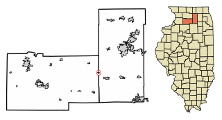
Lee is a village in DeKalb County and Lee County, Illinois, United States. The population was 313 at the 2020 census.

<span class="mw-page-title-main">Rubicon Township, Michigan</span> Civil township in Michigan, United States

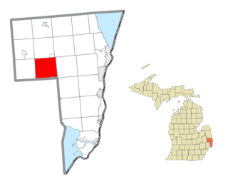
Rubicon Township is a civil township of Huron County in the U.S. state of Michigan. The population was 705 at the 2020 census.

<span class="mw-page-title-main">Riley Township, St. Clair County, Michigan</span> Civil township in Michigan, United States

Riley Township is a civil township of St. Clair County in the U.S. state of Michigan. The population was 3,199 at the 2020 Census.

<span class="mw-page-title-main">Thedford, Nebraska</span> Village in and county seat of Thomas County Nebraska, United States

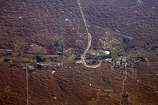
Thedford is a village and county seat of Thomas County, Nebraska, United States. The population was 208 at the 2020 census.

<span class="mw-page-title-main">Stafford, New York</span> Town in New York, United States

Stafford is a town in Genesee County, New York, United States. The population was 2,459 at the 2010 census. The town was named after a town of the same name in England.

Rodman is a town in Jefferson County, New York, United States. The population was 1,176 at the 2010 census. The name is derived from a public official, Daniel Rodman.

<span class="mw-page-title-main">Chimney Rock, North Carolina</span> Village in North Carolina, United States

Chimney Rock is a village in Rutherford County, North Carolina, United States. The population was 113 at the 2010 census. The village takes its name from a large granite outcropping located on a summit above the village itself in Chimney Rock State Park.

<span class="mw-page-title-main">Rayland, Ohio</span> Village in Ohio, United States

Rayland is a village in southern Jefferson County, Ohio, United States, along the Ohio River. The population was 389 at the 2020 census. It is part of the Weirton–Steubenville metropolitan area.

<span class="mw-page-title-main">Port Jefferson, Ohio</span> Village in Ohio, United States

Port Jefferson is a village in Salem Township, Shelby County, Ohio, United States. The population was 308 at the 2020 census.

<span class="mw-page-title-main">Monroe, Pennsylvania</span> Borough in Pennsylvania, United States

Monroe is a borough in Bradford County, Pennsylvania, United States. It is part of Northeastern Pennsylvania. The population was 482 at the 2020 census.

<span class="mw-page-title-main">Rosholt, Wisconsin</span> Village in Wisconsin, United States

Rosholt is a village in Portage County, Wisconsin, United States. The population was 478 at the 2020 census.

<span class="mw-page-title-main">Weyerhaeuser, Wisconsin</span> Village in Wisconsin, United States

Weyerhaeuser is a village in Rusk County, Wisconsin, United States. The population was 238 at the 2010 census.

<span class="mw-page-title-main">Wilson, St. Croix County, Wisconsin</span> Village in Wisconsin, United States

Wilson is a village in St. Croix County, Wisconsin, United States. The population was 184 at the 2010 census.

<span class="mw-page-title-main">Boulder, Wyoming</span> CDP in Wyoming, United States

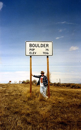
Boulder is a census-designated place (CDP) in Sublette County, Wyoming, United States. The population was 170 at the 2010 census.

<span class="mw-page-title-main">Van Buren (CDP), Maine</span> Census-designated place in Maine, United States

Van Buren is a census-designated place (CDP) comprising the main village within the town of Van Buren in Aroostook County, Maine, United States. The population of the CDP was 1,937 at the 2010 census, out of a population of 2,171 for the entire town.

<span class="mw-page-title-main">Wauzeka, Wisconsin</span> Village in Wisconsin, United States

Wauzeka is a village in Crawford County, Wisconsin, United States. The population was 628 at the 2020 census. The village is located within the Town of Wauzeka near the confluence of the Kickapoo River and Wisconsin River.

<span class="mw-page-title-main">Birchwood, Wisconsin</span> Village in Wisconsin, United States

Birchwood is a village in Washburn County, Wisconsin, United States. The population was 402 at the 2020 census. The village is located within the Town of Birchwood.

<span class="mw-page-title-main">Van Buren, Maine</span> Town in Maine, United States

Van Buren is a town on the Saint John River in Aroostook County, Maine, United States; located across from Saint-Leonard, New Brunswick, Canada. The population was 2,038 at the 2020 census. It is named after U.S. President Martin Van Buren.

References

  1. "2020 U.S. Gazetteer Files". United States Census Bureau. Retrieved May 21, 2022.
  2. 1 2 "U.S. Census website". United States Census Bureau . Retrieved January 31, 2008.
  3. "US Board on Geographic Names". United States Geological Survey. October 25, 2007. Retrieved January 31, 2008.
  4. "US Gazetteer files 2010". United States Census Bureau. Archived from the original on July 2, 2012. Retrieved November 25, 2012.
  5. "Census of Population and Housing". Census.gov. Retrieved June 4, 2015.
  6. "U.S. Census website". United States Census Bureau . Retrieved November 25, 2012.

43°56′27″N82°42′46″W / 43.94083°N 82.71278°W / 43.94083; -82.71278