Kendall is an unincorporated area and census-designated place in Miami-Dade County, Florida. It is part of the Miami metropolitan area of South Florida. At the 2020 census, the area had a population of 80,241.

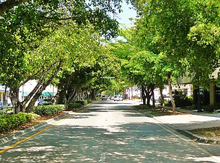
Coconut Grove, also known colloquially as “The Grove,” is an affluent and the oldest continuously inhabited neighborhood of Miami in Miami-Dade County, Florida. The neighborhood is roughly bounded by North Prospect Drive to the south, LeJeune Road to the west, South Dixie Highway and Rickenbacker Causeway to the north, and Biscayne Bay to the east. It is south of the neighborhoods of Brickell and The Roads and east of Coral Gables. The neighborhood's name has been sometimes spelled "Cocoanut Grove" but the definitive spelling "Coconut Grove" was established when the city was incorporated in 1919.

Miami-Dade Transit (MDT) is the primary public transit authority of Miami, Florida and the greater Miami-Dade County area. It is the largest transit system in Florida and the 15th-largest transit system in the United States. As of 2023, the system has 80,168,700 rides per year, or about 277,400 per weekday in the fourth quarter of 2023. MDT operates the Metrobus with their paratransit STS systems run by LSF. MDT also operates two rail transit systems: Metrorail and Metromover.

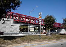
Metromover is a free to ride automated people mover system operated by Miami-Dade Transit in Miami, Florida, United States. Metromover serves the Downtown Miami, Brickell, Park West and Arts & Entertainment District neighborhoods. Metromover connects directly with Metrorail at Government Center and Brickell stations. It also connects to Metrobus with dedicated bus loops at Government Center and Adrienne Arsht Center station. It originally began service to the Downtown/Inner Loop on April 17, 1986, and was later expanded with the Omni and Brickell Loop extensions on May 26, 1994.
Government Center station is an intermodal transit hub in the Government Center district of Downtown Miami, Florida. It is operated by Miami-Dade Transit and serves as a transfer station for the Metrorail and Metromover rapid transit systems and as a bus station for Metrobus, Paratransit, and Broward County Transit buses. MiamiCentral is directly connected via a pedestrian bridge over NW 3rd Street. The station is located near the intersection of Northwest First Street and First Avenue, a part of the Stephen P. Clark Government Center Building. It opened to service May 20, 1984, next to the site of a former FEC railway station which is now MiamiCentral.

Brickell station is a Metrorail rapid transit station in Miami, Florida, serving the system's Green and Orange Lines. One of the core stations of Miami's public transport network, it serves the financial district of Brickell. Combined, the Metrorail and Metromover station complex at Brickell sees roughly 8,430 boardings each weekday, making it the system's second-busiest station.

Coral Way, co-signed State Road 972 between Douglas Road and US 1 in Miami, is a 16.4-mile-long (26.4 km) primary east-west street that extends from Southwest 157th Avenue in western Miami-Dade County to Brickell Avenue in the Brickell neighborhood of Downtown Miami, Florida.
Brickell is a neighborhood in Miami, Florida, historically referenced at times as Southside, located directly east of Interstate 95, south of the Miami River and north of Coconut Grove. Brickell is known as the financial district of Miami, as well as South Florida.

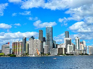
Downtown Miami is the urban city center of Miami, Florida, United States. The city's greater downtown region consists of the Central Business District, Brickell, the Historic District, Government Center, the Arts & Entertainment District, and Park West. It is divided by the Miami River and is bordered by Midtown Miami's Edgewater, and Wynwood sections to its north, Biscayne Bay to its east, the Health District and Overtown to its west, and Coconut Grove to its south.

Metrorail is a rapid transit system in Miami and Miami-Dade County in the U.S. state of Florida. Metrorail is operated by Miami-Dade Transit (MDT), a departmental agency of Miami-Dade County. Opened in 1984, it is Florida's only rapid transit metro system, and is currently composed of two lines of 23 stations on 24.4 miles (39.3 km) of standard gauge track. Metrorail serves the urban core of Miami, connecting Miami International Airport, the Health District, Downtown Miami, and Brickell with the northern developed neighborhoods of Hialeah and Medley to the northwest, and to suburban The Roads, Coconut Grove, Coral Gables, and South Miami, ending at urban Dadeland in Kendall. Metrorail connects to the Metromover in Downtown, which provides metro service to the entirety of Downtown and Brickell. Additionally, it connects to South Florida's commuter rail system at Tri-Rail station, as well as Metrobus routes at all stations. In 2023, the system had 13,439,300 rides, and about 48,300 per day in the fourth quarter of 2023.
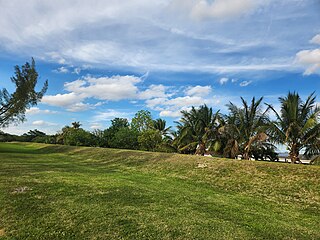
Dadeland is a commercial district and urban neighborhood similar to an edge city, amid the sprawling metropolitan Miami suburbs of Kendall, Glenvar Heights, and Pinecrest, in the U.S. state of Florida, at the end of the Metrorail line.
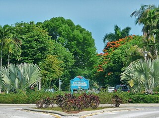
The Roads is a neighborhood of Miami in Miami-Dade County, Florida. It is a triangular area located south of SW 11th Street, between SW 12th Avenue and SW 15th Road, just west of Brickell.
Coral Way is a neighborhood within Miami, Florida that is defined by Coral Way, a road established by Coral Gables founder George E. Merrick during the 1920s. It is located in Miami-Dade County, Florida.
The Greater Miami area, composed of the three counties of Miami-Dade, Broward, and Palm Beach, also known collectively as South Florida, is home to a wide variety of public and private transportation systems. These include heavy rail mass transit (Metrorail), commuter rail (Tri-Rail), automated guideway transit (Metromover), highways, two major airports and seaports, as well as three county-wide bus networks, which cover the entire urbanized area of South Florida. Census and ridership data show that Miami has the highest public transportation usage of any city in Florida, as about 17% of Miamians use public transportation on a regular basis, compared to about 4% of commuters in the South Florida metropolitan area. The majority of public transportation in Miami is operated by Miami-Dade Transit (MDT), which is currently the largest transit system in Florida and was the 14th largest transit system in the United States in 2011.
The South Dade Rail Trail (SDRT) is a rail trail, run by Miami-Dade County Parks and Recreation, that follows the old Florida East Coast Railway rail corridor for 20.5 miles, from Miami to Homestead in South Florida, traversing a diversity of urban, suburban and semi-rural environments.

The Metrobus network provides bus service throughout Miami-Dade County 365 days a year, operated by Miami-Dade Transit. It consists of about 79 routes and 893 buses, which connect most points in the county and part of southern Broward County as well. As of 2023, the system has 58,282,300 rides per year, or about 201,200 per day in the fourth quarter of 2023.

Downtown Dadeland is an urban residential and retail development in Dadeland, Kendall, Florida, USA. Dadeland is an edge city in Kendall, which is part of unincorporated Miami-Dade County. Downtown Dadeland was completed in 2005, during a South Florida real estate boom. Notably, the 7.5-acre (3.0-hectare) development contains 15 acres of parking on two underground levels, unprecedented in South Florida, which averages under 10 feet (3.0 m) of elevation AMSL. Since then, some other projects have pursued more than one sub-grade level, including Brickell City Centre in the Brickell district of Downtown Miami. Underground development in the Miami area is complicated and expensive, due to the high water table. A project on Fort Lauderdale beach planned three levels of underground parking, but revised plans down to a single level mechanical parking garage. The mixed-use development is adjacent to Dadeland South station, the southern terminus of the Metrorail system, which saw significant ridership increases in the 21st century after many transit-oriented developments such as Dadeland were completed. Underground parking, including -1.5 and greater depths, began to become more common in the 2010s, pressured by building codes, aesthetics, and economics.

Bruno Arthur Barreiro is a Republican politician from Florida. He served on the Miami-Dade County Commission from 1998 to 2018, representing part of Miami Beach and the Miami neighborhoods of Brickell, Little Havana, Coral Way, and West Flagler. He resigned on March 31, 2018, to run unsuccessfully in the Republican primary for Florida's 27th congressional district in the 2018 election.
The Ludlam Trail is a proposed 5.6-mile (9 km) shared-use linear park rail trail in Miami-Dade County, Florida, that will follow the former Florida East Coast Railway Little River Branch between NW 7th Street and SW 80th Street. The trail is planned to provide safe and direct pathways for walking, running, and cycling, as well as connect schools, parks, transit stops, residences, workplaces, and shopping areas. The trail is envisioned as part of the "Miami Loop", a network of bikeways that also includes the Perimeter Trail, the Miami River Greenway, and The Underline. A groundbreaking ceremony was held October 26, 2021. Construction is anticipated to start fall of 2026.