Vehicle infrastructure integration

Last updated

Vehicle infrastructure integration (VII) is an initiative fostering research and application development for a series of technologies directly linking road vehicles to their physical surroundings, first and foremost to improve road safety. The technology draws on several disciplines, including transport engineering, electrical engineering, automotive engineering, and computer science. VII specifically covers road transport, although similar technologies are in place or under development for other modes of transport. Planes, for example, use ground-based beacons for automated guidance, allowing the autopilot to fly the plane without human intervention. In highway engineering, improving the safety of a roadway can enhance overall efficiency. VII targets to improve both safety and efficiency.

Contents

Goals

The goal of VII is to provide a communications link between vehicles on the road (via On-Board Equipment, OBE), and between vehicles, and the roadside infrastructure (via Roadside Equipment, RSE), in order to increase the safety, efficiency, and convenience of the transportation system. It is based on widespread deployment of a dedicated short-range communications (DSRC) link, incorporating IEEE 802.11p. VII's development relies on a business model that supports the interests of all parties concerned: industry, transportation authorities, and professional organizations. The initiative has three priorities:

Safety

Current active safety technology relies on vehicle-based radar and vision systems. For example, this technology can reduce rear-end collisions by tracking obstructions in front or behind the vehicle, automatically applying brakes when needed. This technology is somewhat limited in that it senses only the distance and speed of vehicles within the direct line of sight of cameras and the sensing range of radars. It is almost completely ineffective for angled and left-turn collisions. [1] It may even cause a motorist to lose control of the vehicle in the event of an impending head-on collision. The rear-end collisions covered by today's technology are typically less severe than angle, left-turn, or head-on collisions. Existing technology is therefore inadequate for the overall needs of the roadway system.

VII would provide a direct link between a vehicle on the road and all vehicles within a defined vicinity. The vehicles would be able to communicate with each other, exchanging data on speed, orientation, and perhaps even driver awareness and intent. This could increase safety for nearby vehicles, while enhancing the overall sensitivity of the VII system, for example, by performing an automated emergency maneuver (steering, decelerating, braking) more effectively. In addition, the system is designed to communicate with the roadway infrastructure, allowing for complete, real-time traffic information for the entire network, as well as better queue management and feedback to vehicles. It would ultimately close the feedback loops on what is now an open-loop transportation system.

Through VII, roadway markings and road signs could become obsolete. Existing VII applications use sensors within vehicles that can identify markings on the roadway or signing along the side of the road, automatically adjusting vehicle parameters as necessary. Ultimately, VII aims to treat such signs and markings as little more than stored data within the system. This could be in the form of data acquired via beacons along a roadway or stored at a centralized database and distributed to all VII-equipped vehicles.

Efficiency

All the above factors are largely in response to safety but VII could lead to noticeable gains in the operational efficiency of a transportation network. As vehicles will be linked together with a resulting decrease in reaction times, the headway between vehicles could be reduced so that there is less empty space on the road. Available capacity for traffic would therefore be increased. More capacity per lane will in turn mean fewer lanes in general, possibly satisfying the community's concerns about the impact of roadway widening. VII will enable precise traffic-signal coordination by tracking vehicle platoons and will benefit from accurate timing by drawing on real-time traffic data covering volume, density and turning movements.

Real-time traffic data can also be used in the design of new roadways or modification of existing systems as the data could be used to provide accurate origin-destination studies and turning-movement counts for uses in transportation forecasting and traffic operations. Such technology would also lead to improvements for transport engineers to address problems whilst reducing the cost of obtaining and compiling data. Tolling is another prospect for VII technology as it could enable roadways to be automatically tolled. Data could be collectively transmitted to road users for in-vehicle display, outlining the lowest cost, shortest distance, and/or fastest route to a destination on the basis of real-time conditions.

Existing applications

To some extent, results along these lines have been achieved in trials performed around the globe, making use of GPS, mobile phone signals, and vehicle registration plates. GPS is becoming standard in many new high-end vehicles and is an option on most new low- and mid-range vehicles. In addition, many users also have mobile phones which transmit trackable signals (and may also be GPS-enabled). Mobile phones can already be traced for purposes of emergency response. GPS and mobile phone tracking, however, do not provide fully reliable data. Furthermore, integrating mobile phones in vehicles may be prohibitively difficult. Data from mobile phones, though useful, might even increase risks to motorists as they tend to look at their phones rather than concentrate on their driving. Automatic registration plate recognition can provide high levels of data, but continuously tracking a vehicle through a corridor is a difficult task with existing technology. Today's equipment is designed for data acquisition and functions such as enforcement and tolling, not for returning data to vehicles or motorists for response. GPS will nevertheless be one of the key components in VII systems. [2]

Limitations

Privacy

The most common myth about VII is that it includes tracking technology; however, this is not the case. [3] The architecture is designed to prevent identification of individual vehicles, with all data exchange between the vehicle and the system occurring anonymously. Exchanges between the vehicles and third parties such as OEMs and toll collectors will occur, but the network traffic will be sent via encrypted tunnels and will therefore not be decipherable by the VII system.

Other public concerns

Critics of tolling believe it will make driving prohibitively expensive for motorists in the lower-income bracket, conflicting with the wish to provide equal services for all. In response, public transit discounts or road use discounts can be considered for qualifying individuals and/or families. Such provisions currently exist for numerous tolled roadways and could be applicable to roadways that are tolled via VII. However, as VII could allow for the tolling of every VII-enabled roadway, the provisions may be ineffective in view of the increased need to provide user-efficient transit services to every area.

Technical issues

Coordination

A major issue facing the deployment of VII is the problem of how to stand up the system initially. The costs associated with installing the technology in vehicles and providing communications and power at every intersection are significant.

Maintenance

Another factor for consideration in regard to the technology's distribution is how to update and maintain the units. Traffic systems are highly dynamic, with new traffic controls implemented every day and roadways constructed or repaired every year. The vehicle-based option could be updated via the internet (preferably wireless) but may subsequently require all users to have access to internet technology.

Alternatively, if receivers were placed in all vehicles and the VII system was primarily located along the roadside, information could be stored in a centralized database. This would allow the agency responsible to issue updates at any time. These would then be disseminated to the roadside units for passing motorists. Operationally, this method is currently considered to provide the greatest effectiveness but at a high cost to the authorities.

Security

Security of the units is another concern, especially in the light of the public acceptance issue. Criminals could tamper, remove, or destroy VII units regardless of whether they are installed inside vehicles or along the roadside.

Magnets, electric shocks, and malicious software (viruses, hacking, or jamming) could be used to damage VII systems – regardless of whether units are located inside vehicle or along the roadside.

Recent developments

Much of the current research and experimentation is conducted in the United States [4] where coordination is ensured through the Vehicle Infrastructure Integration Consortium, consisting of automobile manufacturers (Ford, General Motors, Daimler Chrysler, Toyota, Nissan, Honda, Volkswagen, BMW), IT suppliers, U.S. Federal and state transportation departments, and professional associations. [5] Trialing is taking place in Michigan [6] and California. [7]

The specific applications now being developed under the U.S. initiative [8] are:

In mid-2007, a VII environment covering some 20 square miles (52 km2) near Detroit was used to test 20 prototype VII applications.[ citation needed ] Several automobile manufacturers are also conducting their own VII research and trailing.

See also

Related Research Articles

<span class="mw-page-title-main">Intelligent transportation system</span> Advanced application

An intelligent transportation system (ITS) is an advanced application which aims to provide innovative services relating to different modes of transport and traffic management and enable users to be better informed and make safer, more coordinated, and 'smarter' use of transport networks.

<span class="mw-page-title-main">Road traffic safety</span> Methods and measures for reducing the risk of death and injury on roads

Road traffic safety refers to the methods and measures used to prevent road users from being killed or seriously injured. Typical road users include pedestrians, cyclists, motorists, vehicle passengers, and passengers of on-road public transport.

Automatic vehicle location is a means for automatically determining and transmitting the geographic location of a vehicle. This vehicle location data, from one or more vehicles, may then be collected by a vehicle tracking system to manage an overview of vehicle travel. As of 2017, GPS technology has reached the point of having the transmitting device be smaller than the size of a human thumb, able to run 6 months or more between battery charges, easy to communicate with smartphones — all for less than $20 USD.

<span class="mw-page-title-main">5-1-1</span> Traffic information telephone hotline in North America

5-1-1 is a transportation and traffic information telephone hotline in some regions of the United States and Canada. Travelers can dial 511, a three-digit telephone number, on landlines and most mobile phones. The number has also extended to be the default name of many state and provincial transportation department road conditions Web sites, such as Wisconsin's site. It is an example of an N11 code, part of the North American Numbering Plan.

<span class="mw-page-title-main">Telematics</span> Interdisciplinary field that encompasses telecommunications

Telematics is an interdisciplinary field encompassing telecommunications, vehicular technologies, electrical engineering, and computer science. Telematics can involve any of the following:

Floating car data (FCD) in traffic engineering and management is typically timestamped geo-localization and speed data directly collected by moving vehicles, in contrast to traditional traffic data collected at a fixed location by a stationary device or observer. In a physical interpretation context, FCD provides a Lagrangian description of the vehicle movements whereas stationary devices provide an Eulerian description. The participating vehicle acts itself consequently as a moving sensor using an onboard GPS receiver or cellular phone. The most common and widespread use of FCD is to determine the traffic speed on the road network. Based on these data, traffic congestion can be identified, travel times can be calculated, and traffic reports can be rapidly generated. In contrast to stationary devices such as traffic cameras, number plate recognition systems, and induction loops embedded in the roadway, no additional hardware on the road network is necessary.

<span class="mw-page-title-main">OnStar</span> Subsidiary of General Motors

OnStar Corporation is a subsidiary of General Motors that provides subscription-based communications, in-vehicle security, emergency services, turn-by-turn navigation, and remote diagnostics systems throughout the United States, Canada, China, Mexico, Europe, Brazil, Colombia, Argentina and the Gulf Cooperation Council countries.

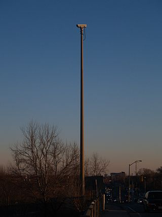
Vehicular communication systems are computer networks in which vehicles and roadside units are the communicating nodes, providing each other with information, such as safety warnings and traffic information. They can be effective in avoiding accidents and traffic congestion. Both types of nodes are dedicated short-range communications (DSRC) devices. DSRC works in 5.9 GHz band with bandwidth of 75 MHz and approximate range of 300 metres (980 ft). Vehicular communications is usually developed as a part of intelligent transportation systems (ITS).

<span class="mw-page-title-main">Traffic reporting</span> Communication of road conditions

Traffic reporting is the near real-time distribution of information about road conditions such as traffic congestion, detours, and traffic collisions. The reports help drivers anticipate and avoid traffic problems. Traffic reports, especially in cities, may also report on major delays to mass transit that does not necessarily involve roads. In addition to periodic broadcast reports, traffic information can be transmitted to GPS units, smartphones, and personal computers.

Vehicular ad hoc networks (VANETs) are created by applying the principles of mobile ad hoc networks (MANETs) – the spontaneous creation of a wireless network of mobile devices – to the domain of vehicles. VANETs were first mentioned and introduced in 2001 under "car-to-car ad-hoc mobile communication and networking" applications, where networks can be formed and information can be relayed among cars. It was shown that vehicle-to-vehicle and vehicle-to-roadside communications architectures will co-exist in VANETs to provide road safety, navigation, and other roadside services. VANETs are a key part of the intelligent transportation systems (ITS) framework. Sometimes, VANETs are referred as Intelligent Transportation Networks. They are understood as having evolved into a broader "Internet of vehicles". which itself is expected to ultimately evolve into an "Internet of autonomous vehicles".

<span class="mw-page-title-main">Roadside assistance</span> Organization that provides automobile maintenance and assistance through dispatched personnel

Roadside assistance, also known as breakdown coverage, is a service that assists motorists, motorcyclists, or bicyclists whose vehicles have suffered a mechanical failure that either cannot be resolved by the motorist, or has prevented them from reasonably or effectively transporting the vehicle to an automobile repair shop. Roadside assistance employees respond to calls for service to inspect the vehicle and attempt to render appropriate repairs. Roadside assistance may be provided by departments of transportation, automobile associations, vehicle insurance providers, or dedicated roadside assistance organizations.

Dashtop mobile equipment refers to wireless mobile devices mounted on the vehicle dashboard. Dashtop mobile equipment (DME) includes satellite radios, GPS navigation, OnStar, mobile TV, HD radio, vehicle tracking system, MVEDR and Broadband Wireless Access (BWA) devices. Currently, the dashtop mobile devices are mostly satellite-based wireless technology. Except for OnStar and BWA devices, most of them are in the stage of passive one-way communications equipment.

Intelligent speed assistance (ISA), or intelligent speed adaptation, also known as alerting, and intelligent authority, is any system that ensures that vehicle speed does not exceed a safe or legally enforced speed. In case of potential speeding, the driver can be alerted or the speed reduced automatically.

GNSS road pricing or GNSS-based tolling is the charging of road users using Global Navigation Satellite System (GNSS) sensors inside vehicles. Road pricing using GNSS simplifies distance-based tolling for all types of roads in a tolled road network since it does not require the installation and operation of roadside infrastructure, such as tollbooths or microwave-based toll gantries. Instead, all vehicles required to pay the distance-based fees are equipped with an On Board Unit (OBU).

<span class="mw-page-title-main">Traffic collision</span> Incident when a vehicle collides with another object

A traffic collision, also known as a motor vehicle collision, occurs when a vehicle collides with another vehicle, pedestrian, animal, road debris, or other moving or stationary obstruction, such as a tree, pole or building. Traffic collisions often result in injury, disability, death, and property damage as well as financial costs to both society and the individuals involved. Road transport is statistically the most dangerous situation people deal with on a daily basis, but casualty figures from such incidents attract less media attention than other, less frequent types of tragedy. The commonly used term car accident is increasingly falling out of favor with many government departments and organizations, with the Associated Press style guide recommending caution before using the term. Some collisions are intentional vehicle-ramming attacks, staged crashes, vehicular homicide or vehicular suicide.

A vehicle miles traveled tax, also frequently referred to as a VMT tax, VMT fee, mileage-based fee, or road user charge, is a policy of charging motorists based on how many miles they have traveled.

<span class="mw-page-title-main">Speed limit enforcement</span> Effort made by appropriately empowered authorities to improve driver compliance with speed limits

Speed limits are enforced on most public roadways by authorities, with the purpose to improve driver compliance with speed limits. Methods used include roadside speed traps set up and operated by the police and automated roadside 'speed camera' systems, which may incorporate the use of an automatic number plate recognition system. Traditionally, police officers used stopwatches to measure the time taken for a vehicle to cover a known distance. More recently, radar guns and automated in-vehicle systems have come into use.

<span class="mw-page-title-main">Internavi</span>

Internavi is a vehicle telematics service offered by the Honda Motor Company to drivers in Japan. In the United States, the service is known as HondaLink, or sometimes MyLink. It provides mobile connectivity for on-demand traffic information services and internet provided maps displayed inside selected Honda vehicles. The service began August 1997 and was first offered in the 1998 Honda Accord and the Honda Torneo sold only in Japan starting July 1998. The service received a revision to services offered October 2002, adding traffic information delivery capabilities for subscribers to the Internavi Premium Club, and was optional on most Honda vehicles sold in Japan. VICS was integrated into the service starting September 2003. Membership in the service has steadily grown to exceed 5 million subscribers as of March 2007.

A connected car is a car that can communicate bidirectionally with other systems outside of the car. This connectivity can be used to provide services to passengers or to support or enhance self-driving functionality. For safety-critical applications, it is anticipated that cars will also be connected using dedicated short-range communications (DSRC) or cellular radios, operating in the FCC-granted 5.9 GHz band with very low latency.

<span class="mw-page-title-main">Cycling infrastructure</span> Facilities for use by cyclists

Cycling infrastructure is all infrastructure cyclists are allowed to use. Bikeways include bike paths, bike lanes, cycle tracks, rail trails and, where permitted, sidewalks. Roads used by motorists are also cycling infrastructure, except where cyclists are barred such as many freeways/motorways. It includes amenities such as bike racks for parking, shelters, service centers and specialized traffic signs and signals. The more cycling infrastructure, the more people get about by bicycle.

References

  1. "Left Turn Accidents". Car Accidents. 23 March 2023. Archived from the original on 6 August 2023. Retrieved 6 August 2023.
  2. GPS Drives Vehicle Infrastructure Integration, GPS World, October 2006.
  3. "Archived copy" (PDF). Archived from the original (PDF) on 5 October 2008. Retrieved 18 September 2007.{{cite web}}: CS1 maint: archived copy as title (link)
  4. U.S. DOT VII Archived 22 October 2006 at the Wayback Machine . Retrieved 21 February 2007.
  5. Full speed ahead for intelligent car design, Financial Times, 20 February 2007
  6. Michigan DOT VII Program Archived 18 February 2007 at the Wayback Machine . Retrieved 21 February 2007.
  7. Expediting Vehicle Infrastructure Integration Archived 11 July 2007 at the Wayback Machine . Retrieved 21 February 2007
  8. Vehicle Infrastructure Integration from U.S. DOT Archived 7 February 2007 at the Wayback Machine . Retrieved 21 February 2007.