The 1960 Valdivia earthquake and tsunami or the Great Chilean earthquake on 22 May 1960 was the most powerful earthquake ever recorded. Various studies have placed it at 9.4–9.6 on the moment magnitude scale. It occurred in the afternoon, and lasted for approximately 10 minutes. The resulting tsunamis affected southern Chile, Hawaii, Japan, the Philippines, eastern New Zealand, southeast Australia, and the Aleutian Islands.

The Maule Region is one of Chile's 16 first order administrative divisions. Its capital is Talca. The region derives its name from the Maule River which, running westward from the Andes, bisects the region and spans a basin of about 20,600 km2. The Maule river is of considerable historic interest because, among other reasons, it marked the southern limits of the Inca Empire.

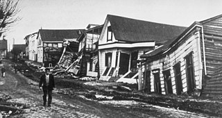
Talca is a city and commune in Chile located about 255 km (158 mi) south of Santiago, and is the capital of both Talca Province and Maule Region. As of the 2012 census, the city had a population of 201,142.
The 1977 San Juan earthquake, also known as Caucete earthquake, took place in the province of San Juan, Argentina, on 23 November at 06:26:26 AM. It measured 7.4 on the surface wave magnitude scale, and had a maximum perceived intensity of X (Extreme) on the Mercalli intensity scale.

The 1946 Nankai earthquake was a great earthquake in Nankaidō, Japan. It occurred on December 21, 1946, at 04:19 JST. The earthquake measured between 8.1 and 8.4 on the moment magnitude scale, and was felt from Northern Honshū to Kyūshū. It occurred almost two years after the 1944 Tōnankai earthquake, which ruptured the adjacent part of the Nankai megathrust.
The 1687 Peru earthquake occurred at 11:30 UTC on 20 October. It had an estimated magnitude of 8.4–8.7 and caused severe damage to Lima, Callao and Ica. It triggered a tsunami and overall about 5,000 people died.
The 1985 Rapel Lake earthquake occurred on 8 April at with a moment magnitude of 7.5 and a maximum perceived intensity of VI (Strong). The shock was centered 75 kilometres (47 mi) southwest of Santiago, Chile, with a focal depth of 37.8 km (23 mi).

The 1906 Valparaíso earthquake hit Valparaíso, Chile, on August 16 at 19:55 local time. Its epicenter was offshore from the Valparaíso Region, and its intensity was estimated at magnitude 8.2 . This earthquake occurred thirty minutes after the 1906 Aleutian Islands earthquake.
The 1956 Nicaragua earthquake occurred on October 24 at 14:42 UTC. The epicenter was located west of Masachapa, Managua Department, Nicaragua. It was an earthquake of magnitude 7.3, or 7.2. Building damage was reported in Managua. A study of W. Montero P. shows that this earthquake might be related to the earthquake of Nicoya Peninsula on October 5, 1950. A tsunami was triggered by the earthquake.

The 2010 Pichilemu earthquakes, also known as the Libertador O'Higgins earthquakes, were a pair of intraplate earthquakes measuring 6.9 and 7.0 that struck Chile's O'Higgins Region on 11 March 2010 about 16 minutes apart. The earthquakes were centred 15 kilometres (9.3 mi) northwest of the city of Pichilemu.

The 1994 offshore Sanriku earthquake occurred on December 28, 1994, at 12:19 UTC. This was a magnitude 7.7 earthquake with epicenter located in the Pacific Ocean at about 180 km east of Hachinohe, Aomori. The intensity reached shindo 6 in Hachinohe, Aomori, about 187.6 km from epicenter. It could be felt in Tokyo, about 632.9 km from epicenter, with shindo 2. The Japanese Meteorological Agency put the magnitude at 7.5. Slip associated with this earthquake continued for more than a year and it has been termed an 'ultra-slow earthquake'.
The 1937 Orizaba earthquake occurred on July 26 at 03:47 UTC, near Orizaba, Veracruz, Mexico. It had a magnitude of 7.3 on the surface wave magnitude scale. Thirty four people were reported dead. Damage was reported in Esperanza, Puebla. This was an intraplate earthquake within the subducting Cocos Plate.
The 1928 Chachapoyas earthquake occurred on May 14 at . It had a magnitude of Mw 7.2, Ms 7.3, or ML 7.3. Chachapoyas, Peru was almost completely destroyed. A landslide in Pinpincos caused the death of 25 people. Many houses were damaged in Machala, Ecuador. The maximum intensity was X (Extreme) on the Mercalli intensity scale. The earthquake could be felt in Lima. It could also be felt in Ecuador, Brazil, and Colombia.
The 1971 Solomon Islands earthquakes occurred in the northern part of the Solomon Islands, within Papua New Guinea as a doublet earthquake. The first large shock occurred on July 14 at 06:11 UTC with a magnitude of 8.0. The second large event occurred on July 26 at 01:23 UTC with a magnitude of Mw 8.1. The initial event on July 14 caused a tsunami, which was observed in Rabaul. The earthquake of July 26 triggered a tsunami with a 3.4 m (11 ft) runup in New Britain.
The 1964 Guerrero earthquake occurred on July 6 at in Guerrero, Mexico. The magnitude of this earthquake was given as Ms 7.4, or ML 7.2.
The 1942 Guatemala earthquake occurred at on August 6 and had ratings of 7.7 on the moment magnitude scale and 7.9 on the surface wave magnitude scale. The epicenter was located off the southern coast of Guatemala, and it was one of the strongest earthquakes ever recorded there.
The 1982 Ometepec earthquake that struck Mexico's southwestern coast near Ometepec (Guerrero) on 7 June was a doublet earthquake that ruptured in two steps. The first happened at 06:52 UTC, the second five hours later at 10:59 UTC. Estimated magnitudes are 6.9 and 7.0 on the scale, and 5.8 and 6.0 on the scale. The maximum Mercalli intensities were VII and VIII, respectively.
The 1993 Kushiro–Oki earthquake was one of two large earthquake to strike the Japanese island of Hōkkaido within the same year. The earthquake with a magnitude of 7.6 Mw or 7.8 MJMA struck at 11:06 UTC or 08:06 pm JST on January 15 near the town of Ashoro. Shaking reached a maximum intensity of IX (Violent) on the Mercalli intensity scale, causing considerable damage, and was felt throughout the island, into northern Honshu, Sakhalin, and the Kuril Islands. As a result of the tremors, two people were killed and more than 600 were wounded.
The 1900 Venezuelan earthquake, occurred on October 28 at between 4:30 and 4:45 am local time. This earthquake had an epicenter off Miranda State or near the Venezuelan capital Caracas, in the Cariaco Basin. It had an estimated moment magnitude of 7.6–7.7 and a surface-wave magnitude of 7.7–8.4. It had a maximum Mercalli intensity assigned VIII–X, causing landslides and liquefaction events. Many buildings were severely damaged or collapsed during the earthquake. It is thought to be the last great earthquake of the 19th century and the largest instrumentally recorded in the republic, having been felt throughout.


