
New Orleans is a consolidated city-parish located along the Mississippi River in the southeastern region of the U.S. state of Louisiana. With a population of 383,997 according to the 2020 U.S. census, it is the most populous city in Louisiana, third most populous city in the Deep South, and the twelfth-most populous city in the southeastern United States. Serving as a major port, New Orleans is considered an economic and commercial hub for the broader Gulf Coast region of the United States. New Orleans is also a region of French Louisiana, along with the Cajun Country.

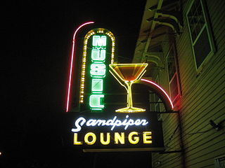
The Faubourg Marigny is a neighborhood of the city of New Orleans, Louisiana, United States.

North Durham is a constituency represented in the House of Commons of the UK Parliament since 2001 by Kevan Jones of the Labour Party.

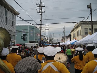
Central City is a neighborhood of the city of New Orleans. It is located in the 11th Ward of New Orleans in Uptown, just above the Garden District, on the "lakeside" of St. Charles Avenue. A subdistrict of the Central City/Garden District Area, its boundaries as defined by the City Planning Commission are: MLK Boulevard, South Claiborne Avenue and the Pontchartrain Expressway to the north, Magazine, Thalia, Prytania and Felicity Streets and St. Charles Avenue to the south and Toledano Street, Louisiana Avenue and Washington Avenue to the west. This old predominantly African-American neighborhood has been important in the city's brass band and Mardi Gras Indian traditions.


The city planning commission for New Orleans divided the city into 13 planning districts and 73 distinct neighborhoods in 1980. Although initially in the study 68 neighborhoods were designated, and later increased by the City Planning Commission to 76 in October 2001 based in census data, most planners, neighborhood associations, researchers, and journalists have since widely adopted the 73 as the number and can even trace the number back to the early 1900s. While most of these assigned boundaries match with traditional local designations, some others differ from common traditional use. This is a result of the city planning commission's wish to divide the city into sections for governmental planning and zoning purposes without crossing United States census tract boundaries. While most of the listed names have been in common use by New Orleanians for generations, some designated names are rarely heard outside the planning commission's usage.
James Bryan Wagner, known as Bryan Wagner, was the first Republican since Reconstruction to have been elected to the New Orleans City Council. He filled a vacancy of an unexpired term in District A from May 1980 to April 1982 and a full term until 1986.
Leonidas is a neighborhood designation in the city of New Orleans. A subdistrict of the Uptown/Carrollton Area, its boundaries as defined by the New Orleans City Planning Commission are: South Claiborne Avenue, Leonidas and Fig Streets to the north, South Carrollton Avenue to the east, the Mississippi River and Jefferson Parish to the west. Although an official city planning district name, the name "Leonidas" is not widely used nor has it any historical usage and the area is usually referred to by the larger neighborhood "Uptown, or "Carrollton".
The neighborhood of Faubourg Lafayette is a division in the city of New Orleans, Louisiana. It is also known as the 10th Ward of New Orleans, and it is one of the city's 17 wards. Faubourg Lafayette was founded with small settlements around steamboat landings in New Orleans. John Poultney acquired the property from Madame Rousseau on May 2, 1818. This was a plantation measuring about 10 arpents, near the Mississippi River waterfront. The property was bounded by the lower line of property owned by Jacques François Enoul de Livaudais. This property ran through the squares between Soraparu and First streets at Tchoupitoulas Street. St. Andrew Street bounds the property below.
Ward No. 15, Kolkata Municipal Corporation is an administrative division of Kolkata Municipal Corporation in Borough No. 2, covering parts of Maniktala neighbourhood in North Kolkata, in the Indian state of West Bengal.
Ward No. 16, Kolkata Municipal Corporation is an administrative division of Kolkata Municipal Corporation in Borough No. 2, covering parts of Maniktala neighbourhood in North Kolkata, in the Indian state of West Bengal.
Ward No. 19, Kolkata Municipal Corporation is an administrative division of Kolkata Municipal Corporation in Borough No. 2, covering parts of Shobhabazar and Beniatola (Ahiritola) neighbourhoods in North Kolkata, in the Indian state of West Bengal.
Ward No. 58, Kolkata Municipal Corporation is an administrative division of Kolkata Municipal Corporation in Borough No. 7, covering parts of Tangra, Dhapa (Mathpukur) and East Kolkata Wetlands (Arupota-Bosetala-Boinchtala-Durgapur-Anandabad-Khanaberia) neighbourhoods in central-east Kolkata, in the Indian state of West Bengal. The Eastern Metropolitan Bypass cuts across the ward.
Ward No. 64, Kolkata Municipal Corporation is an administrative division of Kolkata Municipal Corporation in Borough No. 7, covering parts of Tangra (Chinatown) in central Kolkata and Topsia, Science City, Forum Atmosphere and Tiljala neighbourhoods in South Kolkata, in the Indian state of West Bengal.
Ward No. 80, Kolkata Municipal Corporation is an administrative division of Kolkata Municipal Corporation in Borough No. 9, covering parts of Kidderpore, Garden Reach, Tikiapara, Alipore Mint Colony, Taratala neighbourhoods in South Kolkata, in the Indian state of West Bengal.
Ward No. 85, Kolkata Municipal Corporation is an administrative division of Kolkata Municipal Corporation in Borough No. 8, covering parts of Ballygunge neighbourhood in South Kolkata, in the Indian state of West Bengal.
Ward No. 86, Kolkata Municipal Corporation is an administrative division of Kolkata Municipal Corporation in Borough No. 8, covering parts of Ballygunge and Gariahat neighbourhoods in South Kolkata, in the Indian state of West Bengal.
Ward No. 135, Kolkata Municipal Corporation is an administrative division of Kolkata Municipal Corporation in Borough No. 15, covering parts of Garden Reach neighbourhood in the Indian state of West Bengal.

