Related Research Articles
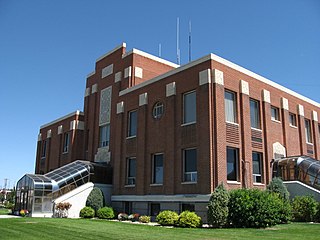
Cassia County is a county in the U.S. state of Idaho. As of the 2020 Census the county had a population of 24,655. The county seat and largest city is Burley. Cassia County is included in the Burley, ID Micropolitan Statistical Area.

Samson is a city in Geneva County, Alabama, United States. It is part of the Dothan, Alabama Metropolitan Statistical Area. At the 2010 census the population was 1,940, down from 2,071 in 2000. Samson incorporated in 1905, although other sources cited 1906.
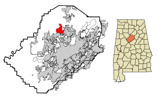
Adamsville is a city in western Jefferson County, Alabama. It is north from the Birmingham suburb of Pleasant Grove. It initially incorporated in 1901, but disincorporated in 1915. It later reincorporated in 1953. According to the 2010 census, this town had a population of 4,522, down from its peak population of 4,965 in 2000.
Mount Olive, also spelled Mt. Olive is an unincorporated community and a census-designated place (CDP) in Jefferson County, Alabama. Its location is in the suburbs of Birmingham. As of the 2010 census, the population of the community is 4,079. Mount Olive is bordered on the south and the east by the town of Gardendale, and in fact, some areas that had previously been in Mount Olive have been annexed into Gardendale over the years. Running along part of the border between Mt. Olive and Gardendale is the major expressway, Interstate 65. Eventually, part of Birmingham's Northern Beltline will cut through northwestern sections of Mt. Olive. Mt. Olive has its own elementary school, and was formerly the home of a junior high school.

Trinity is a town in Morgan County, Alabama, United States. It is included in the Decatur Metropolitan Area and the Huntsville-Decatur Combined Statistical Area. As of the 2020 census, the population of the town was 2,526, up from 2,095 in 2010. It was incorporated in 1901.

Pesotum is a village in Champaign County, Illinois, United States. The population was 551 at the 2010 census.
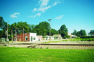
Bellmont is a village in Bellmont Precinct, Wabash County, Illinois, United States. The population was 297 at the 2000 census.

Albion is a town in Albion and Jefferson townships, Noble County, in the U.S. state of Indiana. The population was 2,349 at the 2010 census. The city is the county seat of Noble County.

Elk Run Heights is a city in Black Hawk County, Iowa, United States. The population was 1,069 at the 2020 census. It is part of the Waterloo–Cedar Falls Metropolitan Statistical Area.

Albion is a city in Marshall County, Iowa, United States. The population was 448 at the 2020 census.

Manhattan Beach is a small city in Crow Wing County, Minnesota, United States, near Crosslake. The population was 57 at the 2010 census. It is part of the Brainerd Micropolitan Statistical Area.

Maple Plain is a city in Hennepin County, Minnesota, United States. The population was 1,768 at the 2010 census.

Hallock is a city in and the county seat of Kittson County, Minnesota, United States. The population was 906 at the 2020 census.
Glencoe is the county seat of McLeod County, Minnesota, United States. The population was 5,631 at the 2010 census.

Buhl is a city in Saint Louis County, Minnesota, United States. Its population was 1,000 at the 2010 census.
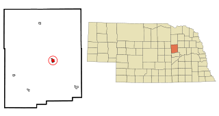
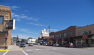
Albion is a city in and the county seat of Boone County, Nebraska, United States. The population was 1,650 at the 2010 census.

Elk Creek Township is a township in Erie County, Pennsylvania, United States. The population was 1,788 at the 2020 census, down from 1,798 at the 2010 census.

Folly Beach is a public city on Folly Island in Charleston County, South Carolina, United States. The population was 2,617 at the 2010 census, up from 2,116 in 2000. Folly Beach is within the Charleston-North Charleston-Summerville metropolitan area and the Charleston-North Charleston Urbanized Areas.

Ortonville is a city in Big Stone County in the U.S. state of Minnesota at the southern tip of Big Stone Lake, along the border with South Dakota. The population was 2,021 at the 2020 census. It is the county seat of Big Stone County. Big Stone Lake State Park is nearby.
Albion No. 2 is an election precinct, or township equivalent, in Edwards County, Illinois. As of the 2020 Census the population was 780.
References
- ↑ "Geographic Names Information System". edits.nationalmap.gov. Retrieved 2023-01-25.
- ↑ "Explore Census Data". data.census.gov. Retrieved 2022-06-28.
- ↑ Bureau, US Census. "Gazetteer Files". Census.gov. Retrieved 2023-01-21.
- ↑ "Explore Census Data". data.census.gov. Retrieved 2023-01-22.
Municipalities and communities of Edwards County, Illinois, United States | ||
|---|---|---|
| Cities |  | |
| Villages | ||
| Precincts | ||
| Unincorporated communities | ||
| Ghost towns | ||
| Footnotes | ‡This populated place also has portions in an adjacent county or counties | |