Related Research Articles

Bertie County is a county located in the northeast area of the U.S. state of North Carolina. As of the 2020 census, the population was 17,934. Its county seat is Windsor. The county was created in 1722 as Bertie Precinct and gained county status in 1739.
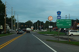
Addison is a town in Winston County, Alabama, United States. It incorporated in December 1949. At the 2020 U.S. Census, it had a population of 659, down from 758 in 2010.

Soperton is a city in Treutlen County, Georgia, United States. The population was 3,115 at the 2010 census, up from 2,824 in 2000. The city is the county seat of Treutlen County.

Old Ripley is a village in Bond County, Illinois, United States. The population was 82 at the 2020 census.

Oakfield is a town in Aroostook County, Maine, United States. The population was 661 at the 2020 census. The village of Oakfield, listed as a census-designated place, is in the northwest corner of the town.

Maple Plain is a city in Hennepin County, Minnesota, United States. The population was 1,768 at the 2010 census.

Hallock is a city in and the county seat of Kittson County, Minnesota, United States. The population was 906 at the 2020 census.

Avery Creek is a census-designated place (CDP) in Buncombe County, North Carolina, United States. The population was 1,950 at the 2010 census. It is part of the Asheville Metropolitan Statistical Area.

Masury is an unincorporated community and census-designated place in eastern Trumbull County, Ohio, United States. The population was 2,001 at the 2020 census. It is part of the Youngstown–Warren metropolitan area.

Lower Chanceford Township is a township in York County, Pennsylvania, United States. The population was 3,028 at the 2020 census.

North Hopewell Township is a township in York County, Pennsylvania, United States. The population was 2,723 at the 2020 census.

Centerville is a census-designated place (CDP) in Anderson County, South Carolina, United States. The population was 6,586 at the 2010 census.

West Hamlin is a town in Lincoln County, West Virginia, United States, along the Guyandotte River. The population was 519 at the 2020 census, and is now down to 509, according to the 2021 census. West Hamlin is a part of the Huntington-Ashland, WV-KY-OH, Metropolitan Statistical Area (MSA). West Hamlin is west of the county seat at Hamlin, hence the name.
Winter is a town in Sawyer County, Wisconsin, United States. The population was 969 at the 2000 census. The Village of Winter is located within the town, but not a part of it. The unincorporated community of Hay Stack Corner is also located in the town.

Concord Township is one of twenty-two townships in Adams County, Illinois, United States. As of the 2020 census, its population was 279 and it contained 111 housing units.
Albion No. 1 is an election precinct, or township equivalent, in Edwards County, Illinois. As of the 2020 Census the population was 1,060.
Albion No. 2 is an election precinct, or township equivalent, in Edwards County, Illinois. As of the 2020 Census the population was 780.
Bone Gap is an election precinct, or township equivalent, in Edwards County, Illinois. As of the 2020 Census the population was 438.
Browns is an election precinct, or township equivalent, in Edwards County, Illinois. As of the 2020 Census the population was 324.
Dixon is an election precinct, or township equivalent, in Edwards County, Illinois. As of the 2020 Census the population was 221.
References
- ↑ "Geographic Names Information System". edits.nationalmap.gov. Retrieved 2023-01-25.
- 1 2 "Explore Census Data". data.census.gov. Retrieved 2023-01-22.
- ↑ Bureau, US Census. "Gazetteer Files". Census.gov. Retrieved 2023-01-22.
Municipalities and communities of Edwards County, Illinois, United States | ||
|---|---|---|
| Cities |  | |
| Villages | ||
| Precincts | ||
| Unincorporated communities | ||
| Ghost towns | ||
| Footnotes | ‡This populated place also has portions in an adjacent county or counties | |