Related Research Articles

Fayette is a city and the county seat of Fayette County, Alabama, United States. The population was 4,619 at the 2010 census, down from 4,922 at the 2000 census.

Vincent is a census-designated place (CDP) in the central San Gabriel Valley, in Los Angeles County, California, United States. The city name and zipcode for addresses south of Arrow Highway is Covina and 91722, respectively, and Azusa and 91702 for addresses north of Arrow Highway. The population was 15,922 at the 2010 census, up from 15,097 at the 2000 census. Vincent is named after Vincent Avenue, which passes through the community.

Chubbuck is a city in Bannock County, Idaho. It is part of the Pocatello Metropolitan Statistical Area. The population was 13,922 at the 2010 census. Chubbuck is located immediately north of Pocatello, Idaho, and has opposed several consolidation proposals since the 1960s.

Manhattan Beach is a small city in Crow Wing County, Minnesota, United States, near Crosslake. The population was 57 at the 2010 census. It is part of the Brainerd Micropolitan Statistical Area.

Maple Plain is a city in Hennepin County, Minnesota, United States. The population was 1,768 at the 2010 census.
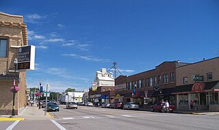
Glencoe is the county seat of McLeod County, Minnesota, United States. The population was 5,631 at the 2010 census.

Buhl is a city in Saint Louis County, Minnesota, United States. Its population was 1,000 at the 2010 census.

Saltillo is a city in Lee County, Mississippi, located in the northern part of the Tupelo micropolitan area. The population was 4,922 at the 2020 Census.

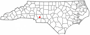
Valley Hill is an unincorporated community and census-designated place (CDP) in Henderson County, North Carolina, United States. The population was 2,070 at the 2010 census. It is part of the Asheville Metropolitan Statistical Area.

Pleasant Valley is a city in Marion County, West Virginia, United States. The population was 3,506 at the 2020 census.

Belmont is a town in Pleasants County, West Virginia, United States. It is part of the Parkersburg-Marietta-Vienna, WV-OH Metropolitan Statistical Area. The population was 872 at the 2020 census.
Locust is a small rural city in Stanly and Cabarrus counties in the U.S. state of North Carolina. The population was 2,930 at the 2010 census.
Albion No. 1 is an election precinct, or township equivalent, in Edwards County, Illinois. As of the 2020 Census the population was 1,060.
Albion No. 2 is an election precinct, or township equivalent, in Edwards County, Illinois. As of the 2020 Census the population was 780.
Albion No. 3 is an election precinct, or township equivalent, in Edwards County, Illinois. As of the 2020 Census the population was 723.
Bone Gap is an election precinct, or township equivalent, in Edwards County, Illinois. As of the 2020 Census the population was 438.
Browns is an election precinct, or township equivalent, in Edwards County, Illinois. As of the 2020 Census the population was 324.
Dixon is an election precinct, or township equivalent, in Edwards County, Illinois. As of the 2020 Census the population was 221.
Ellery is an election precinct, or township equivalent, in Edwards County, Illinois. As of the 2020 Census the population was 138.
Salem No. 1 Precinct is one of the 12 precincts of Edwards County, Illinois. As of the 2020 census, the population was 546.
References
- ↑ "Geographic Names Information System". edits.nationalmap.gov. Retrieved 2023-01-26.
- 1 2 "Explore Census Data". data.census.gov. Retrieved 2023-01-22.
- ↑ Bureau, US Census. "Gazetteer Files". Census.gov. Retrieved 2023-01-22.
| | This Edwards County, Illinois location article is a stub. You can help Wikipedia by expanding it. |
Municipalities and communities of Edwards County, Illinois, United States | ||
|---|---|---|
| Cities |  | |
| Villages | ||
| Precincts | ||
| Unincorporated communities | ||
| Ghost towns | ||
| Footnotes | ‡This populated place also has portions in an adjacent county or counties | |