Alta, Utah

Last updated
Alta, Utah
Town
Alta ski lessons - Feb 21, 2011.jpg
Alta Ski Area, February 2011
Flag of Alta, Utah.svg
Salt Lake County Utah incorporated and unincorporated areas Alta highlighted.svg
Location in Salt Lake County and the state of Utah.
Map of USA UT.svg
Location of Utah in the United States
Coordinates: 40°34′51″N111°38′14″W / 40.58083°N 111.63722°W / 40.58083; -111.63722
Country United States
State Utah
County Salt Lake
Settled1865
Incorporated 1970
Named for Spanish for 'high'
Government
  TypeMayor/Council
  MayorRoger Bourke (2021) [1]
Area
[2]
  Total4.1 sq mi (11 km2)
  Land4.1 sq mi (11 km2)
  Water0.01 sq mi (0.03 km2)
Elevation
8,560 ft (2,610 m)
Population
 (2020)
  Total228
  Density56/sq mi (21/km2)
Time zone UTC-7 (MST)
  Summer (DST) UTC-6 (MDT)
ZIP code
84092
Area codes 385, 801
FIPS code 49-00650 [3]
GNIS feature ID1437483 [4]
Website www.townofalta.com

Alta is a town in eastern Salt Lake County, Utah, United States. It is part of the Salt Lake City, Utah Metropolitan Statistical Area. The population was 228 at the 2020 census, a large decrease from the 2010 figure of 383.

Contents

Alta is centered in the Alta Ski Area, a ski resort that has 500,000 annual visitors. It is known for its powder skiing [5] and its decision to not allow snowboarding.

History

The Emma Silver Mine and the City (c.1875) UTHA1879 pg67 ALTA CITY AND EMMA MINE.jpg
The Emma Silver Mine and the City (c.1875)
Cecret Lake near Alta Cecret Lake Panorama Albion Basin Alta Utah July 2009.jpg
Cecret Lake near Alta

Alta has been important to the development of skiing in Utah. Alta was founded about 1865 to house miners from the Emma mine, the Flagstaff mine, and other silver mines in Little Cottonwood Canyon. Sensationally rich silver ore in the Emma mine enabled its owners to sell the mine at an inflated price to British investors in 1871. [6] [7] The subsequent exhaustion of the Emma ore body led to the recall of the American ambassador to Great Britain, who was a director of the company, and to Congressional hearings in Washington DC on the transaction. [8]

An incident that occurred in the town in 1873 was adapted by Rod Serling for the episode entitled "Mr. Garrity and the Graves" of his television series The Twilight Zone .

An 1878 fire and an 1885 avalanche destroyed most of the original mining town, though some mining activity persisted into the 20th century. By the 1930s, only one resident, George Watson, remained in the town. Facing back taxes on mining claims that he owned, Watson donated much of his land in Alta to the U.S. Forest Service, stipulating that the land be used to construct a ski area. In 1935, Norwegian skiing legend Alf Engen was hired to help develop the area, and Alta opened its first ski lift in 1938. By the end of the twentieth century, up to 7,000 people per day could be found on the Alta slopes, and traffic in the Little Cottonwood Canyon was nearing gridlock proportions. [9]

Today, Alta is a small town centered around the Alta Ski Area.

During the COVID-19 pandemic and subsequent government-mandated economic restrictions, [10] Alta briefly gained national attention when it was the only ski resort included in a detailed study of disease-transmission probabilities. The university-based study concluded that buses to the site could be made safe, traveling on ski lifts was safe, and queueing at ski lifts was safe. However, no amount of compensating factors could make indoor-dining at restaurants acceptably safe, and locker rooms could only be considered safe if occupants used "quiet voices". [11]

Geography

According to the United States Census Bureau, the town has a total area of 4.1 square miles (10.5 km²), of which 0.25% is water.

At 8,950 feet (2,730 m), Alta is one of the highest cities in Utah and one of the highest in America.

Demographics

Historical population
CensusPop.Note
1970 93
1980 381309.7%
1990 3974.2%
2000 370−6.8%
2010 3833.5%
2020 228−40.5%
US Decennial Census [12] [13] [14]

As of the 2010 United States Census, there were 386 people in 156 households in the town. The racial makeup of the town was 93 percent white and 4 percent Hispanic or Latino.

The population was 67 percent male and 33 percent female. The population was 4.7 percent under the age of 18, and 2.6 percent was 65 or older.

Climate

Alta experiences a high altitude humid continental climate (Köppen Dfb), which borders on a subalpine climate (Dfc), due to its high elevation. Due to its proximity to the Great Salt Lake, the town receives very heavy snows, averaging over 507 inches (12.9 m) per year. During the very wet season of 1982/1983, Alta received as much as 900 inches (23 m) of snow, leading to record flooding of Wasatch streams as the snow melted during May and June that year. [15] Alta's total precipitation of 108.54 inches (2,756.9 mm) during 1983 is a record for a calendar year in any state of the Mountain West. [16]

Climate data for Alta, Utah, 1991–2020 normals, extremes 1906–present
MonthJanFebMarAprMayJunJulAugSepOctNovDecYear
Record high °F (°C)59
(15)
58
(14)
65
(18)
69
(21)
76
(24)
82
(28)
94
(34)
84
(29)
83
(28)
85
(29)
64
(18)
59
(15)
94
(34)
Mean maximum °F (°C)47.8
(8.8)
46.5
(8.1)
52.6
(11.4)
58.3
(14.6)
67.6
(19.8)
75.8
(24.3)
80.5
(26.9)
78.6
(25.9)
73.9
(23.3)
65.3
(18.5)
54.7
(12.6)
46.9
(8.3)
81.0
(27.2)
Mean daily maximum °F (°C)30.7
(−0.7)
30.7
(−0.7)
36.8
(2.7)
42.3
(5.7)
52.6
(11.4)
64.4
(18.0)
72.9
(22.7)
71.3
(21.8)
62.2
(16.8)
49.5
(9.7)
37.4
(3.0)
30.2
(−1.0)
48.4
(9.1)
Daily mean °F (°C)22.9
(−5.1)
23.0
(−5.0)
28.5
(−1.9)
33.6
(0.9)
43.0
(6.1)
53.3
(11.8)
61.6
(16.4)
60.2
(15.7)
51.7
(10.9)
40.3
(4.6)
29.1
(−1.6)
22.3
(−5.4)
39.1
(4.0)
Mean daily minimum °F (°C)15.0
(−9.4)
15.4
(−9.2)
20.2
(−6.6)
24.8
(−4.0)
33.4
(0.8)
42.2
(5.7)
50.3
(10.2)
49.1
(9.5)
41.1
(5.1)
31.0
(−0.6)
20.7
(−6.3)
14.5
(−9.7)
29.8
(−1.2)
Mean minimum °F (°C)−3.1
(−19.5)
−1.5
(−18.6)
3.3
(−15.9)
9.1
(−12.7)
18.2
(−7.7)
28.3
(−2.1)
39.5
(4.2)
38.6
(3.7)
25.3
(−3.7)
13.6
(−10.2)
1.0
(−17.2)
−3.7
(−19.8)
−7.2
(−21.8)
Record low °F (°C)−26
(−32)
−19
(−28)
−8
(−22)
1
(−17)
10
(−12)
20
(−7)
31
(−1)
30
(−1)
16
(−9)
−4
(−20)
−16
(−27)
−25
(−32)
−26
(−32)
Average precipitation inches (mm)6.37
(162)
5.40
(137)
6.17
(157)
4.78
(121)
3.47
(88)
1.96
(50)
1.48
(38)
2.07
(53)
2.58
(66)
3.50
(89)
4.17
(106)
5.13
(130)
47.08
(1,197)
Average snowfall inches (cm)74.7
(190)
81.2
(206)
71.4
(181)
50.0
(127)
15.9
(40)
4.4
(11)
0.0
(0.0)
0.0
(0.0)
2.6
(6.6)
24.4
(62)
53.9
(137)
79.8
(203)
458.3
(1,163.6)
Average extreme snow depth inches (cm)87.3
(222)
101.6
(258)
107.5
(273)
99.6
(253)
66.7
(169)
17.8
(45)
0.7
(1.8)
0.0
(0.0)
2.7
(6.9)
15.3
(39)
36.4
(92)
60.6
(154)
115.3
(293)
Average precipitation days (≥ 0.01 in)14.113.913.011.910.76.26.98.68.59.611.214.7129.3
Average snowy days (≥ 0.1 in)13.613.112.210.04.91.30.00.00.85.19.714.084.7
Source 1: NOAA [17]
Source 2: National Weather Service [18]

See also

Related Research Articles

<span class="mw-page-title-main">Utah</span> U.S. state

Utah is a landlocked state in the Mountain West subregion of the Western United States. It borders Colorado to its east, Wyoming to its northeast, Idaho to its north, Arizona to its south, and Nevada to its west. Utah also touches a corner of New Mexico in the southeast. Of the fifty U.S. states, Utah is the 13th-largest by area; with a population over three million, it is the 30th-most-populous and 11th-least-densely populated. Urban development is mostly concentrated in two areas: the Wasatch Front in the north-central part of the state, which is home to roughly two-thirds of the population and includes the capital city, Salt Lake City; and Washington County in the southwest, with more than 180,000 residents. Most of the western half of Utah lies in the Great Basin.

<span class="mw-page-title-main">Salt Lake County, Utah</span> County in Utah, United States

Salt Lake County is located in the U.S. state of Utah. As of the 2020 United States census, the population was 1,185,238, making it the most populous county in Utah. Its county seat and largest city is Salt Lake City, the state capital. The county was created in 1850. Salt Lake County is the 37th most populated county in the United States and is one of four counties in the Rocky Mountains to make it into the top 100. Salt Lake County has been the only county of the first class in Utah – under the Utah Code is a county with a population of 700,000 or greater. Although, Utah County directly to the south has recently reached this threshold.

<span class="mw-page-title-main">Cottonwood Heights, Utah</span> City in the United States

Cottonwood Heights is a city located in Salt Lake County, Utah, United States, along the east bench of the Salt Lake Valley. It lies south of the cities of Holladay and Murray, east of Midvale, and north of Sandy within the Salt Lake City, Utah Metropolitan Statistical Area. Originally a census-designated place (CDP), following a successful referendum in May 2004, the city was incorporated on January 14, 2005. The population, as of the 2020 census, was 33,617.

<span class="mw-page-title-main">Sandy, Utah</span> City in Salt Lake County, Utah, United States

Sandy is a city in the Salt Lake City metropolitan area, located in Salt Lake County, Utah, United States. The population was 96,904 according to the 2020 United States Census.

<span class="mw-page-title-main">Park City, Utah</span> City in Utah, United States

Park City is a city in Utah, United States. The vast majority is in Summit County with some portions extending into Wasatch County. It is considered to be part of the Wasatch Back. The city is 32 miles (51 km) southeast of downtown Salt Lake City and 20 miles (32 km) from Salt Lake City's east edge of Sugar House along Interstate 80. The population was 8,396 at the 2020 census. On average, the tourist population greatly exceeds the number of permanent residents.

<span class="mw-page-title-main">Wasatch Range</span> Sub-range of the Rocky Mountains in the western United States

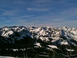
The Wasatch Range or Wasatch Mountains is a mountain range in the western United States that runs about 160 miles (260 km) from the Utah-Idaho border south to central Utah. It is the western edge of the greater Rocky Mountains, and the eastern edge of the Great Basin region. The northern extension of the Wasatch Range, the Bear River Mountains, extends just into Idaho, constituting all of the Wasatch Range in that state.

<span class="mw-page-title-main">Deer Valley</span> Ski resort in Park City, Utah, United States

Deer Valley is an alpine ski resort in the Wasatch Range, located 36 miles (58 km) east of Salt Lake City, in Park City, Utah, United States. The resort, known for its upscale amenities, is consistently ranked among the top ski resorts in North America.

<span class="mw-page-title-main">Snowbird, Utah</span> Unincorporated community in Utah

Snowbird is an unincorporated community in Little Cottonwood Canyon in the Wasatch Range of the Rocky Mountains near Salt Lake City, Utah, United States. It is most famous for Snowbird Ski and Summer Resort, an alpine skiing and snowboarding area, which opened in December 1971.

<span class="mw-page-title-main">Alta Ski Area</span> Ski resort in Alta, Utah, United States

Alta is a ski area in the western United States, located in the town of Alta in the Wasatch Mountains of Utah, in Salt Lake County. With a skiable area of 2,614 acres (10.58 km2), Alta's base elevation is 8,530 ft (2,600 m) and rises to 11,068 ft (3,374 m) for a vertical gain of 2,538 ft (774 m). One of the oldest ski resorts in the country, it opened its first lift in early 1939. Alta is known for receiving more snow than most Utah resorts, with an average annual snowfall of 545 inches (13.8 m). It is also regularly ranked as having the best snow in North America. Alta is one of three remaining ski resorts in the U.S. that prohibits snowboarders, along with nearby competitor Deer Valley and Vermont's Mad River Glen.

<span class="mw-page-title-main">Little Cottonwood Canyon</span> Canyon in Northern Utah

Little Cottonwood Canyon lies within the Wasatch-Cache National Forest along the eastern side of the Salt Lake Valley, roughly 15 miles from Salt Lake City, Utah. The canyon is part of Granite, a CDP and "Community Council" designated by Salt Lake County. The canyon is a glacial trough, carved by an alpine glacier during the last ice age, 15,000 to 25,000 years ago. A number of rare and endemic plant species are found in the canyon's Albion Basin. Introduced Mountain goats inhabit the surrounding mountains.

<span class="mw-page-title-main">Snowbasin</span> Ski resort in Utah, United States

Snowbasin Resort is a ski resort in the western United States, located in Weber County, Utah, 33 miles (53 km) northeast of Salt Lake City, on the back (east) side of the Wasatch Range.

<span class="mw-page-title-main">Solitude Mountain Resort</span> Ski resort in Brighton, Utah, United States

Solitude Mountain Resort is a ski resort located in the Big Cottonwood Canyon of the Wasatch Mountains, thirty miles southeast of Salt Lake City, Utah. With 66 trails, 1,200 acres (4.9 km2) and 2,047 feet (624 m) vertical, Solitude is one of the smaller ski resorts near Salt Lake City, along with its neighbor Brighton. It is a family-oriented mountain, with a wider range of beginner and intermediate slopes than other nearby ski resorts; 50% of its slopes are graded "beginner" or "intermediate," the highest such ratio in the Salt Lake City area. Solitude was one of the first major US resorts to adopt an RFID lift ticket system, allowing lift lines to move more efficiently. It was followed by Alta Ski Area in 2007. Solitude is adjacent to Brighton Ski Resort near the top of Big Cottonwood Canyon. Solitude and Brighton offer a common "Solbright Pass" which provides access to both resorts for a nominal surcharge.

<span class="mw-page-title-main">Brighton Ski Resort</span> Ski resort near Salt Lake City, Utah, United States

Brighton Ski Resort is a ski area in the western United States, located in Big Cottonwood Canyon in Brighton, Utah. About thirty miles (50 km) from downtown Salt Lake City, it is owned and operated by Boyne Resorts.

<span class="mw-page-title-main">Park City Mountain Resort</span> Ski resort in Park City, Utah

Park City Mountain Resort (PCMR) is a ski resort in the western United States in Park City, Utah, located 32 miles (51 km) east of Salt Lake City. Park City, as the ski resort and area is known, contains several training courses for the U.S. Ski Team, including slalom and giant slalom runs. During the 2002 Winter Olympics, it hosted the snowboarding events and the men's and women's alpine giant slalom events.

<span class="mw-page-title-main">Utah State Route 210</span> State highway in Utah, United States

State Route 210 (SR-210) is a state route in the U.S. state of Utah that is the access road for Little Cottonwood Canyon and the ski resorts of Alta and Snowbird. The 13.62 mi (21.92 km) highway straddles the southeastern edge of the Salt Lake Valley before it enters the mouth of Little Cottonwood Canyon.

The economy of Utah is a diversified economy covering industries such as tourism, mining, agriculture, manufacturing, information technology, finance, and petroleum production. The majority of Utah's gross state product is produced along the Wasatch Front, containing the state capital Salt Lake City.

<span class="mw-page-title-main">Cecret Lake</span> Alpine lake in Utah

Cecret Lake is a small alpine lake in Albion Basin which is within the town limits of Alta in the U.S. state of Utah. This area is also part of the Wasatch National Forest. Cecret Lake is also a protected watershed for Salt Lake City. The United States Geological Survey officially spells the name of this lake as "Cecret Lake".

<span class="mw-page-title-main">Little Cottonwood Creek (Salt Lake County, Utah)</span> River in Utah, United States

Little Cottonwood Creek is one of the principal streams entering Salt Lake Valley from the east. The creek rises near the summit of the Wasatch Mountains, a short distance south of the ski resort town of Alta, and flows in a westerly direction through Little Cottonwood Canyon until it emerges into Salt Lake Valley about eleven miles from its source. Thence its course is north westerly through Sandy, Midvale and Murray, Utah until it empties into the Jordan River, about six miles south of Salt Lake City. Its whole length is nearly 27 miles (43 km). The headwaters of Little Cottonwood Creek are in Little Cottonwood Canyon, a glaciated canyon in Uinta-Wasatch-Cache National Forest and the Wasatch and Uinta Mountains eco-region. One of the main tributaries of the creek rises in Cecret Lake, a small sheet of water situated near Alta. The entire Little Cottonwood Creek drainage basin encompasses 46 square miles (120 km2), ranging in elevation from about 4,490 to 11,500 feet.

<span class="mw-page-title-main">Big Cottonwood Creek</span> River in Utah, United States

Big Cottonwood Creek is located in the Wasatch Mountains just east of Salt Lake City. It is part of the Big Cottonwood Creek Watershed, which ranges in elevation from 5,000 to 10,500 feet with the headwaters around 9,600 feet. The creek flows through the Big Cottonwood Canyon in a westerly direction until it emerges into Salt Lake Valley about eighteen miles (29 km) from its highest source. Thence its course is northwesterly through Cottonwood Heights, Holladay, and Murray, Utah for a little over twenty-four miles from the headwaters until it empties into the Jordan River about five miles (8.0 km) south of Salt Lake City. The water eventually flows into the Great Salt Lake. In the summer, its waters are all used for irrigation purposes. From its source to its original outlet in the Jordan River is about twenty-six miles.

Skiing in Utah is a thriving industry which contributes greatly to the state’s economy. Skiing started off in the state as a recreational activity enjoyed by only a few, but since the 1930s, it has increasingly developed into a substantial industry, which creates thousands of jobs and brings in millions of dollars in revenue.

References

  1. "Town of Alta Town Council".
  2. "2019 US Gazetteer Files". US Census Bureau. Retrieved August 7, 2020.
  3. "US Census website". US Census Bureau. Retrieved 31 January 2008.
  4. "US Board on Geographic Names". United States Geological Survey. 25 October 2007. Retrieved 31 January 2008.
  5. "The 11 Unspoken Rules of Powder Skiing". Outdoor Magazine. 17 January 2020. Retrieved 21 January 2021.
  6. "Emma Mine". mineswindles.com.
  7. "The Infamous Emma Mine: A British Interest in the Little Cottonwood District, Utah Territory". Utah Historical Quarterly, Vol. 23. 1955. Retrieved 20 January 2021.
  8. Dan Plazak, A Hole in the Ground with a Liar at the Top, Salt Lake City: University of Utah Press, 2006, ISBN   978-0-87480-840-7, pp. 39-77.
  9. "Governor considers gondola to solve canyon gridlock". Deseret News. 17 January 2021. Retrieved 20 January 2021.
  10. "How Will Covid-19 Change Utah's Ski Season?". ABC4 News, Salt Lake City UT. 18 November 2020. Retrieved 20 January 2021.
  11. "Alta Mayor calls for quiet after study at resort shows how loud talking can spread coronavirus". Salt Lake Tribune. 16 December 2020. Retrieved 20 January 2021.
  12. "Census of Population and Housing". Census.gov. Retrieved June 4, 2015.
  13. "US Census website". US Census Bureau. Retrieved 17 September 2013.
  14. "Archived copy" (PDF). Archived from the original (PDF) on 3 October 2018. Retrieved 15 March 2014.{{cite web}}: CS1 maint: archived copy as title (link)
  15. "Utah Battles Floods, Mud"; in Pittsburgh Post-Gazette ; June 3, 1983; p. 30
  16. "Weather Extremes"
  17. "U.S. Climate Normals Quick Access – Station: Alta, UT". National Oceanic and Atmospheric Administration. Retrieved January 26, 2023.
  18. "NOAA Online Weather Data – NWS Salt Lake City". National Weather Service. Retrieved January 26, 2023.

Further reading