Parker is a census-designated place and unincorporated community in central Yakima County, Washington, United States. It is located on U.S. Route 97 between the cities of Union Gap and Wapato on the Yakama Indian Reservation. The town had a population of 154 at the 2010 census.

Riffe Lake is a long reservoir on the Cowlitz River in the U.S. state of Washington. The 23.5 mi (38 km) lake was created by the construction of Mossyrock Dam, the tallest dam in the state, in 1968 by Tacoma City Light.

The Sultan River is a river in Snohomish County in the U.S. state of Washington. It is a tributary of the Skykomish River, which it joins at the town of Sultan, Washington. The river is dammed in its upper third by Culmback Dam to form Spada Lake.

Cardinal Peak is the highest peak of the Chelan Mountains, a subrange of the Cascade Range in the U.S. state of Washington. It is located in Wenatchee National Forest at the head of the Entiat River drainage basin, in Chelan County. To the west and north, streams flow into Lake Chelan. Cardinal Peak is less than 5 miles (8.0 km) from the lake and rises 7,500 feet (2,300 m) above the lakeshore. At 8,595 feet (2,620 m) high, it is the 49th highest peak in Washington. Its 2,070-foot (630 m) prominence ranks 132nd in the state.

Alder Lake is a 7 mi (11 km) long reservoir on the Nisqually River in Eatonville, Washington in the U.S. state of Washington, which was created by the construction of Alder Dam by Tacoma Power in September 1944. At the very eastern end of the lake is the town of Elbe, Washington.
Valley is a census-designated place and unincorporated community in Stevens County, Washington, United States. In the 2010 census the population was 146.
Artesian is an unincorporated community in Yakima County, Washington, United States, located approximately one mile east of Moxee.
Lichty is an unincorporated community in Yakima County, Washington, United States, located between Sunnyside and Grandview on U.S. Route 12.
Byron is an unincorporated community in Yakima County, Washington, United States, located approximately three miles west of Prosser.
Cliffdell is an unincorporated community in Yakima County, Washington, United States, located approximately 23 miles west of Ellensburg.
Pomona is an unincorporated community in Yakima County, Washington, United States, located immediately northeast of Selah.
Rimrock is an unincorporated community in Yakima County, Washington, United States, located approximately 22 miles west of Yakima on the Tieton River, adjacent to Rimrock Lake.
Longview is an unincorporated historic community in Benton County, Washington, United States, located approximately three miles west of Umatilla, Oregon on the north bank of the Columbia River, just above Devil's Bend Rapids.
Yellepit was an unincorporated community in Benton County, Washington, United States, located approximately three miles southwest of Wallula on the west bank of the Columbia River.
Lindberg is an extinct town in Lewis County, in the U.S. state of Washington. The GNIS lists location as unknown, however period maps show Lindberg on State Route 7, about three miles north of the U.S. Route 12 junction, where the East Fork Tilton River joins Tilton River.
Mayfield is an unincorporated community on the southern shore of Lake Mayfield in Lewis County, Washington. It is located off U.S. Route 12, east of Silver Creek. The Mayfield Dam, which supplies hydroelectricity to Tacoma and its neighboring cities, sits 1-mile west of the area.
Mock is an extinct town in Spokane County, in the U.S. state of Washington. The GNIS classifies it as a populated place.
Rodna is an extinct town in Spokane County, in the U.S. state of Washington. The GNIS classifies it as a populated place.
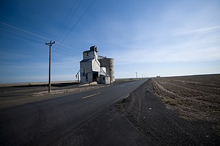
Tokio is a rural location and former rural community in Adams County, in the Palouse region of eastern Washington. It is located along Interstate 90 northeast of Ritzville.
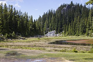
Alturas Lake is a freshwater lake located on the northern slope of Bald Eagle Peak, in King County, Washington. Alturas Lake drains North towards Tonga Ridge and into the East Fork of the Foss River.

