Spokane Valley is a city in Spokane County, Washington, United States, and the largest suburb of Spokane. It is located east of Spokane, west of Coeur d'Alene, Idaho, and surrounds the city of Millwood on three sides. The city incorporated as the City of Spokane Valley on March 31, 2003. The population was 102,976 at the 2020 census, making it the eighth-largest city in Washington state. Spokane Valley is named after the valley of the Spokane River, in which it is located. The city and the general area is colloquially referred to as "The Valley" by residents of the Spokane–Coeur d'Alene area.

The Blue Mountains are a mountain range in the northwestern United States, located largely in northeastern Oregon and stretching into extreme southeastern Washington. The range has an area of about 15,000 square miles (39,000 km2), stretching east and southeast of Pendleton, Oregon, to the Snake River along the Oregon–Idaho border.

The Little Spokane River is a major tributary of the Spokane River, approximately 35 miles (56 km) long, in eastern Washington in the United States. It drains a rural area of forested foothills and a farming valley north of the city of Spokane along the Idaho–Washington border. It has two branches, one starting west of Newport and the other stemming from Eloika Lake farther west.

The Spokane Valley is a valley of the Spokane River through the southern Selkirk Mountains in the U.S. state of Washington. The valley is home to the cities of Spokane and its suburbs Spokane Valley, Liberty Lake, and Millwood. The valley is bounded on the north and south by the Selkirk Mountains, on the west by the Columbia River Basalt Group, and on the east by the Rathdrum Prairie at the Idaho state border. Mica Peak, located south of the valley, is the southernmost peak in the Selkirk Range. The mountain, along with surrounding peaks, separates the Spokane Valley from the Palouse. The Valley contains part of the Spokane Valley–Rathdrum Prairie Aquifer.
Milan is an unincorporated community in Spokane County, Washington, United States. It is named after the Italian city of Milan.

Nine Mile Falls is an unincorporated community in Spokane County, Washington and Stevens County, Washington, United States. The community straddles the Spokane River 9 miles (14 km) away from downtown Spokane, at the location of a former falls that has been the site of Nine Mile Dam since 1908. Following the river, the community is located 16 miles (26 km) downstream from downtown.

Suncrest is a census-designated place (CDP) in Stevens County, Washington, United States. Though it is not incorporated as a city or town, the CDP's population of 5,413 at the 2020 census makes Suncrest the largest community in the county. The community is located along the Spokane River 9.7 miles northwest of the city of Spokane, of which it is a exurb and bedroom community. The community experienced substantial growth starting in the mid-1980s, with gated community and suburban style development. State Route 291 is the main thoroughfare through Suncrest, as well as its main connection to the surrounding area including Spokane.
The Rattlesnake Hills, also known as Rattlesnake Ridge, is a 16-mile (26 km) long anticline mountain ridge in Yakima County and Benton County in the U.S. state of Washington. It should not be confused with the much smaller Rattlesnake Ridge located near the west end of Ahtanum Ridge just south of Yakima, Washington and west of Union Gap, Washington. The highest point in the hills is the 3,629 feet (1,106 m) Lookout Summit, which surpasses the more well-known Rattlesnake Mountain by approximately 100 ft (30 m). The Rattlesnake Hills are part of the Yakima Fold Belt of east-tending long ridges formed by the folding of Miocene Columbia River basalt flows.
Chattaroy is an unincorporated community in Spokane County, Washington, United States. The town is located on U.S. Route 2 approximately 10 miles north-northeast of Spokane at the confluence of the Little Spokane River and Deer Creek.

Monitor is a small unincorporated community in Chelan County, Washington, United States. It is situated along the Wenatchee River about 8 miles upstream from its junction with the Columbia River in the fertile Wenatchee Valley.

Ford is an unincorporated community in Stevens County, Washington, United States. It is on Washington State Route 231 10.5 miles (16.9 km) south-southwest of Springdale. Ford has a post office with ZIP code 99013. Ford has a nondenominational community church. A little-known historical monument commemorating the Tshimakain Mission stands just outside of the main town.
Mica is an unincorporated community in Spokane County, Washington, United States. Mica is located along State Route 27 12 miles (19 km) southeast of downtown Spokane. Mica had a post office with ZIP code 99023.
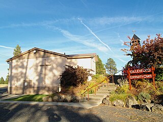
Valleyford is an unincorporated community in Spokane County, Washington, United States. Valleyford has a post office with ZIP code 99036. Valleyford was listed to have a population of 2,913 according to the 2010 United States census.
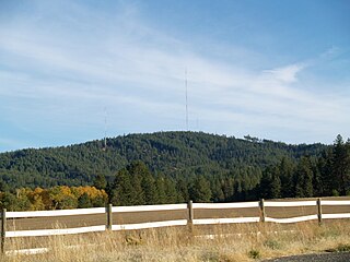
Krell Hill, also known as Tower Mountain, is a peak at the southern end of the Selkirk Mountains in Spokane County, Washington. It rises abruptly to the southeast of the relatively flat South Hill area of the city of Spokane. An area of high topographical relief continues to the east of the mountain towards Mica Peak and the Coeur d'Alene Mountains of the Bitterroot Range, in turn part of the Rocky Mountains. To the north the mountain descends slowly along a ridge, and then into the lower Dishman Hills and eventually into Spokane Valley. To the south and west the mountain towers over relatively flat terrain, with the vast farmland of the Palouse and the Columbia Plateau extending as far as the eye can see.

Buckeye is an unincorporated community in Spokane County, in the U.S. state of Washington. It is located along the Little Spokane River in the northern portion of the county.

Denison is an unincorporated community in Spokane County, in the U.S. state of Washington. The community is located on U.S. Route 395 19 miles due north of Downtown Spokane and about seven miles beyond that city's northern suburban developments. Denison lends its name to two roads in the area, Denison Road and Denison-Chattaroy Road, both of which intersect with Route 395 in the immediate vicinity of Denison. The city of Deer Park is four miles to the north.
Orchard Prairie is an unincorporated community in Spokane County, in the U.S. state of Washington.

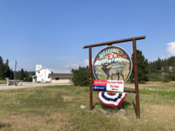
Freeman is an unincorporated community in Spokane County, Washington, United States. It is notable as being the location of the public elementary, middle and high schools serving a large area of rural southeast Spokane County.
Glenrose is an unincorporated community in Spokane County, Washington, United States. It is a rural and suburban community split between sections of farmland with many canola fields and new construction of single-family homes. The community is bounded by mountains on two sides and the Spokane urban area on the other two.

Latah/Hangman is a neighborhood in Spokane, Washington.