Aritao

Last updated
Aritao
Municipality of Aritao
AritaoHalljf3312 07.JPG
Downtown area
Flag of Aritao, Nueva Vizcaya.png
Aritao Nueva Vizcaya.png
Ph locator nueva vizcaya aritao.png
Map of Nueva Vizcaya with Aritao highlighted
OpenStreetMap
Aritao
Philippines location map (square).svg
Red pog.svg
Aritao
Location within the Philippines
Coordinates: 16°17′50″N121°02′02″E / 16.297258°N 121.033819°E / 16.297258; 121.033819
Country Philippines
Region Cagayan Valley
Province Nueva Vizcaya
District Lone district
Barangays 22 (see Barangays)
Government
[1]
  Type Sangguniang Bayan
   Mayor Remelina M. Peros
   Vice Mayor Jayson Ferrer.
   Representative Luisa L. Cuaresma
   Electorate 23,422 voters (2022)
Area
[2]
  Total265.60 km2 (102.55 sq mi)
Elevation
476 m (1,562 ft)
Highest elevation
846 m (2,776 ft)
Lowest elevation
346 m (1,135 ft)
Population
 (2020 census) [3]
  Total42,197
  Density160/km2 (410/sq mi)
   Households
10,307
Economy
   Income class 2nd municipal income class
   Poverty incidence
15.83
% (2018) [4]
   Revenue 198.3 million (2020)
   Assets 380.5 million (2020)
   Expenditure 156 million (2020)
   Liabilities 53.84 million (2020)
Service provider
  ElectricityNueva Vizcaya Electric Cooperative (NUVELCO)
Time zone UTC+8 (PST)
ZIP code
3704
PSGC
IDD : area code +63(0)78
Native languages Gaddang
Ilocano
Isinai
Kallahan
Tagalog
Website aritao.gov.ph

Aritao, officially the Municipality of Aritao (Gaddang : Ili na Aritao; Ilocano : Ili ti Aritao; Tagalog : Bayan ng Aritao), is a 2nd class municipality in the province of Nueva Vizcaya, Philippines. According to the 2020 census, it has a population of 42,197 people. [3]

Contents

The ethnic minority called Isinai (the same term for the local spoken dialect) were the original residents of this town.

Aritao is 30 kilometres (19 mi) from Bayombong and 235 kilometres (146 mi) from Manila.

Etymology

The name Aritao came from the Isinai phrase Ari Tau "which stands for "Our King" (ari means king and tau means our) which refers to the legendary Isinai Chieftain Mengal, a fierce and brave king who resisted Spanish conquest of the Isinai territories around Ajanas and Ynordenan (the areas comprising what is now most of Aritao).

History

The town of Aritao was previously called Ajanas or Afanas. It was formerly the site of an Igorot fortress that was overrun by the Spanish in 1745 which was then further fortified by the colonists. Prior to that, the Spaniards had already established their first permanent settlement in Nueva Vizcaya in 1714 in the town of Buhay, now Barangay Santa Clara. Afanas was later renamedto Aritao, after an Isinay word “Ari-Tau”. In January 1767, the intrepid Spanish Missionary Manuel Corripio succeeded in persuading an Igorot King called Ari Mengal and his tribe to live in the town. These people were later converted into Christianity by Fr. Tomas Gutierrez. In 1776, there was a merger of Aritao with the settlements of Buhay, Mabatu and Pahipahi into one pueblo under the name of Aritao, which was approved by the colonial authorities, with the town center being confirmed to be in the old Aritao. [5]

During the American Era on 30 June 1917, through the initiative of Councilor Jose Aleman, the application for township of Aritao to higher authorities was finally approved by the Secretary of the Interior.

During World War II, Japanese troops entered Aritao in 1942 and were pushed out by Allied forces in 1945 after heavy fighting in the village of Kirang, which lay on the foot of the Cordillera mountain trails towards Baguio.

Geography

Barangays

Aritao is politically subdivided into 22 barangays. Each barangay consists of puroks and some have sitios.

  • Banganan
  • Beti
  • Bone North
  • Bone South
  • Calitlitan
  • Comon
  • Cutar
  • Darapidap
  • Kirang
  • Nagcuartelan
  • Poblacion
  • Sta. Clara
  • Tabueng
  • Tucanon
  • Anayo
  • Baan
  • Balite
  • Canabuan
  • Canarem
  • Latar-Nocnoc-San Francisco
  • Ocao-Capiniaan
  • Yaway

Climate

Climate data for Aritao, Nueva Vizcaya
MonthJanFebMarAprMayJunJulAugSepOctNovDecYear
Mean daily maximum °C (°F)26
(79)
28
(82)
29
(84)
31
(88)
30
(86)
29
(84)
28
(82)
28
(82)
28
(82)
28
(82)
28
(82)
27
(81)
28
(83)
Mean daily minimum °C (°F)18
(64)
18
(64)
19
(66)
22
(72)
23
(73)
23
(73)
23
(73)
23
(73)
23
(73)
21
(70)
20
(68)
18
(64)
21
(69)
Average precipitation mm (inches)21
(0.8)
28
(1.1)
34
(1.3)
58
(2.3)
160
(6.3)
179
(7.0)
226
(8.9)
225
(8.9)
215
(8.5)
168
(6.6)
59
(2.3)
32
(1.3)
1,405
(55.3)
Average rainy days7.58.510.914.923.925.726.725.324.918.611.88.9207.6
Source: Meteoblue [6]

Demographics

Population census of Aritao
YearPop.±% p.a.
1903 477    
1918 1,314+6.99%
1939 6,208+7.67%
1948 7,322+1.85%
1960 11,209+3.61%
1970 18,098+4.90%
1975 19,075+1.06%
1980 22,004+2.90%
YearPop.±% p.a.
1990 25,942+1.66%
1995 29,151+2.21%
2000 31,705+1.82%
2007 34,206+1.05%
2010 37,115+3.01%
2015 37,225+0.06%
2020 42,197+2.50%
Source: Philippine Statistics Authority [7] [8] [9] [10]

Economy

Government

Local government

Aritao, belonging to the lone congressional district of the province of Nueva Vizcaya, is governed by a mayor designated as its local chief executive and by a municipal council as its legislative body in accordance with the Local Government Code. The mayor, vice mayor, and the councilors are elected directly by the people through an election which is being held every three years.

Elected officials

Members of the Municipal Council
(2022–2025) [18]
PositionName
CongressmanLuisa L. Cuaresma
MayorRemelina M. Peros-Galam
Vice-MayorJayson E. Ferrer
CouncilorsAriel M. Tubiera
Aura Bless Crisel F. Galindez
Adonis J. Lejao
Cyrus Will C. Cardenas
Domingo B. Doculan Jr.
Michael M. Villegas
Bernel A. Prado
Vincent L. Lopez

Education

The Schools Division of Nueva Vizcaya governs the town's public education system. The division office is a field office of the DepEd in Cagayan Valley region. [19] The office governs the public and private elementary and public and private high schools throughout the municipality.

Related Research Articles

<span class="mw-page-title-main">Nueva Vizcaya</span> Province in Cagayan Valley, Philippines

Nueva Vizcaya, officially the Province of Nueva Vizcaya, is a landlocked province in the Philippines located in the Cagayan Valley region in Luzon. Its capital is Bayombong. It is bordered by Benguet to the west, Ifugao to the north, Isabela to the northeast, Quirino to the east, Aurora to the southeast, Nueva Ecija to the south, and Pangasinan to the southwest. Quirino province was created from Nueva Vizcaya in 1966.

<span class="mw-page-title-main">Bambang, Nueva Vizcaya</span> Municipality in the Philippines

Bambang, officially the Municipality of Bambang, is a 1st class municipality in the province of Nueva Vizcaya, Philippines. According to the 2020 censusus, it has a population of 55,789 people.

<span class="mw-page-title-main">Palanan</span> Municipality in Isabela, Philippines

Palanan, officially the Municipality of Palanan, is a 1st class municipality in the province of Isabela, Philippines. It also served as the final capital of the First Philippine Republic from 1900 until the capture of President Emilio Aguinaldo by the Americans during the Philippine-American War in 1901. According to the 2020 census, it has a population of 17,684 people.

<span class="mw-page-title-main">Bagabag, Nueva Vizcaya</span> Municipality in Nueva Vizcaya, Philippines

Bagabag, officially the Municipality of Bagabag, is a 2nd class municipality in the province of Nueva Vizcaya, Philippines. According to the 2020 census, it has a population of 37,985 people.

<span class="mw-page-title-main">Angadanan</span> Municipality in Isabela, Philippines

Angadanan, officially the Municipality of Angadanan, is a 3rd class municipality in the province of Isabela, Philippines. At the 2020 census, it had a population of 44,977.

<span class="mw-page-title-main">Cordon, Isabela</span> Municipality in Isabela, Philippines

Cordon, officially the Municipality of Cordon, is a 2nd class municipality in the province of Isabela, Philippines. According to the 2020 census, it has a population of 46,477 people.

<span class="mw-page-title-main">Echague</span> Municipality in Isabela, Philippines

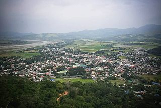
Echague, officially the Municipality of Echague, is a 1st class municipality in the province of Isabela, Philippines. According to the 2020 census, it has a population of 88,410 people. The town is known for the indigenous and endangered Yogad language, which is spoken and conserved by its locals.

<span class="mw-page-title-main">Alfonso Castañeda</span> Municipality in Nueva Vizcaya, Philippines

Alfonso Castañeda, officially the Municipality of Alfonso Castañeda, is a 1st class municipality in the province of Nueva Vizcaya, Philippines. According to the 2020 census, it has a population of 8,539 people.

<span class="mw-page-title-main">Ambaguio</span> Municipality in Nueva Vizcaya, Philippines

Ambaguio, officially the Municipality of Ambaguio, is a 5th class municipality in the province of Nueva Vizcaya, Philippines. According to the 2020 census, it has a population of 15,472 people.

<span class="mw-page-title-main">Bayombong</span> Capital of Nueva Vizcaya, Philippines

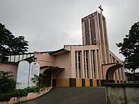
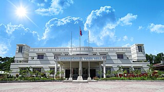
Bayombong, officially the Municipality of Bayombong, is a 1st class municipality and capital of the province of Nueva Vizcaya, Philippines. According to the 2020 census, it has a population of 67,714 people.

<span class="mw-page-title-main">Diadi</span> Municipality in Nueva Vizcaya, Philippines

Diadi, officially the Municipality of Diadi, is a 4th class municipality in the province of Nueva Vizcaya, Philippines. According to the 2020 census, it has a population of 19,236 people.

<span class="mw-page-title-main">Dupax del Sur</span> Municipality in Nueva Vizcaya, Philippines

Dupax del Sur, officially the Municipality of Dupax del Sur, is a 2nd class municipality in the province of Nueva Vizcaya, Philippines. At the 2020 census, it had a population of 21,224 people.

<span class="mw-page-title-main">Kasibu</span> Municipality in Nueva Vizcaya, Philippines

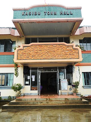
Kasibu, officially the Municipality of Kasibu, is a 3rd class municipality in the province of Nueva Vizcaya, Philippines. According to the 2020 census, it has a population of 41,776 people.

<span class="mw-page-title-main">Kayapa</span> Municipality in Nueva Vizcaya, Philippines

Kayapa, officially the Municipality of Kayapa, is a 3rd class municipality in the province of Nueva Vizcaya, Philippines. According to the 2020 census, it has a population of 26,469 people.

<span class="mw-page-title-main">Quezon, Nueva Vizcaya</span> Municipality in Nueva Vizcaya, Philippines

Quezon, officially the Municipality of Quezon, is a 4th class municipality in the province of Nueva Vizcaya, Philippines. According to the 2020 census, it has a population of 24,055 people.

<span class="mw-page-title-main">Santa Fe, Nueva Vizcaya</span> Municipality in Nueva Vizcaya, Philippines

Santa Fe, officially the Municipality of Santa Fe, is a 3rd class, landlocked municipality in the province of Nueva Vizcaya, Philippines. According to the 2020 census, it has a population of 18,276 people.

<span class="mw-page-title-main">Villaverde, Nueva Vizcaya</span> Municipality in Nueva Vizcaya, Philippines

Villaverde, officially the Municipality of Villaverde, also spelled as Villa Verde, is a 5th class municipality in the province of Nueva Vizcaya, Philippines. According to the 2020 census, it has a population of 20,118 people.

<span class="mw-page-title-main">Cabarroguis</span> Capital of Quirino, Philippines

Cabarroguis, officially the Municipality of Cabarroguis, is a 3rd class municipality and capital of the province of Quirino, Philippines. According to the 2020 census, it has a population of 33,533 people.

<span class="mw-page-title-main">Nagtipunan</span> Municipality in Quirino, Philippines

Nagtipunan, officially the Municipality of Nagtipunan, is a 1st class municipality in the province of Quirino, Philippines. According to the 2020 census, it has a population of 25,399 people. Nagtipunan is the largest town in terms of land area in Quirino and the entire Luzon island.

<span class="mw-page-title-main">Saguday</span> Municipality in Quirino, Philippines

Saguday, officially the Municipality of Saguday, is a 5th class municipality in the province of Quirino, Philippines. According to the 2020 census, it has a population of 17,137 people.

References

  1. Municipality of Aritao | (DILG)
  2. "2015 Census of Population, Report No. 3 – Population, Land Area, and Population Density" (PDF). Philippine Statistics Authority. Quezon City, Philippines. August 2016. ISSN   0117-1453. Archived (PDF) from the original on May 25, 2021. Retrieved July 16, 2021.
  3. 1 2 Census of Population (2020). "Region II (Cagayan Valley)". Total Population by Province, City, Municipality and Barangay. Philippine Statistics Authority . Retrieved 8 July 2021.
  4. "PSA Releases the 2018 Municipal and City Level Poverty Estimates". Philippine Statistics Authority. 15 December 2021. Retrieved 22 January 2022.
  5. Salgado, Pedro. "Various Towns of Nueva Vizcaya". Cagayan Valley and Easter Cordillera: 1581-1898, Volume II. Rex Publishing. pp. 804–809.
  6. "Aritao: Average Temperatures and Rainfall". Meteoblue. Retrieved 4 July 2021.
  7. Census of Population (2015). "Region II (Cagayan Valley)". Total Population by Province, City, Municipality and Barangay. Philippine Statistics Authority . Retrieved 20 June 2016.
  8. Census of Population and Housing (2010). "Region II (Cagayan Valley)" (PDF). Total Population by Province, City, Municipality and Barangay. National Statistics Office . Retrieved 29 June 2016.
  9. Censuses of Population (1903–2007). "Region II (Cagayan Valley)". Table 1. Population Enumerated in Various Censuses by Province/Highly Urbanized City: 1903 to 2007. National Statistics Office.{{cite encyclopedia}}: CS1 maint: numeric names: authors list (link)
  10. "Province of Nueva Vizcaya". Municipality Population Data. Local Water Utilities Administration Research Division. Retrieved 17 December 2016.
  11. "Poverty incidence (PI):". Philippine Statistics Authority. Retrieved December 28, 2020.
  12. "Estimation of Local Poverty in the Philippines" (PDF). Philippine Statistics Authority. 29 November 2005.
  13. "2003 City and Municipal Level Poverty Estimates" (PDF). Philippine Statistics Authority. 23 March 2009.
  14. "City and Municipal Level Poverty Estimates; 2006 and 2009" (PDF). Philippine Statistics Authority. 3 August 2012.
  15. "2012 Municipal and City Level Poverty Estimates" (PDF). Philippine Statistics Authority. 31 May 2016.
  16. "Municipal and City Level Small Area Poverty Estimates; 2009, 2012 and 2015". Philippine Statistics Authority. 10 July 2019.
  17. "PSA Releases the 2018 Municipal and City Level Poverty Estimates". Philippine Statistics Authority. 15 December 2021. Retrieved 22 January 2022.
  18. "LGU-Officials | Official Website of LGU Aritao". Official Website of LGU Aritao. Retrieved 10 April 2024.
  19. "DEPED REGIONAL OFFICE NO. 02". DepED RO2 | The official website of DepED Regional Office No. 02. Archived from the original on 2022-04-12. Retrieved 2022-03-12.