Villaverde, Nueva Vizcaya

Last updated
Villaverde
Ibung
Municipality of Villaverde
Villaverde,NEjf5678 01.JPG
Municipal Hall
Flag of Villaverde, Nueva Vizcaya.png
Villaverde Nueva Vizcaya.png
Ph locator nueva vizcaya villaverde.png
Map of Nueva Vizcaya with Villaverde highlighted
OpenStreetMap
Villaverde, Nueva Vizcaya
Philippines location map (square).svg
Red pog.svg
Villaverde
Location within the Philippines
Coordinates: 16°36′24″N121°10′58″E / 16.6067°N 121.1828°E / 16.6067; 121.1828
Country Philippines
Region Cagayan Valley
Province Nueva Vizcaya
District Lone district
Named for Padre Juan Villaverde
Barangays 9 (see Barangays)
Government
[1]
  Type Sangguniang Bayan
   Mayor Ronelie U. Valtoribio
   Vice Mayor Kajong Eng. Acosta
   Representative Luisa L. Cuaresma
   Electorate 12,002 voters (2022)
Area
[2]
  Total81.50 km2 (31.47 sq mi)
Elevation
287 m (942 ft)
Highest elevation
787 m (2,582 ft)
Lowest elevation
213 m (699 ft)
Population
 (2020 census) [3]
  Total20,118
  Density250/km2 (640/sq mi)
   Households
5,688
Economy
   Income class 5th municipal income class
   Poverty incidence
7.24
% (2021) [4]
   Revenue 93.77 million (2020)
   Assets 195.3 million (2020)
   Expenditure 76.68 million (2020)
   Liabilities 40.6 million (2020)
Service provider
  ElectricityNueva Vizcaya Electric Cooperative (NUVELCO)
Time zone UTC+8 (PST)
ZIP code
3710
PSGC
IDD : area code +63(0)78
Native languages Ilocano
Tagalog
Website www.lguvillaverde.com

Villaverde, officially the Municipality of Villaverde (Ilocano : Ili ti Villaverde; Tagalog : Bayan ng Villaverde), also spelled as Villa Verde, is a 5th class municipality in the province of Nueva Vizcaya, Philippines. According to the 2020 census, it has a population of 20,118 people. [3]

Contents

Etymology

The town got its name in honor of the Spanish Missionary, father Juan Villaverde.

History

Spanish era

Villaverde was formerly a barrio of Solano, Nueva Vizcaya called Ibung, founded by a Dominican Friar named Alejandro Vidal in 1767. More than a century later, an order from the Spanish Government was issued to Father Juan Villaverde giving instruction to organize into a town. Thus, on May 28, 1872, Ibung became a town of the province of Nueva Vizcaya. Ibung was originally settled by christianized Ifugaos resettled from the area of Kiangan who later abandoned the town after a malaria epidemic in 1890, whereupon they were replaced by Ilocano migrants. [5]

American era

When the American took over, Ibung lost its status as a town because of insufficient funds. Moreover, most of the people residing in the area have transferred to an adjoining towns for fear of their lives from non-Christian tribes who dwelt in Cordillera mountains in the north-west part of the town. Ibung became a barangay of the municipality of Solano again .

Philippine independence

On June 17, 1957, through the sponsorship of the Congressman Leonardo B. Perez, Republic Act. No. 197 was enacted providing for the creation of the town Ibung through the separation of the barrios of Ibung and Bintawan from Solano. [6] On September 1, 1957, Antonio B. Aquino was appointed as the first mayor of Ibung.

Two years later, on June 21, 1959, Republic Act. No. 2515 was enacted amending Republic Act. No. 1972 changing the name of the town from Ibung to Villaverde in honor of Father Juan Villaverde who had organized the town. Romualdo Ubando was appointed as the first Municipal Mayor at that time. In 1963, Antonio B. Aquino was the first elected Mayor after renaming the town.

In 1986, the town's mayor, Romualdo Bediones, was abducted by the New People's Army and held until he was tried by a kangaroo court and executed in public. [7]

Geography

About 280 kilometres (170 mi) from Manila and 14 kilometres (8.7 mi) from the capital town of Bayombong; lies on the northern district of the province and is bounded by Lamut, Ifugao on the North; Solano on the South; Bagabag on the East, and Ambaguio on the West. Villaverde has a total land area of 81.50 square kilometers, the smallest town which accounts for 1.86% of the total land area of Nueva Vizcaya.

Barangays

Villaverde is politically subdivided into 9 barangays. Each barangay consists of puroks and some have sitios.

Barangay Poblacion where the Municipal Hall is located and Barangays Ibung, Bintawan Norte and Bintawan Sur as the commercial and educational center of the town.

  • Bintawan Norte
  • Bintawan Sur
  • Cabuluan
  • Ibung
  • Nagbitin
  • Ocapon
  • Pieza
  • Poblacion (Turod)
  • Sawmill

Climate

Climate data for Villaverde, Nueva Vizcaya
MonthJanFebMarAprMayJunJulAugSepOctNovDecYear
Mean daily maximum °C (°F)24
(75)
26
(79)
28
(82)
31
(88)
31
(88)
30
(86)
30
(86)
29
(84)
29
(84)
28
(82)
26
(79)
24
(75)
28
(82)
Mean daily minimum °C (°F)19
(66)
19
(66)
20
(68)
22
(72)
23
(73)
23
(73)
23
(73)
23
(73)
23
(73)
22
(72)
21
(70)
20
(68)
22
(71)
Average precipitation mm (inches)119
(4.7)
83
(3.3)
54
(2.1)
37
(1.5)
133
(5.2)
132
(5.2)
161
(6.3)
163
(6.4)
153
(6.0)
142
(5.6)
160
(6.3)
224
(8.8)
1,561
(61.4)
Average rainy days18.413.611.69.419.321.923.923.421.116.318.121.4218.4
Source: Meteoblue [8]

Demographics

Population census of Villaverde
YearPop.±% p.a.
1960 7,120    
1970 8,709+2.03%
1975 10,590+4.00%
1980 10,644+0.10%
1990 13,594+2.48%
1995 13,431−0.23%
YearPop.±% p.a.
2000 15,392+2.96%
2007 16,623+1.07%
2010 17,720+2.35%
2015 18,507+0.83%
2020 20,118+1.65%
Source: Philippine Statistics Authority [9] [10] [11] [12]

In the 2020 census, Villaverde had a population of 20,118. [3] The population density was 250 inhabitants per square kilometre (650/sq mi).

Economy

Poverty incidence of Villaverde

2.5
5
7.5
10
12.5
15
2006
12.30
2009
11.07
2012
9.59
2015
9.75
2018
12.54
2021
7.24

Source: Philippine Statistics Authority [13] [14] [15] [16] [17] [18] [19] [20]

Government

Local government

Villaverde, belonging to the lone congressional district of the province of Nueva Vizcaya, is governed by a mayor designated as its local chief executive and by a municipal council as its legislative body in accordance with the Local Government Code. The mayor, vice mayor, and the councilors are elected directly by the people through an election which is being held every three years.

Elected officials

Members of the Municipal Council
(2022-2025) [21]
PositionName
CongressmanLuisa L. Cuaresma
MayorAtty. Ronelie U. Valtoribio
Vice-MayorEngr. Marlon John R. Acosta
CouncilorsAtty. Kruwel JD. Dacumos
Anastacio T. Mariñas, Jr.
Braulio R. Ocumen, Jr.
Johny P. Tuguinay
Christine A. Peralta
Jerry V. Jose
Danilo E. Duro
Rubbyrose U. Barrientos

Education

The Schools Division of Nueva Vizcaya governs the town's public education system. The division office is a field office of the DepEd in Cagayan Valley region. [22] The office governs the public and private elementary and public and private high schools throughout the municipality.

Secondary schools

See also

Related Research Articles

<span class="mw-page-title-main">Dupax del Norte</span> Municipality in Nueva Vizcaya, Philippines

Dupax del Norte, officially the Municipality of Dupax del Norte, is a 3rd class municipality in the province of Nueva Vizcaya, Philippines. According to the 2020 census, it has a population of 33,295 people. Dupax del Norte, situated on the south-eastern part of Nueva Vizcaya, has a total land area of 396 square kilometers. It is bounded by the town of Kasibu in the north, Alfonso Castañeda in the east, Dupax del Sur in the south, and Bambang in the west. It has wide tracts of virgin forests, rich, fertile plains and valleys with mineral deposits and has a climate suitable for agriculture.

<span class="mw-page-title-main">Palanan</span> Municipality in Isabela, Philippines

Palanan, officially the Municipality of Palanan, is a 1st class municipality in the province of Isabela, Philippines. It also served as the final capital of the First Philippine Republic from 1900 until the capture of President Emilio Aguinaldo by the Americans during the Philippine-American War in 1901. According to the 2020 census, it has a population of 17,684 people.

<span class="mw-page-title-main">Bagabag, Nueva Vizcaya</span> Municipality in Nueva Vizcaya, Philippines

Bagabag, officially the Municipality of Bagabag, is a 2nd class municipality in the province of Nueva Vizcaya, Philippines. According to the 2020 census, it has a population of 37,985 people.

<span class="mw-page-title-main">Amulung</span> Municipality in Cagayan, Philippines

Amulung, officially the Municipality of Amulung, is a 2nd class municipality in the province of Cagayan, Philippines. According to the 2020 census, it has a population of 50,336 people.

<span class="mw-page-title-main">Angadanan</span> Municipality in Isabela, Philippines

Angadanan, officially the Municipality of Angadanan, is a 3rd class municipality in the province of Isabela, Philippines. At the 2020 census, it had a population of 44,977.

<span class="mw-page-title-main">Luna, Isabela</span> Municipality in Isabela, Philippines

Luna, officially the Municipality of Luna, is a 5th class municipality in the province of Isabela, Philippines. According to the 2020 census, it has a population of 20,697 people.

<span class="mw-page-title-main">San Manuel, Isabela</span> Municipality in Isabela, Philippines

San Manuel, officially the Municipality of San Manuel, is a 4th class municipality in the province of Isabela, Philippines. According to the 2020 census, it has a population of 34,085 people.

<span class="mw-page-title-main">Alfonso Castañeda</span> Municipality in Nueva Vizcaya, Philippines

Alfonso Castañeda, officially the Municipality of Alfonso Castañeda, is a 1st class municipality in the province of Nueva Vizcaya, Philippines. According to the 2020 census, it has a population of 8,539 people, making it the least populated municipality in the province.

<span class="mw-page-title-main">Ambaguio</span> Municipality in Nueva Vizcaya, Philippines

Ambaguio, officially the Municipality of Ambaguio, is a 5th class municipality in the province of Nueva Vizcaya, Philippines. According to the 2020 census, it has a population of 15,472 people.

<span class="mw-page-title-main">Aritao</span> Municipality in Nueva Vizcaya, Philippines

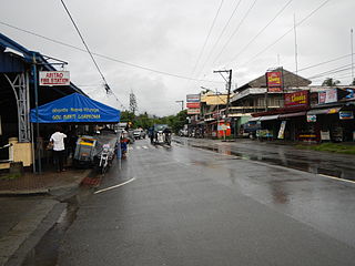
Aritao, officially the Municipality of Aritao, is a 2nd class municipality in the province of Nueva Vizcaya, Philippines. According to the 2020 census, it has a population of 42,197 people.

<span class="mw-page-title-main">Diadi</span> Municipality in Nueva Vizcaya, Philippines

Diadi, officially the Municipality of Diadi, is a 4th class municipality in the province of Nueva Vizcaya, Philippines. According to the 2020 census, it has a population of 19,236 people.

<span class="mw-page-title-main">Dupax del Sur</span> Municipality in Nueva Vizcaya, Philippines

Dupax del Sur, officially the Municipality of Dupax del Sur, is a 2nd class municipality in the province of Nueva Vizcaya, Philippines. At the 2020 census, it had a population of 21,224 people.

<span class="mw-page-title-main">Kasibu</span> Municipality in Nueva Vizcaya, Philippines

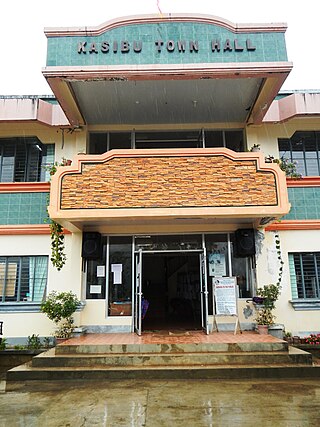
Kasibu, officially the Municipality of Kasibu, is a 3rd class municipality in the province of Nueva Vizcaya, Philippines. According to the 2020 census, it has a population of 41,776 people.

<span class="mw-page-title-main">Kayapa</span> Municipality in Nueva Vizcaya, Philippines

Kayapa, officially the Municipality of Kayapa, is a 3rd class municipality in the province of Nueva Vizcaya, Philippines. According to the 2020 census, it has a population of 26,469 people.

<span class="mw-page-title-main">Quezon, Nueva Vizcaya</span> Municipality in Nueva Vizcaya, Philippines

Quezon, officially the Municipality of Quezon, is a 4th class municipality in the province of Nueva Vizcaya, Philippines. According to the 2020 census, it has a population of 24,055 people.

<span class="mw-page-title-main">Santa Fe, Nueva Vizcaya</span> Municipality in Nueva Vizcaya, Philippines

Santa Fe, officially the Municipality of Santa Fe, is a 3rd class, landlocked municipality in the province of Nueva Vizcaya, Philippines. According to the 2020 census, it has a population of 18,276 people.

<span class="mw-page-title-main">Solano, Nueva Vizcaya</span> Municipality in Nueva Vizcaya, Philippines

Solano, officially the Municipality of Solano, is a 1st class municipality in the province of Nueva Vizcaya, Philippines. According to the 2020 census, it has a population of 65,287 inhabitants..

<span class="mw-page-title-main">Cabarroguis</span> Capital of Quirino, Philippines

Cabarroguis, officially the Municipality of Cabarroguis, is a 3rd class municipality and capital of the province of Quirino, Philippines. According to the 2020 census, it has a population of 33,533 people.

<span class="mw-page-title-main">Nagtipunan</span> Municipality in Quirino, Philippines

Nagtipunan, officially the Municipality of Nagtipunan, is a 1st class municipality in the province of Quirino, Philippines. According to the 2020 census, it has a population of 25,399 people. Nagtipunan is the largest town in terms of land area in Quirino and the entire Luzon island.

<span class="mw-page-title-main">Saguday</span> Municipality in Quirino, Philippines

Saguday, officially the Municipality of Saguday, is a 5th class municipality in the province of Quirino, Philippines. According to the 2020 census, it has a population of 17,137 people, making it the least populated municipality in the province.

References

  1. Municipality of Villaverde | (DILG)
  2. "2015 Census of Population, Report No. 3 – Population, Land Area, and Population Density" (PDF). Philippine Statistics Authority. Quezon City, Philippines. August 2016. ISSN   0117-1453. Archived (PDF) from the original on May 25, 2021. Retrieved July 16, 2021.
  3. 1 2 3 Census of Population (2020). "Region II (Cagayan Valley)". Total Population by Province, City, Municipality and Barangay. Philippine Statistics Authority . Retrieved 8 July 2021.
  4. "PSA Releases the 2021 City and Municipal Level Poverty Estimates". Philippine Statistics Authority. 2 April 2024. Retrieved 28 April 2024.
  5. Salgado, Pedro. "Various Towns of Nueva Vizcaya". Cagayan Valley and Easter Cordillera: 1581-1898, Volume II. Rex Publishing. pp. 876–881.
  6. "An Act Creating the Municipality of Ibung, Province of Nueva Vizcaya". LawPH.com. Retrieved 2011-04-13.
  7. "Foreign News Briefs". UPI. January 13, 1986. Retrieved August 19, 2022.
  8. "Villaverde: Average Temperatures and Rainfall". Meteoblue. Retrieved 4 July 2021.
  9. Census of Population (2015). "Region II (Cagayan Valley)". Total Population by Province, City, Municipality and Barangay. Philippine Statistics Authority . Retrieved 20 June 2016.
  10. Census of Population and Housing (2010). "Region II (Cagayan Valley)" (PDF). Total Population by Province, City, Municipality and Barangay. National Statistics Office . Retrieved 29 June 2016.
  11. Censuses of Population (1903–2007). "Region II (Cagayan Valley)". Table 1. Population Enumerated in Various Censuses by Province/Highly Urbanized City: 1903 to 2007. National Statistics Office.{{cite encyclopedia}}: CS1 maint: numeric names: authors list (link)
  12. "Province of Nueva Vizcaya". Municipality Population Data. Local Water Utilities Administration Research Division. Retrieved 17 December 2016.
  13. "Poverty incidence (PI):". Philippine Statistics Authority. Retrieved December 28, 2020.
  14. "Estimation of Local Poverty in the Philippines" (PDF). Philippine Statistics Authority. 29 November 2005.
  15. "2003 City and Municipal Level Poverty Estimates" (PDF). Philippine Statistics Authority. 23 March 2009.
  16. "City and Municipal Level Poverty Estimates; 2006 and 2009" (PDF). Philippine Statistics Authority. 3 August 2012.
  17. "2012 Municipal and City Level Poverty Estimates" (PDF). Philippine Statistics Authority. 31 May 2016.
  18. "Municipal and City Level Small Area Poverty Estimates; 2009, 2012 and 2015". Philippine Statistics Authority. 10 July 2019.
  19. "PSA Releases the 2018 Municipal and City Level Poverty Estimates". Philippine Statistics Authority. 15 December 2021. Retrieved 22 January 2022.
  20. "PSA Releases the 2021 City and Municipal Level Poverty Estimates". Philippine Statistics Authority. 2 April 2024. Retrieved 28 April 2024.
  21. "2019 National and Local Elections" (PDF). Commission on Elections. Retrieved March 10, 2022.
  22. "DEPED REGIONAL OFFICE NO. 02". DepED RO2 | The official website of DepED Regional Office No. 02.