Armstrong Township, Lycoming County, Pennsylvania

Last updated

Armstrong Township,
Lycoming County,
Pennsylvania
Hagermans Run Reservoir.JPG
Hagermans Run Reservoir from PA Route 554, Armstrong Township
Map of Lycoming County Pennsylvania Highlighting Armstrong Township.png
Map of Lycoming County, Pennsylvania highlighting Armstrong Township
Map of Pennsylvania highlighting Lycoming County.svg
Map of Lycoming County, Pennsylvania
Coordinates: 41°12′17″N77°1′48″W / 41.20472°N 77.03000°W / 41.20472; -77.03000
Country United States
State Pennsylvania
County Lycoming
Settled1795
Formed1842
Area
[1]
  Total25.50 sq mi (66.06 km2)
  Land24.74 sq mi (64.09 km2)
  Water0.76 sq mi (1.97 km2)  2.11%
Elevation
1,348 ft (582 m)
Population
 (2020) [2]
  Total685 Increase2.svg
  Estimate 
(2021) [2]
679
  Density28.33/sq mi (10.94/km2)
Time zone UTC-5 (Eastern Time Zone (North America))
  Summer (DST) UTC-4 (EDT)
ZIP code
17702
Area code 570
FIPS code 42-081-03072
GNIS feature ID1216739 [3]
Website www.armstrongtownship.org

Armstrong Township is a township in Lycoming County, Pennsylvania, United States. The population was 685 at the 2020 census. [2] It is part of the Williamsport, Pennsylvania Metropolitan Statistical Area.

Contents

History

The first European settlers arrived in Armstrong Township in 1773. Thomas Hartley, Michael Graybill, George Leffler, and John Kern all received warrants for land on February 11, 1773. Hartley then purchased the properties of Graybill, Leffler and Kern on March 31, 1773. This was to avoid a Province of Pennsylvania law that stated that no one man could purchase more than one tract of land. Marcus Huling appears to have been the first permanent settler in Mosquito Valley, which makes up the greatest portion of Armstrong Township. Huling settled in the eastern portion of Mosquito Valley, near where Culbertson's Path crossed. Huling and family cleared land and built a cabin, a sawmill, and distillery in 1795. Huling's son, Thomas, carried on the family businesses until his death. Although the Hulings were apparently successful businessmen, they never saw fit to settle their debt on the land that they had developed. Upon Thomas Huling's death, the land was foreclosed upon and left to be reclaimed by nature until the arrival of German farmers in 1832. [4]

Armstrong Township was formed from part of Clinton Township in 1842. It is named in honor of James Armstrong, a prominent lawyer. The boroughs of South Williamsport and DuBoistown were formed subsequently from it.

Mosquito Valley was cleared by the lumber companies that made nearby Williamsport the "Lumber Capital of the World." Lumberjacks harvested the old-growth forests of white pine and hemlock. They then floated the logs down Mosquito Run to the sawmills close to the mouth of the creek. Farmers moved into the area and began several successful orchard and dairy operations after the valley was cleared of trees.

Armstrong Township is not limited to Mosquito Valley alone. Bald Eagle Mountain runs through the northernmost portions of it. From this ridge, several mountain streams find their source. The lumber barons from Williamsport flocked to Mosquito Run in the south and western sections of the township and to Hagermans Run in the eastern portion of the township. The barons built summer cottages on both streams, fished for trout in the waters, and built small dams for recreational swimming and ice skating. They also built several trout hatcheries in Mosquito Valley.

The Williamsport Municipal Water Authority saw the value of the fresh water that was in abundant supply in both Mosquito and Hagermans runs. It acquired water rights to the streams and bought up most of the farmland in the southwestern portion of Armstrong Township in the early 1920s as part of its watershed. Visitors to the "water company" lands can see the stone remains of the early settlers homesteads spread throughout the watershed. This mass purchase of farmland in Armstrong County and the ceding of territory to neighboring boroughs has accounted for the steep decline in population since 1890. Mosquito Run and Hagerman's Run continue to supply drinking water for Williamsport and surrounding communities.

The water authority built a multimillion-dollar water filtration plant in the 1990s in Mosquito Valley. With the construction of this plant the lands of the water authority were opened as a nature preserve to the general public.

Geography

Armstrong Township is bordered by Duboistown, South Williamsport, and the West Branch Susquehanna River to the north (with Williamsport, Loyalsock Township, and Montoursville north of the river), Brady and Clinton townships to the south and east, Washington Township to the south, and Limestone, Bastress and Susquehanna townships to the west.

Bald Eagle Mountain is in the northern part of the township, and the crest of North White Deer Ridge forms the southern border. The two ridges join in the eastern part of the township at an unnamed 2,000-foot (610 m) summit. Mosquito Valley is in the western part of the township, between the two ridges, and Mosquito Creek exits the valley by cutting north through Bald Eagle Mountain and entering Duboistown before reaching the West Branch of the Susquehanna. Hagermans Run is east of the center of the township, with Hagerman Lake, a public water supply, near the run's headwaters at the north base of North White Deer Ridge. Like Mosquito Creek, Hagermans Run cuts north through Bald Eagle Mountain, but passes through South Williamsport before reaching the West Branch.

U.S. Route 15 passes through the eastern side of Armstrong Township, leading north 4 miles (6 km) to Williamsport and south 19 miles (31 km) to Lewisburg. The township is 80 miles (130 km) north of Harrisburg, the state capital. Pennsylvania Route 554 runs through the Hagermans Run valley, leading north to South Williamsport and Williamsport, and south over North White Deer Ridge 8 miles (13 km) to Elimsport in Washington Township.

According to the United States Census Bureau, Armstrong Township has a total area of 25.5 square miles (66.1 km2). 24.7 square miles (64.1 km2) of it are land, and 0.77 square miles (2.0 km2) of it (2.98%) are water. [1]

Demographics

Historical population
CensusPop.Note
2000 717
2010 681−5.0%
2020 6850.6%
2021 (est.)679 [2] −0.9%
U.S. Decennial Census [5]

As of the census [6] of 2000, there were 717 people, 294 households, and 204 families residing in the township. The population density was 28.6 inhabitants per square mile (11.0/km2). There were 334 housing units at an average density of 13.3/sq mi (5.2/km2). The racial makeup of the township was 99.30% White, 0.42% African American, 0.14% Native American, and 0.14% from two or more races. Hispanic or Latino of any race were 0.28% of the population.

There were 294 households, out of which 28.6% had children under the age of 18 living with them, 56.8% were married couples living together, 8.8% had a female householder with no husband present, and 30.6% were non-families. 25.9% of all households were made up of individuals, and 10.5% had someone living alone who was 65 years of age or older. The average household size was 2.44 and the average family size was 2.93.

In the township the population was spread out, with 23.3% under the age of 18, 4.6% from 18 to 24, 28.7% from 25 to 44, 28.7% from 45 to 64, and 14.6% who were 65 years of age or older. The median age was 42 years. For every 100 females there were 97.0 males. For every 100 females age 18 and over, there were 97.8 males.

The median income for a household in the township was $34,844, and the median income for a family was $42,031. Males had a median income of $32,188 versus $21,417 for females. The per capita income for the township was $18,423. About 6.5% of families and 9.4% of the population were below the poverty line, including 13.6% of those under age 18 and 3.4% of those age 65 or over.

See also

Related Research Articles

<span class="mw-page-title-main">Lycoming County, Pennsylvania</span> County in Pennsylvania, United States

Lycoming County is a county in the Commonwealth of Pennsylvania. As of the 2020 census, the population was 114,188. Its county seat is Williamsport. The county is part of the Central Pennsylvania region of the state.

<span class="mw-page-title-main">Bastress Township, Lycoming County, Pennsylvania</span> Township in Pennsylvania, United States

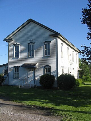
Bastress Township is a township in Lycoming County, Pennsylvania, United States. The population was 528 at the 2020 census. It is part of the Williamsport, Pennsylvania Metropolitan Statistical Area.

<span class="mw-page-title-main">Cascade Township, Pennsylvania</span> Township in Pennsylvania, United States

Cascade Township is a township in Lycoming County, Pennsylvania, United States. The population was 420 at the 2020 census. It is part of the Williamsport, Pennsylvania Metropolitan Statistical Area.

<span class="mw-page-title-main">Clinton Township, Lycoming County, Pennsylvania</span> Township in Pennsylvania, United States

Clinton Township is a township in Lycoming County, Pennsylvania, United States. The population was 3,719 at the 2020 census, up from 3,708 in 2010. It is part of the Williamsport, Pennsylvania Metropolitan Statistical Area.

<span class="mw-page-title-main">Cogan House Township, Lycoming County, Pennsylvania</span> Township in Pennsylvania, United States

Cogan House Township is a township in Lycoming County, Pennsylvania, United States. The population was 930 at the 2020 census. It is part of the Williamsport, Pennsylvania Metropolitan Statistical Area.

<span class="mw-page-title-main">Cummings Township, Lycoming County, Pennsylvania</span> Township in Pennsylvania, United States

Cummings Township is a township in Lycoming County, Pennsylvania, United States. The population was 264 at the 2020 census, down from 273 in 2010. It is part of the Williamsport, Pennsylvania Metropolitan Statistical Area. Cummings Township is home to Little Pine State Park and Upper Pine Bottom State Park.

<span class="mw-page-title-main">Duboistown, Pennsylvania</span> Borough in Pennsylvania, United States

Duboistown is a borough in Lycoming County, Pennsylvania, United States. The population was 1,198 at the 2020 census. It is part of the Williamsport, Pennsylvania Metropolitan Statistical Area.

<span class="mw-page-title-main">Gamble Township, Lycoming County, Pennsylvania</span> Township in Pennsylvania, United States

Gamble Township is a township in Lycoming County, Pennsylvania, United States. The population was 780 at the 2020 census, up from 756 in 2010. It is part of the Williamsport Metropolitan Statistical Area.

<span class="mw-page-title-main">Jackson Township, Lycoming County, Pennsylvania</span> Township in Pennsylvania, United States

Jackson Township is a township in Lycoming County, Pennsylvania, United States. The population was 394 at the 2020 census. It is part of the Williamsport Metropolitan Statistical Area.

<span class="mw-page-title-main">Limestone Township, Lycoming County, Pennsylvania</span> Township in Pennsylvania, United States

Limestone Township is a township in Lycoming County, Pennsylvania, United States. The population was 1,968 at the 2020 census. It is part of the Williamsport Metropolitan Statistical Area.

<span class="mw-page-title-main">Loyalsock Township, Pennsylvania</span> Township in Pennsylvania, United States

Loyalsock Township is a township in Lycoming County, Pennsylvania, United States. The population was 11,561 at the 2020 census. It is part of the Williamsport Metropolitan Statistical Area. It is the second largest municipality in Lycoming County, in terms of population, behind the county seat, Williamsport.

<span class="mw-page-title-main">Lycoming Township, Pennsylvania</span> Township in Pennsylvania, United States

Lycoming Township is a township in Lycoming County, Pennsylvania, United States. The population was 1,490 at the 2020 census. It is part of the Williamsport Metropolitan Statistical Area.

<span class="mw-page-title-main">Piatt Township, Pennsylvania</span> Township in Pennsylvania, United States

Piatt Township is a township in Lycoming County, Pennsylvania, United States. The population was 1,045 at the 2020 census. It is part of the Williamsport Metropolitan Statistical Area.

<span class="mw-page-title-main">South Williamsport, Pennsylvania</span> Borough in Pennsylvania, United States

South Williamsport is a borough in Lycoming County, Pennsylvania, United States. It is famous for hosting the Little League World Series. The population was 6,259 at the 2020 census. It is part of the Williamsport, Pennsylvania Metropolitan Statistical Area.

<span class="mw-page-title-main">Susquehanna Township, Lycoming County, Pennsylvania</span> Township in Pennsylvania, United States

Susquehanna Township is a township in Lycoming County, Pennsylvania, United States. The population was 972 at the 2020 census. It is part of the Williamsport Metropolitan Statistical Area.

<span class="mw-page-title-main">Washington Township, Lycoming County, Pennsylvania</span> Township in Pennsylvania, United States

Washington Township is a township in Lycoming County, Pennsylvania, United States. The population was 1,769 at the 2020 census. It is part of the Williamsport Metropolitan Statistical Area.

<span class="mw-page-title-main">Woodward Township, Lycoming County, Pennsylvania</span> Township in Pennsylvania, United States

Woodward Township is a township in Lycoming County, Pennsylvania, United States. The population was 2,043 at the 2020 census, down from 2,200 in 2010. It is part of the Williamsport Metropolitan Statistical Area.

<span class="mw-page-title-main">White Deer Hole Creek</span> Tributary of the West Branch Susquehanna River

White Deer Hole Creek is a 20.5-mile (33.0 km) tributary of the West Branch Susquehanna River in Clinton, Lycoming and Union counties in the U.S. state of Pennsylvania. A part of the Chesapeake Bay drainage basin, the White Deer Hole Creek watershed drains parts of ten townships. The creek flows east in a valley of the Ridge-and-valley Appalachians, through sandstone, limestone, and shale from the Ordovician, Silurian, and Devonian periods.

<span class="mw-page-title-main">Culbertson's Path</span> Native American trail in Pennsylvania, US

Culbertson's Path was a Native American trail in north central Pennsylvania in the United States, which connected the Great Island Path with the Sheshequin Path. The eastern / southern end of the path was on the West Branch Susquehanna River at what is now the village of Allenwood in Gregg Township, Union County. The northern / western end was in Old Lycoming Township just north of what is now the city of Williamsport in Lycoming County.

<span class="mw-page-title-main">West Branch Susquehanna Valley</span>

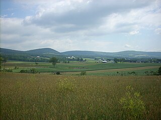
The West Branch Susquehanna Valley of central Pennsylvania, United States, in the Ridge-and-valley Appalachians, is the low-lying area draining into the West Branch Susquehanna River southeast of the Allegheny Front, northeast of the Bald Eagle Valley, southwest of the Wyoming Valley and north of the water gap formed between Shamokin Mountain and Montour Ridge.

References

  1. 1 2 "2016 U.S. Gazetteer Files". United States Census Bureau. Retrieved August 14, 2017.
  2. 1 2 3 4 Bureau, US Census. "City and Town Population Totals: 2020-2021". Census.gov. US Census Bureau. Retrieved July 15, 2022.
  3. "US Board on Geographic Names". United States Geological Survey. October 25, 2007. Retrieved January 31, 2008.
  4. Meginness, John Franklin (1892). "Washington, Clinton, Armstrong, and Brady". History of Lycoming County, Pennsylvania: including its aboriginal history; the colonial and revolutionary periods; early settlement and subsequent growth; organization and civil administration; the legal and medical professions; internal improvement; past and present history of Williamsport; manufacturing and lumber interests; religious, educational, and social development; geology and agriculture; military record; sketches of boroughs, townships, and villages; portraits and biographies of pioneers and representative citizens, etc. etc (1st ed.). Chicago: Brown, Runk & Co. ISBN   0-7884-0428-8. Archived from the original on March 1, 2007. Retrieved February 20, 2007. (Note: ISBN refers to Heritage Books July 1996 reprint. URL is to a scan of the 1892 version with some OCR typos).
  5. "Census of Population and Housing". Census.gov. Retrieved June 4, 2016.
  6. "U.S. Census website". United States Census Bureau . Retrieved January 31, 2008.