Atok | |
---|---|
Municipality of Atok | |
Location within the Philippines | |
Coordinates: 16°37′38″N120°46′02″E / 16.6272°N 120.7672°E | |
Country | Philippines |
Region | Cordillera Administrative Region |
Province | Benguet |
District | Lone district |
Founded | 1900 |
Barangays | 8 (see Barangays) |
Government | |
• Type | Sangguniang Bayan |
• Mayor | Raymundo S. Sarac |
• Vice Mayor | Angelito D. Galao Sr. |
• Representative | Nestor B. Fongwan |
• Electorate | 11,817 voters (2022) |
Area | |
• Total | 214.99 km2 (83.01 sq mi) |
Elevation | 1,780 m (5,840 ft) |
Highest elevation | 2,717 m (8,914 ft) |
Lowest elevation | 1,004 m (3,294 ft) |
Population (2020 census) [3] | |
• Total | 19,218 |
• Density | 89/km2 (230/sq mi) |
• Households | 4,736 |
Economy | |
• Income class | 4th municipal income class |
• Poverty incidence | 18.70 |
• Revenue | ₱ 128.1 million (2020) |
• Assets | ₱ 378.8 million (2020) |
• Expenditure | ₱ 81.25 million (2020) |
• Liabilities | ₱ 54.42 million (2020) |
Service provider | |
• Electricity | Benguet Electric Cooperative (BENECO) |
Time zone | UTC+8 (PST) |
ZIP code | 2612 |
PSGC | |
IDD : area code | +63 (0)74 |
Native languages | Kankanaey Ibaloi Ilocano Tagalog |
Website | www |
Atok, officially the Municipality of Atok, (Ilocano : Ili ti Atok; Tagalog : Bayan ng Atok), is a 4th class municipality in the province of Benguet, Philippines. According to the 2020 census, it has a population of 19,218 people. [3]
The area of Atok was previously referred to by the natives and Spanish colonizers as Chontog, an Ibaloi word for "mountainous". Spanish military officials and missionaries arrived at Chontog in 1892, establishing precedencias (tax collection stations) in the area and its surrounding settlements. [5]
The Ibaloi phrase Nay patok shi Chontog, which means "on the mountain top", was later shortened to Atok. [6]
During the American rule, Atok was established as one of the 19 townships of the province of Benguet, upon the issuance of Act No. 48 by the Philippine Commission on November 22, 1900. [7] [8]
On August 13, 1908, Benguet was established as a sub-province of the newly created Mountain Province with the enactment of Act No. 1876. As a result, six townships of Benguet were abolished, but Atok remained a constituent town of Benguet sub-province. [8]
During the Second World War, Atok was the scene of fierce pitch battles between the military forces and guerrilla fighters of the 66th Infantry Regiment, Philippine Commonwealth Army, USAFIP-NL and the Japanese Imperial Army forces. The steep terrain along the Halsema road suited Filipino troops, the Philippine Commonwealth military, and guerrillas to mount ambushes against the Japanese forces. One of these battles took place in what is now “Guerrilla Saddle” located at km. 26, in barangay Caliking. [9]
On June 25, 1963, President Diosdado Macapagal issued Executive Order No. 42 converting eight (8) of the thirteen (13) towns (designated as municipal districts) of Benguet into regular municipalities. Atok was among them. [10]
On June 18, 1966, the sub-province of Benguet was separated from the old Mountain Province and was converted into a regular province. Atok remained to be a component municipality of the newly established province. [8] [11]
Atok is located at 16°37′38″N120°46′02″E / 16.6272°N 120.7672°E , situated at the central portion of Benguet. It is bounded by Kibungan on the north, Kabayan on the north-east, Bokod on the southeast, Tublay on the south-west, and Kapangan on the west.
According to the Philippine Statistics Authority, the municipality has a land area of 214.99 square kilometres (83.01 sq mi) [12] constituting 7.76% of the 2,769.08-square-kilometre- (1,069.15 sq mi) total area of Benguet.
The land is characterized as mountainous with many steep cliffs. It is home to Mt. Timbak, the third highest mountain in Luzon. The second highest point in the Philippine Highway System is also located at Barangay Paoay along Halsema Highway, at 2,255 metres (7,400 ft) above sea level. [9] [13] It held formerly the title as the highest point in the Philippine Highway System since World War II until early 2019. This is after the validation and assessment conducted by the Department of Public Works and Highways - Cordillera Administrative Region (DPWH-CAR) Regional Office last January 2019 declaring a new highest point at 2,428.66 meters (7968.045 feet) along the Kiangan-Tinoc-Buguias Road in Tinoc Town some 55 Kilometers east via Atok, Benguet.
Atok is 49 kilometres (30 mi) from Baguio, 44 kilometres (27 mi) from La Trinidad, and 299 kilometres (186 mi) from Manila.
Climate data for Atok, Benguet | |||||||||||||
---|---|---|---|---|---|---|---|---|---|---|---|---|---|
Month | Jan | Feb | Mar | Apr | May | Jun | Jul | Aug | Sep | Oct | Nov | Dec | Year |
Mean daily maximum °C (°F) | 15 (59) | 25 (77) | 26 (79) | 27 (81) | 26 (79) | 25 (77) | 24 (75) | 23 (73) | 24 (75) | 23 (73) | 22 (72) | 16 (61) | 23 (73) |
Mean daily minimum °C (°F) | 5 (41) | 16 (61) | 17 (63) | 19 (66) | 20 (68) | 19 (66) | 19 (66) | 19 (66) | 18 (64) | 16 (61) | 12 (54) | 8 (46) | 16 (60) |
Average precipitation mm (inches) | 42 (1.7) | 48 (1.9) | 74 (2.9) | 110 (4.3) | 269 (10.6) | 275 (10.8) | 362 (14.3) | 325 (12.8) | 330 (13.0) | 306 (12.0) | 126 (5.0) | 61 (2.4) | 2,328 (91.7) |
Average rainy days | 11.2 | 12.0 | 17.1 | 21.2 | 27.1 | 26.8 | 28.1 | 27.0 | 26.0 | 24.5 | 17.7 | 12.4 | 251.1 |
Source: Meteoblue [14] |
Like most part of Benguet it has subtropical highland climate, during the cold months of the year, the municipality experiences very low temperatures reaching 9 degrees Celsius (48 degrees Fahrenheit). This causes common frost to settle on the ground, causing millions of damage to crops, but drawing tourists to the town. [15] [16]
Atok is politically subdivided into 8 barangays. [17] Each barangay consists of puroks and some have sitios.
PSGC | Barangay | Population | ±% p.a. | |||
---|---|---|---|---|---|---|
2020 [3] | 2010 [18] | |||||
141101001 | Abiang | 8.5% | 1,643 | 1,766 | −0.72% | |
141101002 | Caliking | 17.5% | 3,368 | 3,155 | 0.66% | |
141101003 | Cattubo | 13.9% | 2,674 | 2,674 | 0.00% | |
141101004 | Naguey | 8.7% | 1,678 | 1,723 | −0.26% | |
141101005 | Paoay | 22.3% | 4,285 | 4,181 | 0.25% | |
141101006 | Pasdong | 6.8% | 1,304 | 1,078 | 1.92% | |
141101007 | Poblacion | 10.0% | 1,914 | 2,045 | −0.66% | |
141101008 | Topdac | 12.2% | 2,352 | 2,620 | −1.07% | |
Total | 19,218 | 19,218 | 0.00% |
Year | Pop. | ±% p.a. |
---|---|---|
1903 | 5 | — |
1918 | 3,605 | +55.07% |
1939 | 6,047 | +2.49% |
1948 | 5,913 | −0.25% |
1960 | 8,353 | +2.92% |
1970 | 10,215 | +2.03% |
1975 | 11,589 | +2.56% |
1980 | 14,466 | +4.53% |
1990 | 13,853 | −0.43% |
1995 | 14,862 | +1.33% |
2000 | 16,657 | +2.47% |
2007 | 19,253 | +2.02% |
2010 | 19,242 | −0.02% |
2015 | 19,668 | +0.42% |
2020 | 19,218 | −0.45% |
Source: Philippine Statistics Authority [19] [18] [20] [21] |
In the 2020 census, Atok had a population of 19,218. [3] The population density was 89 inhabitants per square kilometre (230/sq mi).
Graphs are unavailable due to technical issues. There is more info on Phabricator and on MediaWiki.org. |
Atok, belonging to the lone congressional district of the province of Benguet, is governed by a mayor designated as its local chief executive and by a municipal council as its legislative body in accordance with the Local Government Code. The mayor, vice mayor, and the councilors are elected directly by the people through an election which is being held every three years.
Position | Name |
---|---|
Congressman | Nestor B. Fongwan [lower-alpha 1] Eric G. Yap (since January 20, 2020) [31] |
Mayor | Raymundo S. Sarac |
Vice-Mayor | Angelito D. Galao Sr. |
Councilors | Franklin L. Smith |
Arthur B. Binay-an | |
Constantina L. Lupante | |
Edward S. Beliano | |
Remejio F. Silog | |
Oliver N. Bodong | |
Alma A. Bumakil | |
Marilou A. Zarate | |
As of 2014, Atok has 22 public elementary schools and 2 public secondary schools. [32] [33] [34]
|
|
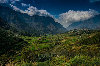
Mountain Province is a landlocked province of the Philippines in the Cordillera Administrative Region in Luzon. Its capital is Bontoc. Mountain Province was formerly referred to as Mountain in some foreign references. The name is usually shortened by locals to Mt. Province.
Langiden, officially the Municipality of Langiden, is a 5th class municipality in the province of Abra, Philippines. According to the 2020 census, it has a population of 3,576 people.
Licuan-Baay, officially the Municipality of Licuan-Baay, is a 5th class municipality in the province of Abra, Philippines. According to the 2020 census, it has a population of 4,566 people.
Pilar, officially the Municipality of Pilar, is a municipality in the province of Abra in the Cordillera Administrative Region of the Philippines. The population was 10,146 at the 2020 census.
San Isidro, officially the Municipality of San Isidro, is a 5th class municipality in the province of Abra, Philippines. According to the 2020 census, it has a population of 4,745 people.
San Quintin, officially the Municipality of San Quintin, is a 5th class municipality in the province of Abra, Philippines. According to the 2020 census, it has a population of 5,705 people.
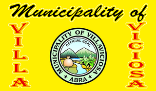
Villaviciosa, officially the Municipality of Villaviciosa, is a 5th class municipality in the province of Abra, Philippines. According to the 2020 census, it has a population of 5,675 people.
Kayapa, officially the Municipality of Kayapa, is a 3rd class municipality in the province of Nueva Vizcaya, Philippines. According to the 2020 census, it has a population of 26,469 people.
La Trinidad, officially the Municipality of La Trinidad, is a 1st class municipality and capital of the province of Benguet, Philippines. According to the 2020 census, it has a population of 137,404 people.
Bakun, officially the Municipality of Bakun,, is a 3rd class municipality in the province of Benguet, Philippines. According to the 2020 census, it has a population of 14,535 people.
Bokod, officially the Municipality of Bokod,, is a 4th class municipality in the province of Benguet, Philippines. According to the 2020 census, it has a population of 14,435 people.
Buguias, officially the Municipality of Buguias,, is a 3rd class municipality in the province of Benguet, Philippines. According to the 2020 census, it has a population of 44,877 people. The municipality is home to the mummy of Apo Anno, one of the most revered and important folk hero in Benguet prior to Spanish arrival.
Itogon, officially the Municipality of Itogon,, is a 1st class municipality in the province of Benguet, Philippines. According to the 2020 census, it has a population of 61,498 people.
Kabayan, officially the Municipality of Kabayan, is a 4th class municipality in the province of Benguet, Philippines. According to the 2020 census, it has a population of 15,806 people.
Kapangan, officially the Municipality of Kapangan,, is a 4th class municipality in the province of Benguet, Philippines. According to the 2020 census, it has a population of 19,297 people.
Kibungan, officially the Municipality of Kibungan, is a 4th class municipality in the province of Benguet, Philippines. According to the 2020 census, it has a population of 17,051 people.
Mankayan, officially the Municipality of Mankayan, is a 1st class municipality in the province of Benguet, Philippines. According to the 2020 census, it has a population of 37,233 people.
Sablan, officially the Municipality of Sablan, is a 5th class municipality in the province of Benguet, Philippines. According to the 2020 census, it has a population of 11,588 people.
Tuba, officially the Municipality of Tuba,, is a 1st class municipality in the province of Benguet, Philippines. According to the 2020 census, it has a population of 48,312 people.
Tublay, officially the Municipality of Tublay, is a 5th class municipality in the province of Benguet, Philippines. According to the 2020 census, it has a population of 19,429 people.
{{cite encyclopedia}}
: CS1 maint: numeric names: authors list (link)