Mankayan

Last updated
Mankayan
Municipality of Mankayan
Lepanto Mines Airstrip 101 3948.jpg
Lepanto Mines Airstrip
Flag of Mankayan, Benguet.png
Mankayan Benguet.png
Motto: 
North to the Future of Benguet
Ph locator benguet mankayan.png
Map of Benguet with Mankayan highlighted
OpenStreetMap
Mankayan
Philippines location map (square).svg
Red pog.svg
Mankayan
Location within the Philippines
Coordinates: 16°51′24″N120°47′36″E / 16.8567°N 120.7933°E / 16.8567; 120.7933
Country Philippines
Region Cordillera Administrative Region
Province Benguet
District Lone district
Founded 1955
Barangays 12 (see Barangays)
Government
[1]
  Type Sangguniang Bayan
   Mayor Frenzel A. Ayong
   Vice Mayor Joseph Denver B. Tongacan
   Representative Nestor B. Fongwan
   Electorate 21,338 voters (2022)
Area
[2]
  Total130.48 km2 (50.38 sq mi)
Elevation
1,338 m (4,390 ft)
Highest elevation
2,214 m (7,264 ft)
Lowest elevation
666 m (2,185 ft)
Population
 (2020 census) [3]
  Total37,233
  Density290/km2 (740/sq mi)
   Households
9,288
Economy
   Income class 1st municipal income class
   Poverty incidence
10.35
% (2018) [4]
   Revenue 175.3 million (2020)
   Assets 334.6 million (2020)
   Expenditure 170.6 million (2020)
   Liabilities 28.92 million (2020)
Service provider
  ElectricityBenguet Electric Cooperative (BENECO)
Time zone UTC+8 (PST)
ZIP code
2608
PSGC
IDD : area code +63(0)74
Native languages Kankanaey
Ibaloi
Ilocano
Tagalog

Mankayan, officially the Municipality of Mankayan (Ilocano : Ili ti Mankayan; Tagalog : Bayan ng Mankayan), is a 1st class municipality in the province of Benguet, Philippines. According to the 2020 census, it has a population of 37,233 people. [3]

Contents

The municipality is known as a mining town, being the location of several mines, including the Lepanto Consolidated Mining Company. [5] [6]

Etymology

The name "Mankayan" is derived from Nancayan, the Hispanic term of the native name of the place, Nangkayang (which means "high up in the mountain"). [5] [6]

History

Pre-colonial period

Nangkayang was once a heavily forested area. The natives of the surrounding settlements of Panat and Bag-ongan mined gold through the labon system, after its reported discovery in a river. Copper was later discovered by the end of the 16th century in Kamangga-an (location of present-day Lepanto). [6]

Spanish period

By the 1800s, the Spanish colonial government sent expeditions to survey the mines. On February 3, 1850, an expedition led by engineer Don Antonio Hernandez confirmed the presence of copper in Mankayan.

In 1852, Lepanto was established by the Spanish as a comandancia politico-militar, [6] [7] composed of several rancherias which included Mankayan. [5]

Seven different mines were discovered in the Mankayan-Suyoc region during Admiral Pedro Durán de Monforte's 1667 expedition, and Simón de Anda's administration (1770-1776) mentioned Igorot copperware. In 1833, Galvey sent ore samples from Gambang ("copper"), Suyoc, and Mankayan, to the governor. The first Spanish mining claim on the Cordillera was made by Tomás Balbas y Castro on 26 March 1856, [8] and established a mining company called the Sociedad Minero-Metalurgica Cantabro Filipino de Mancayan. [5] The company ceased operations in 1875. [6]

American period

Under the American rule, Mankayan remained under the jurisdiction of Lepanto, and later Lepanto-Bontoc until the latter's dissolution. Mankayan was later annexed to the sub-province of Benguet as a municipal district in 1913. [5] [6]

The mining boom in Mankayan began in 1933, with American Victor Lednickey establishing the Lepanto Consolidated Mining Company on September 26, 1936. [5] [6]

Second World War

In 1942, following the outbreak of the war, the Lepanto Consolidated Mining Company, together with the Suyoc Consolidated Mining Company, were taken over by the Japanese Mitsui Mining Company, which renamed the mines into "Mitsui Mankayan Copper Mines". The Mitsui Company controlled the mines until 1945. [5] [6] [9]

Post-war era

After the war, the Lepanto Consolidated Mining Company resumed the mining operations. [5] [6]

Mankayan was converted from a municipal district into a regular municipality on June 16, 1955, by virtue of Republic Act 1302. [10] [11]

In 2018, in order to preserve the highly artistic gangsa-making intangible heritage of the Mankayan elders, the cultural masters of the town converged and began teaching the younger generations the process and importance of gangsa-making to their way of life, effectively preserving indigenous gong culture in the town. [12]

Geography

Mankayan is on the north-western tip of Benguet. It is bordered by Bakun on the west, Buguias on the southeast, Tadian and Bauko on the east, and Cervantes on the north-west.

Mankayan is 94 kilometres (58 mi) from Baguio, 89 kilometres (55 mi) from La Trinidad, and 344 kilometres (214 mi) from Manila.

According to the Philippine Statistics Authority, the municipality has a land area of 130.48 square kilometres (50.38 sq mi) [13] constituting

Barangays

Mankayan is politically subdivided into 12 barangays. [14] Each barangay consists of puroks and some have sitios.

PSGC Barangay Population ±% p.a.
2020 [3] 2010 [15]
141111001 Balili 17.6% 6,537 6,236 0.47%
141111002 Bedbed 2.8% 1,058 864 2.05%
141111003 Bulalacao 8.6% 3,205 3,349 −0.44%
141111004 Cabiten 5.7% 2,129 1,854 1.39%
141111005 Colalo 3.4% 1,268 1,232 0.29%
141111006 Guinaoang 6.0% 2,249 1,855 1.94%
141111008 Paco 15.4% 5,744 6,035 −0.49%
141111009 Palasaan 6.3% 2,358 2,348 0.04%
141111010 Poblacion 6.9% 2,572 3,084 −1.80%
141111011 Sapid 8.6% 3,218 3,271 −0.16%
141111012 Tabio 10.4% 3,855 3,792 0.16%
141111013 Taneg 4.7% 1,760 1,666 0.55%
Total37,23335,5860.45%

Climate

Climate data for Mankayan, Benguet
MonthJanFebMarAprMayJunJulAugSepOctNovDecYear
Mean daily maximum °C (°F)20
(68)
22
(72)
23
(73)
25
(77)
24
(75)
24
(75)
23
(73)
23
(73)
23
(73)
23
(73)
22
(72)
21
(70)
23
(73)
Mean daily minimum °C (°F)13
(55)
14
(57)
15
(59)
17
(63)
18
(64)
18
(64)
18
(64)
18
(64)
18
(64)
17
(63)
16
(61)
15
(59)
16
(61)
Average precipitation mm (inches)35
(1.4)
46
(1.8)
63
(2.5)
117
(4.6)
402
(15.8)
400
(15.7)
441
(17.4)
471
(18.5)
440
(17.3)
258
(10.2)
94
(3.7)
68
(2.7)
2,835
(111.6)
Average rainy days9.911.113.918.926.027.328.928.526.119.714.512.8237.6
Source: Meteoblue [16]

Demographics

Population census of Mankayan
YearPop.±% p.a.
1903 118    
1918 2,977+24.01%
1939 6,865+4.06%
1948 5,742−1.97%
1960 13,812+7.59%
1970 21,780+4.65%
1975 24,123+2.07%
1980 25,684+1.26%
1990 32,889+2.50%
1995 34,699+1.01%
2000 34,502−0.12%
2007 34,563+0.02%
2010 35,586+1.07%
2015 35,953+0.20%
2020 37,233+0.69%
Source: Philippine Statistics Authority [17] [15] [18] [19]

In the 2020 census, Mankayan had a population of 37,233. [3] The population density was 290 inhabitants per square kilometre (750/sq mi).

Economy

Mankayan vegetable terraces Mankayan vegetable terraces (Cervantes-Mankayan-Abatan Road, Mankayan, Benguet; 12-03-2022).jpg
Mankayan vegetable terraces

Government

Local government

Mankayan, belonging to the lone congressional district of the province of Benguet, is governed by a mayor designated as its local chief executive and by a municipal council as its legislative body in accordance with the Local Government Code. The mayor, vice mayor, and the councilors are elected directly by the people through an election which is being held every three years.

Elected officials

Members of the Municipal Council
(2019–2022) [27]
PositionName
CongressmanNestor B. Fongwan [lower-alpha 1]

Eric G. Yap (since January 20, 2020) [29]

MayorFrenzel A. Ayong
Vice-MayorJoseph Denver B. Tongacan
CouncilorsAldrin S. Camiling
Julio Joey C. Culliao
Baylon P. Galuten
Balodoy M. Totanes
Hector B. Gacita
Alejandro N. Wagian
Norberto N. Anasan
Alexander A. Dapiawen

Education

Public schools

As of 2014, Mankayan has 35 public elementary schools and 9 public secondary schools. [30] [31] [32]

Notes

  1. Died on December 18, 2019. [28]

Related Research Articles

<span class="mw-page-title-main">Benguet</span> Province in Cordillera, Philippines

Benguet, officially the Province of Benguet, is a landlocked province of the Philippines located in the southern tip of the Cordillera Administrative Region in the island of Luzon. Its capital is La Trinidad.

<span class="mw-page-title-main">Mountain Province</span> Province in Cordillera, Philippines

Mountain Province is a landlocked province of the Philippines in the Cordillera Administrative Region in Luzon. Its capital is Bontoc. Mountain Province was formerly referred to as Mountain in some foreign references. The name is usually shortened by locals to Mt. Province.

<span class="mw-page-title-main">Luna, Apayao</span> Municipality in Apayao, Philippines

Luna, officially the Municipality of Luna, is a 2nd class municipality in the province of Apayao, Philippines. According to the 2020 census, it has a population of 21,297 people. It currently serves as the de facto capital of Apayao where the provincial capitol and related offices is located the New Apayao Government Center. Kabugao remains as the de jure capital.

<span class="mw-page-title-main">Daguioman</span> Municipality in Abra, Philippines

Daguioman, officially the Municipality of Daguioman, is a 5th class municipality in the province of Abra, Philippines. According to the 2020 census, it had a population of 2,019 people.

<span class="mw-page-title-main">Villaviciosa, Abra</span> Municipality in Abra, Philippines

Villaviciosa, officially the Municipality of Villaviciosa, is a 5th class municipality in the province of Abra, Philippines. According to the 2020 census, it has a population of 5,675 people.

<span class="mw-page-title-main">Kayapa</span> Municipality in Nueva Vizcaya, Philippines

Kayapa, officially the Municipality of Kayapa, is a 3rd class municipality in the province of Nueva Vizcaya, Philippines. According to the 2020 census, it has a population of 26,469 people.

<span class="mw-page-title-main">La Trinidad, Benguet</span> Capital of Benguet, Philippines

La Trinidad, officially the Municipality of La Trinidad, is a 1st class municipality and capital of the province of Benguet, Philippines. According to the 2020 census, it has a population of 137,404 people.

<span class="mw-page-title-main">Atok, Benguet</span> Municipality in Benguet, Philippines

Atok, officially the Municipality of Atok,, is a 4th class municipality in the province of Benguet, Philippines. According to the 2020 census, it has a population of 19,218 people.

<span class="mw-page-title-main">Bakun, Benguet</span> Municipality in Benguet, Philippines

Bakun, officially the Municipality of Bakun,, is a 3rd class municipality in the province of Benguet, Philippines. According to the 2020 census, it has a population of 14,535 people.

<span class="mw-page-title-main">Bokod, Benguet</span> Municipality in Benguet, Philippines

Bokod, officially the Municipality of Bokod,, is a 4th class municipality in the province of Benguet, Philippines. According to the 2020 census, it has a population of 14,435 people.

<span class="mw-page-title-main">Buguias</span> Municipality in Benguet, Philippines

Buguias, officially the Municipality of Buguias,, is a 3rd class municipality in the province of Benguet, Philippines. According to the 2020 census, it has a population of 44,877 people. The municipality is home to the mummy of Apo Anno, one of the most revered and important folk hero in Benguet prior to Spanish arrival.

<span class="mw-page-title-main">Itogon</span> Municipality in Benguet, Philippines

Itogon, officially the Municipality of Itogon,, is a 1st class municipality in the province of Benguet, Philippines. According to the 2020 census, it has a population of 61,498 people.

<span class="mw-page-title-main">Kabayan, Benguet</span> Municipality in Benguet, Philippines

Kabayan, officially the Municipality of Kabayan, is a 4th class municipality in the province of Benguet, Philippines. According to the 2020 census, it has a population of 15,806 people.

<span class="mw-page-title-main">Kapangan</span> Municipality in Benguet, Philippines

Kapangan, officially the Municipality of Kapangan,, is a 4th class municipality in the province of Benguet, Philippines. According to the 2020 census, it has a population of 19,297 people.

<span class="mw-page-title-main">Kibungan</span> Municipality in Benguet, Philippines

Kibungan, officially the Municipality of Kibungan, is a 4th class municipality in the province of Benguet, Philippines. According to the 2020 census, it has a population of 17,051 people.

<span class="mw-page-title-main">Sablan, Benguet</span> Municipality in Benguet, Philippines

Sablan, officially the Municipality of Sablan, is a 5th class municipality in the province of Benguet, Philippines. According to the 2020 census, it has a population of 11,588 people.

<span class="mw-page-title-main">Tuba, Benguet</span> Municipality in Benguet, Philippines

Tuba, officially the Municipality of Tuba,, is a 1st class municipality in the province of Benguet, Philippines. According to the 2020 census, it has a population of 48,312 people.

<span class="mw-page-title-main">Tublay</span> Municipality in Benguet, Philippines

Tublay, officially the Municipality of Tublay, is a 5th class municipality in the province of Benguet, Philippines. According to the 2020 census, it has a population of 19,429 people.

<span class="mw-page-title-main">Lagawe</span> Capital of Ifugao, Philippines

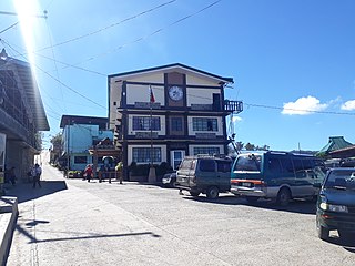
Lagawe, officially the Municipality of Lagawe is a 4th class municipality and capital of the province of Ifugao, Philippines. According to the 2020 census, it has a population of 18,876 people.

<span class="mw-page-title-main">Mayoyao</span> Municipality in Cordillera Administrative Region, Philippines

Mayoyao, officially the Municipality of Mayoyao is a 4th class municipality in the province of Ifugao, Philippines. According to the 2020 census, it has a population of 15,621 people.

References

  1. Municipality of Mankayan | (DILG)
  2. "2015 Census of Population, Report No. 3 – Population, Land Area, and Population Density" (PDF). Philippine Statistics Authority. Quezon City, Philippines. August 2016. ISSN   0117-1453. Archived (PDF) from the original on May 25, 2021. Retrieved July 16, 2021.
  3. 1 2 3 4 Census of Population (2020). "Cordillera Administrative Region (CAR)". Total Population by Province, City, Municipality and Barangay. Philippine Statistics Authority . Retrieved 8 July 2021.
  4. "PSA Releases the 2018 Municipal and City Level Poverty Estimates". Philippine Statistics Authority. 15 December 2021. Retrieved 22 January 2022.
  5. 1 2 3 4 5 6 7 8 "Municipality of Mankayan". Province of Benguet (official website). Retrieved 6 January 2015.
  6. 1 2 3 4 5 6 7 8 9 "Municipality of Mankayan, Benguet". Department of the Interior and Local Government - Cordillera Administrative Region (official website). 29 April 2013. Archived from the original on 6 February 2015. Retrieved 6 January 2015.
  7. "History: Benguet Province". Province of Benguet (official website). Archived from the original on 19 October 2014. Retrieved 6 January 2015.
  8. Scott, William (1974). The Discovery of the Igorots. Quezon City: New Day Publishers. pp. 57–60, 245–246. ISBN   9711000873.
  9. Bagamaspad, Anavic; Hamada-Pawid, Zenaida (1985). A People's History of Benguet. Baguio Printing & Publishing Company, Inc. p. 299.
  10. "R.A. No. 1302: An Act to Convert the Municipal District of Mankayan, Sub-province of Benguet, Mountain Province, into a Municipality". Chan Robles Virtual Law Library. Retrieved 6 January 2015.
  11. "R.A. No. 1302: An Act to Convert the Municipal District of Mankayan, Sub-province of Benguet, Mountain Province, into a Municipality". PhilippineLaw.info. Retrieved 6 January 2015.
  12. "News". Philippine Information Agency.
  13. "Province: Benguet". PSGC Interactive. Quezon City, Philippines: Philippine Statistics Authority . Retrieved 12 November 2016.
  14. "Municipal: Mankayan". PSGC Interactive. Quezon City, Philippines: Philippine Statistics Authority . Retrieved 8 January 2016.
  15. 1 2 Census of Population and Housing (2010). "Cordillera Administrative Region (CAR)" (PDF). Total Population by Province, City, Municipality and Barangay. National Statistics Office . Retrieved 29 June 2016.
  16. "Mankayan: Average Temperatures and Rainfall". Meteoblue. Retrieved 21 March 2020.
  17. Census of Population (2015). "Cordillera Administrative Region (CAR)". Total Population by Province, City, Municipality and Barangay. Philippine Statistics Authority . Retrieved 20 June 2016.
  18. Censuses of Population (1903–2007). "Cordillera Administrative Region (CAR)". Table 1. Population Enumerated in Various Censuses by Province/Highly Urbanized City: 1903 to 2007. National Statistics Office.{{cite encyclopedia}}: CS1 maint: numeric names: authors list (link)
  19. "Province of Benguet". Municipality Population Data. Local Water Utilities Administration Research Division. Retrieved 17 December 2016.
  20. "Poverty incidence (PI):". Philippine Statistics Authority. Retrieved December 28, 2020.
  21. "Estimation of Local Poverty in the Philippines" (PDF). Philippine Statistics Authority. 29 November 2005.
  22. "2003 City and Municipal Level Poverty Estimates" (PDF). Philippine Statistics Authority. 23 March 2009.
  23. "City and Municipal Level Poverty Estimates; 2006 and 2009" (PDF). Philippine Statistics Authority. 3 August 2012.
  24. "2012 Municipal and City Level Poverty Estimates" (PDF). Philippine Statistics Authority. 31 May 2016.
  25. "Municipal and City Level Small Area Poverty Estimates; 2009, 2012 and 2015". Philippine Statistics Authority. 10 July 2019.
  26. "PSA Releases the 2018 Municipal and City Level Poverty Estimates". Philippine Statistics Authority. 15 December 2021. Retrieved 22 January 2022.
  27. "2019 National and Local Elections" (PDF). Commission on Elections. Retrieved March 12, 2022.
  28. Cimatu, Frank (December 19, 2019). "Benguet Representative Nestor Fongwan dies at 68". Rappler.com. Retrieved January 30, 2020.
  29. "House names party-list solon as Benguet caretaker". Philippine News Agency. January 22, 2020. Retrieved March 12, 2022.
  30. "Masterlist of Public Elementary Schools for the School year 2012- 2013". Department of Education (Philippines), July 15, 2013. Archived from the original (XLSX) on 4 March 2016. Retrieved 28 December 2014.
  31. 1 2 "Masterlist of Secondary Schools (School Year 2013- 2014)". Department of Education (Philippines), July 4, 2013. Archived from the original (XLSX) on 1 July 2014. Retrieved 20 November 2014.
  32. 1 2 "Masterlist of Public Schools SY 2013-2014". Department of Education (Philippines), 22 October 2014. Archived from the original (XLSX) on 21 April 2016. Retrieved 28 December 2014.