
In the Philippines, provinces are one of its primary political and administrative divisions. There are 82 provinces at present, which are further subdivided into component cities and municipalities. The local government units in the National Capital Region, as well as independent cities, are independent of any provincial government. Each province is governed by an elected legislature called the Sangguniang Panlalawigan and an elected governor.
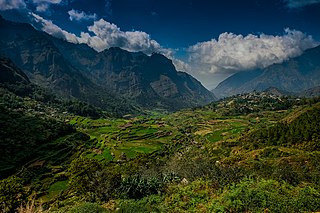
Benguet, officially the Province of Benguet, is a landlocked province of the Philippines located in the southern tip of the Cordillera Administrative Region in the island of Luzon. Its capital is La Trinidad.

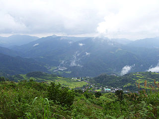
Mountain Province is a landlocked province of the Philippines in the Cordillera Administrative Region in Luzon. Its capital is Bontoc. Mountain Province was formerly referred to as Mountain in some foreign references. The name is usually shortened by locals to Mt. Province.
Apayao, officially the Province of Apayao, is a landlocked province in the Philippines in the Cordillera Administrative Region in Luzon. Kabugao serves as its capital. The provincial capitol and its associated offices are located at the New Government Center in Luna.

Kalinga, officially the Province of Kalinga, is a landlocked province in the Philippines situated within the Cordillera Administrative Region in Luzon. Its capital is Tabuk and borders Mountain Province to the south, Abra to the west, Isabela to the east, Cagayan to the northeast, and Apayao to the north. Kalinga and Apayao are the result of the 1995 partitioning of the former province of Kalinga-Apayao which was seen to better service the respective needs of the various indigenous peoples in the area.

Kalinga-Apayao was a province of the Philippines in the Cordillera Administrative Region in the island of Luzon. It was formed, along with Benguet, Ifugao, and the new Mountain Province, from the earlier Mountain Province, with the passage of Republic Act No. 4695 in 1966. The said law was amended by RA No. 7878 in 1995, which divided the province into two new ones, Kalinga and Apayao.

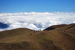
The Cordillera Administrative Region, also known as the Cordillera Region and Cordillera, is an administrative region in the Philippines, situated within the island of Luzon. It is the only landlocked region in the insular country, bordered by the Ilocos Region to the west and southwest, and by the Cagayan Valley Region to the north, east, and southeast. It is the least populous region in the Philippines, with a population less than that of the city of Manila.

The indigenous peoples of the Cordillera Mountain Range of northern Luzon, Philippines, often referred to by the exonym Igorot people, or more recently, as the Cordilleran peoples, are a ethnic group composed of nine main ethnolinguistic groups whose domains are in the Cordillera Mountain Range, altogether numbering about 1.5 million people in the early 21st century.

Alilem, officially the Municipality of Alilem, is a 4th class municipality in the province of Ilocos Sur, Philippines. According to the 2020 census, it has a population of 7,361 people.

Cervantes, officially the Municipality of Cervantes, is a 4th class municipality in the province of Ilocos Sur, Philippines. According to the 2020 census, it has a population of 19,449 people.

Tagudin, officially the Municipality of Tagudin, is a 2nd class municipality in the province of Ilocos Sur, Philippines. According to the 2020 census, it has a population of 41,538 people.

Bontoc, officially the Municipality of Bontoc, is a 2nd class municipality and capital of the province of Mountain Province, Philippines. According to the 2020 census, it has a population of 24,104 people.
Lubuagan, officially the Municipality of Lubuagan is a 4th class municipality in the province of Kalinga, Philippines. According to the 2020 census, it has a population of 9,323 people.
Bakun, officially the Municipality of Bakun,, is a 3rd class municipality in the province of Benguet, Philippines. According to the 2020 census, it has a population of 14,535 people.

Mankayan, officially the Municipality of Mankayan, is a 1st class municipality in the province of Benguet, Philippines. According to the 2020 census, it has a population of 37,233 people.

The legislative districts of Ilocos Sur are the representations of the province of Ilocos Sur in the various national legislatures of the Philippines. The province is currently represented in the lower house of the Congress of the Philippines through its first and second congressional districts.
The legislative districts of Mountain Province are the representations of Mountain Province in the various national legislatures of the Philippines. The province is currently represented in the lower house of the Congress of the Philippines through its lone congressional district.

The Kalinga people are an indigenous ethnic group whose ancestral domain is in the Cordillera Mountain Range of the northern Philippines. They are mainly found in Kalinga province which has an area of 3,282.58 sq. km. Some of them, however, already migrated to Mountain Province, Apayao, Cagayan, and Abra. The Kalinga numbered 163,167 as of 2010.
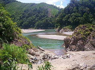
The Chico River Dam Project was a proposed hydroelectric power generation project involving the Chico River on the island of Luzon in the Philippines that locals, notably the Kalinga people, resisted because of its threat to their residences, livelihood, and culture. The project was shelved in the 1980s after public outrage in the wake of the murder of opposition leader Macli-ing Dulag. It is now considered a landmark case study concerning ancestral domain issues in the Philippines.

Amburayan was an administrative division of the Philippines, existing as a politico-military comandancia from 1890 to 1902, and a sub-province from 1902 to 1920. Its territory encompassed most of the Amburayan River watershed, initially predominantly inhabited by the Kankana-ey.

