The Yakima River is a tributary of the Columbia River in south central and eastern Washington state, named for the indigenous Yakama people. Lewis and Clark mention in their journals that the Chin-nâm pam called the river Tâpe têtt, possibly from the French tape-tête, meaning "head hit". The length of the river from headwaters to mouth is 214 miles (344 km), with an average drop of 9.85 feet per mile (1.866 m/km). It is the longest river entirely in Washington state.

Montgomery County is a county in the U.S. state of Indiana. As of the 2020 United States census, it had a population of 37,936. Its county seat is Crawfordsville. The county is divided into eleven townships which provide local services.
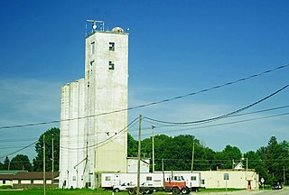
Crawfordsville is a city in Montgomery County in west central Indiana, United States, 49 miles (79 km) west by northwest of Indianapolis. As of the 2020 census, the city had a population of 16,306. The city is the county seat of Montgomery County, the only chartered city and the largest populated place in the county. It is the principal city of the Crawfordsville, IN Micropolitan Statistical Area, which encompasses all of Montgomery County. The city is also part of the Indianapolis–Carmel–Muncie, IN Combined Statistical Area.

Darlington is a town in Franklin Township, Montgomery County, in the U.S. state of Indiana. The population was 711 at the 2020 census, down from 843 in 2010.
New Market is a town in Montgomery County, Indiana, in the United States. The population was 559 at the 2020 census, down from 636 in 2010.

Colorado National Monument is a National Park Service unit near the city of Grand Junction, Colorado. Sheer-walled canyons cut deep into sandstone and granite–gneiss–schist rock formations. This is an area of desert land high on the Colorado Plateau, with pinyon and juniper forests on the plateau. The park hosts a wide range of wildlife, including red-tailed hawks, golden eagles, ravens, jays, desert bighorn sheep, and coyotes. Activities include hiking, horseback riding, road bicycling, and scenic drives; a visitor center on the west side contains a natural history museum and gift shop. There are scenic views from trails, Rim Rock Drive, which winds along the plateau, and the campground. Nearby are the Book Cliffs and the largest flat-topped mountain in the world, the Grand Mesa.

Bandelier National Monument is a 33,677-acre (13,629 ha) United States National Monument near Los Alamos in Sandoval and Los Alamos counties, New Mexico. The monument preserves the homes and territory of the Ancestral Puebloans of a later era in the Southwest. Most of the pueblo structures date to two eras, dating between 1150 and 1600 AD.

The Organ Mountains are a rugged mountain range in southern New Mexico in the Southwestern United States. Organ Mountains–Desert Peaks National Monument was declared a national monument on May 21, 2014. They lie 10 mi (16 km) east of the city of Las Cruces, in Doña Ana County.

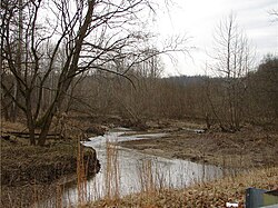
Sugar Creek is a waterway located in the U.S. state of Indiana. It originates in a farm field approximately two miles south of Kempton, Indiana, and travels west-southwest for about 93 miles (150 km) before merging with the Wabash River 5 miles (8.0 km) north of Montezuma. The largest community on the waterway is Crawfordsville.

The Rio Chama, a major tributary river of the Rio Grande, is located in the U.S. states of Colorado and New Mexico. The river is about 130 miles (210 km) long altogether. From its source to El Vado Dam its length is about 50 miles (80 km), from El Vado Dam to Abiquiu Dam is about 51 miles (82 km), and from Abiquiu Dam to its confluence with the Rio Grande is about 34 miles (55 km).
Sycamore Canyon Wilderness is a 56,000-acre wilderness area in the Coconino, Kaibab and Prescott national forests in the U.S. state of Arizona. Encompassing Sycamore Canyon and its surrounds from south of Williams to the confluence of Sycamore Creek with the Verde River, the wilderness is about 40 miles (64 km) southwest of Flagstaff. The canyon is one of several in Arizona that cut through the Mogollon Rim. Relevant United States Geological Survey (USGS) map quadrangles are Davenport Hill, White Horse Lake, May Tank Pocket, Perkinsville, Sycamore Basin, and Clarkdale. Red Rock-Secret Mountain Wilderness borders Sycamore Canyon Wilderness on the east.

Eldorado Canyon State Park is part of the Colorado State Park system. It was established in 1978 and is located in Boulder County near the city of Boulder. The park consists of two areas, the Inner Canyon and Crescent Meadows. The park encompasses 885 acres (3.6 km2) with a variety of recreation opportunities available. Eldorado Canyon is home to one of the world's most accessible and comprehensive rock climbing areas. This state park is open during daylight hours only, visitors are expected to leave before dusk.

State Route 129 (SR 129) is a state highway in Asotin County, Washington, United States. It travels north–south at the southeastern corner of the state, connecting with Oregon Route 3 (OR 3) at the Oregon state line south of Anatone. The 43-mile (69 km) highway then follows the Snake River, which marks the Idaho state border, north to Clarkston and terminates at U.S. Route 12 (US 12). SR 129 also has a short spur route that connects to a separate intersection with US 12 in Clarkston.

Eldorado Mountain is a mountain summit on the eastern flank of the Front Range of the Rocky Mountains of North America. The 8,344-foot (2,543 m) peak is located 8.1 miles (13.1 km) south by west of downtown Boulder, Colorado, United States. The mountain is largely in Boulder County but it straddles the border and its southern flanks are located in Jefferson County. Its name was probably borrowed from the nearby community of Eldorado Springs.
Mace is an unincorporated community and census-designated place (CDP) in Walnut Township, Montgomery County, in the U.S. state of Indiana.

In 1821, William Offield built a cabin on a creek,, four miles southwest of the future site of Crawfordsville, Indiana in an area now known as Balhinch. He and William Miller were the first two settlers in the area.

The Golden Spread Council is a local council of the Boy Scouts of America and serves youth in the panhandles of Texas and Oklahoma. Its service area includes all or part of 23 counties in Texas and three counties in Oklahoma. Through 2010, the council served approximately 5,300 youth members and 1,700 adult leaders.

Lake Holiday is an unincorporated community and census-designated place (CDP) in Union Township, Montgomery County, in the U.S. state of Indiana. It is a private community on the banks of its eponymous body of water. As of the 2020 census, the community had a population of 921 residents.

Cottonwood Canyon State Park, established in 2013, is the second largest state park in Oregon, encompassing 8,000 acres (3,200 ha) on the lower John Day River. The largest is Silver Falls State Park at 9,064 acres (3,668 ha).