
Darlington is a town in Franklin Township, Montgomery County, in the U.S. state of Indiana. The population was 843 at the 2010 census.

Monroe is a small unincorporated community in Lauramie Township, Tippecanoe County, in the U.S. state of Indiana. The community is part of the Lafayette, Indiana Metropolitan Statistical Area.

Big Creek Township is one of twelve townships in White County, Indiana, United States. As of the 2010 census, its population was 819 and it contained 362 housing units.

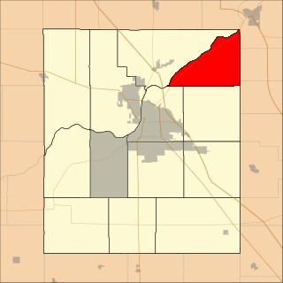
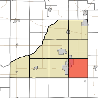
Franklin Township is one of eleven townships in Montgomery County, Indiana, United States. As of the 2010 census, its population was 1,915 and it contained 801 housing units.

Union Township is one of eleven townships in Montgomery County, Indiana, United States. As of the 2010 census, its population was 24,587 and it contained 10,723 housing units. Wabash College is located in Crawfordsville in this township.

Fairfield Township is one of thirteen townships in Tippecanoe County, Indiana. As of the 2010 census, its population was 51,113 and it contained 24,527 housing units.

Lauramie Township is one of thirteen townships in Tippecanoe County, Indiana, United States. As of the 2010 census, its population was 2,596 and it contained 1,021 housing units.

Perry Township is one of thirteen townships in Tippecanoe County, Indiana, United States. As of the 2010 census, its population was 7,161 and it contained 2,782 housing units.

Sheffield Township is one of thirteen townships in Tippecanoe County, Indiana, United States. As of the 2010 census, its population was 3,865 and it contained 1,454 housing units.

Tippecanoe Township is one of thirteen townships in Tippecanoe County, Indiana, United States. As of the 2010 census, its population was 7,702 and it contained 3,085 housing units.
Washington Township is one of thirteen townships in Tippecanoe County, Indiana, United States. As of the 2010 census, its population was 2,432 and it contained 1,002 housing units.

Wea Township is one of thirteen townships in Tippecanoe County, Indiana, United States. As of the 2010 census, its population was 31,660 and it contained 13,022 housing units.

California Township is one of nine townships in Starke County, in the U.S. state of Indiana. As of the 2010 census, its population was 2,011 and it contained 1,383 housing units.
North Bend Township is one of nine townships in Starke County, in the U.S. state of Indiana. As of the 2010 census, its population was 1,394 and it contained 862 housing units.

Wayne Township is one of nine townships in Starke County, in the U.S. state of Indiana. As of the 2010 census, its population was 4,541 and it contained 1,938 housing units.

Warren Township is one of thirteen townships in St. Joseph County, in the U.S. state of Indiana. As of the 2000 census, its population was 6,430.

Deer Creek Township is one of fourteen townships in Miami County, Indiana, United States. As of the 2010 census, its population was 4,839 and it contained 745 housing units. The south quarter of the Grissom Joint Air Reserve Base is located in this township.
East Monticello is an unincorporated community in Union Township, White County, in the U.S. state of Indiana.
Carp is an unincorporated community in the northeastern part of Montgomery Township, Owen County, in the U.S. state of Indiana. It lies near the intersection of US Highway 231 and County Road 50 East, which is a community nearly eight miles north of the city of Spencer, the county seat of Owen County. Its elevation is 722 feet, and it is located at 39°23′6″N86°45′39″W.
New Hope is an unincorporated community in the southeast corner of Franklin Township, Owen County, in the U.S. state of Indiana. It lies near the intersection of County Road 740 South and County Road 285 West, which is a community about nine miles southwest of the city of Spencer, the county seat. Its elevation is 522 feet, and it is located at 39°10′59″N86°49′40″W.

