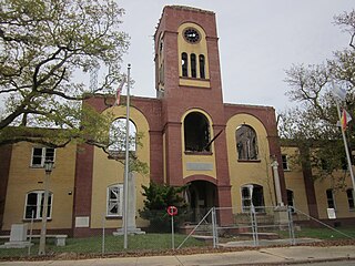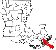
The fleur-de-lis or fleur-de-lys, is a stylized lily that is used as a decorative design or motif, and many of the Catholic saints of France, particularly St. Joseph, are depicted with a lily. Since France is a historically Catholic nation, the fleur-de-lis became "at one and the same time, religious, political, dynastic, artistic, emblematic, and symbolic", especially in French heraldry.

Vermilion Parish is a parish located in the U.S. state of Louisiana. As of the 2010 census, the population was 57,999. The parish seat is Abbeville. The parish was created in 1844.

Evangeline Parish is a parish located in the U.S. state of Louisiana. As of the 2010 census, the population was 33,984. The parish seat is Ville Platte.

Galliano is a census-designated place on the Bayou Lafourche in Lafourche Parish, Louisiana, United States. As of the 2000 census, the CDP population was 7,356. It is part of the Houma–Bayou Cane–Thibodaux Metropolitan Statistical Area.

The Gulf Intracoastal Waterway is the portion of the Intracoastal Waterway located along the Gulf Coast of the United States. It is a navigable inland waterway running approximately 1,050 mi (1,690 km) from Carrabelle, Florida, to Brownsville, Texas.

Shediac is a Canadian town in Westmorland County, New Brunswick. The town is known as the "Lobster Capital of the World" and hosts an annual festival every July which promotes its ties to lobster fishing. At the western entrance to the town is a 90-tonne sculpture called The World's Largest Lobster.

WTIX-FM is an oldies outlet serving the New Orleans area. The station is owned by Michael A. "Michael In The Morning" Costello and operates at 94.3 MHz with an ERP of 100 kW. Its city of license is Galliano, Louisiana. Its studios are in Metairie and its transmitter is in St. Bernard Parish, Louisiana.
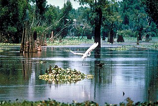
The Atchafalaya Basin, or Atchafalaya Swamp, is the largest wetland and swamp in the United States. Located in south central Louisiana, it is a combination of wetlands and river delta area where the Atchafalaya River and the Gulf of Mexico converge. The river stretches from near Simmesport in the north through parts of eight parishes to the Morgan City southern area.

Barataria Bay, also Barrataria Bay, is a bay of the Gulf of Mexico, about 15 miles (24 km) long and 12 miles (19 km) wide, in southeastern Louisiana, in Jefferson Parish and Plaquemines Parish, United States. It is separated from the gulf by two barrier islands, Grand Isle and Grand Terre.
Pointe-du-Chêne is a small community in Westmorland County, New Brunswick. Located on Shediac Bay, an inlet of the Northumberland Strait, Pointe-du-Chêne, also called La Pointe, is the home of Parlee Beach Provincial Park. It was once the terminus of the European and North American Railway and was a key stopover for Pan-Am's Trans Atlantic air service inaugurated in 1939. Pointe-du-Chêne became a cottage resort area in the early 20th century. Summer excursion trains from Moncton brought day trippers to the seashore. The railway terminus and proximity to Parlee Beach, made it an ideal location for cottages.

The Isreal LaFleur Bridge is a concrete pillar vehicular bridge located in Lake Charles, Louisiana. The bridge was built in 1962 as part of Interstate 210. It is named after Isreal LaFleur, who spearheaded the project to build it.
West Pointe à la Hache is an unincorporated community in Plaquemines Parish, Louisiana, United States.
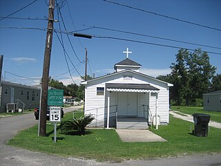
Phoenix is an unincorporated community in Plaquemines Parish, Louisiana, United States.
Bayou Chene was previously a small unincorporated community in St. Martin Parish, Louisiana, United States. The community was located in the Atchafalaya Basin.
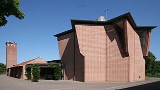
Ølby is a neighbourhood north of the town of Køge divided into two parts, the village of Ølby and east of the village near the shore of the Bay of Køge a suburb named Ølby Lyng 35 km south-west of Copenhagen, Denmark, located in the northern part of Køge. The suburb is connected with the radial line Køgebugtbanen, a part of the S-train network, at the Ølby station.
Pointe-aux-Chênes is an unincorporated community located in Terrebonne Parish, Louisiana,United States. In Cajun French, the area is known as Pointe-aux-Chenes. The community shares a zip code with Montegut (70377) and has many residents of Chitimacha descent. In 1993, they established the independent Pointe-au-Chien Indian Tribe, which is one of three state-recognized Houma tribes.
Hormiguero was a Mayan city which was at its peak in the Late Classic Period (650–850). It is located 22 kilometers south of Xpuhil in the Mexican state of Campeche. Only a few of its 84 known structures have been excavated. Structure II is the most completely excavated building at the site and one of the most wildly theatrical of all Rio Bec buildings. It is a rectangular platform, with two soaring, false-staircase towers either side of a colossal Chenes-style monster-portal. Inside there are several large chambers. Nearby is the Central Group, a complex of large temples, most of which are not excavated. Of those that are, Structure V is the most impressive. It is a towering pyramid with a well-preserved Chenes-style temple at the top.
Hopedale is an unincorporated community in Saint Bernard Parish, Louisiana, United States in metropolitan New Orleans.The latitude of Hopedale is 29.820N; the longitude is-89.656W. Hopedale is in the Central Standard time zone at an elevation of 3 feet. It is a fishing community. Hopedale was devastated by Hurricane Katrina in August 2005.

Davant is an unincorporated community located in the delta of the Mississippi River in the parish of Plaquemines, Louisiana, United States.
Duvic is an unincorporated community in Plaquemines Parish, Louisiana, United States.
