Bedford Air Force Station

Last updated

Bedford Air Force Station
Air Defense Command.svg
Part of Air Defense Command (ADC)
USA Virginia location map.svg
Red pog.svg
Bedford AFS
Location of Bedford AFS, Virginia
Coordinates 37°31′02″N079°30′37″W / 37.51722°N 79.51028°W / 37.51722; -79.51028
TypeAir Force Station
CodeADC ID: M-121, NORAD ID: Z-121
Site information
Controlled byFlag of the United States Air Force.svg  United States Air Force
Site history
Built1954
In use1954-1975
Garrison information
Garrison649th Aircraft Control and Warning (later Radar) Squadron

Bedford Air Force Station is a closed United States Air Force General Surveillance Radar station. It is located 12.7 miles (20.4 km) north of Bedford, Virginia. It was closed in 1975.

Contents

History

Bedford AFS was established by Air Defense Command in 1954 as part of a planned deployment of forty-four Phase I Mobile Radar stations. It was one of twenty-nine stations which were sited around the perimeter of the country to support the permanent ADC network of seventy-five stations. The deployment had been projected to be operational by mid-1952. Funding, constant site changes, construction, and equipment delivery delayed deployment

The 649th Airborne Control and Warning Squadron achieved beneficial occupancy by 1 December 1954. Operational status was achieved in 1956 with the activation of the AN/MPS-8 and AN/MPS-11 radars, and initially the station functioned as a Ground-Control Intercept (GCI) and warning station. As a GCI station, the squadron's role was to guide interceptor aircraft toward unidentified intruders picked up on the unit's radar scopes.

By 1958 the AN/MPS-8 had been superseded by a pair of AN/FPS-6 height-finder radars. In 1959 an AN/FPS-20A search radar replaced the AN/MPS-11 set. During 1959 Bedford AFB joined the Semi Automatic Ground Environment (SAGE) system, initially feeding data to DC-04 at Fort Lee AFS, Virginia. After joining, the squadron was re-designated as the 649th Radar Squadron (SAGE) on 1 October 1959. The radar squadron provided information 24/7 the SAGE Direction Center where it was analyzed to determine range, direction altitude speed and whether or not aircraft were friendly or hostile.

In 1960 this site also began performing air traffic control duties for the FAA. In 1963 the search radar was upgraded and redesignated as an AN/FPS-67. On 31 July 1963, the site was redesignated as NORAD ID Z-121.

Over the years, the equipment at the station was upgraded or modified to improve the efficiency and accuracy of the information gathered by the radars. The 649th was inactivated and the Air Force closed the facility on 30 June 1975. Afterward the FAA took over the facility, and today it is an active Joint Surveillance System (JSS) site, now operating an ARSR-3 Long Range Air Route Surveillance Radar. Most of the buildings on the site have been torn down, the housing and GATR site have been obliterated as well.

Air Force units and assignments

Emblem of the 649th Radar Squadron 649th Radar Squadron - Emblem.png
Emblem of the 649th Radar Squadron

Units:

Activated as 649th Aircraft Control Squadron at Orlando AFB, Florida on 20 November 1948
Moved to Roslyn, New York ca. 1 April 1949
Inactivated 1 October 1949
Redesignated 649th Aircraft Control and Warning Squadron
Activated at Roslyn (later Roslyn AFS), NY, on 26 May 1953 (not manned or equipped)
Redesignated 649th Radar Squadron (SAGE), on 1 October 1959
Redesignated 649th Radar Squadron, on 1 February 1974
Inactivated on 30 June 1975

Assignments:

See also

Related Research Articles

Dickinson Air Force Station is a closed United States Air Force General Surveillance Radar station. It is located 3.8 miles (6.1 km) northeast of Dickinson, North Dakota. It was closed in 1965.

<span class="mw-page-title-main">Tonopah Air Force Station</span> Radar station in Nevada, US 1956–1970

Tonopah Air Force Station is a closed United States Air Force General Surveillance Radar station. It is located 1.1 miles (1.8 km) south of Tonopah, Nevada. It was closed in 1970.

<span class="mw-page-title-main">Cut Bank Air Force Station</span> US Air Force radar station

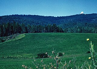
Cut Bank Air Force Station is a closed United States Air Force General Surveillance Radar station. It is located 30.4 miles (48.9 km) northwest of Cut Bank, Montana. It was closed in 1965.

North Charleston Air Force Station is a closed United States Air Force General Surveillance Radar station. It is located in the City of North Charleston, South Carolina. It was closed in 1980.

<span class="mw-page-title-main">Winston-Salem Air Force Station</span> Closed United States Air Force General Surveillance Radar station in North Carolina

Winston-Salem Air Force Station is a closed United States Air Force General Surveillance Radar station that was active from 1956 to 1970. It is located 1 mile (1.6 km) southeast of Winston-Salem, North Carolina.

<span class="mw-page-title-main">Caswell Air Force Station</span> Former Air Force radar station

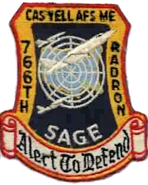
Caswell Air Force Station is a closed United States Air Force General Surveillance Radar station. It is located 4.3 miles (6.9 km) north of Limestone, Maine. It was closed in 1980.

<span class="mw-page-title-main">Kirksville Air Force Station</span> Former US Air Force radar station in Missouri

Kirksville Air Force Station is a closed United States Air Force General Surveillance Radar station. It is located 7.1 miles (11.4 km) north of Kirksville, Missouri. It was closed by the Air Force in 1968. Today the radar site is used by the Federal Aviation Administration (FAA) as a Joint Surveillance System (JSS) site.

<span class="mw-page-title-main">Bellefontaine Air Force Station</span> Former US Air Force radar station in Ohio

Bellefontaine Air Force Station is a closed United States Air Force General Surveillance Radar station. It is located 2.3 miles (3.7 km) east-northeast of Bellefontaine, Ohio. It was closed in 1969.

Omaha Air Force Station is a closed United States Air Force General Surveillance Radar station. It is located 7.5 miles (12.1 km) north of Omaha, Nebraska. It was closed in 1968.

<span class="mw-page-title-main">Finland Air Force Station</span> Radar station in Minnesota, US 1950–1980

Finland Air Force Station is a closed United States Air Force General Surveillance Radar station. It is located 2.8 miles (4.5 km) north of Finland, Minnesota. It was closed in 1980.

<span class="mw-page-title-main">Grand Rapids Air Force Station</span> Closed US military installation

Grand Rapids Air Force Station is a closed United States Air Force General Surveillance Radar station. It is located 0.7 miles (1.1 km) east-northeast of Grand Rapids, Minnesota. It was closed in 1963.

<span class="mw-page-title-main">Gettysburg Air Force Station</span> Radar station in South Dakota, US 1956–1965

Gettysburg Air Force Station is a closed United States Air Force General Surveillance Radar station. It is located 2.6 miles (4.2 km) north of Gettysburg, South Dakota. It was closed in 1968.

<span class="mw-page-title-main">Burns Air Force Station</span> Closed United States Air Force General Surveillance Radar station

Burns Air Force Station is a closed United States Air Force General Surveillance Radar station. It is located 5.2 miles (8.4 km) west-southwest of Burns, Oregon. It was closed in 1974.

Red Bluff Air Force Station is a closed United States Air Force General Surveillance Radar station. It is located 4.3 miles (6.9 km) west-southwest of Red Bluff, California. It was closed in 1970.

Mica Peak Air Force Station is a closed United States Air Force General Surveillance Radar station. It is located atop Mica Peak, 6.3 miles (10.1 km) east-northeast of Mica, Washington. It was closed in 1975 by the Air Force, and turned over to the Federal Aviation Administration (FAA).

<span class="mw-page-title-main">Cottonwood Air Force Station</span> Former US Air Force radar station in Idaho

Cottonwood Air Force Station is a former United States Air Force General Surveillance Radar station. The radar site was located at the summit of Cottonwood Butte, 5.7 miles (9.2 km) west-northwest of Cottonwood in Idaho County, Idaho. It was closed in 1965 and transferred to the state of Idaho in 1974, when it was converted to its present use as a minimum-security correctional facility.

<span class="mw-page-title-main">Blaine Air Force Station</span> Closed United States Air Force General Surveillance Radar station

Blaine Air Force Station is a closed United States Air Force General Surveillance Radar station. It is located 5.5 miles (8.9 km) south of Blaine, Washington. It was closed in 1979.

Makah Air Force Station is a closed United States Air Force General Surveillance Radar station. It is located 2.4 miles (3.9 km) south of Neah Bay, Washington. It was closed in 1988 by the Air Force, and turned over to the Federal Aviation Administration (FAA).

Naselle Air Force Station is a closed United States Air Force General Surveillance Radar station. It is located 3.9 miles (6.3 km) north of Naselle, Washington. It was decommissioned by the Air Force in 1966 and later used for commercial and recreational uses.

Houma Air Force Station is a closed United States Air Force General Surveillance Radar station. It is located 3.5 miles (5.6 km) southeast Houma, Louisiana. It was closed in 1970.

References

PD-icon.svg This article incorporates public domain material from the Air Force Historical Research Agency