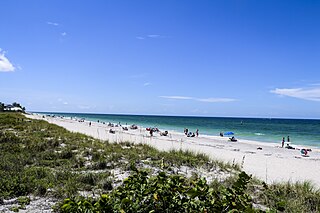
Manasota Key is a census-designated place (CDP) consisting mainly of the community of Englewood Beach in Charlotte County, Florida, United States. The population of the CDP was 1,326 at the 2020 census, up from 1,229 at the 2010 census. It is part of the Punta Gorda, Florida Metropolitan Statistical Area, included in the North Port-Bradenton, Florida Combined Statistical Area.

Desoto Lakes is a census-designated place (CDP) in Sarasota County, Florida, United States. The population was 2,137 at the 2020 US census, down from 3,646 at the 2010 US Census. It is part of the North Port–Bradenton–Sarasota, Florida Metropolitan Statistical Area.

Gulf Gate Estates is a census-designated place (CDP) in Sarasota County, Florida, United States. The population was 11,118 at the 2020 census, up from 10,911 at the 2010 census. It is part of the North Port–Bradenton–Sarasota, Florida Metropolitan Statistical Area.

Kensington Park is a census-designated place (CDP) in Sarasota County, Florida, United States. The population was 3,697 at the 2020 census, down from 3,901 at the 2010 census. It is part of the North Port–Bradenton–Sarasota, Florida Metropolitan Statistical Area.

Lake Sarasota is a census-designated place (CDP) in Sarasota County, Florida, United States. The population was 3,979 at the 2020 census, down from 4,679 at the 2010 census. It is part of the North Port–Bradenton–Sarasota, Florida Metropolitan Statistical Area.

Laurel is a census-designated place (CDP) in Sarasota County, Florida, United States. The population was 12,186 as of 2020 census, up from 8,171 at the 2010 census. Laurel is part of the North Port–Bradenton–Sarasota, Florida Metropolitan Statistical Area.

Nokomis is an unincorporated town in Sarasota County and a census-designated place (CDP) along the Gulf Coast of Florida, United States, located south of Osprey and just north of Venice. The town has access to the coast through Nokomis Public Beach and Casey Key. The town's population was 3,217 at the 2020 census, up from 3,167 at the 2010 census. It is part of the North Port–Bradenton–Sarasota, Florida Metropolitan Statistical Area.

North Sarasota is a census-designated place (CDP) in Sarasota County, Florida, United States. The population was 2,418 at the 2020 census, down from 6,982 at the 2010 census. It is part of the North Port–Bradenton–Sarasota, Florida Metropolitan Statistical Area.

Osprey is a census-designated place (CDP) in Sarasota County, Florida, United States. The population was 6,690 at the 2020 census, up from 6,100 at the 2010 census. It is part of the North Port–Bradenton–Sarasota, Florida Metropolitan Statistical Area.

Ridge Wood Heights is a census-designated place (CDP) in Sarasota County, Florida, United States. The population was 5,064 at the 2020 census, up from 4,795 at the 2010 census. It is part of the North Port–Bradenton–Sarasota, Florida Metropolitan Statistical Area.

Sarasota Springs is a census-designated place (CDP) in Sarasota County, Florida, United States. The population was 12,521 at the 2020 census, down from 14,395 at the 2010 census. It is part of the North Port–Bradenton–Sarasota, Florida Metropolitan Statistical Area.

Siesta Key is a barrier island off the southwest coast of the U.S. state of Florida, located between Roberts Bay and the Gulf of Mexico. A portion of it lies within the city boundary of Sarasota, but the majority of the key is a census-designated place (CDP) in Sarasota County. Siesta Key is part of the North Port–Bradenton–Sarasota, Florida Metropolitan Statistical Area.

South Gate Ridge is a census-designated place (CDP) in Sarasota County, Florida, United States. The population was 6,024 at the 2020 census, up from 5,688 at the 2010 census. It is part of the North Port–Bradenton–Sarasota, Florida Metropolitan Statistical Area.

South Sarasota is a census-designated place (CDP) in Sarasota County, Florida, United States. The population was 5,133 at the 2020 census, up from 4,950 at the 2010 census. It is part of the North Port–Bradenton–Sarasota, Florida Metropolitan Statistical Area.

South Venice is a census-designated place (CDP) in Sarasota County, Florida, United States. The population was 15,619 at the 2020 census, up from 13,949 at the 2010 census. It is part of the North Port–Bradenton–Sarasota, Florida Metropolitan Statistical Area.

Southgate is a census-designated place (CDP) in Sarasota County, Florida, United States. The population was 6,287 at the 2020 census, down from 7,173 at the 2010 census. It is part of the North Port–Bradenton–Sarasota, Florida Metropolitan Statistical Area.

The Meadows is a census-designated place (CDP) in Sarasota County, Florida, United States. The population was 5,037 at the 2020 census, up from 3,994 at the 2010 census. The CDP is part of the North Port–Bradenton–Sarasota, Florida Metropolitan Statistical Area.

Vamo is a census-designated place (CDP) in Sarasota County, Florida, United States. The population was 2,822 at the 2020 census, down from 4,727 at the 2010 census. It is part of the North Port–Bradenton–Sarasota, Florida Metropolitan Statistical Area.

Venice Gardens is a census-designated place (CDP) in Sarasota County, Florida, United States. The population was 3,402 at the 2020 census, down from 7,104 at the 2010 census. It is part of the North Port–Bradenton–Sarasota, Florida Metropolitan Statistical Area.
Warm Mineral Springs is a census-designated place (CDP) in Sarasota County, Florida, United States. The population was 5,442 at the 2020 census, up from 5,061 at the 2010 census. It is part of the North Port–Bradenton–Sarasota, Florida Metropolitan Statistical Area.

