Englewood, Florida

Last updated

Englewood, Florida
Sunset at Manasota Beach Club - April 2011.jpg
Sunset from the Manasota Beach Club
Sarasota County Florida Incorporated and Unincorporated areas Englewood Highlighted.svg
Location in Sarasota County and the state of Florida
Coordinates: 26°57′47″N82°21′7″W / 26.96306°N 82.35194°W / 26.96306; -82.35194
CountryFlag of the United States (23px).png  United States
State Flag of Florida.svg  Florida
Counties Sarasota, Charlotte
Platted1896 [1]
Area
[2]
  Total22.32 sq mi (57.82 km2)
  Land18.82 sq mi (48.75 km2)
  Water3.50 sq mi (9.07 km2)
Elevation
10 ft (3 m)
Population
 (2020)
  Total20,800
  Density1,105.03/sq mi (426.65/km2)
Time zone UTC−05:00 (Eastern (EST))
  Summer (DST) UTC−04:00 (EDT)
ZIP Codes
34223, 34224, 34295
Area code 941
FIPS code 12-20825 [3]
GNIS feature ID 0282217
[3]

Englewood is a census-designated place (CDP) in Charlotte and Sarasota counties in the U.S. state of Florida. As of the 2020 census, it had a population of 20,800, up from 14,863 at the 2010 census. It is part of the North Port-Bradenton-Sarasota, Florida Metropolitan Statistical Area.

Contents


History

Archeological digs in what is now Englewood discovered ceramics belonging to both the Weeden Island culture and Safety Harbor culture. [4] [5]

One of the earliest white settlers in the area was a man named William Goff, who arrived by schooner from Tampa in 1878. He settled a piece of land just a few miles south of where Englewood would be platted. On July 3, 1895, a post office was established in the area as well. The Great Freeze of 1894 and 1895, along with a bad freeze in 1896, led to the decimation of many local orange plants. For this reason, by 1897, a Manatee County General Directory listed fish as the chief product for Englewood. [6]

The original plat of Englewood was recorded and filed on August 17, 1896. [7] The home lots were 1-acre (0.40 ha), and the grove lotslikely intended for citruswere 10 acres (4.0 ha). The area was developed by three brothers, and the name Englewood came from their hometown, Englewood, Chicago. [8] Some streets, such as Dearborn, Harvard, and Yale, are named after those in Chicago.

In 1898, the Englewood Inn was opened, a relatively large hotel with 16 rooms. The hotel serviced visitors from up north until it burned down in 1909. [9]

In 1921, both Sarasota and Charlotte County were created. [10] [11] Englewood, which was initially more on the modern Sarasota side of the county line, would eventually expand to its current size that now resides in both counties.

Geography

According to the United States Census Bureau, the CDP has a total area of 13.1 square miles (33.8 km2), of which 9.8 square miles (25.4 km2) is land and 3.3 square miles (8.5 km2), or 24.99%, is water. [12]

Demographics

Historical population
CensusPop.Note
1970 3,549
1980 7,657115.8%
1990 15,02596.2%
2000 16,1967.8%
2010 14,863−8.2%
2020 20,80039.9%
Source: [13]

As of the 2020 United States census, [14] Englewood had a population of 20,800 with 10,173 households which resulted in a rate of 1.92 persons per household.

By age the population was split with 1.2% under 5 years old, 6.3% under 18 years old, and 57.5% 65 years and older. 50.3% of the population were female persons. By race, the population was split with 95.5% white, 0.1% American Indian and Alaska Native, 2.1% Asian, 0.1% Native Hawaiian and other Pacific Islander, 1.9% two or more races, and 1.3% Hispanic or Latino. There were 2,626 veterans living in the city and 7.2% of the population were foreign born persons.

The CDP had an owner-occupied housing unit rate of 85.6%. The median value of owner-occupied housing units was $233,800. The median gross rent was $1,068. 93.1% of households had a computer and 84.5% had a broadband internet subscription.

94.2% of the population 25 years and older were High School graduates or higher and 30.2% of that same population had a Bachelor’s degree or higher.

Education

The Englewood Community Redevelopment Area (CRA) is a special district created by the Sarasota County Board of County Commissioners in 1999 on the Sarasota side of Englewood. The Sarasota and Charlotte County School Districts have an interlocal agreement allowing some Charlotte County residents to use the Englewood Elementary School and the Sarasota County students to use the Middle and High School located in Charlotte County. Englewood has a private utility company, the Englewood Water District, and the Englewood Fire District that serve the community.

Englewood contains multiple public elementary schools and one public high school (Lemon Bay High School). Several private schools are also located within Englewood. Englewood Christian Academy, Heritage Christian Academy, and Genesis Christian Academy [15] offer grades K–12. L.A. Ainger Middle School, a public school serving grades 6–8, located in nearby Rotonda West, Florida, is the nearest public middle school.

Popular entertainment includes the beach, restaurants, and a small shopping district located primarily along Dearborn Street.

Related Research Articles

<span class="mw-page-title-main">Charlotte County, Florida</span> County in Florida, United States

Charlotte County is a U.S. county located in southwestern Florida. As of the 2020 census, the population was 186,847. Its county seat is Punta Gorda.

<span class="mw-page-title-main">Sarasota County, Florida</span> County in Florida, United States

Sarasota County is a county located in Southwest Florida. At the 2020 US census, the population was 434,006. Its county seat is Sarasota and its largest city is North Port. Sarasota County is part of the North Port–Bradenton–Sarasota, FL metropolitan statistical area.

<span class="mw-page-title-main">Grove City, Florida</span> Census-designated place in Florida, United States

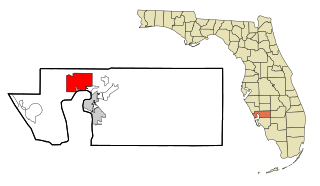
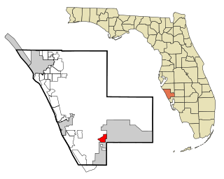
Grove City is an unincorporated community and census-designated place (CDP) in Charlotte County, Florida, United States. The population was 2,174 at the 2020 census, up from 1,804 at the 2010 census. It is part of the Punta Gorda, FL Metropolitan Statistical Area, included in the North Port-Bradenton, Florida Combined Statistical Area.

<span class="mw-page-title-main">Manasota Key, Florida</span> Census-designated place in Florida, United States

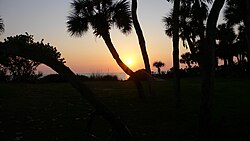
Manasota Key is a census-designated place (CDP) consisting mainly of the community of Englewood Beach in Charlotte County, Florida, United States. The population of the CDP was 1,326 at the 2020 census, up from 1,229 at the 2010 census. It is part of the Punta Gorda, Florida Metropolitan Statistical Area, included in the North Port-Bradenton, Florida Combined Statistical Area.

<span class="mw-page-title-main">Port Charlotte, Florida</span> Census-designated place in Florida, United States

Port Charlotte is an unincorporated community and census-designated place (CDP) in Charlotte County, Florida, United States. The population was 60,625 at the 2020 census, up from 54,392 at the 2010 census. It is part of the Punta Gorda, Florida Metropolitan Statistical Area, included in the North Port-Bradenton, Florida Combined Statistical Area.

<span class="mw-page-title-main">North Fort Myers, Florida</span> Census-designated place in Florida, United States

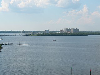
North Fort Myers is an unincorporated area and census-designated place (CDP) in Lee County, Florida, United States. The population was 42,719 at the 2020 census, up from 39,407 at the 2010 census. It is part of the Cape Coral-Fort Myers, Florida Metropolitan Statistical Area.

<span class="mw-page-title-main">Bayshore Gardens, Florida</span> Census-designated place in Florida, United States

Bayshore Gardens is a census-designated place (CDP) and planned community in Manatee County, Florida, United States. The population was 19,904 at the 2020 census, up from 16,323 in 2010. It is part of the North Port-Bradenton-Sarasota, Florida Metropolitan Statistical Area.

<span class="mw-page-title-main">Taft, Florida</span> Census-designated place in Florida, United States

Taft is a census-designated place and an unincorporated area in Orange County, Florida, United States. The population was 2,205 at the 2010 census. It is part of the Orlando–Kissimmee Metropolitan Statistical Area.

<span class="mw-page-title-main">Fruitville, Florida</span> Census-designated place in Florida, United States

Fruitville is a census-designated place (CDP) in Sarasota County, Florida, United States. The population was 15,484 at the 2020 census, up from 13,224 at the 2010 census. It is part of the North Port–Bradenton–Sarasota, Florida Metropolitan Statistical Area.

<span class="mw-page-title-main">Nokomis, Florida</span> Census-designated place in Florida, United States

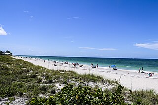
Nokomis is an unincorporated town in Sarasota County and a census-designated place (CDP) along the Gulf Coast of Florida, United States, located south of Osprey and just north of Venice. The town has access to the coast through Nokomis Public Beach and Casey Key. The town's population was 3,217 at the 2020 census, up from 3,167 at the 2010 census. It is part of the North Port–Bradenton–Sarasota, Florida Metropolitan Statistical Area.

<span class="mw-page-title-main">North Port, Florida</span> City in Florida, United States

North Port is a city located in Sarasota County, Florida, United States. The population was 74,793 at the 2020 US Census,, up from 57,357 at the 2010 US Census. It is a principal city in the North Port–Bradenton–Sarasota, Florida Metropolitan Statistical Area.

<span class="mw-page-title-main">Osprey, Florida</span> Census-designated place in Florida, United States

Osprey is a census-designated place (CDP) in Sarasota County, Florida, United States. The population was 6,690 at the 2020 census, up from 6,100 at the 2010 census. It is part of the North Port–Bradenton–Sarasota, Florida Metropolitan Statistical Area.

<span class="mw-page-title-main">South Venice, Florida</span> Census-designated place in Florida, United States

South Venice is a census-designated place (CDP) in Sarasota County, Florida, United States. The population was 15,619 at the 2020 census, up from 13,949 at the 2010 census. It is part of the North Port–Bradenton–Sarasota, Florida Metropolitan Statistical Area.

<span class="mw-page-title-main">The Meadows, Florida</span> Census-designated place in Florida, United States

The Meadows is a census-designated place (CDP) in Sarasota County, Florida, United States. The population was 5,037 at the 2020 census, up from 3,994 at the 2010 census. The CDP is part of the North Port–Bradenton–Sarasota, Florida Metropolitan Statistical Area.

<span class="mw-page-title-main">Venice, Florida</span> City in Florida, United States

Venice is a city in Sarasota County, Florida, United States. The city includes what locals call "Venice Island", a portion of the mainland that is accessed via bridges over the artificially created Intracoastal Waterway. The city is located in Southwest Florida. As of the 2020 Census, the city had a population of 25,463, up from 20,748 at the 2010 Census. Venice is part of the North Port–Bradenton–Sarasota, Florida Metropolitan Statistical Area.

<span class="mw-page-title-main">Warm Mineral Springs, Florida</span> Census-designated place in Florida, United States

Warm Mineral Springs is a census-designated place (CDP) in Sarasota County, Florida, United States. The population was 5,442 at the 2020 census, up from 5,061 at the 2010 census. It is part of the North Port–Bradenton–Sarasota, Florida Metropolitan Statistical Area.

<span class="mw-page-title-main">Sarasota metropolitan area</span> Metropolitan area in Florida, United States

The Sarasota metropolitan area is a metropolitan area located in Southwest Florida. The metropolitan area is defined by the Office of Management and Budget (OMB) as the North Port–Bradenton–Sarasota Metropolitan Statistical Area, a metropolitan statistical area (MSA) consisting of Manatee County and Sarasota County. The principal cities listed by the OMB for the MSA are North Port, Bradenton, Sarasota, Lakewood Ranch, and Venice. At the 2020 census, the MSA had a population of 833,716. The Census Bureau estimates that its population was 891,411 in 2022.

Lakewood Ranch is a planned community and census-designated place (CDP) in southeastern Manatee County and northeastern Sarasota County, Florida, United States, consisting of approximately 31,000 acres (13,000 ha). It is part of the North Port-Bradenton-Sarasota, Florida Metropolitan Statistical Area. According to the 2020 census, the CDP had a population of 34,877.

Woodmere is an unincorporated community 5 miles (8.0 km) north of Englewood in Sarasota County, Florida.

<span class="mw-page-title-main">Desoto Acres, Florida</span> Census-designated place in Florida, United States

Desoto Acres is a census-designated place (CDP) in northwestern Sarasota County, Florida, United States. It is 4 miles (6 km) north of downtown Sarasota and is bordered to the east by Desoto Lakes.

References

  1. "Englewood's beginnings". Sarasota Herald-Tribune. August 30, 1995. p. 10. Retrieved November 3, 2015.
  2. "2020 U.S. Gazetteer Files". United States Census Bureau. Retrieved October 31, 2021.
  3. 1 2 "Englewood". Geographic Names Information System . United States Geological Survey, United States Department of the Interior. October 19, 1979. Retrieved January 17, 2019.
  4. Bullen, R. P. (1969). Southern Limit of Timucua Territory. The Florida Historical Quarterly, 47(4), 414–419. http://www.jstor.org/stable/30140244, pg. 418
  5. Deming, J., Schwarz, R., Carender, P., Delanaye, D., & Williams, J. Sarasota County Department of Historical Resources. (1990). An Historic Resources Survey of the Coastal Zone of Sarasota County, Florida. Department of Environmental Regulation. Retrieved from https://www.govinfo.gov/content/pkg/CZIC-g70-215-c63-f6-1990/html/CZIC-g70-215-c63-f6-1990.htm, pg. 19
  6. Deming, et al (1990). pg. 123
  7. Deming, J., Schwarz, R., Carender, P., Delanaye, D., & Williams, J. Sarasota County Department of Historical Resources. (1990). An Historic Resources Survey of the Coastal Zone of Sarasota County, Florida. Department of Environmental Regulation. Retrieved from https://www.govinfo.gov/content/pkg/CZIC-g70-215-c63-f6-1990/html/CZIC-g70-215-c63-f6-1990.htm. pg. 123
  8. "Englewood's Beginnings...The Proud History of Today's Thriving Community". Sarasota Herald Tribune. Retrieved January 6, 2022.
  9. Shank, Ann. "The Nichols Brothers of Englewood". Sarasota History Alive!. Retrieved January 7, 2022.
  10. "Our History".
  11. Cassell, F.A. (2019). Creating Sarasota County. The History Press.
  12. "Geographic Identifiers: 2010 Demographic Profile Data (G001): Englewood CDP, Florida". U.S. Census Bureau, American Factfinder. Archived from the original on February 12, 2020. Retrieved April 11, 2013.
  13. "Census of Population and Housing". U.S. Census Bureau . Retrieved January 15, 2019.
  14. "QuickFacts Englewood CDP, Florida". United States Census Bureau. Retrieved April 17, 2023.
  15. Dr. Charles McCombs. "About GCA". Self-published by Genesis Christian Academy. Retrieved January 13, 2022.