Manasota Key, Florida

Last updated

Manasota Key, Florida
Englewood Beach
Englewood Beach081915 024NEW.jpg
Englewood Beach
Charlotte County Florida Incorporated and Unincorporated areas Manasota Key Highlighted.svg
Location in Charlotte County and the state of Florida
Coordinates: 26°56′N82°22′W / 26.933°N 82.367°W / 26.933; -82.367
CountryUnited States
State Florida
County Charlotte
Area
[1]
  Total3.07 sq mi (7.95 km2)
  Land1.06 sq mi (2.74 km2)
  Water2.01 sq mi (5.21 km2)
Elevation
0 ft (0 m)
Population
 (2020)
  Total1,326
  Density1,252.12/sq mi (483.57/km2)
Time zone UTC-5 (Eastern (EST))
  Summer (DST) UTC-4 (EDT)
ZIP code
34223 [2]
Area code 941
FIPS code 12-42750 [3]
GNIS feature ID1867173 [4]

Manasota Key is a census-designated place (CDP) consisting mainly of the community of Englewood Beach in Charlotte County, Florida, United States. The population of the CDP was 1,326 at the 2020 census, up from 1,229 at the 2010 census. It is part of the Punta Gorda, Florida Metropolitan Statistical Area, included in the North Port-Bradenton, Florida Combined Statistical Area.

Contents

History

The name "Manasota Key" refers to an 11-mile-long (18 km) peninsula (transformed into a barrier island by the Gulf Intracoastal Waterway) that continues north into Sarasota County. The community of Englewood Beach occupies the Charlotte County portion of the key, while the Sarasota County part of the peninsula contains the community of Manasota Beach. The key continues north as Caspersen Beach, extending as far as the Venice city limits.

Manasota is a portmanteau of "Sarasota" and "Manatee". [5]

Geography

The Manasota Key CDP is located in the northwestern corner of Charlotte County at 26°56′N82°22′W / 26.933°N 82.367°W / 26.933; -82.367 . [6] As noted above, the barrier island of the same name extends north well into Sarasota County. Its western edge is the Gulf of Mexico, and to the east is Lemon Bay, an estuary. The community of Englewood Beach occupies most of the CDP, and it is connected to the mainland by Beach Road, which crosses Lemon Bay to Englewood. The southern end of the CDP, which includes Manasota Key, Peterson Island, and Whidden Key, is covered by Stump Pass Beach State Park. Stump Pass is a channel that connects Lemon Bay to the Gulf of Mexico and separates Manasota Key from Don Pedro Island to the south. Grove City is located directly to the east across Lemon Bay from the south end of Manasota Key.

According to the United States Census Bureau, the CDP has a total area of 3.1 square miles (8.0 km2), of which 1.0 square mile (2.7 km2) is land and 2.0 square miles (5.2 km2), or 65.97%, is water. [7]

The extinct Chadwick Beach cotton mouse was endemic to the Englewood Beach area.

Demographics

Historical population
CensusPop.Note
1990 1,395
2000 1,345−3.6%
2010 1,229−8.6%
2020 1,3267.9%
U.S. Decennial Census [8]

As of the 2000 U.S. Census, there were 1,345 people, 769 households, and 459 families residing in the CDP. The population density was 1,263.2 inhabitants per square mile (487.7/km2). There were 1,867 housing units at an average density of 1,753.4 per square mile (677.0/km2). The racial makeup of the CDP was 99.26% White, 0.15% African American, 0.30% Asian, 0.22% from other races, and 0.07% from two or more races. Hispanic or Latino of any race were 0.97% of the population. [3]

There were 769 households, out of which 3.5% had children under the age of 18 living with them, 57.0% were married couples living together, 2.2% had a female householder with no husband present, and 40.3% were non-families. 35.9% of all households were made up of individuals, and 23.7% had someone living alone who was 65 years of age or older. The average household size was 1.75 and the average family size was 2.16.

In the CDP, the population was spread out, with 3.9% under the age of 18, 1.1% from 18 to 24, 8.1% from 25 to 44, 32.5% from 45 to 64, and 54.4% who were 65 years of age or older. The median age was 67 years. For every 100 females, there were 83.0 males. For every 100 females age 18 and over, there were 82.1 males.

The median income for a household in the CDP was $44,071, and the median income for a family was $57,059. Males had a median income of $58,750 versus $36,607 for females. The per capita income for the CDP was $40,759. None of the families and 4.7% of the population were living below the poverty line, including no under eighteens and 6.1% of those over 64.

Related Research Articles

<span class="mw-page-title-main">Charlotte County, Florida</span> County in Florida, United States

Charlotte County is a U.S. county located in southwestern Florida. As of the 2020 census, the population was 186,847. Its county seat is Punta Gorda.

<span class="mw-page-title-main">Englewood, Florida</span> Census-designated place in Florida, United States

Englewood is a census-designated place (CDP) in Charlotte and Sarasota counties in the U.S. state of Florida. As of the 2020 census, it had a population of 20,800, up from 14,863 at the 2010 census. It is part of the North Port-Bradenton-Sarasota, Florida Metropolitan Statistical Area.

<span class="mw-page-title-main">Grove City, Florida</span> Census-designated place in Florida, United States

Grove City is an unincorporated community and census-designated place (CDP) in Charlotte County, Florida, United States. The population was 2,174 at the 2020 census, up from 1,804 at the 2010 census. It is part of the Punta Gorda, FL Metropolitan Statistical Area, included in the North Port-Bradenton, Florida Combined Statistical Area.

<span class="mw-page-title-main">Bayport, Florida</span> Census-designated place in Florida, United States

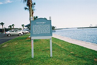
Bayport is an unincorporated community and census-designated place (CDP) in Hernando County, Florida, United States. The population was 43 at the 2010 census.

<span class="mw-page-title-main">Pine Island, Hernando County, Florida</span> Census-designated place in Florida, United States

Pine Island is an unincorporated community and census-designated place (CDP) in Hernando County, Florida, United States. The population was 64 at the 2010 census, unchanged from the 2000 census.

<span class="mw-page-title-main">Bradenton Beach, Florida</span> City in Florida, United States

Bradenton Beach is a city on Anna Maria Island in Manatee County, Florida, United States. The population was 908 at the 2020 census, down from 1,171 in 2010. It is part of the North Port-Bradenton-Sarasota, Florida Metropolitan Statistical Area.

<span class="mw-page-title-main">Memphis, Florida</span> Census-designated place in Florida, United States

Memphis is an unincorporated community and census-designated place (CDP) in Manatee County, Florida, United States. The population was 9,024 as of the 2020 census, up from 7,848 in 2010. It is part of the North Port–Bradenton–Sarasota, Florida Metropolitan Statistical Area.

<span class="mw-page-title-main">West Bradenton, Florida</span> Census-designated place in Florida, United States

West Bradenton is an unincorporated area and census-designated place (CDP) in Manatee County, Florida, United States. The population was 4,247 at the 2020 census, up from 4,192 at the 2010 census. It is part of the North Port–Bradenton–Sarasota, Florida Metropolitan Statistical Area.

<span class="mw-page-title-main">Whitfield, Manatee County, Florida</span> Census-designated place in Florida, United States

Whitfield, also known as Whitfield Estates, is an unincorporated community and census-designated place (CDP) in Manatee County, Florida, United States. As of the 2020 census it had a population of 2,989, up from 2,882 at the 2010 census. It is part of the North Port–Bradenton–Sarasota, Florida Metropolitan Statistical Area. It receives its mail from the Sarasota post office located in Sarasota County.

<span class="mw-page-title-main">Gulf Gate Estates, Florida</span> Census-designated place in Florida, United States

Gulf Gate Estates is a census-designated place (CDP) in Sarasota County, Florida, United States. The population was 11,118 at the 2020 census, up from 10,911 at the 2010 census. It is part of the North Port–Bradenton–Sarasota, Florida Metropolitan Statistical Area.

<span class="mw-page-title-main">Kensington Park, Florida</span> Census-designated place in Florida, United States

Kensington Park is a census-designated place (CDP) in Sarasota County, Florida, United States. The population was 3,697 at the 2020 census, down from 3,901 at the 2010 census. It is part of the North Port–Bradenton–Sarasota, Florida Metropolitan Statistical Area.

<span class="mw-page-title-main">Lake Sarasota, Florida</span> Census-designated place in Florida, United States

Lake Sarasota is a census-designated place (CDP) in Sarasota County, Florida, United States. The population was 3,979 at the 2020 census, down from 4,679 at the 2010 census. It is part of the North Port–Bradenton–Sarasota, Florida Metropolitan Statistical Area.

<span class="mw-page-title-main">Nokomis, Florida</span> Census-designated place in Florida, United States

Nokomis is an unincorporated town in Sarasota County and a census-designated place (CDP) along the Gulf Coast of Florida, United States, located south of Osprey and just north of Venice. The town has access to the coast through Nokomis Public Beach and Casey Key. The town's population was 3,217 at the 2020 census, up from 3,167 at the 2010 census. It is part of the North Port–Bradenton–Sarasota, Florida Metropolitan Statistical Area.

<span class="mw-page-title-main">North Sarasota, Florida</span> Census-designated place in Florida, United States

North Sarasota is a census-designated place (CDP) in Sarasota County, Florida, United States. The population was 2,418 at the 2020 census, down from 6,982 at the 2010 census. It is part of the North Port–Bradenton–Sarasota, Florida Metropolitan Statistical Area.

<span class="mw-page-title-main">Sarasota Springs, Florida</span> Census-designated place in Florida, United States

Sarasota Springs is a census-designated place (CDP) in Sarasota County, Florida, United States. The population was 12,521 at the 2020 census, down from 14,395 at the 2010 census. It is part of the North Port–Bradenton–Sarasota, Florida Metropolitan Statistical Area.

<span class="mw-page-title-main">Siesta Key, Florida</span> Census-designated place in Florida, United States

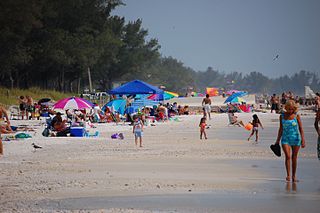
Siesta Key is a barrier island off the southwest coast of the U.S. state of Florida, located between Roberts Bay and the Gulf of Mexico. A portion of it lies within the city boundary of Sarasota, but the majority of the key is a census-designated place (CDP) in Sarasota County. Siesta Key is part of the North Port–Bradenton–Sarasota, Florida Metropolitan Statistical Area.

<span class="mw-page-title-main">Southgate, Florida</span> Census-designated place in Florida, United States

Southgate is a census-designated place (CDP) in Sarasota County, Florida, United States. The population was 6,287 at the 2020 census, down from 7,173 at the 2010 census. It is part of the North Port–Bradenton–Sarasota, Florida Metropolitan Statistical Area.

<span class="mw-page-title-main">Vamo, Florida</span> Census-designated place in Florida, United States

Vamo is a census-designated place (CDP) in Sarasota County, Florida, United States. The population was 2,822 at the 2020 census, down from 4,727 at the 2010 census. It is part of the North Port–Bradenton–Sarasota, Florida Metropolitan Statistical Area.

<span class="mw-page-title-main">Venice Gardens, Florida</span> Census-designated place in Florida, United States

Venice Gardens is a census-designated place (CDP) in Sarasota County, Florida, United States. The population was 3,402 at the 2020 census, down from 7,104 at the 2010 census. It is part of the North Port–Bradenton–Sarasota, Florida Metropolitan Statistical Area.

<span class="mw-page-title-main">Sun City Center, Florida</span> Census-designated place in Florida, United States

Sun City Center is an unincorporated census-designated place (CDP) in southern Hillsborough County, Florida, United States. It is located south of Tampa and north of Sarasota on I-75. As of the 2020 census, the population was 30,952. The ZIP Code serving the community is 33573.

References

  1. "2020 U.S. Gazetteer Files". United States Census Bureau. Retrieved October 31, 2021.
  2. "Manasota Key FL ZIP Code". zipdatamaps.com. 2023. Retrieved February 17, 2023.
  3. 1 2 "U.S. Census website". United States Census Bureau . Retrieved January 31, 2008.
  4. "US Board on Geographic Names". United States Geological Survey. October 25, 2007. Retrieved January 31, 2008.
  5. McCarthy, John. "A Guide to Sarasota Beaches". Sarasota Magazine. SagaCity Media. Retrieved January 27, 2018.
  6. "US Gazetteer files: 2010, 2000, and 1990". United States Census Bureau. February 12, 2011. Retrieved April 23, 2011.
  7. "Geographic Identifiers: 2010 Demographic Profile Data (G001): Manasota Key CDP, Florida". U.S. Census Bureau, American Factfinder. Archived from the original on February 12, 2020. Retrieved June 25, 2014.
  8. "Census of Population and Housing". Census.gov. Retrieved June 4, 2016.