Bethulie

Last updated
Bethulie
Nederduitse Gereformeerde Church, Grey Street, Bethulie.JPG
Nederduitse Gereformeerde Church, Grey Street, Bethulie
South Africa Free State location map.svg
Red pog.svg
Bethulie
South Africa adm location map.svg
Red pog.svg
Bethulie
Africa location map.svg
Red pog.svg
Bethulie
Coordinates: 30°28′S25°58′E / 30.467°S 25.967°E / -30.467; 25.967
Country South Africa
Province Free State
District Xhariep
Municipality Kopanong
Established1863 [1]
Government
  TypeMunicipality
  MayorXolile Mathwa [2] (ANC)
Area
[3]
  Total37.0 km2 (14.3 sq mi)
Population
 (2023) [3]
  Total+−16,000
  Density−430/km2 (−1,100/sq mi)
Racial makeup (2011)
[3]
   Black African 81.6%
   Coloured 9.3%
   Indian/Asian 0.7%
   White 8.0%
  Other0.4%
First languages (2011)
[3]
   Xhosa 43.8%
   Sotho 31.0%
   Afrikaans 18.9%
   English 2.7%
  Other3.7%
Time zone UTC+2 (SAST)
Postal code (street)
9992
PO box
9992
Area code 051

Bethulie is a small sheep and cattle farming town in the Free State province of South Africa. The name meaning chosen by God was given by directors of a mission station in 1829 which the town formed around. The mission building is the oldest settler built building still standing in the Free State. The town was also home to one of the largest concentration camps run by the British during the Boer War. The Dutch Reformed Church was built in 1862.

Contents

History

Evidence of life was found to be dated to 250 million years ago in the form of fossils.

The first land dwellers to be active in the Bethulie region were the Bushmen, whose various drawings are still in existence in the area. In 1828 a mission station was established by the London Missionary Society for the local people, the San Bushman. It was originally known as Groot Moordenaarspoort (Murderer's Pass) after a vicious clash between the Sotho and Griqua tribes. In 1832 the missionary Jean Pierre Pellissier, whose home is one of the oldest pioneer buildings north of the Orange River, replaced the London missionaries. It now houses a historical museum displaying items of the past and information on the life and trial of Jean Pellissier and Chief Lephoi and his people. Until 1833 Bethulie was known as Caledon (after the nearby Caledon River). This name was in conflict with a Western Cape town bearing the same name. Then in 1833 a French Missionary Society, the "Paris Evangelical Missionary Society" took over control of the area and renamed the mission station Bethulua, meaning "Place of Worship". In 1835 it was renamed Verheullpolis and in 1863 the town was established and renamed Heidelberg. In 1872 the town was again renamed to Bethulie. During the Anglo-Boer War (1899 to 1902) the third largest concentration camp erected by the British was also situated in Bethulie.

Timeline

D.H. Steyn Bridge near Bethulie DH Steyn Bridge near Bethulie.JPG
D.H. Steyn Bridge near Bethulie

The D.H. Steyn Bridge or Hennie Steyn Bridge is an arched bridge near the town of Bethulie, it is a combined road and rail bridge which spans the Orange River just outside Bethulie. It is 1,152 m (1,260 yds) long, and 51.5m high and thereby the longest bridge in South Africa. It is also claimed to be the longest in the southern hemisphere. Work started 1899 and completed 1901.

Notable people

Bethulie's most famous son was Patrick Mynhardt, whose one-man shows featuring Herman Charles Bosman's character Oom Schalk Lourens were popular in South Africa.[ citation needed ] His autobiographical show Boy from Bethulie formed the basis for a book of the same name.[ citation needed ]

Related Research Articles

<span class="mw-page-title-main">Mafikeng</span> Capital city of the North-West Province, South Africa

Mahikeng, formerly known as Mafikeng and alternatively known as Mafeking, is the capital city of the North West province of South Africa.

<span class="mw-page-title-main">Orange Free State</span> 1854–1902 Boer republic in Southern Africa

The Orange Free State was an independent Boer sovereign republic under British suzerainty in Southern Africa during the second half of the 19th century, which ceased to exist after it was defeated and surrendered to the British Empire at the end of the Second Boer War in 1902. It is one of the three historical precursors to the present-day Free State province.

<span class="mw-page-title-main">Martinus Theunis Steyn</span> South African lawyer and statesman (1857–1916)

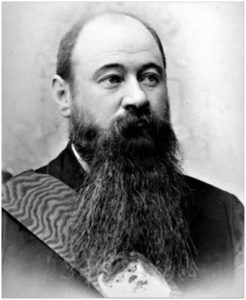
MartinusTheunis Steyn was a South African lawyer, politician, and statesman. He was the sixth and last president of the independent Orange Free State from 1896 to 1902.

<span class="mw-page-title-main">Treaty of Vereeniging</span> 1902 peace treaty which ended the Second Boer War

The Treaty of Vereeniging was a peace treaty, signed on 31 May 1902, that ended the Second Boer War between the South African Republic and the Orange Free State, on the one side, and the United Kingdom on the other.

<span class="mw-page-title-main">Hendrik Potgieter</span> South African Voortrekker leader (1792–1852)

Andries Hendrik Potgieter, known as Hendrik Potgieter was a Voortrekker leader and the last known Champion of the Potgieter family. He served as the first head of state of Potchefstroom from 1840 and 1845 and also as the first head of state of Zoutpansberg from 1845 to 1852.

<span class="mw-page-title-main">Estcourt</span> Place in KwaZulu-Natal, South Africa

Estcourt is a town in the uThukela District of KwaZulu-Natal Province, South Africa. The main economic activity is farming with large bacon and processed food factories situated around the town. The N3 freeway passes close to the town, linking it to the rest of South Africa.

<span class="mw-page-title-main">Petrus Steyn</span> Place in Free State, South Africa

Petrus Steyn, is a small farming town between Tweeling and Kroonstad, 35 km north-east of Lindley in the Free State province of South Africa. It is at the centre of an agricultural area known for wheat, maize, sunflower, potato, cattle, hunting, sheep production and forms part of the breadbasket in the Free State. It is the highest town above sea level in the Free State. In 2012 the town's name was changed to Mamafubedu. Farming industries in Mamafubedu provide potatoes worldwide.

<span class="mw-page-title-main">Winburg</span> Place in Free State, South Africa

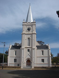
Winburg is a small mixed farming town in the Free State province of South Africa.

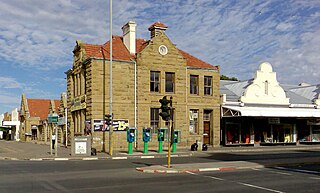
Heilbron is a small farming town in the Free State province of South Africa which services the cattle, dairy, sorghum, sunflower and maize industries. Raw stock beneficiation occurs in leisure foods, dairy products and stock feeds. It also serves as a dormitory town for the Gauteng metropolis.

<span class="mw-page-title-main">Smithfield, South Africa</span> Place in Free State, South Africa

Smithfield is a small town in the Free State province of South Africa. Founded in 1848 in the Orange River Sovereignty, the town is situated in a rural farming district and is the third oldest town in present-day Free State, after Philippolis and Winburg.

<span class="mw-page-title-main">Aliwal North</span> Place in Eastern Cape, South Africa

Aliwal North is a town in central South Africa on the banks of the Orange River, Eastern Cape Province. It is a medium-sized commercial centre in the northernmost part of the Eastern Cape. The Dutch Reformed Church was built in 1855.

<span class="mw-page-title-main">Free State–Basotho Wars</span> 1858–1868 series of Boer Wars in Southern Africa

The Free State–Basotho Wars refers to a series of wars fought between King Moshoeshoe I, the ruler of the Basotho Kingdom, and white settlers, in what is now known as the Free State. These can be divided into the Senekal's War of 1858, the Seqiti War in 1865−1866 and the Third Basotho War in 1867−68.

Emmarentia is a suburb of Johannesburg, South Africa.

<span class="mw-page-title-main">Pieter Jeremias Blignaut</span>

Pieter Jeremias Blignaut was a South African (Boer) civil servant, Government Secretary of the Orange Free State (1879–1902), and served twice as Acting State President, first after the death of President Brand (1888–1889), and again after the resignation of President Reitz in 1895–1896. After the conclusion of the South African War, Blignaut served as member of both the legislative council and the Legislative Assembly of the Orange River Colony. He was also a member of several state commissions.


Jean Pierre Pellissier was a missionary from the Paris Evangelical Missionary Society to Southern Africa.

<span class="mw-page-title-main">National Women's Monument</span>

The National Women's Monument in Bloemfontein, South Africa, is a monument commemorating the roughly 27,000 Boer women and children who died in British concentration camps during the Second Boer War. The Monument is a Provincial Heritage Site in the Free State.

<span class="mw-page-title-main">Military history of Australia during the Second Boer War</span>

The military history of Australia during the Boer War is complex, and includes a period of history in which the six formerly autonomous British Australian colonies federated to become the Commonwealth of Australia. At the outbreak of the Second Boer War, each of these separate colonies maintained their own, independent military forces, but by the cessation of hostilities, these six armies had come under a centralised command to form the Australian Army.

Richard Miles was a Motswana (Tswana) catechist and preacher "to the native tribes beyond the border" in South Africa.

The South Australian Bushmen was a mounted infantry squadron of the Colony of South Australia that served in the Second Boer War, the third contingent contributed by the colony.

<span class="mw-page-title-main">Volksraad (Orange Free State)</span> Abolished legislature of the Orange Free State

The Volksraad of the Orange Free State was the unicameral parliament of the Orange Free State. It was the supreme authority of Orange Free State.

References

  1. Robson, Linda Gillian (2011). "Annexure A" (PDF). The Royal Engineers and settlement planning in the Cape Colony 1806–1872: Approach, methodology and impact (PhD thesis). University of Pretoria. pp. xlv–lii. hdl:2263/26503.
  2. Free State Tourism.org Archived January 6, 2014, at the Wayback Machine
  3. 1 2 3 4 Sum of the Main Places Bethulie and Lephoi from Census 2011.