Trans-Nzoia County is a county in the former Rift Valley Province, Kenya, located between the Nzoia River and Mount Elgon, 380 km northwest of Nairobi. At its centre is the town of Kitale which is the capital and largest town. The county borders Bungoma to the west, Uasin Gishu and Kakamega to the south, Elgeyo-Marakwet to the east, West Pokot to the north and the Republic of Uganda to the Northwest. Trans Nzoia covers an area of 2495.5 square kilometres.

Kericho is the biggest town in Kericho County located in the highlands west of the Kenyan Rift Valley. Standing on the edge of the Mau Forest, Kericho has a warm and temperate climate making it an ideal location for agriculture and in particular, the large scale cultivation of tea.

Kericho County is one of the 47 counties in Kenya. The county seats between longitude 35°02' and 35°40' East and between the equator and latitude 0°23' South with an altitude of about 2002m above sea level. It borders Uasin Gishu County to the North West, Baringo County to the North-East, Nandi County to the North-West, Nakuru County to the East and Bomet County to the South, Kisumu County to the Northwest and Nyamira County to the West. It has a population of 901,777 and an area of 2,111 km². Its capital and largest town is Kericho.

Nyeri County is a county located in the central region of Kenya. Its capital and largest town is Nyeri. It has a population of 759,164 and an area of 2361 km2. Mutahi Kahiga was governor as of 2022. Previous governors include Nderitu Gachagua, who died while receiving treatment in London, Wamathai Samuel Githaiga, and Wahome Gakuru, who died in a road accident at Kabati near Kenol heading towards Thika Super Highway. It is also the home county of the third president of Kenya, the late President Mwai Kibaki.

Siaya County is one of the counties in the former Nyanza Province in western Kenya. It is bordered by Busia County to the north, Kakamega County, and Vihiga County to the northeast and Kisumu County to the southeast. It shares a water border with Homa Bay County which is located south of Siaya County. The total area of the county is approximately 2,496.1 km2. The county lies between latitude 0° 26' to 0° 18' north and longitude 33° 58' east and 34° 33' west. Siaya has been split up into six new districts. Under the 2010 Constitution, the role of the districts is still unclear as much of the administrative authority was transferred to the county. The capital is Siaya, although the largest town is Bondo.
Litein is a town located in the Kericho County, Kenya. It was previously the capital of the former Buret District. Litein has an urban population of 4,000. The town is along the Kericho-Sotik road. It also has a road link to Bomet.

Kitui County is a county in the former Eastern Province of Kenya with its capital and largest town being Kitui, although Mwingi is also another major urban centre. The county has a population of 1,136,187. and an area of 30,496 km2. It lies between latitudes 0°10 South and 3°0 South and longitudes 37°50 East and 39°0 East.
Londiani is a Kenyan town in the Kericho County. It is 49 km from Kericho, which is about a 50-minute drive. As of 2009, it had a total population of 44,953.

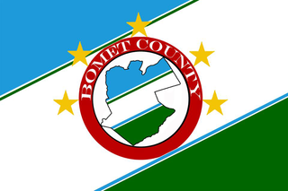
Bomet County is a county in the former Rift Valley Province of Kenya. Initially a district, Bomet District was created from the former Kericho District in 1992. The capital of Bomet County is Bomet. It has a population of 875,689 in 2019 and an area of 1,630.0 km2 (629.3 sq mi).
Kerugoya is the biggest town in Kirinyaga County, located 10 kilometres east of Karatina and 40 kilometres west of Embu. It is situated in the former Kirinyaga district. Travel directions by road from Nairobi is through Thika Road past Thika, Kenol and Makuyu. The road leads through Makutano until Sagana town, where a road branches off the East towards Kagio town up to Kirinyaga University branching North towards the town.
Joyce Cherono Abonyo was a Kenyan politician who served as the second governor of Bomet County from 2017 until her death on 29 July 2019. She was a Member of Parliament representing Sotik constituency, before she was elected to the gubernatorial seat.
Mathira Constituency is an electoral constituency in Kenya. It is one of six constituencies in Nyeri County. The constituency was established for the 1963 elections. Mathira is popularly known as Mathira ya Githomo (education). It has the most educated population in the country. It sits at the foot of Mount Kenya. Mathira is known for growing tea and coffee. Karatina is to the east. Several tarmac roads crisscross Mathira, including the Kenol-Marua superhighway.
Uriri is an electoral constituency in Kenya. It is one of eight constituencies of Migori County. There are five wards in the constituency, all electing councillors to the Migori County council. The constituency was established for the 1997 elections. Its mainly inhabited by two ethnic tribes namely Luo and the Abaluhya, who live harmoniously, with kiswahili being the major language in this sub county region.
Sotik Constituency is an electoral constituency in Kenya established for the 1997 elections. It is one of five constituencies in Bomet County. Sotik has one major river, River Kipsonoi. Sotik is also a hilly place with the main crops being grown are tea and maize. The Nairobi Kisii highway passes through Sotik. Recently, many developments have occurred; Sotik Market was put up by the former governor Hon Isaac Ruto, since then infrastructure has been improving. Sotik is also a religious center with over 10 churches set up in the area, e.g., Bethel AGC, St Joseph's Sotik catholic church and Gustavo D' Kerich chapel.
Chepalungu Constituency is an electoral constituency in Kenya. It is one of five constituencies of Bomet County. The constituency was established for the 1966 elections.
Konoin Constituency is an electoral constituency in Bomet County, Kenya. It is one of five constituencies in Bomet County and was one of three constituencies of the former Buret District. The constituency has seven wards, all electing councillors for the Bureti County Council. The constituency was established for the 1988 elections. The Konoin Technical Training Institute is located within the constituency.
Bomet District was an administrative district in the Rift Valley Province of Kenya. Its capital town is Bomet. The district has a population of 382,794 and an area of 1,882 km2.
Bomet Central is a constituency in Kenya inhabited by the Kipsigis community. It is one of five constituencies in Bomet County. It has a population of 126, 950 as of 2019 and an area of approximately 261.5 km2 (101.0 sq mi).
Sotik town is an urban centre situated in Sotik Sub-county within Bomet County in the Western region of Kenya and managed by Sotik Town Council. Initially, it was the home of Mugenik Barngetuny Araap Sitonik, a prominent Kipsigis prophet of the late 19th century. Sotik is a metropolitan town with a majority of the residents from the Kipsigis ethnicity and a minority being from other ethnicities from Kenya including notably, Somalis and Indians. The town is home to Kalenjin music artist Philip Yegon, Kenyan athletes: Paul Kipsiele Koech and Mercy Cherono; and Kenyan politicians: Lorna Laboso and the late Joyce Cherono Laboso.
AGC Tenwek Hospital in Bomet County, Kenya, established in 1937, is a 361-bed teaching and referral hospital offering surgical, medical, maternity, and pediatric services. It is Kenya's largest Mission Hospital.


