This article may require cleanup to meet Wikipedia's quality standards. The specific problem is: Incorrect citations.(July 2022) |
Voi | |
---|---|
Town | |
Coordinates: 03°23′26″S38°34′37″E / 3.39056°S 38.57694°E | |
Country | Kenya |
County | Taita-Taveta County |
Location | Voi Location |
Town | 1932 |
Elevation | 580 m (1,900 ft) |
Population (2009) [2] | |
• Town | 45,483 |
• Urban | 17,152 |
• Rural | 28,331 |
Time zone | UTC+3 (EAT) |
Voi is the largest town in Taita-Taveta County in southern Kenya, in the former Coast Province. It lies at the western edge of the Taru Desert, south and west of the Tsavo East National Park. The Sagala Hills are to the south.
Voi is a marketplace for agricultural and meat products from the fertile Taita Hills as well as the surrounding areas. [1] Voi's town centre consists mostly of general stores, shops, markets, kiosks and hotels. Most lodges that service tourists for the national parks are located in the suburbs at the edge of town. The Voi Sisal Estates are located to the west of the town.
Voi existed even before the arrival of the Portuguese, Arabs and other visitors at the Kenyan Coast [disputed ... see talk section. Also, the "Kenya Coast" did not conceptually exist prior to 1920 and at the time of Voi's origin much of the "Kenya Coast" (BEA Protectorate) was on 'loan' from Zanzibar]. However, some citations have it that the town started to grow at the end of the 19th century when the Uganda Railway was constructed. People started to move in to work on the railway and the nearby sisal estates. [3] However, township status with an area of about 16.27 square kilometres (6.28 sq mi) [4] was not granted until 1932. The town has long since outgrown the original grant. [1]
Voi has a hot semi-arid climate (Köppen climate classification BSh).
Climate data for Voi | |||||||||||||
---|---|---|---|---|---|---|---|---|---|---|---|---|---|
Month | Jan | Feb | Mar | Apr | May | Jun | Jul | Aug | Sep | Oct | Nov | Dec | Year |
Mean daily maximum °C (°F) | 31.6 (88.9) | 32.9 (91.2) | 33.3 (91.9) | 31.8 (89.2) | 29.9 (85.8) | 29.0 (84.2) | 28.1 (82.6) | 28.0 (82.4) | 29.2 (84.6) | 31.1 (88.0) | 31.4 (88.5) | 30.6 (87.1) | 30.6 (87.1) |
Mean daily minimum °C (°F) | 20.1 (68.2) | 20.2 (68.4) | 20.8 (69.4) | 20.4 (68.7) | 20.0 (68.0) | 18.3 (64.9) | 17.5 (63.5) | 17.2 (63.0) | 17.6 (63.7) | 18.9 (66.0) | 20.1 (68.2) | 20.4 (68.7) | 19.3 (66.7) |
Average precipitation mm (inches) | 34 (1.3) | 29 (1.1) | 79 (3.1) | 100 (3.9) | 30 (1.2) | 6 (0.2) | 3 (0.1) | 8 (0.3) | 15 (0.6) | 26 (1.0) | 106 (4.2) | 119 (4.7) | 555 (21.9) |
Average precipitation days | 5 | 3 | 8 | 7 | 5 | 2 | 1 | 2 | 3 | 4 | 10 | 8 | 58 |
Source: World Meteorological Organization [5] |
Voi has two railway stations. The first and oldest station, lies on the Kenya-Uganda Railway which was built by the British between 1895 and 1901 linking the port of Mombasa with Uganda. This station also forms the junction between the main line and a smaller, now abandoned line to Taveta at the Tanzania border. The second, newer, railway station serves the Mombasa–Nairobi Standard Gauge Railway. Passenger trains on the newer railway line have four daily stopovers in Voi (two either way). Passenger services on the old, British-built railway ceased in May 2017 [6] but freight trains continue running on that line.
Taxis can be found in the town centre. Fares are negotiated, not regulated. There are taxis for various routes mainly to residential estates such as Mwakingali, Ikanga, Sikujua, Mabomani, Birikani, Sofia, Kaloleni, Tanzania, Msinga, Kariakoo, Msambweni and Mazeras.
Matatus (Minibus/Sharetaxis) run between the town centre and surrounding areas. There are also matatus traveling to Mombasa, taita hills, Wundanyi, Taveta, Kasighau, Mbololo and other places. Their routes are regulated by SACCOs such as TATAMA, 2TS and Wumeri.
Coast bus, Simba coach,dreamliner Tahmeed and Mash are among many bus companies that run day and night services to the rest of Kenya. Voi has a bus park where travellers can buy bus tickets for travel to various destinations across the country.
The Ikanga Air Strip is nearby. It is still under construction by the Kenya Airports Authority.
Other forms of transport include three-wheeler auto rickshaws (tuk tuks) and motorcycle taxis (boda boda) which operate 24/7 and are very cheap.
The Municipality is divided into six wards: Marungu, Sagalla, Mbololo, Kaloleni, Ngolia, and Kasigau.
Each ward elects one Member of the County Assembly (MCA) who represents her/his ward in the County Assembly for 5 years.
Internet services are available from several internet cafes in town. There is 4G mobile phone coverage in Voi and its environs.
Voi features as a setting for two levels of the first-person shooter Xbox 360 console game Halo 3 . Halo 3 takes place late in the year 2552,[ citation needed ] wherein Voi is depicted as formerly having been a heavily industrialized, sprawling city — vastly different from the real and present Voi. According to the backstory, the nearby city of Mombasa, renamed New Mombasa, has become a final port of call for spacefaring traffic. To take advantage of its fortuitous proximity to New Mombasa, Voi refocused its resources from agriculture and tourism to the more lucrative pursuit of heavy industry. This shift resulted in major expansion of the town, which eventually absorbed the surrounding towns of Gutini, Ikanga, and Mariwenyi. The geography of the area has also been altered in the fictional version of Voi. Global warming has caused massive flooding of plains around the city of New Mombasa. Rather than a catastrophe, authorities viewed this event as an opportunity, and excavated a channel leading far inland to Voi. As a result, Voi became an inland port city, subsidising road transport of cargo to New Mombasa.[ citation needed ] By the time of the events in the game, Voi has been almost entirely destroyed by ruthless excavation by the Covenant, the invading extraterrestrial enemy of humanity. Only an extant sliver of warehouse complexes, which hints at the former existence of Voi, is encountered within the game. The Taita Hills to the west are also used extensively in other levels within the game. A subterranean military base, known as Crow's Nest, is located in one of the Taita hills, specifically Chawia hill, located between Mlegwa and Mwatate.
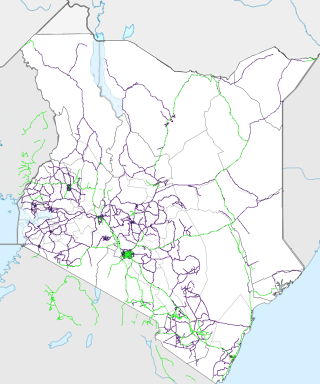
Transport in Kenya refers to the transportation structure in Kenya. The country has an extensive network of paved and unpaved roads.
Mombasa is a coastal city in southeastern Kenya along the Indian Ocean. It was the first capital of British East Africa, before Nairobi was elevated to capital status in 1907. It now serves as the capital of Mombasa County. The town is known as "the white and blue city" in Kenya. It is the country's oldest and second-largest city after Nairobi, with a population of about 1,208,333 people according to the 2019 census. Its metropolitan region is the second-largest in the country, and has a population of 3,528,940 people.
Wundanyi is a town in the Taita-Taveta County of Kenya. Other urban centres in the county include Voi, Taveta and Mwatate.
Taveta is the name of a tribe found in Kenya. It is also the name of the principal town in the land of the Taveta people and the name of the surrounding subdistrict of Kenya.
Kilifi County was formed in 2010 as a result of a merger of Kilifi District and Malindi District, Kenya. Its capital is Kilifi and its largest town is Malindi. Kilifi county is one of the five counties that make up the Kenyan Coast. The county has a population of 1,453,787 people following the 2019 census which covers an area of 12,245.90 km2 (4,728.17 sq mi).
Taita–Taveta County is a county in Kenya. Located approximately 200 km northwest of Mombasa, and 360 km southeast of Nairobi, it is a port and major gateway to the United Republic of Tanzania through Taveta. The county headquarters are located in Mwatate. It is one of the six counties in the Coastal region of Kenya. Major towns include Voi, Taveta, Mwatate, and Wundanyi.
Taveta is a town in the Taita-Taveta County, Kenya.
Bura is a town in Taita-Taveta County, Kenya.
Mwatate is a town in Taita-Taveta County, Kenya. It is the county capital, although it is the fourth-largest town in the county. Other urban centers in Taita-Taveta County include Voi, Wundanyi and Taveta.
The Taita people are an ethnic group in Kenya's Taita-Taveta County. They speak Kidawida or Kitaita, which belongs to the Bantu language family. The West-Bantu migrated to the Taita-Taveta County around 1000-1300.
Mariakani is a town in Kenya lying on the boundary of Kaloleni and Kinango districts in the old Coast Province of Kenya, 36 kilometres northwest of the port city of Mombasa.
Tsavo West National Park is located in Taita-Taveta County of Kenya. The park covers an area of 9,065 square kilometres. The A109 road Nairobi-Mombasa and a railway divides it from the adjoining Tsavo East National Park. Together with adjoining ranches and protected areas, they comprise the Tsavo Conservation Area. Tsavo West is a more popular destination due to its magnificent scenery and the Mzima Springs, the rich and varied wildlife, a good road system, a rhino reserve, rock climbing potential and guided walks along the Tsavo River. The park is operated by Kenya Wildlife Service.
Likoni is a division of Mombasa County, Kenya, and is located to the south-west of Mombasa Island.
Railway stations in Kenya include:
Mombasa Road, also known as the Nairobi–Mombasa Road, or Mombasa–Nairobi Road or A109 Road (Kenya) is the main road between Nairobi, Kenya's capital and largest city and Mombasa, the country's largest port city. The road is a component of the Northern Corridor. It is part of the Lagos–Mombasa Highway.
Wesu District Hospital is a 60-bed government hospital in Kenya under the Ministry of Medical Services. It is located in the town of Wundanyi, Taita-Taveta County.
Taita-Taveta District was a district of Kenya, located in the Coast Province of that country. It lies approximately 200 km northwest of Mombasa and 360 km southeast of Nairobi city.
Arusha–Holili–Taveta–Voi Road (A23) is a road in Tanzania and Kenya, connecting the towns of Arusha, Moshi, and Holili in Tanzania with Taveta and Voi in Kenya.
The Anglican dioceses of Mombasa are the Anglican presence in and around Mombasa and south-east Kenya; they are part of the Anglican Church of Kenya. The remaining dioceses of the Church are in the areas of Maseno, of Mount Kenya, and of Nakuru.
Granton Graham Samboja is a Kenyan politician and media executive who served as the second governor of Taita Taveta County from 2017 to 2022. He is a member of the Jubilee Party of Kenya. Samboja capitalized on his background in the media and his links with President Uhuru Kenyatta to get into politics. His education background remains the subject of controversy.