
Botetourt County is a US county that lies in the Roanoke Region of Virginia. Located in the mountainous portion of the state, the county is bordered by two major ranges, the Blue Ridge Mountains and the Appalachian Mountains.
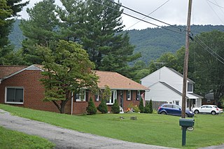
Blue Ridge is a census-designated place (CDP) in southern Botetourt County, Virginia, United States. The population was 3,185 at the 2020 census. The CDP is located along U.S. Route 460. It is part of the Roanoke Metropolitan Statistical Area.

U.S. Route 460 (US 460) is an auxiliary route of U.S. Route 60. It currently runs for 655 miles (1,054 km) from Norfolk, Virginia, at its parent route U.S. Route 60 at Ocean View to Frankfort, Kentucky, intersecting its parent route once again. It passes through the states of Virginia, West Virginia, and Kentucky. It goes through the cities and towns of Norfolk, Portsmouth, Suffolk, Petersburg, Farmville, Lynchburg, Roanoke, Christiansburg, Blacksburg, Tazewell, and Grundy, in Virginia; Princeton and Bluefield in West Virginia; and Pikeville, Georgetown, and Frankfort in Kentucky.

Elliston is a census-designated place (CDP) in Montgomery County, Virginia, United States. It lies between the city of Roanoke and the town of Christiansburg in the southwestern part of the state. The population as of the 2010 Census was 902. It is home to a small fire department, an elementary school, two gas stations, a train stop, and several churches. Most of its residents commute to larger towns. A set of railroad tracks separates the northwestern part of the town from the rest. US highway 11-460 further divides the town into two distinct neighborhoods, "Oldtown," which formed along the Valley Road in the 1850s, and "The Brake," a predominantly African-American area that developed after the Civil War.
The Roanoke Valley in southwest Virginia is an area adjacent to and including the Roanoke River between the Blue Ridge Mountains to the east and the Appalachian Plateau to the west. The valley includes much of Roanoke County, as well as the two independent cities of Roanoke and Salem.
U.S. Route 460 (US 460) in Virginia runs west-east through the southern part of the Commonwealth. The road has two separate pieces in Virginia, joined by a relatively short section in West Virginia. Most of US 460 is a four-lane divided highway and is a major artery in the southern third of the state. From Petersburg to Suffolk, US 460 is a four-lane non-divided highway. It is a popular alternative to Interstate 64 (I-64) when going from Richmond and other points in central Virginia to the Currituck Sound and Outer Banks of North Carolina, avoiding the congestion and tunnels of the more northerly I-64 corridor. The road passes through several small towns that built up at stops along the railroad line.

U.S. Route 221 (US 221) is a part of the U.S. Highway System that runs from Perry, Florida to Lynchburg, Virginia. In Virginia, the U.S. Highway runs 149.61 miles (240.77 km) from the North Carolina state line near Independence north to its northern terminus at US 29 Business, US 460 Business, and US 501 Business in Lynchburg. US 221 connects Independence, Galax, and Hillsville in Southwest Virginia while running concurrently with US 58. The U.S. Highway connects those communities with Roanoke via Floyd County, within which US 221 is the main east–west highway. Entering Bedford County, US 221 exits the Blue Ridge Mountains; it then passes through the Piedmont town of Bedford on its way to Lynchburg and shares a brief overlap with US 460 Business through the town. The U.S. Highway also runs concurrently with US 460 from Roanoke to Bedford and parallels that U.S. Highway from Bedford to Lynchburg.
Williamson Road is a Roanoke, Virginia neighborhood in north-central Roanoke. It borders the neighborhoods of Roundhill and Preston Park to the north, Belmont to the south, Hollins to the east, and Gainsboro and Washington Park to the west opposite Interstate 581. It is bisected by Williamson Road.
Nace is an unincorporated community in Botetourt County, Virginia, United States.
Springwood is an unincorporated community in Botetourt County, Virginia, United States. Located in the northern part of the Roanoke Valley and at the southern tip of the Shenandoah Valley, Springwood is part of the Roanoke Metropolitan Area and sits along the banks of the James River.
Hanging Rock is an unincorporated community in Roanoke County, Virginia, United States located directly north of Salem. The community is named for a prominent rock outcrop. The intersection of Virginia State Route 311 and Virginia State Route 419 is in Hanging Rock.
Starkey is an unincorporated community in southern Roanoke County, Virginia, United States. The community lies south of U.S. 221 near the Blue Ridge Parkway. This is the location of the Starkey School listed on the National Register of Historic Places.
The Roanoke Region is the area of the Commonwealth of Virginia surrounding the city of Roanoke. Its usage may refer to the metropolitan statistical area or the Roanoke Valley, but it sometimes includes areas in the Allegheny Mountains and New River Valley which includes Alleghany County, Montgomery County, Covington, Clifton Forge, Blacksburg, Christiansburg, and Radford. Bedford County and Floyd County are sometimes included as part of the region.
Carvins Cove was a community in both Botetourt and Roanoke County, Virginia, United States, that was abandoned and subsequently inundated in order to create the Carvins Cove Reservoir by the City of Roanoke in the mid–1940s.
Bent Mountain is an unincorporated community in Roanoke County, Virginia, United States. Bent Mountain is located on U.S. Route 221 13.6 miles (21.9 km) southwest of Roanoke. Bent Mountain has a post office with ZIP code 24059.

Christopher T. Head is an American politician. A Republican, he currently serves in the Senate of Virginia, representing the 3rd district which includes all of Alleghany County, Botetourt County, Craig County, Rockbridge County, Buena Vista, Covington, Lexington, Staunton and Waynesboro, and parts of Augusta County and Roanoke County. He previously served in the Virginia House of Delegates from 2012-2024, representing the 17th district, made up parts of Botetourt and Roanoke counties and the city of Roanoke, in the western part of the state.
The Carolina Road or the "Old Carolina Road" are names for various sections of the Great Wagon Road and other routes in colonial America. "The 'Old Carolina Road', extending from Lancaster, Pennsylvania to the Yadkin Valley, was one of the most heavily traveled roads in eighteenth century America." Parts of the 180-mile-long (290 km) Journey Through Hallowed Ground National Heritage Area scenic byway follow the Old Carolina Road through Pennsylvania, Maryland and Virginia.
The Trader's Path was a colonial highway through southwestern Virginia, established in 1740.
Elijah McClanahan was a noted planter and soldier in western Virginia and the Roanoke Valley. He was a Lieutenant Colonel in the 5th/121st Virginia Militia in the War of 1812, and was one of the largest landholders in what later became Roanoke County, Virginia.
George Woodson Hansbrough was a Virginia farmer, lawyer and soldier who during his final decade reported opinions issued by the Virginia Supreme Court. During the American Civil War, Hansbrough recruited a company of Confederate States Army volunteers from Taylor County in what became West Virginia during that conflict, and later recruited another company from near Roanoke, Virginia.


