Related Research Articles

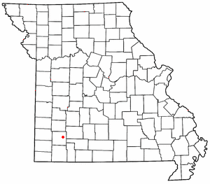
Johnson County is a county located in western portion of the U.S. state of Missouri. As of the 2020 census, the population was 54,013. Its county seat is Warrensburg. The county was formed December 13, 1834 from Lafayette County and named for Vice President Richard Mentor Johnson.

Omaha is a town in Boone County, Arkansas, United States. As of the 2020 census the population stood at 128. It is a rural community located approximately 10 miles from Branson, Missouri and 15 miles from Harrison. The town is part of the Harrison Micropolitan Statistical Area.

Wallace, originally named Jacksonville, is a town located in Jackson Township, Fountain County, Indiana, United States. At the 2010 census, the town had a total population of 105.

Gibbs is a village in Wilson Township, Adair County, Missouri, United States. The population was 107 at the 2010 census.
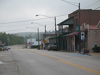
Steelville is a city in Crawford County, Missouri, United States. The population was 1,472 at the 2020 census. It is the county seat of Crawford County. Steelville is the hometown of Congressman Albert Reeves and Missouri State Representative Jason Chipman. The town was named after the landowner James Steel.

West Plains is a city in and the county seat of Howell County, Missouri, United States. The population was 12,184 at the 2020 census.

Warrensburg is a city in and the county seat of Johnson County, Missouri, United States. The population was 20,313 at the 2020 census. The Warrensburg Micropolitan Statistical Area consists of Johnson County. The city is a college town as it is home to the University of Central Missouri.
Spencer is a small unincorporated crossroads in eastern Lawrence County, Missouri, United States. It lies along former U.S. Route 66 approximately six miles (10 km) west of Halltown.
The Blackwater River is a 79.3-mile-long (127.6 km) tributary of the Lamine River in west-central Missouri in the United States. Via the Lamine and Missouri rivers, it is part of the watershed of the Mississippi River. The Blackwater River was named from the character of its banks and water.
Monticello Township is a former township in northwest Johnson County, Kansas. It is now merged with Lenexa and Shawnee, Kansas.

John William "Blind" Boone was an American pianist and composer of ragtime music.
Columbus is an unincorporated community in Johnson County, in the U.S. state of Missouri.
McCracken is an unincorporated community in Christian County, in the U.S. state of Missouri. It is about 3.3 miles east of Ozark, Missouri.
Alpha is an unincorporated community in Grundy County, in the U.S. state of Missouri.
Burtville is an unincorporated community in southeastern Johnson County, in the U.S. state of Missouri.
Cornelia is an unincorporated community in southern Johnson County, in the U.S. state of Missouri.
Warrensburg Township is an inactive township in Johnson County, in the U.S. state of Missouri.
Bowman Township is a township in Sullivan County, in the U.S. state of Missouri.
Vandalia is an unincorporated community in Jasper County, in the U.S. state of Iowa.
References
- ↑ U.S. Geological Survey Geographic Names Information System: Bowmansville, Missouri
- ↑ Cornelia, MO, 7.5 Minute Topographic Quadrangle, USGS, 1955 (1974 rev.)
- ↑ "SHOW ME - Johnson County - Western Missouri History: Bowmansville, Missouri (Warrensburg) Bowman's Grocery and Gas". SHOW ME - Johnson County - Western Missouri History. December 19, 2016. Retrieved June 8, 2021.
- ↑ "Johnson County Place Names, 1928–1945 (archived)". The State Historical Society of Missouri. Archived from the original on June 24, 2016. Retrieved October 20, 2016.
{{cite web}}: CS1 maint: bot: original URL status unknown (link) - ↑ "Wants on the Map". The Kansas City Times. September 9, 1916. Retrieved June 4, 2021.
- ↑ "J. W. Bowman". The Clinton Eye. November 25, 1927. p. 1. Retrieved June 4, 2021.
- ↑ "Are 352 Merchants in Johnson County". The Warrensburg Standard-Herald. November 8, 1929. Retrieved June 4, 2021.
- ↑ Cockrell, Ewing. History of Johnson County, Missouri, Volume 2, p. 588-89 (1918)
Municipalities and communities of Johnson County, Missouri, United States | ||
|---|---|---|
| Cities |  | |
| Townships | ||
| CDPs | ||
| Unincorporated communities | ||
| Footnotes | ‡This populated place also has portions in an adjacent county or counties | |
38°42′33″N93°44′02″W / 38.7091793°N 93.7338269°W
| | This Johnson County, Missouri state location article is a stub. You can help Wikipedia by expanding it. |