Leeton, Missouri

Last updated

Leeton, Missouri
Johnson County Missouri Incorporated and Unincorporated areas Leeton Highlighted.svg
Location of Leeton, Missouri
Coordinates: 38°35′1″N93°41′43″W / 38.58361°N 93.69528°W / 38.58361; -93.69528
Country United States
State Missouri
County Johnson
Area
[1]
  Total0.52 sq mi (1.34 km2)
  Land0.52 sq mi (1.34 km2)
  Water0.00 sq mi (0.00 km2)
Elevation
[2]
948 ft (289 m)
Population
 (2020)
  Total532
  Density1,031.01/sq mi (397.89/km2)
Time zone UTC-6 (Central (CST))
  Summer (DST) UTC-5 (CDT)
ZIP code
64761
Area code 660
FIPS code 29-41402 [3]
GNIS feature ID0720898 [2]

Leeton is a city in southeast Johnson County, Missouri, United States. The population was 566 at the 2010 census.

Contents

History

Leeton was platted in 1895, and named after J. J. Lee, the original owner of the town site. [4] A post office called Leeton has been in operation since 1882. [5]

Geography

Leeton is located at 38°35′1″N93°41′43″W / 38.58361°N 93.69528°W / 38.58361; -93.69528 (38.583655, -93.695270). [6]

According to the United States Census Bureau, the city has a total area of 0.51 square miles (1.32 km2), all land. [7]

Demographics

Historical population
CensusPop.Note
1910 420
1920 46310.2%
1930 416−10.2%
1940 4364.8%
1950 372−14.7%
1960 371−0.3%
1970 42514.6%
1980 60442.1%
1990 6324.6%
2000 619−2.1%
2010 566−8.6%
2020 532−6.0%
U.S. Decennial Census [8]

2010 census

As of the census [9] of 2010, there were 566 people, 232 households, and 151 families living in the city. The population density was 1,109.8 inhabitants per square mile (428.5/km2). There were 283 housing units at an average density of 554.9 per square mile (214.2/km2). The racial makeup of the city was 96.5% White, 0.4% African American, 1.2% Native American, 0.4% Asian, and 1.6% from two or more races. Hispanic or Latino of any race were 1.1% of the population.

There were 232 households, of which 37.1% had children under the age of 18 living with them, 46.6% were married couples living together, 11.2% had a female householder with no husband present, 7.3% had a male householder with no wife present, and 34.9% were non-families. 30.2% of all households were made up of individuals, and 9.9% had someone living alone who was 65 years of age or older. The average household size was 2.44 and the average family size was 3.01.

The median age in the city was 38.4 years. 24.9% of residents were under the age of 18; 9.2% were between the ages of 18 and 24; 23.7% were from 25 to 44; 30.5% were from 45 to 64; and 11.8% were 65 years of age or older. The gender makeup of the city was 54.1% male and 45.9% female.

2000 census

As of the census [3] of 2000, there were 619 people, 239 households, and 164 families living in the city. The population density was 1,220.2 inhabitants per square mile (471.1/km2). There were 277 housing units at an average density of 546.0 per square mile (210.8/km2). The racial makeup of the city was 97.74% White, 0.16% African American, 0.16% Native American, 0.16% Asian, 1.29% from other races, and 0.48% from two or more races. Hispanic or Latino of any race were 1.62% of the population.

There were 239 households, out of which 35.6% had children under the age of 18 living with them, 49.8% were married couples living together, 15.1% had a female householder with no husband present, and 31.0% were non-families. 23.8% of all households were made up of individuals, and 13.4% had someone living alone who was 65 years of age or older. The average household size was 2.59 and the average family size was 3.04.

In the city the population was spread out, with 30.4% under the age of 18, 7.6% from 18 to 24, 27.6% from 25 to 44, 22.0% from 45 to 64, and 12.4% who were 65 years of age or older. The median age was 35 years. For every 100 females there were 90.5 males. For every 100 females age 18 and over, there were 83.4 males.

The median income for a household in the city was $29,063, and the median income for a family was $31,000. Males had a median income of $29,750 versus $18,750 for females. The per capita income for the city was $313,207. About 14.3% of families and 14.4% of the population were below the poverty line, including 20.0% of those under age 18 and 4.5% of those age 65 or over.

Points of interest

Education

Leeton R-X School District operates one elementary school, one middle school, and Leeton High School. [10]

Leeton has a public library, a branch of the Trails Regional Library. [11]

Related Research Articles

<span class="mw-page-title-main">Johnson County, Missouri</span> County in Missouri, United States

Johnson County is a county located in western portion of the U.S. state of Missouri. As of the 2020 census, the population was 54,013. Its county seat is Warrensburg. The county was formed December 13, 1834 from Lafayette County and named for Vice President Richard Mentor Johnson.

<span class="mw-page-title-main">Benton City, Missouri</span> Village in Missouri, United States

Benton City is a village in Audrain County, Missouri, United States. The population was 104 at the 2010 census.

<span class="mw-page-title-main">Lincoln, Missouri</span> City in Benton County, Missouri, United States

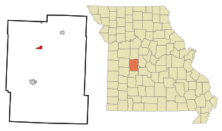
Lincoln is a city in Benton County, Missouri, United States. The population was 1,144 at the 2020 census.

<span class="mw-page-title-main">Kingston, Missouri</span> City in Missouri, United States

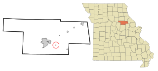
Kingston is a city in Caldwell County, Missouri, and is part of the Kansas City metropolitan area with the United States. The population was 290 at the 2020 census. It is the county seat of Caldwell County.

<span class="mw-page-title-main">Lake Winnebago, Missouri</span> City in Missouri, United States

Lake Winnebago is a city in Cass County, Missouri, United States. The population was 1,131 at the 2010 census. It is part of the Kansas City metropolitan area.

<span class="mw-page-title-main">Highlandville, Missouri</span> City in Missouri, United States

Highlandville is a city in Christian County, Missouri, United States. The population was 963 at the 2020 census. It is part of the Springfield, Missouri Metropolitan Statistical Area.

<span class="mw-page-title-main">Wayland, Missouri</span> City in Missouri, United States

Wayland is a city in Clark County, Missouri, United States. As of the 2020 census, its population was 408. It is part of the Fort Madison–Keokuk, IA-MO Micropolitan Statistical Area.

<span class="mw-page-title-main">Berger, Missouri</span> City in Missouri, United States

Berger is a city in northwest Franklin County, Missouri, United States, located south of the Missouri River. The population was 256 at the 2020 census.

<span class="mw-page-title-main">Laredo, Missouri</span> City in Missouri, United States

Laredo is a city in Grundy County, Missouri, United States. The population was 156 at the 2020 census. Laredo is pronounced "la-read-oh" which varies from the traditional pronunciation.

<span class="mw-page-title-main">Urich, Missouri</span> City in Missouri, United States

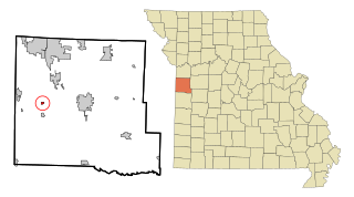
Urich is a city in Henry County, Missouri, United States. The population was 505 at the 2010 census.

<span class="mw-page-title-main">Carytown, Missouri</span> City in Missouri, United States

Carytown is a village in Jasper County, Missouri, United States. The population was 287 at the 2020 census. It is part of the Joplin, Missouri Metropolitan Statistical Area.

<span class="mw-page-title-main">Foley, Missouri</span> City in Missouri, United States

Foley is a city in Lincoln County, Missouri, United States. The population was 161 at the 2010 census.

<span class="mw-page-title-main">Ethel, Missouri</span> Town in Missouri, United States

Ethel is a town in Macon County, Missouri, United States. The population was 41 at the 2020 census.

<span class="mw-page-title-main">Chamois, Missouri</span> City in Missouri, United States

Chamois is a city in Osage County, Missouri, United States. The population was 377 at the 2020 census. It is part of the Jefferson City, Missouri Metropolitan Statistical Area.

<span class="mw-page-title-main">New Melle, Missouri</span> City in Missouri, United States

New Melle is a small country community in St. Charles County, Missouri, United States. It is located approximately 38 miles west of St. Louis. The population was 475 at the 2010 census.

<span class="mw-page-title-main">Bel-Ridge, Missouri</span> City in Missouri, United States

Bel-Ridge is a suburban city in northern St. Louis County, Missouri, United States. The population was 2,737 at the 2010 census. Bel-Ridge is part of the Normandy Schools Collaborative. Bel-Ridge became a city in 2015 by a vote of the voters.

<span class="mw-page-title-main">Country Club Hills, Missouri</span> City in Missouri, United States

Country Club Hills is a city in St. Louis County, Missouri, United States. The population was 1,274 at the 2010 census.

<span class="mw-page-title-main">Glendale, Missouri</span> City in Missouri, United States

Glendale is a city in St. Louis County, Missouri, United States. The population was 5,925 at the 2010 census.

<span class="mw-page-title-main">Williamsville, Missouri</span> City in Missouri, United States

Williamsville is a city in Wayne County, Missouri, United States, along the Black River. The population was 279 at the 2020 census.

<span class="mw-page-title-main">Lake Annette, Missouri</span> City in Missouri, United States

Lake Annette is a city in Cass County, Missouri, United States. The population was 100 at the 2010 census. It is part of the Kansas City metropolitan area.

References

  1. "ArcGIS REST Services Directory". United States Census Bureau. Retrieved August 28, 2022.
  2. 1 2 U.S. Geological Survey Geographic Names Information System: Leeton, Missouri
  3. 1 2 "U.S. Census website". United States Census Bureau . Retrieved January 31, 2008.
  4. "Johnson County Place Names, 1928–1945 (archived)". The State Historical Society of Missouri. Archived from the original on June 24, 2016. Retrieved October 23, 2016.{{cite web}}: CS1 maint: bot: original URL status unknown (link)
  5. "Post Offices". Jim Forte Postal History. Retrieved October 23, 2016.
  6. "US Gazetteer files: 2010, 2000, and 1990". United States Census Bureau. February 12, 2011. Retrieved April 23, 2011.
  7. "US Gazetteer files 2010". United States Census Bureau. Archived from the original on July 2, 2012. Retrieved July 8, 2012.
  8. "Census of Population and Housing". Census.gov. Retrieved June 4, 2015.
  9. "U.S. Census website". United States Census Bureau . Retrieved July 8, 2012.
  10. "Leeton R-X School District". Greatschools. Retrieved March 25, 2018.
  11. "Locations". Trails Regional Library. Archived from the original on March 25, 2018. Retrieved March 25, 2018.