Bristol, Florida | |
---|---|
City of Bristol | |
Coordinates: 30°25′37″N84°58′45″W / 30.42694°N 84.97917°W | |
Country | United States |
State | Florida |
County | Liberty |
Settled | 1859 [1] |
Incorporated | June 19, 1958 [2] [3] |
Government | |
• Type | Mayor-Council |
• Mayor | James P. Kersey |
• Councilmembers | Christian “Chris” Vowell, Thomas "Tommy" Rankin |
• City Clerk | Robin Hatcher |
• City Attorney | Jackson Summers |
Area | |
• Total | 1.64 sq mi (4.24 km2) |
• Land | 1.64 sq mi (4.24 km2) |
• Water | 0.00 sq mi (0.00 km2) |
Elevation | 174 ft (53 m) |
Population (2020) | |
• Total | 918 |
• Density | 560.44/sq mi (216.41/km2) |
Time zone | UTC-5 (Eastern (EST)) |
• Summer (DST) | UTC-4 (EDT) |
ZIP code | 32321 |
Area code | 850 |
FIPS code | 12-08600 [5] |
GNIS feature ID | 0279406 [6] |
Website | www |
Bristol is a city in and the county seat of Liberty County, Florida, United States. It is the only incorporated city in Liberty County. [7] The population was 918 at the 2020 census.
The exact coordinates for the City of Bristol is located in northwestern Liberty County at 30°25′37″N84°58′45″W / 30.427063°N 84.979099°W , [8] in the Florida Panhandle.
It sits atop a 150-foot-high (46 m) bluff overlooking the east side of the Apalachicola River. Florida State Road 20 passes through the city, leading west 4 miles (6 km) to Blountstown and east 44 miles (71 km) to Tallahassee, the state capital. Florida State Road 12 leads northeast from Bristol 18 miles (29 km) to Greensboro.
According to the United States Census Bureau, Bristol has a total area of 1.6 square miles (4.2 km2), all land. [9]
Like all of North Florida, the climate in this area is characterized by hot, humid summers and generally mild winters. According to the Köppen climate classification, the City of Bristol has a humid subtropical climate zone (Cfa).
Climate data for Bristol, Florida | |||||||||||||
---|---|---|---|---|---|---|---|---|---|---|---|---|---|
Month | Jan | Feb | Mar | Apr | May | Jun | Jul | Aug | Sep | Oct | Nov | Dec | Year |
Record high °F (°C) | 83 (28) | 85 (29) | 90 (32) | 92 (33) | 100 (38) | 102 (39) | 102 (39) | 101 (38) | 98 (37) | 95 (35) | 87 (31) | 84 (29) | 102 (39) |
Mean daily maximum °F (°C) | 64 (18) | 67 (19) | 74 (23) | 79 (26) | 86 (30) | 90 (32) | 91 (33) | 90 (32) | 88 (31) | 81 (27) | 73 (23) | 66 (19) | 79 (26) |
Daily mean °F (°C) | 52 (11) | 55 (13) | 61 (16) | 66 (19) | 74 (23) | 79 (26) | 81 (27) | 80 (27) | 77 (25) | 69 (21) | 61 (16) | 54 (12) | 67 (20) |
Mean daily minimum °F (°C) | 40 (4) | 42 (6) | 48 (9) | 52 (11) | 61 (16) | 68 (20) | 71 (22) | 70 (21) | 66 (19) | 57 (14) | 49 (9) | 42 (6) | 56 (13) |
Record low °F (°C) | 4 (−16) | 0 (−18) | 19 (−7) | 31 (−1) | 36 (2) | 49 (9) | 60 (16) | 59 (15) | 48 (9) | 33 (1) | 20 (−7) | 12 (−11) | 0 (−18) |
Average rainfall inches (mm) | 4.80 (122) | 4.92 (125) | 5.86 (149) | 3.68 (93) | 5.04 (128) | 5.92 (150) | 7.36 (187) | 6.78 (172) | 4.15 (105) | 4.11 (104) | 3.51 (89) | 3.77 (96) | 59.9 (1,520) |
Source: The Weather Channel [10] |
Census | Pop. | Note | %± |
---|---|---|---|
1960 | 614 | — | |
1970 | 626 | 2.0% | |
1980 | 1,044 | 66.8% | |
1990 | 937 | −10.2% | |
2000 | 845 | −9.8% | |
2010 | 996 | 17.9% | |
2020 | 918 | −7.8% | |
U.S. Decennial Census [11] |
Race | Pop 2010 [12] | Pop 2020 [13] | % 2010 | % 2020 |
---|---|---|---|---|
White (NH) | 797 | 712 | 80.02% | 77.56% |
Black or African American (NH) | 95 | 72 | 9.54% | 7.84% |
Native American or Alaska Native (NH) | 13 | 6 | 1.31% | 0.65% |
Asian (NH) | 2 | 6 | 0.20% | 0.65% |
Pacific Islander or Native Hawaiian (NH) | 0 | 1 | 0.00% | 0.11% |
Some other race (NH) | 0 | 7 | 0.00% | 0.76% |
Two or more races/Multiracial (NH) | 14 | 24 | 1.41% | 2.61% |
Hispanic or Latino (any race) | 75 | 90 | 7.53% | 9.80% |
Total | 996 | 918 | ||
As of the 2020 United States census, there were 918 people, 352 households, and 210 families residing in the city. [14]
As of the 2010 United States census, there were 996 people, 322 households, and 183 families residing in the city. [15]
As of the census [5] of 2000, there were 845 people, 326 households, and 235 families residing in the city. The population density was 517.1 inhabitants per square mile (199.7/km2). There were 393 housing units at an average density of 240.5 per square mile (92.9/km2). The racial makeup of the city was 87.22% White, 3.79% African American, 1.78% Native American, 5.44% from other races, and 1.78% from two or more races. Hispanic or Latino of any race were 5.80% of the population.
There were 326 households, out of which 30.7% had children under the age of 18 living with them, 52.8% were married couples living together, 14.1% had a female householder with no husband present, and 27.9% were non-families. 25.8% of all households were made up of individuals, and 12.0% had someone living alone who was 65 years of age or older. The average household size was 2.48 and the average family size was 2.91.
In the city, the population was spread out, with 24.9% under the age of 18, 8.5% from 18 to 24, 25.6% from 25 to 44, 24.5% from 45 to 64, and 16.6% who were 65 years of age or older. The median age was 39 years. For every 100 females, there were 88.2 males. For every 100 females age 18 and over, there were 87.3 males.
The median income for a household in the city was $31,607, and the median income for a family was $36,932. Males had a median income of $26,473 versus $22,500 for females. The per capita income for the city was $17,949. About 14.8% of families and 19.8% of the population were below the poverty line, including 24.9% of those under age 18 and 15.5% of those age 65 or over.
All public schools in Bristol are served by Liberty County School District.
Two schools are based in Bristol:
One notable feature of the park is the 2 ft (610 mm) narrow gauge Veterans Memorial Railroad, operating multiple types of locomotives including a coal-powered steam locomotive built by Crown Metal Products. [16] [17]
A widely reported claim was once made by Elvy E. Callaway that the site of the Biblical Garden of Eden lay in northern Liberty County. He cited as evidence the Apalachicola River, with its four heads, and local sources of torreya (which Callaway claimed was gopher wood, the material said to have been used by Noah in constructing his ark). [18]
Bay County is a county on the Emerald Coast in Northwest Florida. As of the 2020 census, the population was 175,216. Its county seat is Panama City.
Franklin County is a county along the Gulf of Mexico in the panhandle of the U.S. state of Florida. As of the 2020 census, the population was 12,451, making it the third-least populous county in Florida. The county seat is Apalachicola.
Liberty County is a county located in the state of Florida. As of the 2020 census, the population was 7,974, making it the least populous county in Florida. Its county seat is Bristol. Liberty County is one of only two dry counties in Florida.
Archer is a city in Alachua County, Florida, United States. It is part of the Gainesville metropolitan area. As of the 2020 census, the city had a population of 1,140.
Callaway is a city in Bay County, Florida, United States, and is a suburb of Panama City. The population was 14,405 at the 2010 census. It is part of the Panama City–Lynn Haven–Panama City Beach Metropolitan Statistical Area.
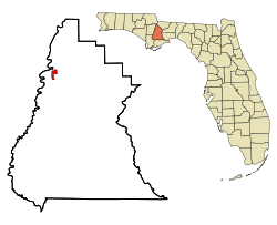
Blountstown is a city and the county seat of Calhoun County, Florida, United States. As of the 2020 census, the city had a population of 2,266.
Apalachicola is a city and the county seat of Franklin County, Florida, United States, on the shore of Apalachicola Bay, an inlet of the Gulf of Mexico. The population was 2,341 at the 2020 census.
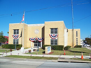
Port St. Joe is a city and the county seat of Gulf County, Florida. It is located at the intersection of U.S. Highway 98 and State Road 71. As of the 2020 census, the population was 3,357.
Wewahitchka is a city in Gulf County, Florida, United States. The population was 2,074 as of the 2020 census. From the creation of Gulf County in 1925 until 1965, it served as the county seat before the county seat was moved to Port St. Joe. The city took its name from a Native American word meaning "water eyes". Two lakes along the edge of town look like a perfect pair of eyes.
Tice is an unincorporated community and census-designated place (CDP) in Lee County, Florida, United States. As of the 2020 census, the CDP population was 4,853. It is part of the Cape Coral-Fort Myers, Florida Metropolitan Statistical Area.
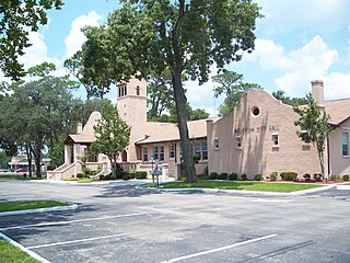
Belleview is a city in Marion County, Florida, United States. The population was 5,413 at the 2020 census, up from 4,492 in 2010. It is part of the Ocala Metropolitan Statistical Area. The city's name comes from the French words belle and vue, meaning "beautiful view". "City with Small Town Charm" is the city's motto.
New Liberty is a city in Scott County, Iowa, United States. The population was 138 at the time of the 2020 census.
Liberty is a city in Montgomery County, Kansas, United States. As of the 2020 census, the population of the city was 99.
Callaway is a city in Becker County, Minnesota, USA, approximately 11 miles from the county seat, Detroit Lakes, Minnesota. The population was 178 at the 2020 census. Callaway is often associated with a nearby town, Richwood, Minnesota.
Auxvasse is a city in northern Callaway County, Missouri, United States. It is part of the Jefferson City, Missouri Metropolitan Statistical Area. The population was 983 at the 2010 census.
Callaway is a village in Custer County, Nebraska, United States. The population was 539 at the 2010 census.
West Liberty is a borough in Butler County, Pennsylvania, United States. The population was 343 at the 2010 census.
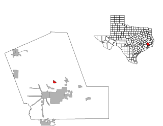
Dayton Lakes is a city in Liberty County, Texas, United States. The population was 93 at the 2010 census. Prior to 1985 Dayton Lakes city was a developed and marketed recreational subdivision named Dayton Lake Estates. In January 1985 the corporation that marketed the original subdivision held and election of residents and when the election was successful, they petitioned the District Court in Liberty County, Texas and The City of Dayton Lakes, TX, a Non Profit Corporation, was created as a city/town. The actual document was filed and recorded on January 19, 1985. Those corporate papers are the city's legal identity.
West Liberty is a town in Ohio County, West Virginia, United States. The population was 1,557 at the 2020 census. It is part of the Wheeling metropolitan area.
New Martinsville is a city in and the county seat of Wetzel County, West Virginia, United States, along the Ohio River. The population was 5,186 at the 2020 census.