Related Research Articles

The Muckleshoot are a Lushootseed-speaking Native American tribe, part of the Coast Salish peoples of the Pacific Northwest. They are descendants of the Duwamish and Puyallup peoples whose traditional territory was located along the Green and White rivers, including up to the headwaters in the foothills of the Cascade Mountains, in present-day Washington State. Since the mid-19th century, their reservation is located in the area of Auburn, Washington, about 15 miles (24 km) northeast of the port of Tacoma and 35 miles (55 km) southeast of Seattle, another major port.

The Fraser River is the longest river within British Columbia, Canada, rising at Fraser Pass near Blackrock Mountain in the Rocky Mountains and flowing for 1,375 kilometres (854 mi), into the Strait of Georgia just south of the City of Vancouver. The river's annual discharge at its mouth is 112 cubic kilometres (27 cu mi) or 3,550 cubic metres per second (125,000 cu ft/s), and it discharges 20 million tons of sediment into the ocean.

Burnaby is a city in the Lower Mainland region of British Columbia, Canada. Located in the centre of the Burrard Peninsula, it neighbours the City of Vancouver to the west, the District of North Vancouver across the confluence of the Burrard Inlet with its Indian Arm to the north, Port Moody and Coquitlam to the east, New Westminster and Surrey across the Fraser River to the southeast, and Richmond on the Lulu Island to the southwest.

Simon Fraser was a Canadian explorer and fur trader who charted much of what is now the Canadian province of British Columbia. He also built the first European settlement in British Columbia.

The Colville Indian Reservation is an Indian reservation in the northwest United States, in north central Washington, inhabited and managed by the Confederated Tribes of the Colville Reservation, which is federally recognized.

The Thompson River is the largest tributary of the Fraser River, flowing through the south-central portion of British Columbia, Canada. The Thompson River has two main branches, the South Thompson River and the North Thompson River. The river is home to several varieties of Pacific salmon and trout. The area's geological history was heavily influenced by glaciation, and the several large glacial lakes have filled the river valley over the last 12,000 years. Archaeological evidence shows human habitation in the watershed dating back at least 8,300 years. The Thompson was named by Fraser River explorer, Simon Fraser, in honour of his friend, Columbia Basin explorer David Thompson. Recreational use of the river includes whitewater rafting and angling.

The Burrard Peninsula is a peninsula in the Lower Mainland region of British Columbia, Canada, bounded by the Burrard Inlet to the north, the Georgia Strait to the west, the North Arm of Fraser River to the south, and the Pitt River and Douglas Island to the east. The City of Vancouver occupies almost all of the western half of the peninsula, and the Cities of Burnaby and New Westminster occupy more than half of the eastern half. At its northeastern end, the peninsula is connected to the Eagle Mountain and Mount Burke of the Coast Mountains via a small isthmus at the center of the Tri-Cities.

The Musqueam Indian Band is a First Nations band government in the Canadian province of British Columbia. It is the only First Nations band whose reserve community lies within the boundaries of the City of Vancouver.
The Stave River is a tributary of the Fraser, joining it at the boundary between the municipalities of Maple Ridge and Mission, about 35 kilometres (22 mi) east of Vancouver, British Columbia, Canada, in the Central Fraser Valley region.
N'Quatqua, variously spelled Nequatque, N'quat'qua, is the proper historic name in the St'at'imcets language for the First Nations village of the Stl'atl'imx people of the community of D'Arcy, which is at the upper end of Anderson Lake about 35 miles southeast of Lillooet and about the same distance from Pemberton. The usage is synonymous with Nequatque Indian Reserve No. 1, which is 177 ha. in size and located adjacent to the mouth of the Gates River.
Taylor Creek is a stream in Seattle, Washington, flowing from Lakeridge Park in Deadhorse Canyon, west of Rainier Avenue S at 68th Avenue S, to Lake Washington. The creek's name comes from the Taylor sawmill, which in the late 1880s was located where the creek flowed into Lake Washington, to the east of the park. The ravine has been the focus of efforts to plant native vegetation and restore salmon runs in Taylor Creek. With volunteer effort and some city matching grants, restoration has been underway since 1971. Volunteers have planted thousands of indigenous trees and plants, removed tons of garbage, removed invasive plants, and had city help removing fish-blocking culverts and improving trails. Sightings of raccoons, opossum and birds are common. Taylor is the fourth-largest creek in urban Seattle. In 2010, the city of Seattle began a project to improve fish passage along the creek.
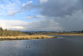
Burnaby Lake is a lake located in Burnaby, British Columbia and is the focal geographic feature and namesake of Burnaby Lake Regional Park. The lake occupies 3.11 square kilometres of land, and is home to a large variety of wildlife. At least 70 species of birds make the lake and surrounding areas their home, and about 214 species of birds visit the lake throughout the year. The park has been managed by the Metro Vancouver Parks Department since 1977.
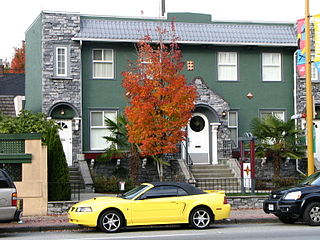
North Burnaby is a general name for a large neighbourhood in the City of Burnaby, British Columbia, that includes a number of smaller ones. It stretches from Boundary Road in the west to Burnaby Mountain with Simon Fraser University in the east and bounded by Burrard Inlet to the north and the Lougheed Highway to the south. It is a desirable place to live for many local and immigrant families which is reflected by real-estate prices that keep climbing and have doubled in the last 15 years.
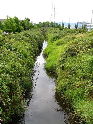
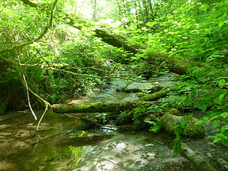
Still Creek is a long stream flowing across Central Burnaby, British Columbia and into Burnaby Lake. Still Creek's path lies mainly through the industrial area which contributes to its high level of pollution, although through dedicated work of local volunteers the creek is slowly recovering.

Westridge is a residential neighbourhood in Burnaby, British Columbia, Canada.
Burnaby Public Library or BPL is a public library that serves Burnaby, British Columbia and the surrounding Lower Mainland. According to its 2019-2022 strategic plan, BPL aims to "empower the community to engage with and share stories, ideas and information." BPL provides access to information services and library collections through its four branches as well as online and through community outreach.
The Central Valley Greenway (CVG) is a 24-kilometre pedestrian and cyclist route in Metro Vancouver, running from Science World in Vancouver to New Westminster, through Burnaby. The greenway officially opened on June 27, 2009, with opening celebrations, guided bike tours, and walking tours on sections of the route. Despite its official opening, some sections are complete on an interim basis and are anticipated to be upgraded in the future.
The Bridge River Rapids, also known as the Six Mile Rapids, the Lower Fountain, the Bridge River Fishing Grounds, and in the St'at'imcets language as Sat' or Setl, is a set of rapids on the Fraser River, located in the central Fraser Canyon at the mouth of the Bridge River six miles north of the confluence of Cayoosh Creek with the Fraser and on the northern outskirts of the District of Lillooet, British Columbia, Canada.
The Salmon River is a small river in the Township of Langley in the Lower Mainland region of British Columbia, Canada, flowing northwest then northeast to enter Bedford Channel, which separates McMillan Island from Fort Langley, which is just southwest.
References
- ↑ "Waterways of Burnaby" (PDF). City of Burnaby. 2019. Retrieved February 17, 2023.
Coordinates: 49°13′49″N122°52′31″W / 49.230350°N 122.875271°W
| Features | |
|---|---|
| History | |
| Geography | |
| Politics | |
| Public services | |
| Education | |
| Culture | |
| Transportation | |
New Westminster, British Columbia | |||||||||
|---|---|---|---|---|---|---|---|---|---|
| Culture |
| ||||||||
| Geography |
| ||||||||
| Government and institutions |
| ||||||||
| Schools |
| ||||||||
| Transportation |
| ||||||||