Burket, Indiana

Last updated

Burket, Indiana
Burket-indiana-from-above.jpg
Burket from the air
Kosciusko County Indiana Incorporated and Unincorporated areas Burket Highlighted 1809226.svg
Location of Burket in Kosciusko County, Indiana.
Coordinates: 41°09′18″N85°58′07″W / 41.15500°N 85.96861°W / 41.15500; -85.96861
Country United States
State Indiana
County Kosciusko
Township Seward
Area
[1]
  Total0.07 sq mi (0.18 km2)
  Land0.07 sq mi (0.18 km2)
  Water0.00 sq mi (0.00 km2)
Elevation
[2]
863 ft (263 m)
Population
 (2020)
  Total123
  Density1,732.39/sq mi (665.82/km2)
Time zone UTC-5 (Eastern (EST))
  Summer (DST) UTC-5 (EST)
ZIP code
46508
Area code 574
FIPS code 18-09226 [3]
GNIS feature ID2396618 [2]

Burket is a town in Seward Township, Kosciusko County, in the U.S. state of Indiana. [2] The population was 195 at the 2010 census.

Contents

History

Burket (originally spelled Burkett) was surveyed and platted by Elias Burkett in the spring of 1882. [4] The Burket post office was established in 1882. [5]

Geography

According to the 2010 census, Burket has a total area of 0.07 square miles (0.18 km2), all land. [6]

Demographics

Historical population
CensusPop.Note
1940 216
1950 2170.5%
1960 25919.4%
1970 210−18.9%
1980 26023.8%
1990 200−23.1%
2000 195−2.5%
2010 1950.0%
2020 123−36.9%
U.S. Decennial Census [7]

2010 census

As of the census [8] of 2010, there were 195 people, 68 households, and 45 families living in the town. The population density was 2,785.7 inhabitants per square mile (1,075.6/km2). There were 74 housing units at an average density of 1,057.1 per square mile (408.1/km2). The racial makeup of the town was 96.9% White, 2.6% Native American, and 0.5% from two or more races. Hispanic or Latino of any race were 3.6% of the population.

There were 68 households, of which 41.2% had children under the age of 18 living with them, 47.1% were married couples living together, 13.2% had a female householder with no husband present, 5.9% had a male householder with no wife present, and 33.8% were non-families. 29.4% of all households were made up of individuals, and 17.6% had someone living alone who was 65 years of age or older. The average household size was 2.87 and the average family size was 3.56.

The median age in the town was 34.3 years. 32.8% of residents were under the age of 18; 7.8% were between the ages of 18 and 24; 28.2% were from 25 to 44; 19.5% were from 45 to 64; and 11.8% were 65 years of age or older. The gender makeup of the town was 44.6% male and 55.4% female.

2000 census

As of the census [3] of 2000, there were 195 people, 76 households, and 55 families living in the town. The population density was 2,685.1 inhabitants per square mile (1,036.7/km2). There were 78 housing units at an average density of 1,074.0 per square mile (414.7/km2). The racial makeup of the town was 97.95% White, 1.54% from other races, and 0.51% from two or more races. Hispanic or Latino of any race were 1.54% of the population.

There were 76 households, out of which 31.6% had children under the age of 18 living with them, 53.9% were married couples living together, 13.2% had a female householder with no husband present, and 27.6% were non-families. 25.0% of all households were made up of individuals, and 11.8% had someone living alone who was 65 years of age or older. The average household size was 2.57 and the average family size was 3.11.

In the town, the population was spread out, with 26.7% under the age of 18, 10.3% from 18 to 24, 29.2% from 25 to 44, 21.5% from 45 to 64, and 12.3% who were 65 years of age or older. The median age was 33 years. For every 100 females, there were 105.3 males. For every 100 females age 18 and over, there were 93.2 males.

The median income for a household in the town was $27,500, and the median income for a family was $38,571. Males had a median income of $28,250 versus $19,583 for females. The per capita income for the town was $13,098. About 4.3% of families and 11.6% of the population were below the poverty line, including none of those under the age of eighteen and 26.7% of those 65 or over.

Related Research Articles

<span class="mw-page-title-main">Claypool, Indiana</span> Town in Indiana, United States

Claypool is a town in Clay Township, Kosciusko County, in the U.S. state of Indiana. The population was 431 at the 2010 census.

<span class="mw-page-title-main">Etna Green, Indiana</span> Town in Indiana, United States

Etna Green is a town in Etna Township, Kosciusko County, in the U.S. state of Indiana. The population was 586 at the 2010 census.

<span class="mw-page-title-main">Leesburg, Indiana</span> Town in Indiana, United States

Leesburg is a town in Plain Township, Kosciusko County, in the U.S. state of Indiana. The population was 555 at the 2010 Census. The town of Leesburg was laid out in 1833 by Levi Lee. It includes the Leesburg Historic District.

<span class="mw-page-title-main">Mentone, Indiana</span> Town in Indiana, United States

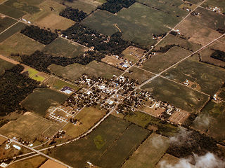
Mentone is a town in Harrison and Franklin townships, Kosciusko County, in the U.S. state of Indiana. Mentone is the self-proclaimed "Egg Basket of the Midwest" because of prolific commercial egg production in the area, and holds an Egg Festival annually in early June to celebrate its heritage. A large concrete egg stands near the town center and is considered locally to be the "Largest Egg in the World". The Lawrence D. Bell Aircraft Museum, is located within the town limits. The Popular Rotorcraft Association has its home at the PRA Mentone Airport C92) and is home to their annual fly-in convention.

<span class="mw-page-title-main">Milford, Kosciusko County, Indiana</span> Town in Indiana, United States

Milford is a town in Van Buren Township, Kosciusko County, in the U.S. state of Indiana. The population was 1,614 at the 2020 census.

<span class="mw-page-title-main">Pierceton, Indiana</span> Town in Indiana, United States

Pierceton is a town in Washington Township, Kosciusko County, in the U.S. state of Indiana. The population was 928 at the 2020 census.

<span class="mw-page-title-main">Sidney, Indiana</span> Town in Indiana, United States

Sidney is a town in Jackson Township, Kosciusko County, in the U.S. state of Indiana. The population was 83 at the 2010 census.

<span class="mw-page-title-main">Silver Lake, Indiana</span> Town in Indiana, United States

Silver Lake is a town in Lake Township, Kosciusko County, in the U.S. state of Indiana. The population was 915 at the 2010 census.

<span class="mw-page-title-main">Syracuse, Indiana</span> Town in Indiana, United States

Syracuse is a town in Turkey Creek Township, Kosciusko County, in the U.S. state of Indiana. The population was 3,079 at the 2020 census. Syracuse is the location of Lake Syracuse and the nearby, larger Lake Wawasee, in addition to several other lakes in the region. The National Weather Service operates a Weather Forecast Office South of town, toward North Webster. It serves Northern Indiana.

<span class="mw-page-title-main">Hammond, Maine</span> Town in the state of Maine, United States

Hammond is a town in Aroostook County, Maine, United States. The population was 91 at the 2020 census.

<span class="mw-page-title-main">Hersey, Maine</span> Town in the state of Maine, United States

Hersey is a town in Aroostook County, Maine, United States. The population was 73 at the 2020 census.

<span class="mw-page-title-main">New Canada, Maine</span> Town in the state of Maine, United States

New Canada is a town in Aroostook County, Maine, United States. The population was 310 at the 2020 census.

<span class="mw-page-title-main">Perham, Maine</span> Town in the state of Maine, United States

Perham is a town in Aroostook County, Maine, United States. The population was 371 at the 2020 census. The town was named after Maine's 33rd governor, Sidney Perham.

<span class="mw-page-title-main">Sherman, Maine</span> Town in the state of Maine, United States

Sherman is a town in Aroostook County, Maine, United States. The population was 815 at the 2020 census.

Lowell is a town in Penobscot County, Maine, United States. The population was 368 at the 2020 census.

Detroit is a town in Somerset County, Maine, United States. The population was 885 at the 2020 census.

<span class="mw-page-title-main">Davy, West Virginia</span> Town in West Virginia, United States

Davy is a town in McDowell County, West Virginia, United States. The population was 420 at the 2010 census. Founded in 1873, the town was originally called Hallsville but the name would change to Davy by 1901. Davy was officially incorporated in 1948. It is a mostly residential community in a coal mining district along the main line of the Norfolk Southern Railway.

<span class="mw-page-title-main">Newburg, West Virginia</span> Town in West Virginia, United States

Newburg is a town in western Preston County, West Virginia, United States. The population was 275 at the 2020 census. It is part of the Morgantown metropolitan area.

<span class="mw-page-title-main">Camden-on-Gauley, West Virginia</span> Town in West Virginia, United States

Camden-on-Gauley is a town in Webster County, West Virginia, United States, along the Gauley River. The population was 126 at the 2020 census.

<span class="mw-page-title-main">St. Albans, Maine</span> Town in the state of Maine, United States

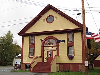
St. Albans is a town in Somerset County, Maine, United States. The population was 2,045 at the 2020 census.

References

  1. "2020 U.S. Gazetteer Files". United States Census Bureau. Retrieved March 16, 2022.
  2. 1 2 3 U.S. Geological Survey Geographic Names Information System: Burket, Indiana
  3. 1 2 "U.S. Census website". United States Census Bureau . Retrieved January 31, 2008.
  4. Biographical and Historical Record of Kosciusko County, Indiana. Lewis Publishing Company. 1887. p. 728.
  5. "Kosciusko County". Jim Forte Postal History. Retrieved November 25, 2014.
  6. "G001 - Geographic Identifiers - 2010 Census Summary File 1". United States Census Bureau. Archived from the original on February 13, 2020. Retrieved July 13, 2015.
  7. "Census of Population and Housing". Census.gov. Retrieved June 4, 2015.
  8. "U.S. Census website". United States Census Bureau . Retrieved December 11, 2012.