Mentone, Indiana

Last updated

Mentone, Indiana
Mentone, Indiana.jpg
Kosciusko County Indiana Incorporated and Unincorporated areas Mentone Highlighted 1848402.svg
Location of Mentone in Kosciusko County, Indiana.
Coordinates: 41°10′27″N86°02′18″W / 41.17417°N 86.03833°W / 41.17417; -86.03833
Country United States
State Indiana
County Kosciusko
Township Harrison, Franklin
Area
[1]
  Total0.59 sq mi (1.54 km2)
  Land0.58 sq mi (1.51 km2)
  Water0.01 sq mi (0.03 km2)
Elevation
[2]
833 ft (254 m)
Population
 (2020)
  Total943
  Density1,617.50/sq mi (624.55/km2)
Time zone UTC-5 (Eastern (EST))
  Summer (DST) UTC-4 (EDT)
ZIP code
46539
Area code 574
FIPS code 18-48402 [3]
GNIS feature ID2396750 [2]

Mentone is a town in Harrison and Franklin townships, Kosciusko County, in the U.S. state of Indiana. [2] Mentone is the self-proclaimed "Egg Basket of the Midwest" because of prolific commercial egg production in the area, and holds an Egg Festival annually in early June to celebrate its heritage. A large concrete egg stands near the town center and is considered locally to be the "Largest Egg in the World". The Lawrence D. Bell Aircraft Museum, is located within the town limits. The Popular Rotorcraft Association has its home at the PRA Mentone Airport C92) and is home to their annual fly-in convention.

Contents

The population was 1,001 at the 2010 census.

History

Mentone was platted in 1882. [4] It was likely named after Menton, in France. [5] The Mentone post office was established in 1882. [6]

Mentone from the air, looking southwest Mentone-indiana-from-above.jpg
Mentone from the air, looking southwest

Geography

A 10-foot-tall concrete egg celebrating Mentone's egg production. Mentone Indiana concrete egg.jpg
A 10-foot-tall concrete egg celebrating Mentone's egg production.

According to the 2010 census, Mentone has a total area of 0.59 square miles (1.53 km2), of which 0.58 square miles (1.50 km2) (or 98.31%) is land and 0.01 square miles (0.03 km2) (or 1.69%) is water. [7]

Demographics

Historical population
CensusPop.Note
1890 780
1900 757−2.9%
1910 728−3.8%
1920 678−6.9%
1930 7043.8%
1940 7313.8%
1950 7989.2%
1960 8131.9%
1970 8302.1%
1980 97317.2%
1990 912−6.3%
2000 898−1.5%
2010 1,00111.5%
2020 943−5.8%
U.S. Decennial Census [8]

2010 census

As of the census [9] of 2010, there were 1,001 people, 369 households, and 267 families living in the town. The population density was 1,725.9 inhabitants per square mile (666.4/km2). There were 423 housing units at an average density of 729.3 per square mile (281.6/km2). The racial makeup of the town was 94.1% White, 0.3% African American, 0.8% Native American, 3.1% from other races, and 1.7% from two or more races. Hispanic or Latino of any race were 4.8% of the population.

There were 369 households, of which 38.8% had children under the age of 18 living with them, 53.1% were married couples living together, 14.4% had a female householder with no husband present, 4.9% had a male householder with no wife present, and 27.6% were non-families. 22.8% of all households were made up of individuals, and 12.2% had someone living alone who was 65 years of age or older. The average household size was 2.71 and the average family size was 3.13.

The median age in the town was 31.2 years. 28.8% of residents were under the age of 18; 10.9% were between the ages of 18 and 24; 26.6% were from 25 to 44; 22.6% were from 45 to 64; and 11.2% were 65 years of age or older. The gender makeup of the town was 49.7% male and 50.3% female.

2000 census

As of the census [3] of 2000, there were 898 people, 335 households, and 230 families living in the town. The population density was 1,424.6 inhabitants per square mile (550.0/km2). There were 365 housing units at an average density of 579.0 per square mile (223.6/km2). The racial makeup of the town was 94.99% White, 0.11% African American, 0.22% Native American, 3.79% from other races, and 0.89% from two or more races. Hispanic or Latino of any race were 5.90% of the population.

There were 335 households, out of which 38.8% had children under the age of 18 living with them, 55.8% were married couples living together, 9.3% had a female householder with no husband present, and 31.3% were non-families. 27.5% of all households were made up of individuals, and 14.9% had someone living alone who was 65 years of age or older. The average household size was 2.68 and the average family size was 3.25.

In the town, the population was spread out, with 31.2% under the age of 18, 9.4% from 18 to 24, 26.5% from 25 to 44, 17.5% from 45 to 64, and 15.5% who were 65 years of age or older. The median age was 32 years. For every 100 females, there were 93.5 males. For every 100 females age 18 and over, there were 89.0 males.

The median income for a household in the town was $38,750, and the median income for a family was $42,222. Males had a median income of $27,250 versus $22,917 for females. The per capita income for the town was $15,372. About 5.7% of families and 6.3% of the population were below the poverty line, including 8.2% of those under age 18 and 1.8% of those age 65 or over.

Education

The town has a lending library, the Bell Memorial Public Library. [10]

Notable people

Related Research Articles

<span class="mw-page-title-main">Mentone, Alabama</span> Town in Alabama, United States

Mentone is a town in DeKalb County, Alabama, United States. It is located atop Lookout Mountain.

<span class="mw-page-title-main">Mentone, California</span> Census-designated place in California, United States

Mentone is a census-designated place in San Bernardino County, California, United States. The population was 7,803 at the 2000 census and 8,720 at the 2010 census. It is located at 34°3′53″N117°7′13″W.

<span class="mw-page-title-main">St. Paul, Indiana</span> Town in Indiana, United States

St. Paul or Saint Paul is a small town on the border of Decatur and Shelby counties in the U.S. state of Indiana. The population was 1,031 at the 2010 census.

<span class="mw-page-title-main">Stilesville, Indiana</span> Town in Indiana, United States

Stilesville is a town in Franklin Township, Hendricks County, Indiana, United States. The population was 316 at the 2010 Census.

<span class="mw-page-title-main">Burket, Indiana</span> Town in Indiana, United States

Burket is a town in Seward Township, Kosciusko County, in the U.S. state of Indiana. The population was 195 at the 2010 census.

<span class="mw-page-title-main">Claypool, Indiana</span> Town in Indiana, United States

Claypool is a town in Clay Township, Kosciusko County, in the U.S. state of Indiana. The population was 431 at the 2010 census.

<span class="mw-page-title-main">Etna Green, Indiana</span> Town in Indiana, United States

Etna Green is a town in Etna Township, Kosciusko County, in the U.S. state of Indiana. The population was 586 at the 2010 census.

<span class="mw-page-title-main">Leesburg, Indiana</span> Town in Indiana, United States

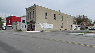
Leesburg is a town in Plain Township, Kosciusko County, in the U.S. state of Indiana. The population was 555 at the 2010 Census. The town of Leesburg was laid out in 1833 by Levi Lee. It includes the Leesburg Historic District.

<span class="mw-page-title-main">Milford, Kosciusko County, Indiana</span> Town in Indiana, United States

Milford is a town in Van Buren Township, Kosciusko County, in the U.S. state of Indiana. The population was 1,614 at the 2020 census.

<span class="mw-page-title-main">North Webster, Indiana</span> Town in Indiana, United States

North Webster is a town in Tippecanoe Township, Kosciusko County, in the U.S. state of Indiana. The population was 1,146 at the 2010 census. The National Weather Service operates a Weather Forecast Office North of town toward Syracuse.

<span class="mw-page-title-main">Pierceton, Indiana</span> Town in Indiana, United States

Pierceton is a town in Washington Township, Kosciusko County, in the U.S. state of Indiana. The population was 928 at the 2020 census.

<span class="mw-page-title-main">Sidney, Indiana</span> Town in Indiana, United States

Sidney is a town in Jackson Township, Kosciusko County, in the U.S. state of Indiana. The population was 83 at the 2010 census.

<span class="mw-page-title-main">Silver Lake, Indiana</span> Town in Indiana, United States

Silver Lake is a town in Lake Township, Kosciusko County, in the U.S. state of Indiana. The population was 915 at the 2010 census.

<span class="mw-page-title-main">Syracuse, Indiana</span> Town in Indiana, United States

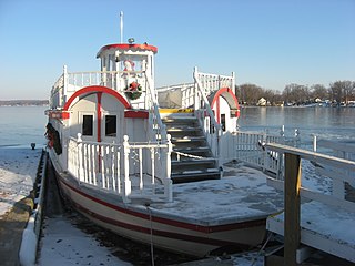
Syracuse is a town in Turkey Creek Township, Kosciusko County, in the U.S. state of Indiana. The population was 3,079 at the 2020 census. Syracuse is the location of Lake Syracuse and the nearby, larger Lake Wawasee, in addition to several other lakes in the region. The National Weather Service operates a Weather Forecast Office South of town, toward North Webster. It serves Northern Indiana.

<span class="mw-page-title-main">Winona Lake, Indiana</span> Town in Indiana, United States

Winona Lake is a town in Wayne Township, Kosciusko County, in the U.S. state of Indiana, and the major suburb of Warsaw. The population was 4,908 at the 2010 census.

<span class="mw-page-title-main">Oolitic, Indiana</span> Town in Indiana, United States

Oolitic is a town in Indian Creek and Shawswick townships, Lawrence County, Indiana, United States. The population was 1,184 at the 2010 census.

<span class="mw-page-title-main">Bethany, Indiana</span> Town in Indiana, United States

Bethany is a town in Clay Township, Morgan County, in the U.S. state of Indiana. The population was 95 at the 2020 census.

<span class="mw-page-title-main">Brooklyn, Indiana</span> Town in Indiana, United States

Brooklyn is a town in Clay and Brown townships, Morgan County, Indiana, United States. The population was 2,511 at the 2020 census, up from 1,598 in 2010.

<span class="mw-page-title-main">Paragon, Indiana</span> Town in Indiana, United States

Paragon is a town in Ray Township, Morgan County, in the U.S. state of Indiana. The population was 556 at the 2020 census, down from 659 in 2010.

<span class="mw-page-title-main">Clear Lake, Indiana</span> Town in Indiana, United States

Clear Lake is a town located in the northeast corner of Steuben County, Indiana, in Clear Lake Township. As such, is the northeasternmost community in the State of Indiana. The population was 339 at the 2010 census.

References

  1. "2020 U.S. Gazetteer Files". United States Census Bureau. Retrieved March 16, 2022.
  2. 1 2 3 U.S. Geological Survey Geographic Names Information System: Mentone, Indiana
  3. 1 2 "U.S. Census website". United States Census Bureau . Retrieved January 31, 2008.
  4. Biographical and Historical Record of Kosciusko County, Indiana. Lewis Publishing Company. 1887. p. 731.
  5. Baker, Ronald L. (October 1995). From Needmore to Prosperity: Hoosier Place Names in Folklore and History . Indiana University Press. p.  215. ISBN   978-0-253-32866-3. The name comes from Menton, a city on the Mediterranean in France...
  6. "Kosciusko County". Jim Forte Postal History. Retrieved November 25, 2014.
  7. "G001 - Geographic Identifiers - 2010 Census Summary File 1". United States Census Bureau. Archived from the original on February 13, 2020. Retrieved July 17, 2015.
  8. "Census of Population and Housing". Census.gov. Retrieved June 4, 2015.
  9. "U.S. Census website". United States Census Bureau . Retrieved December 11, 2012.
  10. "Indiana public library directory" (PDF). Indiana State Library. Retrieved March 8, 2018.