Burlington, Indiana

Last updated

Burlington, Indiana
Carroll County Indiana Incorporated and Unincorporated areas Burlington Highlighted 1809244.svg
Location of Burlington in Carroll County, Indiana.
Coordinates: 40°28′55″N86°23′41″W / 40.48194°N 86.39472°W / 40.48194; -86.39472
Country United States
State Indiana
County Carroll
Township Burlington
Founded1828
Incorporated1967
Area
[1]
  Total0.61 sq mi (1.58 km2)
  Land0.61 sq mi (1.58 km2)
  Water0.00 sq mi (0.00 km2)
Elevation
[2]
778 ft (237 m)
Population
 (2020)
  Total517
  Density844.77/sq mi (326.26/km2)
Time zone UTC−5 (EST)
  Summer (DST) UTC−5 (EST)
ZIP code
46915
Area code 765
FIPS code 18-09244 [3]
GNIS feature ID2396619 [2]
Website http://burlingtonindiana.org/

Burlington is a town in Burlington Township, Carroll County, Indiana, United States. The population was 603 at the 2010 census. It is part of the Lafayette, Indiana Metropolitan Statistical Area. State Road 22 connects it to Kokomo.

Contents

History

Burlington was laid out in 1832 by David Stipp – an employee of the United States General Land Office [4] in Crawfordsville, Indiana – about a year after settlers first appeared in the area. [5] Stipp donated land for the town's first school house. The town was incorporated in 1967. It is named for Wyandot Chief Burlington. [6] In 1830, work began on the Michigan Road which passed directly through the center of town. The road, which became Indiana's first superhighway, connected Madison, Indiana and Michigan City, Indiana turning the town into a major thoroughfare. [7]

Geography

According to the 2010 census, Burlington has a total area of 0.6 square miles (1.55 km2), all land. [8]

Climate

July is typically the warmest month in Burlington, when highs average 84 °F (29 °C) and lows average 63 °F (17 °C). January is coldest, when the high temperatures average 33 °F (-1 °C) and the lows average 18 °F (-8 °C). The highest recorded temperature was 105 °F (41 °C) in 1980, and the lowest was -26 °F (−32 °C) in 1983. [9]

Demographics

Historical population
CensusPop.Note
1850 164
1970 685
1980 680−0.7%
1990 568−16.5%
2000 444−21.8%
2010 60335.8%
2020 517−14.3%
U.S. Decennial Census [10]

2010 census

As of the census [11] of 2010, there were 603 people, 258 households, and 173 families living in the town. The population density was 1,005.0 inhabitants per square mile (388.0/km2). There were 286 housing units at an average density of 476.7 per square mile (184.1/km2). The racial makeup of the town was 98.8% White, 0.5% African American, 0.2% Asian, and 0.5% from two or more races. Hispanic or Latino of any race were 2.0% of the population.

There were 258 households, of which 31.0% had children under the age of 18 living with them, 54.7% were married couples living together, 10.1% had a female householder with no husband present, 2.3% had a male householder with no wife present, and 32.9% were non-families. 28.3% of all households were made up of individuals, and 13.9% had someone living alone who was 65 years of age or older. The average household size was 2.34 and the average family size was 2.81.

The median age in the town was 40.6 years. 23.5% of residents were under the age of 18; 6.5% were between the ages of 18 and 24; 24.9% were from 25 to 44; 23.4% were from 45 to 64; and 21.7% were 65 years of age or older. The gender makeup of the town was 45.8% male and 54.2% female.

2000 census

As of the census [3] of 2000, there were 444 people, 207 households, and 127 families living in the town. The population density was 820.0 inhabitants per square mile (316.6/km2). There were 217 housing units at an average density of 400.7 per square mile (154.7/km2). The racial makeup of the town was 99.10% White, 0.23% African American, 0.23% from other races, and 0.45% from two or more races. Hispanic or Latino of any race were 0.68% of the population.

There were 207 households, out of which 22.2% had children under the age of 18 living with them, 48.3% were married couples living together, 9.7% had a female householder with no husband present, and 38.6% were non-families. 34.3% of all households were made up of individuals, and 20.8% had someone living alone who was 65 years of age or older. The average household size was 2.14 and the average family size was 2.71.

In the town, the population was spread out, with 19.6% under the age of 18, 7.2% from 18 to 24, 29.5% from 25 to 44, 21.8% from 45 to 64, and 21.8% who were 65 years of age or older. The median age was 41 years. For every 100 females, there were 92.2 males. For every 100 females age 18 and over, there were 86.9 males.

The median income for a household in the town was $38,472, and the median income for a family was $52,917. Males had a median income of $35,000 versus $17,917 for females. The per capita income for the town was $22,482. About 3.3% of families and 5.5% of the population were below the poverty line, including 2.7% of those under age 18 and 10.0% of those age 65 or over.

Education

The town has a free lending library, the Burlington Community Library. [12]

Related Research Articles

<span class="mw-page-title-main">West Harrison, Indiana</span> Town in Indiana, United States

West Harrison is a town in Harrison Township, Dearborn County, Indiana, United States. The population was 289 at the 2010 census.

<span class="mw-page-title-main">St. Paul, Indiana</span> Town in Indiana, United States

St. Paul or Saint Paul is a small town on the border of Decatur and Shelby counties in the U.S. state of Indiana. The population was 1,031 at the 2010 census.

<span class="mw-page-title-main">Ashley, Indiana</span> Town in Indiana, United States

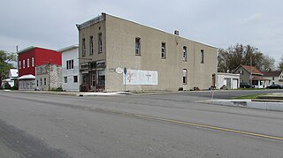
Ashley is a town in Indiana located on the border of Smithfield Township, DeKalb County and Steuben Township, Steuben County. The population was 983 at the 2010 census.

<span class="mw-page-title-main">Atlanta, Indiana</span> Town in Indiana, United States

Atlanta is a town in Jackson Township, Hamilton County, Indiana, United States. The population was 725 at the 2010 census.

<span class="mw-page-title-main">Wilkinson, Indiana</span> Town in Indiana, United States

Wilkinson is a town in Brown Township, Hancock County, Indiana, United States. The population was 449 at the 2010 census.

<span class="mw-page-title-main">Stilesville, Indiana</span> Town in Indiana, United States

Stilesville is a town in Franklin Township, Hendricks County, Indiana, United States. The population was 316 at the 2010 Census.

<span class="mw-page-title-main">Andrews, Indiana</span> Town in Indiana, United States

Andrews is a town in Dallas Township, Huntington County, Indiana, United States. The population was 1,048 at the 2020 census.

<span class="mw-page-title-main">New Whiteland, Indiana</span> Town in Indiana, United States

New Whiteland is a town in Pleasant Township, Johnson County, Indiana, United States. The population was 5,550 at the 2020 census.

<span class="mw-page-title-main">Whiteland, Indiana</span> Town in Indiana, United States

Whiteland is a town in Pleasant, Franklin and Clark townships, Johnson County, Indiana, United States. The population was 4,599 at the 2020 census.

<span class="mw-page-title-main">Sidney, Indiana</span> Town in Indiana, United States

Sidney is a town in Jackson Township, Kosciusko County, in the U.S. state of Indiana. The population was 83 at the 2010 census.

<span class="mw-page-title-main">Woodlawn Heights, Indiana</span> Town in Indiana, United States

Woodlawn Heights is a town in Anderson Township, Madison County, Indiana, United States. It is part of the Indianapolis–Carmel–Anderson metropolitan statistical area. The population was 91 at the 2020 census.

<span class="mw-page-title-main">Bethany, Indiana</span> Town in Indiana, United States

Bethany is a town in Clay Township, Morgan County, in the U.S. state of Indiana. The population was 95 at the 2020 census.

<span class="mw-page-title-main">Paragon, Indiana</span> Town in Indiana, United States

Paragon is a town in Ray Township, Morgan County, in the U.S. state of Indiana. The population was 556 at the 2020 census, down from 659 in 2010.

<span class="mw-page-title-main">Bloomingdale, Indiana</span> Town in Indiana, United States

Bloomingdale is a town in Penn Township, Parke County, in the U.S. state of Indiana. The population was 335 at the 2010 census.

<span class="mw-page-title-main">Mecca, Indiana</span> Town in Indiana, United States

Mecca is a town in Wabash Township, Parke County, in the U.S. state of Indiana. The population was 335 at the 2010 census.

<span class="mw-page-title-main">Clear Lake, Indiana</span> Town in Indiana, United States

Clear Lake is a town located in the northeast corner of Steuben County, Indiana, in Clear Lake Township. As such, is the northeasternmost community in the State of Indiana. The population was 339 at the 2010 census.

Burlington is a town in Penobscot County, Maine, United States. It is part of the Bangor Metropolitan Statistical Area. The population was 373 at the 2020 census.

<span class="mw-page-title-main">Burlington, Wyoming</span> Town in Wyoming, United States

Burlington is a town in Big Horn County, Wyoming, United States. The population was 288 at the 2010 census.

<span class="mw-page-title-main">North Crows Nest, Indiana</span> Town in Indiana, United States

North Crows Nest is a town in Washington Township, Marion County, Indiana, United States. It is approximately 7 miles (11 km) north of downtown Indianapolis. The population was 44 at the 2020 census. It has existed as an "included town" since 1970, when it was incorporated into Indianapolis as part of Unigov. It is part of Indianapolis, but retains town governmental powers under IC 36-3-1-11.

<span class="mw-page-title-main">Burlington (town), Wisconsin</span> Town in Wisconsin, United States

The Town of Burlington is located in Racine County, Wisconsin. The population was 6,465 at the 2020 census. The City of Burlington is located mostly within the town. The census-designated places of Bohners Lake, and Browns Lake are located within the town. The unincorporated community of Cedar Park is also located in the town.

References

  1. "2020 U.S. Gazetteer Files". United States Census Bureau. Retrieved March 16, 2022.
  2. 1 2 U.S. Geological Survey Geographic Names Information System: Burlington, Indiana
  3. 1 2 "U.S. Census website". United States Census Bureau . Retrieved January 31, 2008.
  4. "History". Town of Burlington, Indiana. Retrieved June 2, 2014.
  5. "Burlington of Carroll County Indiana".
  6. Allison, Harold (1986). The Tragic Saga of the Indiana Indians. Paducah, Kentucky: Graphic Design of Indiana. p. 301. ISBN   0-938021-07-9.
  7. Esaray, Logan (1915). A History of Indiana. W.K. Stewart Co. p. 260.
  8. "G001 - Geographic Identifiers - 2010 Census Summary File 1". United States Census Bureau. Archived from the original on February 13, 2020. Retrieved July 13, 2015.
  9. "Historic Average". Intellicast. Retrieved May 23, 2017.
  10. "Census of Population and Housing". Census.gov. Retrieved June 4, 2015.
  11. "U.S. Census website". United States Census Bureau . Retrieved December 11, 2012.
  12. "Libraries". Carroll County, IN. Archived from the original on March 4, 2018. Retrieved March 4, 2018.