Burton, West Virginia

Last updated

Burton
USA West Virginia location map.svg
Red pog.svg
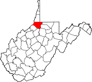
Burton
Location within the state of West Virginia
Usa edcp location map.svg
Red pog.svg
Burton
Burton (the United States)
Coordinates: 39°39′50″N80°25′50″W / 39.66389°N 80.43056°W / 39.66389; -80.43056
Country United States
State West Virginia
County Wetzel
Time zone UTC-5 (Eastern (EST))
  Summer (DST) UTC-4 (EDT)
ZIP code
26562 [1]

Nestled in the foothills of the Appalachian Mountains, Burton is an unincorporated community in Wetzel County, West Virginia, United States, located on a stretch of highway where both WV Route 7 and US Route 250 join for a few short miles between Cottontown and Hundred. These two roads are responsible for the majority of traffic to and from the area and provide important connections to New Martinsville to the west (approximately 45 minutes by car); Fairmont to the southeast (approx. 45 minutes); Morgantown, to the west (approx. 60 minutes); and Moundsville to the northeast (approx. 70 minutes). Other important connections include WV Route 69 North into Pennsylvania, where it becomes PA Route 18 and leads towards Waynesburg (approx 45 minutes) and beyond to Pittsburgh (approx 90-120 mins, traffic dependent). Pittsburgh International Airport, is the nearest intercontinental airport, while Burton is also served by a smaller regional airport, Morgantown Municipal Airport.

It is thought to be named for George Bartrug, who settled here circa 1812. The name difference may be due to an apparent misreading of the name by railway officials. [2] Due to its distance from the county seat and other settled areas, Burton had a major role in period lawlessness lasting through the 1870s, including thieves, houses of ill repute, gambling, and saloons. A band of concerned citizens formed the Redman Gang and helped drive crime from the area. The area remained sparsely settled until the B&O Railroad was constructed through the town in 1852, but later became an important stop on the railroad, serving as a supply depot for extraction of natural resources. [3]

The train tracks that once ran through Burton are long gone, and the right-of-way is now owned by Consol Coal. [4] The rail bed connects to the East Wetzel Rail Trail in Hundred, WV, [5] and is commonly used by hikers, bikers, and ATV enthusiasts.

The rail bed runs adjacent to Fish Creek, a small waterway that drains Burton and other local towns, eventually flowing into the Ohio River to drain into the Mississippi River basin. [6]

Businesses located in Burton include Whitehill's Auto Body, a body shop that can perform most automotive repairs, including mounting tires, brakes and shocks, exhaust work, and is an official West Virginia Inspection Station. They also offer a 3 bay self-service car wash, and a small used car sales lot.

There is a small roadside park, notable for its large quarried stone rollers that sit on stands by the road. The turnoff for the park also leads to the former United States Post Office, which was closed in 2011 and replaced with extended delivery and a drop box. [7] Next door is the former Burton School, now The Community Health Center, known locally as "The Burton Clinic." For more serious health care needs, Burton is served by Wetzel County Hospital, Mon General Hospital, and Ruby Memorial Hospital, all approximately an hour away by ambulance.

The town has one church, Harmony Baptist Church, which has been active for over 150 years. It is located on a knoll overlooking the western half of the town, and has a cemetery located adjacent.

Local major industry includes the production of oil and gas, underground coal mining, and timber. [8]

Burton is currently not included in any major cell phone carrier's advertised service area, although CDMA customers may get minimal reception in the area from towers located near Fairview, WV, and Mannington, WV. [9] There are no GSM towers located nearby. [10]

Telephone service is available through Frontier Communications, which also offers high-speed DSL internet in the area. [11]

Natural gas is provided by Dominion, [12] and power is offered through Allegheny Power, now merged with First Energy Services. [13]

Children in Burton attend Long Drain School, a K-8 school located several miles away on Route 7, or Hundred High School, located just down the road in Hundred. [14]

Related Research Articles

<span class="mw-page-title-main">Interstate 68</span> Interstate in West Virginia and Maryland

Interstate 68 (I-68) is a 112.9-mile (181.7 km) Interstate Highway in the US states of West Virginia and Maryland, connecting I-79 in Morgantown, West Virginia, east to I-70 in Hancock, Maryland. I-68 is also Corridor E of the Appalachian Development Highway System. From 1965 until the freeway's construction was completed in 1991, it was designated as U.S. Route 48 (US 48). In Maryland, the highway is known as the National Freeway, an homage to the historic National Road, which I-68 parallels between Keysers Ridge and Hancock. The freeway mainly spans rural areas and crosses numerous mountain ridges along its route. A road cut at Sideling Hill exposed geological features of the mountain and has become a tourist attraction.

<span class="mw-page-title-main">Wetzel County, West Virginia</span> County in West Virginia, United States

Wetzel County is a county in the U.S. state of West Virginia. As of the 2020 census, the population was 14,442. Its county seat is New Martinsville. The county, founded in 1846, is named for Lewis Wetzel, a famous frontiersman and Indian fighter. Its northern border aligns with the Mason-Dixon line, but is to the west of the line's western terminus.

<span class="mw-page-title-main">Keyser, West Virginia</span> City in West Virginia, United States

Keyser is a city in and the county seat of Mineral County, West Virginia. It is part of the Cumberland, MD-WV Metropolitan Statistical Area. The population was 4,853 at the 2020 census.

<span class="mw-page-title-main">Piedmont, West Virginia</span> Town in West Virginia, United States

Piedmont is a town in Mineral County, West Virginia, United States. It is part of the Cumberland, MD-WV metropolitan statistical area. The population was 716 at the 2020 census. Piedmont was chartered in 1856 and the town is the subject of Colored People: A Memoir by Piedmont native Henry Louis Gates Jr.

<span class="mw-page-title-main">Morgantown, West Virginia</span> City in West Virginia

Morgantown is a city in and the county seat of Monongalia County, West Virginia, United States, situated along the Monongahela River. The largest city in North Central West Virginia and the third-largest city in the state, Morgantown is best known as the home of West Virginia University. The population was 30,347 at the 2020 census. The city serves as the anchor of the Morgantown metropolitan area, which had a population of 138,176 in 2020.

<span class="mw-page-title-main">New Martinsville, West Virginia</span> City in West Virginia, United States

New Martinsville is a city in and the county seat of Wetzel County, West Virginia, United States, along the Ohio River. The population was 5,186 at the 2020 census.

<span class="mw-page-title-main">North Central West Virginia Airport</span> Airport in West Virginia, United States

North Central West Virginia Airport is a public/military airport a mile northeast of Bridgeport and six miles east of Clarksburg, in Harrison County, West Virginia. It is owned and operated by the Benedum Airport Authority, serving Harrison and Marion County, and was formerly Benedum Airport and Harrison-Marion Regional Airport. The airport sees two airlines, with some passenger service subsidized by the Essential Air Service program.

<span class="mw-page-title-main">Morgantown Municipal Airport</span> Airport

Morgantown Municipal Airport is three miles east of Morgantown, in Monongalia County, West Virginia. It is also known as Walter L. Bill Hart Field. It sees one passenger airline, Southern Airways Express, subsidized by the Essential Air Service program.

<span class="mw-page-title-main">Mid-Ohio Valley Regional Airport</span> Airport in West Virginia, U.S.

Mid-Ohio Valley Regional Airport is seven miles northeast of Parkersburg, in Wood County, West Virginia. It is owned by the Wood County Airport Authority and is also known as Wood County Airport or Gill Robb Wilson Field. It serves the Mid-Ohio Valley area which includes the Ohio cities of Marietta and Belpre and the West Virginia cities of Williamstown, Parkersburg and Vienna. It has scheduled passenger service subsidized by the Essential Air Service program.

<span class="mw-page-title-main">West Virginia Route 69</span>

West Virginia Route 69 is a north–south state highway located within Wetzel County, West Virginia. The southern terminus of the route is at U.S. Route 250 in Hundred. The northern terminus is at the Pennsylvania state line three miles (5 km) north of Hundred, where WV 69 continues northward as Pennsylvania Route 18.

<span class="mw-page-title-main">West Virginia Route 705</span>

West Virginia Route 705 is a short east–west state highway partially located within the Monongalia County city of Morgantown in the U.S. state of West Virginia. The western terminus of the route is at U.S. Route 19 and West Virginia Route 7, directly in front of the WVU Coliseum. The eastern terminus is at U.S. Route 119 near the Morgantown Municipal Airport. The route is major road in northern Morgantown. It is maintained by the West Virginia Department of Transportation.

Minnehaha Springs is an unincorporated community located in Pocahontas County, West Virginia, United States. It was named for the fictional Native American "princess," Minnehaha, and the mineral springs on the Lockridge farm. It is the only community with this name in the United States. On the site of what is now Camp Twin Creeks warm mineral springs can still be found.

<span class="mw-page-title-main">Greater Pittsburgh</span> Region in the U.S. State of Pennsylvania

Greater Pittsburgh is a populous region centered around Pittsburgh, Pennsylvania, the region's largest city and economic hub. The region encompasses Pittsburgh's urban core county, Allegheny, and six adjacent Pennsylvania counties: Armstrong, Beaver, Butler, Fayette, Washington, and Westmoreland in Western Pennsylvania, which constitutes the Pittsburgh, PA Metropolitan Statistical Area MSA as defined by the U.S. Census Bureau.


Transport in the U.S. state of West Virginia is handled by the West Virginia Department of Transportation (WVDOT) which employs more than 6,000 in West Virginia.

Wetzel County Schools is the school district within Wetzel County, West Virginia, United States.

The West Virginia University Health System, commonly branded as WVU Medicine is a nonprofit health enterprise affiliated with West Virginia University. It provides services throughout West Virginia and portions of the surrounding states of Maryland, Ohio, and Pennsylvania.

North Central West Virginia is a region of the U.S. state of West Virginia. The region's largest cities are Morgantown, Fairmont and Clarksburg.

Mountain Line Transit Authority is the main provider of public transportation located in Morgantown, West Virginia and the surrounding area. It is also the provider of bus service on the campus of West Virginia University. Inter-city bus service to Fairmont, Clarksburg, Waynesburg, PA, Pittsburgh, PA, and the Pittsburgh International Airport is achieved with the Grey Line. Fare for all local routes is $0.75, while Grey Line can cost up to $20 for a single person to Pittsburgh International Airport from Clarksburg WV. In 2022, the system had a ridership of 554,100, or about per weekday as of the first quarter of 2023.

<span class="mw-page-title-main">Point Pleasant Creek</span> River in West Virginia, United States

Point Pleasant Creek is a tributary of Middle Island Creek, 10.4 miles (16.7 km) long, in northwestern West Virginia in the United States. Via Middle Island Creek and the Ohio River, it is part of the watershed of the Mississippi River, draining an area of 60.5 square miles (157 km2) in a rural region on the unglaciated portion of the Allegheny Plateau.

References

  1. "Burton ZIP Code". zipdatamaps.com. 2022. Retrieved November 30, 2022.
  2. Kenny, Hamill (1945). West Virginia Place Names: Their Origin and Meaning, Including the Nomenclature of the Streams and Mountains. Piedmont, WV: The Place Name Press. p. 144.
  3. http://www.rootsweb.ancestry.com/~wvwetzel/Communities/Burton.htm [ user-generated source ]
  4. "The Canal Arrives in Cumberland - Chesapeake & Ohio Canal National Historical Park (U.S. National Park Service)".
  5. List of rail trails in West Virginia
  6. List of rivers of West Virginia
  7. "Burton Post Office Closes - WetzelChronicle.com | News, information, New Martinsville and Wetzel County WV - Wetzel Chronicle". Archived from the original on July 17, 2014. Retrieved August 10, 2012.
  8. http://www.wetzelcountychamber.com/files/127/Fact%20Book2.pdf%5B%5D
  9. "Network Awards | Why Verizon".
  10. "AT&T Coverage Viewer". Archived from the original on September 19, 2009. Retrieved September 30, 2009.
  11. "Home". frontier.com.
  12. "Home". dom.com.
  13. "Welcome Allegheny Energy | FES". Archived from the original on July 22, 2012. Retrieved August 10, 2012.
  14. Wetzel County Schools