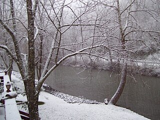
New Creek is an unincorporated community in Mineral County, West Virginia. It lies near the intersection of New Creek and U.S. Route 50, and is 6 miles (9.7 km) south of Keyser. The ZIP code for New Creek is 26743.

High View is an unincorporated community in Hampshire County, West Virginia, United States. It is located south of Capon Bridge along West Virginia Route 259 on the Virginia line. High View is home to the Bhavana Society Forest Monastery and Retreat Center. According to the 2000 census, the High View community has a population of 791.

Rocky Gap is an unincorporated community that is located in Bland County in the U.S. state of Virginia. In the year of 2016, there was an estimate that there were a total of 511 people living in Rocky Gap. Rocky Gap has one zip code (24366).

Walker is an unincorporated community in Wood County, West Virginia, United States. Walker is located on County Route 7 in eastern Wood County, 4 miles (6.4 km) east of West Virginia Route 47, along Walker Creek and the North Bend Rail Trail. Walker has a post office with ZIP code 26180.

Sharon is an unincorporated community and coal town in southeastern Kanawha County, West Virginia, United States, located along the West Virginia Turnpike.

Rockport is an unincorporated community in Wood County, West Virginia, United States. It lies at an elevation of 705 feet (215 m), along Tygart Creek. It is the last exit in Southern Wood County along I-77 and is unincorporated, with the ZIP code of 26169.

Wallace is an unincorporated community and census-designated place in Harrison County, West Virginia, United States.

Falling Rock is an unincorporated community in Kanawha County, West Virginia, United States. Falling Rock is located at the confluence of Falling Rock Creek with the Elk River 3 miles (4.8 km) southwest of Clendenin along US Route 19. Falling Rock has a post office with ZIP code 25079.

Turtle Creek is an unincorporated community in Boone County, West Virginia, United States. Turtle Creek is located along U.S. Route 119 3.5 miles (5.6 km) southwest of Madison. Turtle Creek has a post office with ZIP code 25203.

Dry Creek is an unincorporated community in Raleigh County, West Virginia, United States. Dry Creek is located on West Virginia Route 3 16 miles (26 km) west-northwest of Beckley. Dry Creek has a post office with ZIP code 25062.

Clear Creek is an unincorporated community in Raleigh County, West Virginia, United States. Clear Creek is 4.5 miles (7.2 km) west of Pax. Clear Creek has a post office with ZIP code 25044.

Big Creek is a census-designated place (CDP) in Logan County, West Virginia, United States. Big Creek is located on West Virginia Route 10 2.5 miles (4.0 km) northwest of Chapmanville. Big Creek has a post office with ZIP code 25505. As of the 2010 census, its population was 237.

Peach Creek is an unincorporated community in Logan County, West Virginia, United States. Peach Creek is located on the east bank of the Guyandotte River across from West Logan. Peach Creek has a post office with ZIP code 25639.

Mammoth is an unincorporated community in Kanawha County, West Virginia, United States. Mammoth is 4.5 miles (7.2 km) northeast of Cedar Grove, along Kellys Creek. Mammoth has a post office with ZIP code 25132.

Hewett is an unincorporated community in Boone County, West Virginia, United States. Hewett is 7 miles (11 km) south-southwest of Madison. Hewett has a post office with ZIP code 25108.

Big Otter is an unincorporated community in Clay County, West Virginia, United States. Big Otter is located on Big Otter Creek at the junction of Interstate 79 and West Virginia Route 16. The community is 9.5 miles (15.3 km) north-northeast of Clay, the county seat of Clay County. Big Otter is part of ZIP code 25113. Its original post office with a zip code of 25020 closed in 1979.

Nebo is an unincorporated community in Clay County, West Virginia, United States. Nebo is located on West Virginia Route 16, 12 miles (19 km) north-northeast of Clay, along the Stinson Creek near its source. Nebo no longer has a post office with ZIP code 25141.

Davin is an unincorporated community in Logan County, West Virginia, United States. Davin is located on West Virginia Route 10 and Huff Creek, 3 miles (4.8 km) east-southeast of Man. Davin has a post office with ZIP code 25617.

Lorado is an unincorporated community in Logan County, West Virginia, United States. Lorado is 10 miles (16 km) east-northeast of Man, along Buffalo Creek. Lorado has a post office with ZIP code 25630.

Wilkinson is an unincorporated community in Logan County, West Virginia, United States. Wilkinson is located along West Virginia Route 44 and Island Creek, 1.5 miles (2.4 km) south of Logan. Wilkinson has a post office with ZIP code 25653.


