Campbell, Missouri

Last updated

Campbell, Missouri
CampbellMissouri-VistorsCenter.JPG
Campbell Visitors Center
Motto: 
Peach Capital of Missouri
Dunklin County Missouri Incorporated and Unincorporated areas Campbell Highlighted.svg
Location of Campbell, Missouri
Coordinates: 36°29′34″N90°4′24″W / 36.49278°N 90.07333°W / 36.49278; -90.07333
Country United States
State Missouri
County Dunklin
Area
[1]
  Total1.40 sq mi (3.64 km2)
  Land1.40 sq mi (3.64 km2)
  Water0.00 sq mi (0.00 km2)
Elevation
[2]
315 ft (96 m)
Population
 (2020)
  Total1,605
  Density1,143.16/sq mi (441.24/km2)
Time zone UTC-6 (Central (CST))
  Summer (DST) UTC-5 (CDT)
ZIP code
63933
Area code 573
FIPS code 29-10864 [3]
GNIS feature ID2393725 [2]
Website City website

Campbell is a city in northern Dunklin County, Missouri, United States. The population was 1,992 at the 2010 census.

Contents

History

Campbell was originally called Four Mile, and under the latter name settlement was made in 1844. [4] The town site was platted in 1886, and the present name adopted from Alexander Campbell, a local judge. [4] A post office called Four Mile was established in 1855, and the name was changed to Campbell in 1882. [5]

Geography

Campbell is located in the northwestern part of the Missouri Bootheel at the intersection of US Route 62 and Missouri Route 53. Malden is seven miles to the northeast and St. Francis, Arkansas is 4.5 miles to the southwest on the St. Francis River. Kennett is approximately 17 miles to the south. [6]

According to the United States Census Bureau, the city has a total area of 1.40 square miles (3.63 km2), all land. [7]

Demographics

Historical population
CensusPop.Note
1900 737
1910 1,781141.7%
1920 2,02513.7%
1930 1,592−21.4%
1940 1,78612.2%
1950 1,9318.1%
1960 1,9641.7%
1970 1,9790.8%
1980 2,1347.8%
1990 2,1651.5%
2000 1,883−13.0%
2010 1,9925.8%
2020 1,605−19.4%
source: [8]

2010 census

As of the census [9] of 2010, there were 1,992 people, 799 households, and 495 families living in the city. The population density was 1,422.9 inhabitants per square mile (549.4/km2). There were 903 housing units at an average density of 645.0 per square mile (249.0/km2). The racial makeup of the city was 97.84% White, 0.10% Black or African American, 0.25% Native American, 0.05% Asian, 0.45% from other races, and 1.31% from two or more races. Hispanic or Latino people of any race were 2.11% of the population.

There were 799 households, of which 32.7% had children under the age of 18 living with them, 40.6% were married couples living together, 15.9% had a female householder with no husband present, 5.5% had a male householder with no wife present, and 38.0% were non-families. 32.7% of all households were made up of individuals, and 16.9% had someone living alone who was 65 years of age or older. The average household size was 2.40 and the average family size was 3.03.

The median age in the city was 39.8 years. 24.8% of residents were under the age of 18; 8.2% were between the ages of 18 and 24; 23% were from 25 to 44; 24.6% were from 45 to 64; and 19.4% were 65 years of age or older. The gender makeup of the city was 46.5% male and 53.5% female.

2000 census

As of the census [3] of 2000, there were 1,883 people, 853 households, and 499 families living in the city. The population density was 1,477.9 inhabitants per square mile (570.6/km2). There were 966 housing units at an average density of 758.2 per square mile (292.7/km2). The racial makeup of the city was 98.14% White, 0.58% Native American, 0.16% Pacific Islander, 0.27% from other races, and 0.85% from two or more races. Hispanic or Latino people of any race were 1.38% of the population.

There were 853 households, out of which 28.5% had children under the age of 18 living with them, 40.3% were married couples living together, 14.3% had a female householder with no husband present, and 41.4% were non-families. 37.5% of all households were made up of individuals, and 22.2% had someone living alone who was 65 years of age or older. The average household size was 2.21 and the average family size was 2.90.

In the city the population was spread out, with 24.7% under the age of 18, 8.2% from 18 to 24, 25.9% from 25 to 44, 21.3% from 45 to 64, and 19.9% who were 65 years of age or older. The median age was 38 years. For every 100 females, there were 88.9 males. For every 100 females age 18 and over, there were 81.3 males.

The median income for a household in the city was $21,838, and the median income for a family was $27,802. Males had a median income of $24,286 versus $17,000 for females. The per capita income for the city was $14,026. About 11.6% of families and 20.2% of the population were below the poverty line, including 27.0% of those under age 18 and 18.8% of those age 65 or over.

Education

Campbell R-2 School District operates one elementary school and Campbell High School. [10]

Campbell has a public library, a branch of the Dunklin County Library. [11]

Arts and culture

The city of Campbell holds many events for the town and surrounding areas, including Easter egg hunts in the softball fields, fireworks for the 4th of July, citywide yard sales, auto shows, craft fairs, senior citizen dances, Campbell High School annual reunions, and the annual Missouri Peach Fair. [12]

In 1944, the Campbell American Legion, local peach farmers, and local business owners hosted the first ever Peach Festival. This was initially a one-day event then, including a picnic where people could barbecue, and prizes given to the farmers with the best peaches. In 2011, the event expanded to become the official Missouri Peach Fair. It is now a seven-day celebration of a good year's harvest. It includes carnival rides, arcade games, food stands, pageant contests, and raffle drawings.

Notable people

Related Research Articles

<span class="mw-page-title-main">Arbyrd, Missouri</span> City in Missouri, United States

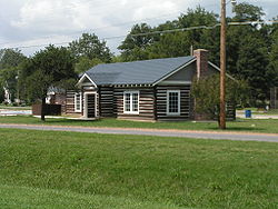
Arbyrd is a small town in southeast Dunklin County, Missouri, United States. The population was 404 at the 2020 census. The town was officially incorporated in 1919.

<span class="mw-page-title-main">Cardwell, Missouri</span> City in Missouri, United States

Cardwell is a city in southwest Dunklin County, Missouri, United States. The population was 713 at the 2010 census. The current Mayor of Cardwell is Brandon Cupp and the current aldermen are Harvey Beasley, Mike Clark, and Chuck Walls.

<span class="mw-page-title-main">Clarkton, Missouri</span> City in Missouri, United States

Clarkton is a city in Dunklin County, Missouri, United States. The population was 1,288 at the 2010 census. Clarkton is the oldest city in Dunklin County.

<span class="mw-page-title-main">Holcomb, Missouri</span> City in Missouri, United States

HolcombHAW-kəm is a city in Dunklin County, Missouri, United States. The population was 635 at the 2010 census.

<span class="mw-page-title-main">Rives, Missouri</span> Village in Missouri, United States

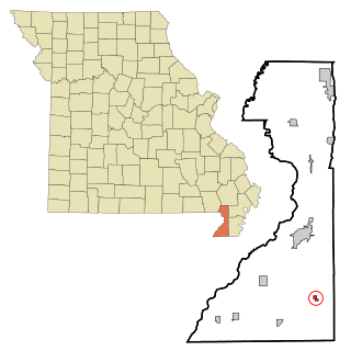
Rives is a town in Dunklin County, Missouri, United States. The population was 63 at the 2010 census.

<span class="mw-page-title-main">Senath, Missouri</span> City in Missouri, United States

Senath is a city in Dunklin County, Missouri, United States. The population was 1,767 at the 2010 census.

<span class="mw-page-title-main">Barnhart, Missouri</span> CDP in Missouri, United States

Barnhart is a census-designated place (CDP) in Jefferson County, Missouri, United States. Barnhart is also a suburb of St. Louis.

<span class="mw-page-title-main">Horine, Missouri</span> Census-designated place in Missouri, United States

Horine is an unincorporated community and census-designated place (CDP) in Jefferson County, Missouri, United States. The population was 821 at the 2010 census, down from 923 in 2000.

<span class="mw-page-title-main">Pevely, Missouri</span> City in Missouri, United States

Pevely is a city in Jefferson County, Missouri, United States, and is also a suburb of St. Louis. The population was 6,107, at the 2020 United States Census.

<span class="mw-page-title-main">Tallapoosa, Missouri</span> City in Missouri, United States

Tallapoosa is a city in New Madrid County, Missouri, United States. The population was 78 at the 2020 census.

<span class="mw-page-title-main">Green Ridge, Missouri</span> City in Missouri, United States

Green Ridge is a city located along Route 127 in Pettis County, Missouri, United States. The population was 476 at the 2010 census.

<span class="mw-page-title-main">Bolivar, Missouri</span> City in Missouri, United States

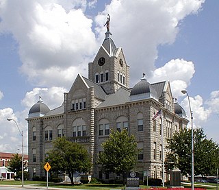
Bolivar is a city and county seat of Polk County, Missouri, United States.

<span class="mw-page-title-main">Country Club Hills, Missouri</span> City in Missouri, United States

Country Club Hills is a city in St. Louis County, Missouri, United States. The population was 1,274 at the 2010 census.

<span class="mw-page-title-main">Crystal Lake Park, Missouri</span> City in Missouri, United States

Crystal Lake Park is a Missouri Class 4 city in St. Louis County, Missouri, United States. The population was 508 at the 2020 census.

<span class="mw-page-title-main">Lakeshire, Missouri</span> City in Missouri, United States

Lakeshire is a city in St. Louis County, Missouri, United States. The population was 1,432 at the 2010 census.

<span class="mw-page-title-main">Hornersville, Missouri</span> City in Missouri, United States

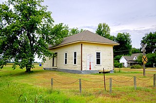
Hornersville is a city in Dunklin County, Missouri, United States, founded in 1840. The population was 537 at the 2020 census.

<span class="mw-page-title-main">Kennett, Missouri</span> City in Missouri, United States

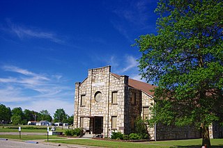
Kennett is a city in and the county seat of Dunklin County, Missouri, United States. The city is located in the southeast corner of Missouri, 4 miles (6.4 km) east of Arkansas and 20 miles (32 km) from the Mississippi River. It had a population of 10,515 at the 2020 census. Kennett is the largest city in the Bootheel, a mostly agricultural area.

<span class="mw-page-title-main">Clarkson Valley, Missouri</span> City in Missouri, United States

Clarkson Valley is a city in St. Louis County, Missouri, United States. The population was 2,609 at the 2020 census.

<span class="mw-page-title-main">Moline Acres, Missouri</span> City in Missouri, United States

Moline Acres is a city in St. Louis County, Missouri, United States. The population was 2,442 at the 2010 census.

<span class="mw-page-title-main">Argyle, Missouri</span> Town in Missouri, United States

Argyle is a town in Osage and Maries counties in the U.S. state of Missouri. The population was 144 at the 2020 census.

References

  1. "ArcGIS REST Services Directory". United States Census Bureau. Retrieved August 28, 2022.
  2. 1 2 U.S. Geological Survey Geographic Names Information System: Campbell, Missouri
  3. 1 2 "U.S. Census website". United States Census Bureau . Retrieved January 31, 2008.
  4. 1 2 "Dunklin County Place Names, 1928–1945 (archived)". The State Historical Society of Missouri. Archived from the original on June 24, 2016. Retrieved September 29, 2016.{{cite web}}: CS1 maint: bot: original URL status unknown (link)
  5. "Post Offices". Jim Forte Postal History. Retrieved September 29, 2016.
  6. Missouri Atlas & Gazetteer, DeLorme, 1st ed., 1998, pp. 67 and 70, ISBN   0899332242
  7. "US Gazetteer files 2010". United States Census Bureau. Archived from the original on July 2, 2012. Retrieved July 8, 2012.
  8. "Missouri Population 1900 - 1990" (PDF). Missouri Census Data Center. Archived from the original (CSV) on July 4, 2014. Retrieved October 6, 2014.
  9. "U.S. Census website". United States Census Bureau . Retrieved July 8, 2012.
  10. "Campbell R-II School District". Great Schools. Retrieved March 17, 2018.
  11. "Locations". Dunklin County Library. Retrieved March 17, 2018.
  12. "Campbell's Official City Website". Archived from the original on January 28, 2011. Retrieved April 6, 2011.