Dunklin County is located in the Bootheel of the U.S. state of Missouri. As of the 2020 census, the population was 28,283. The largest city and county seat is Kennett. The county was officially organized on February 14, 1845, and is named in honor of Daniel Dunklin, a Governor of Missouri who died the year before the county was organized.
Clarkton is a city in Dunklin County, Missouri, United States. The population was 1,288 at the 2010 census. Clarkton is the oldest city in Dunklin County.

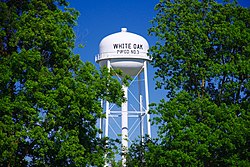
HolcombHAW-kəm is a city in Dunklin County, Missouri, United States. The population was 635 at the 2010 census.

Horine is an unincorporated community and census-designated place (CDP) in Jefferson County, Missouri, United States. The population was 821 at the 2010 census, down from 923 in 2000.

Hornersville is a city in Dunklin County, Missouri, United States, founded in 1840. The population was 663 at the 2010 census.

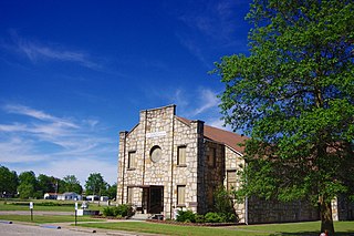
Kennett is a city in and the county seat of Dunklin County, Missouri, United States. The city is located in the southeast corner of Missouri, 4 miles (6.4 km) east of Arkansas and 20 miles (32 km) from the Mississippi River. It has a population of 10,932 according to the 2010 Census. Kennett is the largest city in the Bootheel, a mostly agricultural area.

Gibson is an unincorporated community in northern Dunklin County, Missouri, United States. It is located thirteen miles (19 km) north of Kennett on Route 53.

Hollywood is an unincorporated community in southern Dunklin County, Missouri, United States. It is located less than one mile from Route 164, approximately twelve miles south of Kennett.
Caruth is an unincorporated community in Dunklin County, in the U.S. state of Missouri.
Brian is an unincorporated community in Dunklin County, in the U.S. state of Missouri.
Cockrum is an unincorporated community in Dunklin County, in the U.S. state of Missouri.
Cotton Plant is an unincorporated community in Dunklin County, in the U.S. state of Missouri.
Europa is an unincorporated community in Dunklin County, in the U.S. state of Missouri.
Frisbee is an unincorporated community in Dunklin County, in the U.S. state of Missouri.
Glennonville is an unincorporated community in Dunklin County, in the U.S. state of Missouri.
Ipley is an unincorporated community in Dunklin County, in the U.S. state of Missouri.
Nesbit is an unincorporated community in Dunklin County, in the U.S. state of Missouri.
Octa is an unincorporated community in Dunklin County, in the U.S. state of Missouri.
Valley Ridge is an unincorporated community in Dunklin County, in the U.S. state of Missouri.
Wilhelmina is an unincorporated community in Dunklin County, in the U.S. state of Missouri.