Charleston, Arkansas

Last updated

Charleston, Arkansas
Franklin County Courthouse, Charleston, AR.jpg
Franklin County Arkansas Incorporated and Unincorporated areas Charleston Highlighted 0513300.svg
Location of Charleston in Franklin County, Arkansas.
Coordinates: 35°17′41″N94°02′54″W / 35.29472°N 94.04833°W / 35.29472; -94.04833
Country United States
State Arkansas
County Franklin
Area
[1]
  Total3.94 sq mi (10.21 km2)
  Land3.83 sq mi (9.93 km2)
  Water0.11 sq mi (0.28 km2)
Elevation
[2]
485 ft (148 m)
Population
 (2020)
  Total2,588
  Density675.01/sq mi (260.62/km2)
Time zone UTC-6 (Central (CST))
  Summer (DST) UTC-5 (CDT)
ZIP code
72933
Area code 479
FIPS code 05-13300
GNIS feature ID2404028 [2]
Website aboutcharleston.com

Charleston is a city in Franklin County, Arkansas, United States, and along with Ozark is one of the two county seats of Franklin County. [3] It is part of the Fort Smith, Arkansas-Oklahoma Metropolitan Statistical Area. The population was 2,494 at the 2010 census, [4] down from 2,965 in 2000.

Contents

History

Charleston was platted in 1870. [5]

In 1954, Charleston was the first school district in the former Confederate States to implement school integration in response to Brown v. Board of Education . On July 27, 1954, the school board, including President Howard Madison Orsburn, George Hairston, Archibald Schaffer, Herbert Shumate, and Homer Keith, unanimously voted to "disband the Colored School and admit the Colored children into the grade and high school when classes open for the fall semester." Accordingly, when the schools opened on August 23, 11 black children were in attendance alongside 480 whites. [6] School Superintendent Woodie Haynes made an agreement with the local press not to cover the event, and stonewalled any outside reporters that asked questions. [7] The decision to integrate had financial benefits, as the district had been paying a considerable sum to transport black high school students to Fort Smith, and were able to close the old Rosenwald school. During the Civil Rights era, the city was among a few Southern cities which surprisingly showed little resistance to integration. [8] Charleston suffered some discrimination from other schools and the state; many schools refused to play football against them and the band was denied the opportunity to play in some band competitions. In 1961, the first two black students to graduate from Charleston were Barbara (Williams) Dotson and Joe Ferguson. [6]

Geography

Charleston is in southwestern Franklin County, along Arkansas Highway 22, which leads east 9 miles (14 km) to Ratcliff and west 24 miles (39 km) to Fort Smith.

According to the United States Census Bureau, Charleston has a total area of 4.4 square miles (11.4 km2), of which 4.3 square miles (11.1 km2) is land and 0.1 square miles (0.3 km2), or 2.53%, is water. [4]

Demographics

Historical population
CensusPop.Note
1880 393
1890 370−5.9%
1910 576
1920 73427.4%
1930 85115.9%
1940 95812.6%
1950 9681.0%
1960 1,0367.0%
1970 1,49744.5%
1980 1,74816.8%
1990 2,12821.7%
2000 2,96539.3%
2010 2,494−15.9%
2020 2,5883.8%
U.S. Decennial Census [9]
2014 Estimate [10]

2020 census

Charleston racial composition [11]
RaceNumberPercentage
White (non-Hispanic)2,28088.1%
Black or African American (non-Hispanic)230.89%
Native American 341.31%
Asian 90.35%
Other/Mixed 1716.61%
Hispanic or Latino 712.74%

As of the 2020 United States census, there were 2,588 people, 997 households, and 639 families residing in the city.

2000 census

As of the census [12] of 2000, there were 2,965 people, 1,201 households, and 815 families residing in the city. The population density was 706.4 inhabitants per square mile (272.7/km2). There were 1,315 housing units at an average density of 313.3 per square mile (121.0/km2). The racial makeup of the city was 95.58% White, 0.07% Black or African American, 0.64% Native American, 0.34% Asian, 1.48% from other races, and 1.89% from two or more races. 2.06% of the population were Hispanic or Latino of any race.

There were 1,201 households, out of which 31.7% had children under the age of 18 living with them, 52.3% were married couples living together, 11.9% had a female householder with no husband present, and 32.1% were non-families. 29.2% of all households were made up of individuals, and 14.7% had someone living alone who was 65 years of age or older. The average household size was 2.40 and the average family size was 2.96.

In the city, the population was spread out, with 25.7% under the age of 18, 7.9% from 18 to 24, 26.7% from 25 to 44, 20.4% from 45 to 64, and 19.3% who were 65 years of age or older. The median age was 38 years. For every 100 females, there were 92.3 males. For every 100 females age 18 and over, there were 89.7 males.

The median income for a household in the city was $30,824, and the median income for a family was $39,598. Males had a median income of $27,917 versus $18,512 for females. The per capita income for the city was $14,912. About 8.6% of families and 14.4% of the population were below the poverty line, including 17.1% of those under age 18 and 16.6% of those age 65 or over.

Notable people

Education

Public education

The Charleston School District provides public education from kindergarten through grade 12 from its three facilities, Charleston High School (grades 9–12), Charleston Elementary School (grades K–4), and Charleston Middle School (grades 5–8).

The Public School District of Charleston, Arkansas was the first school district to integrate in the former Confederate States of America. The high school was destroyed in middle 2010 to make way for a larger middle school. There is currently a small monument to the integration in front of Charleston Middle School.

Related Research Articles

<span class="mw-page-title-main">Franklin County, Alabama</span> County in Alabama, United States

Franklin County is a county located in the U.S. state of Alabama. As of the 2020 census, the population was 32,113. Its county seat is Russellville. Its name is in honor of Benjamin Franklin, famous statesman, scientist, and printer. It is a dry county, although the city of Russellville is wet.

<span class="mw-page-title-main">Franklin County, Georgia</span> County in Georgia, United States

Franklin County is a county located in the northeastern part of the U.S. state of Georgia. As of the 2020 census, the population was 23,424. The county seat is Carnesville. On February 25, 1784, Franklin and Washington became Georgia's eighth and ninth counties, with Franklin named in honor of patriot Benjamin Franklin.

<span class="mw-page-title-main">Franklin County, Arkansas</span> County in Arkansas, United States

Franklin County is a county in Arkansas. As of the 2020 census, the population was 17,097. The county has two county seats, Charleston and Ozark. The county was formed on December 19, 1837, and named for Benjamin Franklin, American statesman. Franklin County is a damp county, with alcohol sales allowed except in Prairie & Alix townships, and limits on liquor sales in the city of Branch.

<span class="mw-page-title-main">Lowell, Arkansas</span> City in Arkansas, United States

Lowell is a city in Benton County, Arkansas, United States. Located within the Ozarks, the first settlement was along Old Wire Road in the 1840s, and although destroyed during the Civil War, the community was reestablished by J. R. McClure and thrived when the St. Louis–San Francisco Railway came through the area in the 1880s. The city is a growing bedroom community within the rapidly growing Northwest Arkansas region. Lowell is the headquarters of trucking company J.B. Hunt. Lowell's population was 9,839 at the 2020 census, an increase of 34% since 2010.

<span class="mw-page-title-main">Cedarville, Arkansas</span> City in Arkansas, United States

Cedarville is a city in Crawford County, Arkansas, United States. It is part of the Fort Smith, Arkansas-Oklahoma Metropolitan Statistical Area. The population was 1,410 at the 2020 census.

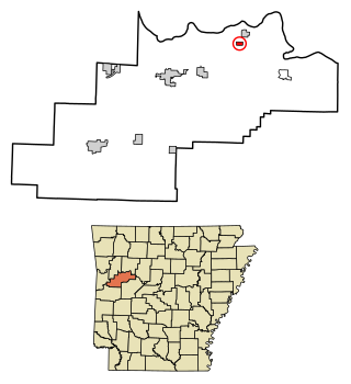
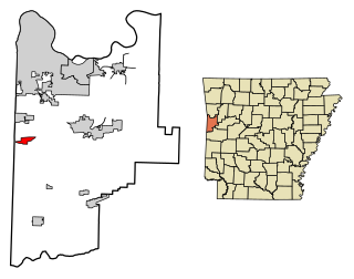
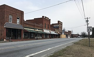
Branch is a city in Franklin County, Arkansas, United States. It is part of the Fort Smith, Arkansas-Oklahoma Metropolitan Statistical Area. The population was 367 at the 2010 census.

<span class="mw-page-title-main">Lamar, Arkansas</span> City in Arkansas, United States

Lamar is a city in Johnson County, Arkansas, United States. The population was 1,605 at the 2010 census, up from 1,415 at the 2000 census.

<span class="mw-page-title-main">Hoxie, Arkansas</span> City in Arkansas, United States

Hoxie is a city in Lawrence County, Arkansas, United States. It lies immediately south of Walnut Ridge. The population was 2,780 at the 2010 census.

<span class="mw-page-title-main">Scranton, Arkansas</span> City in Arkansas, United States

Scranton is a city in Logan County, Arkansas, United States. The population was 224 at the 2010 census. It was named after Scranton, Pennsylvania.

<span class="mw-page-title-main">Austin, Arkansas</span> City in Arkansas, United States

Austin is a city in Lonoke County, Arkansas, United States. The population was 2,038 as of the 2010 census and an estimated 3,693 as of 2018. It is part of the Little Rock–North Little Rock–Conway Metropolitan Statistical Area.

<span class="mw-page-title-main">Murfreesboro, Arkansas</span> City in Arkansas, United States

Murfreesboro is a city in, and the county seat of, Pike County, Arkansas, United States. Its population was 1,641 at the 2010 census. The Crater of Diamonds State Park is located approximately 1 miles southeast of the city.

<span class="mw-page-title-main">London, Arkansas</span> City in Arkansas, United States

London is a city in Pope County, Arkansas, United States. The population was 1,039 at the 2010 census. It is part of the Russellville Micropolitan Statistical Area.

<span class="mw-page-title-main">Maumelle, Arkansas</span> City in Arkansas, United States

Maumelle is a city in Pulaski County, Arkansas, United States. As of the 2020 census, the city's population was 19,251. The city is located northwest of Little Rock, bordering the opposite shore of the Arkansas River and is part of the Little Rock metropolitan area.

<span class="mw-page-title-main">Mansfield, Arkansas</span> City in Arkansas, United States

Mansfield is a city in Scott and Sebastian counties Arkansas, United States. The Sebastian County portion of the city is part of the Fort Smith, Arkansas-Oklahoma Metropolitan Statistical Area. As of the 2010 Census, the population was 1,139. The population was 1,097 at the 2000 census.

<span class="mw-page-title-main">Hackett, Arkansas</span> City in Arkansas, United States

Hackett is a city in Sebastian County, Arkansas, United States. It is part of the Fort Smith, Arkansas-Oklahoma Metropolitan Statistical Area. The population was 812 at the 2010 census.

<span class="mw-page-title-main">Calion, Arkansas</span> City in Arkansas, United States

Calion is a second-class city in Union County, Arkansas, United States. The population was 494 at the 2010 census.

<span class="mw-page-title-main">Wiederkehr Village, Arkansas</span> City in Arkansas, United States

Wiederkehr Village is a city in Franklin County, Arkansas, United States. It is part of the Fort Smith, Arkansas-Oklahoma Metropolitan Statistical Area. The population was 38 at the 2010 census. It is named after Swiss winemaker Johann Andreas Wiederkehr, who immigrated to the area in 1880.

Franklin Township is a rural township in Wright County, Minnesota, United States. The township population was 2,774 at the 2000 census.

<span class="mw-page-title-main">Charleston, Mississippi</span> City in Mississippi, United States

Charleston is a city in north central Mississippi and one of the two county seats of Tallahatchie County, which is located on both sides of the Tallahatchie River. This city is located east of the river and its population was 2,193 at the 2010 census.

<span class="mw-page-title-main">Stokesdale, North Carolina</span> Town in North Carolina, United States

Stokesdale is a town in Guilford County, North Carolina, United States with small parts in the counties of Rockingham, Forsyth, and Stokes. The population was 5,924 at the 2020 census. Belews Lake is located nearby, and North Carolina Highway 68 and North Carolina Highway 65 both intersect U.S. Route 158 near the town's center.

References

  1. "2020 U.S. Gazetteer Files". United States Census Bureau. Retrieved October 29, 2021.
  2. 1 2 U.S. Geological Survey Geographic Names Information System: Charleston, Arkansas
  3. "Find a County". National Association of Counties. Archived from the original on May 31, 2011. Retrieved June 7, 2011.
  4. 1 2 "Geographic Identifiers: 2010 Census Summary File 1 (G001): Charleston city, Arkansas (revised 05-17-2012)". American Factfinder. U.S. Census Bureau. Archived from the original on February 13, 2020. Retrieved April 19, 2016.
  5. History of Benton, Washington, Carroll, Madison, Crawford, Franklin, and Sebastian Counties, Arkansas. Higginson Book Company. 1889. p. 654.
  6. 1 2 "Desegregation of Charleston Schools". Encyclopedia of Arkansas. Retrieved January 4, 2018.
  7. Appleby, David. "Hoxie - The First Stand" . Retrieved January 4, 2018.
  8. Barclay, Leland (February 13, 2018). "Barclay: Charleston saw little integration resistance". Southwest Times Record. Retrieved September 13, 2020.[ permanent dead link ]
  9. "Census of Population and Housing". Census.gov. Retrieved June 4, 2015.
  10. "Annual Estimates of the Resident Population for Incorporated Places: April 1, 2010 to July 1, 2014". Archived from the original on May 22, 2015. Retrieved June 4, 2015.
  11. "Explore Census Data". data.census.gov. Retrieved January 1, 2022.
  12. "U.S. Census website". United States Census Bureau . Retrieved January 31, 2008.
  13. Boutwell, Christian (March 26, 2019). "Bull tough: Charleston rider rode into glory". Arkansas Democrat Gazette. Retrieved April 30, 2020.