Clay Junction, West Virginia

Last updated
Clay Junction, West Virginia
Unincorporated community
USA West Virginia location map.svg
Red pog.svg
Clay Junction
Location within the state of West Virginia
Usa edcp location map.svg
Red pog.svg
Clay Junction
Clay Junction (the US)
Coordinates: 38°28′29″N81°4′39″W / 38.47472°N 81.07750°W / 38.47472; -81.07750 Coordinates: 38°28′29″N81°4′39″W / 38.47472°N 81.07750°W / 38.47472; -81.07750
Country United States
State West Virginia
County Clay
Elevation 725 ft (221 m)
Time zone Eastern (EST) (UTC-5)
  Summer (DST) EDT (UTC-4)
GNIS ID 1554140 [1]

Clay Junction is an unincorporated community in Clay County, West Virginia, United States.

Unincorporated area Region of land not governed by own local government

In law, an unincorporated area is a region of land that is not governed by a local municipal corporation; similarly an unincorporated community is a settlement that is not governed by its own local municipal corporation, but rather is administered as part of larger administrative divisions, such as a township, parish, borough, county, city, canton, state, province or country. Occasionally, municipalities dissolve or disincorporate, which may happen if they become fiscally insolvent, and services become the responsibility of a higher administration. Widespread unincorporated communities and areas are a distinguishing feature of the United States and Canada. In most other countries of the world, there are either no unincorporated areas at all, or these are very rare; typically remote, outlying, sparsely populated or uninhabited areas.
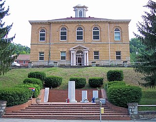
Clay County, West Virginia County in the United States

Clay County is a county in the U.S. state of West Virginia. As of the 2010 census, the population was 9,386. Its county seat is Clay. The county was founded in 1858 and named in honor of Henry Clay, famous American statesman, member of the United States Senate from Kentucky and United States Secretary of State in the 19th century.

West Virginia State of the United States of America

West Virginia is a state located in the Appalachian region in the Southern United States and is also considered to be a part of the Middle Atlantic States. It is bordered by Pennsylvania to the north, Maryland to the east and northeast, Virginia to the southeast, Kentucky to the southwest, and Ohio to the northwest. West Virginia is the 41st largest state by area, and is ranked 38th in population. The capital and largest city is Charleston.

Related Research Articles

Clay County, Minnesota County in the United States

Clay County is a county in the U.S. state of Minnesota. As of the 2010 United States Census, the population was 58,999. Its county seat is Moorhead.

Ashland may refer to:

Clay, West Virginia Town in West Virginia, United States

Clay is a town in and the county seat of Clay County, West Virginia, United States. The population was 491 at the 2010 census. It is the only incorporated town in Clay County.

Junction, West Virginia Unincorporated community in West Virginia, United States

Junction is an unincorporated community in Hampshire County in the U.S. state of West Virginia. Historically referred to as Moorefield Junction, Junction received its name because of its location at the crossroads of U.S. Route 220/West Virginia Route 28 and the Northwestern Turnpike. The community is located along Mill Creek.

Big Otter, West Virginia Unincorporated community in West Virginia, United States

Big Otter is an unincorporated community in Clay County, West Virginia, United States. Big Otter is located on Big Otter Creek at the junction of Interstate 79 and West Virginia Route 16. The community is 9.5 miles (15.3 km) north-northeast of Clay, the county seat of Clay County. Big Otter is part of ZIP code 25113. Its original post office with a zip code of 25020 closed in 1979.

Wallback, West Virginia Unincorporated community in West Virginia, United States

Wallback is an unincorporated community in Clay and Roane counties, West Virginia, United States. Wallback is located at the junction of Interstate 79 and West Virginia Route 36, 7.5 miles (12.1 km) north-northwest of Clay. Wallback has a post office with ZIP code 25285.

Nebo, Clay County, West Virginia Unincorporated community in West Virginia, United States

Nebo is an unincorporated community in Clay County, West Virginia, United States. Nebo is located on West Virginia Route 16, 12 miles (19 km) north-northeast of Clay, along the Stinson Creek near its source. Nebo no longer has a post office with ZIP code 25141.

Stonecoal Junction, West Virginia Unincorporated community in West Virginia, United States

Stonecoal Junction is an unincorporated community in Raleigh County, West Virginia, United States. Stonecoal Junction is located on County Route 33 at the confluence of Winding Gulf and Stonecoal Creek, 0.6 miles (0.97 km) southwest of Rhodell.

Tyler Mountain, West Virginia Unincorporated community in West Virginia, United States

Tyler Mountain is an unincorporated community in Kanawha County, West Virginia, United States. Tyler Mountain is located at the junction of West Virginia Route 62 and West Virginia Route 501 5.5 miles (8.9 km) west-northwest of Charleston.

Beckley Junction, West Virginia Unincorporated community in West Virginia, United States

Beckley Junction is an unincorporated community located in Raleigh County, West Virginia.

Terry Junction, West Virginia Unincorporated community in West Virginia, United States

Terry Junction is an unincorporated community in Raleigh County, West Virginia.

Laurel Junction, West Virginia Unincorporated community in West Virginia, United States

Laurel Junction was an unincorporated community in Wood County, West Virginia.

Elk Run Junction, West Virginia Unincorporated community in West Virginia, United States

Elk Run Junction is an unincorporated community in Boone County, West Virginia.

Rum Junction, West Virginia Unincorporated community in West Virginia, United States

Rum Junction is an unincorporated community in Logan County, West Virginia.

Trace Junction, West Virginia Unincorporated community in West Virginia, United States

Trace Junction is an unincorporated community in Logan County, West Virginia.

Rouzer, West Virginia Unincorporated community in West Virginia, United States

Rouzer is an unincorporated community in Clay County, West Virginia, United States. It was also known as Shelley Junction.

KM Junction, West Virginia Unincorporated community in West Virginia, United States

KM Junction is an unincorporated community in Fayette County, West Virginia.

Tidewater and Western Railroad building in Virginia, United States

The Farmville and Powhatan Railroad went bankrupt in 1905 and became the Tidewater and Western Railroad. The line survived until 1917 when it was pulled up and sent to France for the World War I effort. The Tidewater and Western Railroad carried freight and passengers along a route from Farmville, Virginia to Bermuda Hundred. The Tidewater and Western Railroad continued to have Western Union Telegraphs run along the rails. These connected to telegraphs on the Atlantic Coast Line along the East Coast of the U.S.A. and to Europe.

References