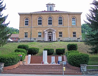
Clay County is a county in the U.S. state of West Virginia. As of the 2020 census, the population was 8,051. Its county seat is Clay. The county was founded in 1858 and named in honor of Henry Clay, famous American statesman, member of the United States Senate from Kentucky and United States Secretary of State in the 19th century.
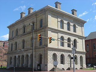
Ohio County is a county located in the Northern Panhandle of the U.S. state of West Virginia. As of the 2020 census, the population was 42,425. Its county seat is Wheeling. The county was formed in 1776 from the District of West Augusta, Virginia. It was named for the Ohio River, which forms its western boundary with the state of Ohio. West Liberty was designated as the county seat in 1777, serving to 1797.

Wirt County is a county in the U.S. state of West Virginia. As of the 2020 census, the population was 5,194, making it the least populous county in West Virginia. Its county seat is Elizabeth. The county was created in 1848 by the Virginia General Assembly and named for U.S. Attorney General and presidential candidate William Wirt. The county is served by one high school, Wirt County High School.

Wetzel County is a county in the U.S. state of West Virginia. As of the 2020 census, the population was 14,442. Its county seat is New Martinsville. The county, founded in 1846, is named for Lewis Wetzel, a famous frontiersman and Indian fighter. Its northern border aligns with the Mason-Dixon line, but is to the west of the line's western terminus.

Kanawha County is a county in the U.S. state of West Virginia. As of the 2020 census, the population was 180,745, making it West Virginia's most populous county. The county seat is Charleston, which is also the state capital. Kanawha County is part of the Charleston, WV Metropolitan Statistical Area.
Hancock County is a county in the U.S. state of West Virginia. As of the 2020 census, the population was 29,095. Its county seat is New Cumberland and its largest city is Weirton. The county was created from Brooke County in 1848 and named for John Hancock, first signer of the Declaration of Independence. Hancock County is the northernmost point in both West Virginia and, by some definitions, the Southern United States; being at the tip of the state's Northern Panhandle. Hancock County is part of the Weirton-Steubenville, WV-OH Metropolitan Statistical Area, which is also included in the Pittsburgh-New Castle-Weirton, PA-WV-OH Combined Statistical Area.

Clay is a town in and the county seat of Clay County, West Virginia, United States. The population was 399 at the 2020 census. It is the only incorporated town in Clay County.

James Barbour was an American politician, planter, and lawyer. He served as a delegate from Orange County, Virginia, in the Virginia General Assembly and as speaker of the Virginia House of Delegates. He was the 18th Governor of Virginia and the first Governor to reside in the current Virginia Governor's Mansion. After the War of 1812, Barbour became a U.S. Senator and the United States Secretary of War (1825–1828).

The 2000 United States House of Representatives elections were held on November 7, 2000, to elect U.S. Representatives to serve in the 107th United States Congress. They coincided with the election of George W. Bush as President of the United States. The Republican Party won 221 seats, while the Democratic Party won 212 and independents won two.

The Elk River is a tributary of the Kanawha River, 172 miles (277 km) long, in central West Virginia in the United States. Via the Kanawha and Ohio rivers, it is part of the watershed of the Mississippi River.

West Virginia's 3rd congressional district is an obsolete U.S. congressional district in southern West Virginia. At various times the district covered different parts of the state, but in its final form included the state's second-largest city, Huntington; included Bluefield, Princeton, and Beckley; and has a long history of coal mining, forestry, and farming.

Shepherd Hall, also known as Monument Place and formerly as Stone Mansion, is a historic house listed on the National Register of Historic Places in the city of Wheeling in the U.S. state of West Virginia. It is located in the Elm Grove area of Wheeling, Ohio County, West Virginia.

Matthew Clay was a Virginia lawyer, planter, Continental Army officer and politician who served in the United States House of Representatives and the Virginia House of Delegates representing Pittsylvania County.

The Pennsylvanian Pottsville Formation is a mapped bedrock unit in Pennsylvania, western Maryland, West Virginia, Ohio, and Alabama. It is a major ridge-former in the Ridge-and-Valley Appalachians of the eastern United States. The Pottsville Formation is conspicuous at many sites along the Allegheny Front, the eastern escarpment of the Allegheny or Appalachian Plateau.
The West Virginia Circuit Courts are the West Virginia state trial courts of general jurisdiction. They are the only state trial courts in West Virginia that are courts of record. West Virginia's 55 counties are divided into 31 circuits, each comprising anywhere from one to four counties. Different circuits have different numbers of judges; 11 circuits have only a single judge. Effective with the 2024 election, the circuits will be realigned into 30 circuits, with only one having a single judge.

This is a list of the National Register of Historic Places listings in Clay County, West Virginia.

The 2016 United States House of Representatives elections in West Virginia were held on November 8, 2016, to elect the three U.S. representatives from the state of West Virginia, one from each of the state's three congressional districts. The elections coincided with the 2016 U.S. presidential election, as well as other elections to the House of Representatives, elections to the United States Senate and various state and local elections.

Grant District, formerly Grant Magisterial District, is one of five historic magisterial districts in Jackson County, West Virginia, United States. The district was originally established as a civil township in 1863, and converted into a magisterial district in 1872. When Jackson County was redistricted in the 1990s, the area of Grant District was included in the new Northern Magisterial District. However, the county's historic magisterial districts continue to exist in the form of tax districts, serving all of their former administrative functions except for the election of county officials.

Ravenswood District, formerly Ravenswood Magisterial District, is one of five historic magisterial districts in Jackson County, West Virginia, United States. The district was originally known as Gilmore Township, one of five civil townships established in 1863; the name officially became "Ravenswood" in 1871, and Jackson County's townships were converted into magisterial districts in 1872. When Jackson County was redistricted in the 1990s, the area of Ravenswood District was divided between the new Northern and Western Magisterial Districts. However, the county's historic magisterial districts continue to exist in the form of tax districts, serving all of their former administrative functions except for the election of county officials.

The Northern Magisterial District is one of three magisterial districts in Jackson County, West Virginia, United States. It was established during a process of redistricting undertaken in the 1990s. In 2010, 8,753 people lived in the district.


