Collamer, Indiana

Last updated

Collamer, Indiana
Eel River Collamer Dam 1998.jpg
Collamer Dam, over the Eel River
Location map of Whitley County, Indiana.svg
Red pog.svg
Collamer
Located in the state of Indiana
Coordinates: 41°04′33″N85°39′53″W / 41.07583°N 85.66472°W / 41.07583; -85.66472
Country United States
State Indiana
County Whitley
Township Cleveland
PlattedFebruary 9, 1846
Elevation
[1]
797 ft (243 m)
Time zone UTC-5 (Eastern (EST))
  Summer (DST) UTC-4 (EDT)
Area code 260
FIPS code 18-14320 [2]
GNIS feature ID 432761

Collamer is an unincorporated community in Cleveland Township, Whitley County, Indiana, United States, [3] located on the Eel River and at the intersection of Indiana State Road 14 and Whitley County road 900 W. Smith Rambo platted the town February 9, 1846. Collamer is named after Jacob Collamer, 13th United States Postmaster General.

Contents

Geography

Collamer is located at 41°04′33″N85°39′53″W / 41.07583°N 85.66472°W / 41.07583; -85.66472 (41.0758,-85.6647). [4]

Demographics

Because the town is unincorporated, no exact information is available from the United States Census Bureau. In the 1895 U.S. Atlas Indiana, Collamer had a population of 163. [5]

History

On October 23, 1826 in what is now Wabash, Indiana Potawatomi and Miami Indians signed a peace treaty with the United States government to open lands north of the Wabash River to white settlers. These negotiations, led by Michigan Governor Lewis Cass, resulted in the Paradise Springs Peace Treaty. The Potowatomi before that point were located on the Eel River, which they called the Kenapocomoco (KE-NA-PE-COM-A-QUA), in a series of villages named Pierrish’s Village, located at present day North Manchester, southwest of Collamer. The Miami, led by Chief Little Turtle before that point had their villages located on the Eel River between South Whitley and Columbia City, northeast of Collamer.

Settlement of Collamer began in 1845, which was originally called Millersburg, after the town's first merchant Elias Miller. [6] The location was selected because of the convenient location to the Wabash and Erie Railroad and the Eel River. When the town wished to established a post office, they discovered that the post office name Millersburg, Indiana had been taken. After some frustration and consideration, on September 18, 1849 they choose the name Collamer, after President Zachary Taylor's Postmaster General Jacob Collamer. [7]

Built along the north side of the Eel River, the community by 1880 had a "gristmill, a sawmill, two general stores, a drug store, a boot and shoe store, a grade school, a Christian Church, a physician and a post office." [8] In the early 1870s the Detroit, Eel River & Illinois Railroad was built alongside the east side of Collamer and began operations in 1872.

The rail line was abandoned between 1954 and 1977. [9] Today only the Christian Church, the Collamer Church of God, and the pillars of the railroad bridge remain.

A post office was established at Collamer in 1849, and remained in operation until it was discontinued in 1922. [10]

Grist Mill

A structure similar in stature to the Stockdale Mill near Roann, Indiana, the four-story Collamer Grist Mill was built in 1845 by (Elias) Miller and Harder the summer before the official platting of the town. The mill first ground corn, then wheat and other small grains. "The Eel River provided a remarkable constant supply for the water-powered millstones. Early writers tell of the Eel as one of the best power streams around." [11] Improvements were made to the mill in the late 1800s, with the removal of original millstones for a roller mill. Henry Hauptmeyer installed an electric generator to the mill and some years between 1918 and 1934 the mill and dam powered Collamer and neighboring community Sidney. [12] After overloading problems and a washout of the mill race, the mill stopped operation. On May 19, 1934, the mill collapsed. [12]

Dam

Collamer's best known landmark was the Collamer Dam. The first dam was built in 1845 out of "wooden timbers with the chinks closed with packings of small sticks and straw," originally constructed to provide power for a gristmill. [13] In 1904 the dam that stood until January 2020 was built by O. Grant Gandy and Company, and was used to power Collamer and Sidney for a time.

Due in part to damage sustained in October 2019, [14] as well as ongoing safety concerns, including the death of a kayaker in 2017, [15] removal of the Collamer Dam began on January 8, 2020. [16] Demolition was completed the next day. [17]

Related Research Articles

<span class="mw-page-title-main">Whitley County, Indiana</span> County in Indiana, United States

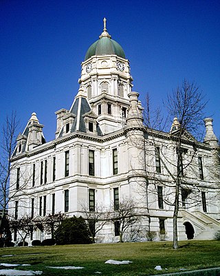
Whitley County is a rural county in the U.S. state of Indiana. As of the 2020 United States census, the population was 34,191. Whitley County is the 49th largest county in Indiana. The county seat is Columbia City. The county has the highest county number (92) on Indiana license plates, as it is alphabetically the last in the state's list of counties. It is part of the Fort Wayne Metropolitan Statistical Area and the Fort Wayne–Huntington–Auburn Combined Statistical Area.

<span class="mw-page-title-main">Wabash County, Indiana</span> County in Indiana, United States

Wabash County is a county located in the northern central part of the U.S. state of Indiana. As of 2020, the population was 30,976. The county seat is Wabash.

<span class="mw-page-title-main">Wabash River</span> Tributary of the Ohio River in the United States

The Wabash River is a 503-mile-long (810 km) river that drains most of the state of Indiana in the United States. It flows from the headwaters in Ohio, near the Indiana border, then southwest across northern Indiana turning south near the Illinois border, where the southern portion forms the Indiana-Illinois border before flowing into the Ohio River.

<span class="mw-page-title-main">Wabash and Erie Canal</span> Disused canal in Indiana

The Wabash and Erie Canal was a shipping canal that linked the Great Lakes to the Ohio River via an artificial waterway. The canal provided traders with access from the Great Lakes all the way to the Gulf of Mexico. Over 460 miles long, it was the longest canal ever built in North America.

<span class="mw-page-title-main">Indiana State Road 13</span>

State Road 13 (SR 13) is a north–south state road in the US state of Indiana. The southern terminus is at an intersection with U.S. Highway 36 and SR 67, in the town of Fortville, and its northern terminus is at the Michigan state line. At its northern end, signage for SR 13 ends at the interchange with the Indiana Toll Road; the highway continues unsigned for an additional 0.6 miles (0.97 km) running concurrently with US 131 to the state line. The state road runs through six counties in central and north-central Indiana mostly through rural farm fields and small towns.

<span class="mw-page-title-main">Eel River (Wabash River tributary)</span> River in Indiana, United States

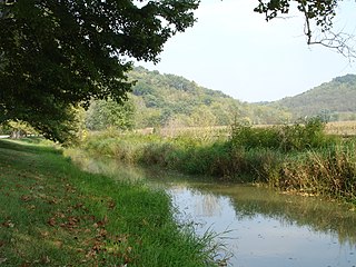
The Eel River is a 94-mile-long (151 km) tributary of the Wabash River in northern Indiana in the United States. Via the Wabash and Ohio rivers, its waters flow to the Mississippi River and ultimately the Gulf of Mexico. The Eel River rises southeast of Huntertown in Allen County and flows southwest through Allen, Whitley, Kosciusko, Wabash, Miami, and Cass counties to join the Wabash at Logansport. The river was called Kineepikwameekwa Siipiiwi - "river of the snake fish" by the Miami people, who inhabited the area at the time of European contact, the English rendered it as Ke-na-po-co-mo-co. It is the northern of the two rivers named Eel River within Indiana.

<span class="mw-page-title-main">Fort Wayne metropolitan area, Indiana</span> Combined statistical area in Indiana, United States

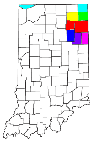
As of March 2020, the Fort Wayne–Huntington–Auburn Combined Statistical Area (CSA), or Fort Wayne Metropolitan Area, or Northeast Indiana is a federally designated metropolitan area consisting of eight counties in northeast Indiana, anchored by the city of Fort Wayne.

<span class="mw-page-title-main">Watson's Mill</span>

Watson's Mill is an historic flour and gristmill in Manotick, Ontario, Canada. It is the only working museum in the Ottawa area and one of the very few operating industrial grist mills in North America. Watson's Mill still sells stone-ground whole wheat flour which is made on site. The mill is also well known for its ghost Annabelle. The legend is that Ann Currier, wife of Joseph, haunts the mill, following her death in a tragic accident there in 1861. Watson's Mill is Manotick's most recognized landmark. Its image is used as a symbol for the village.

<span class="mw-page-title-main">Whitewater Canal</span> United States historic place

The Whitewater Canal, which was built between 1836 and 1847, spanned a distance of 76 miles (122 km) and stretched from Lawrenceburg, Indiana on the Ohio River to Hagerstown, Indiana near the West Fork of the White River.

<span class="mw-page-title-main">Butler Branch (Indiana)</span>

The Butler Branch is a historic railroad line that operated in Indiana, USA. It ran between the city of Logansport on the Wabash River in north central Indiana and the namesake town of Butler near the Ohio border in northeastern Indiana.

<span class="mw-page-title-main">Metamora, Indiana</span> Census-designated place in Indiana, United States

Metamora is an unincorporated town and census-designated place in Metamora Township, Franklin County, Indiana. The town was once a stop along the Whitewater Canal and is now primarily dependent on tourism. As of the 2010 census, it had a population of 188.

<span class="mw-page-title-main">Liberty Mills, Indiana</span> Unincorporated community in Indiana, United States

Liberty Mills is an unincorporated community on the Eel River in Chester Township, Wabash County, in the U.S. state of Indiana. Proprietor John Comstock (1802–1879) platted the town June 24, 1837. The name Liberty Mills comes from the number of mills the town once operated, including a saw mill, a carding mill, and a distillery, with one of the mills coming from the ‘Liberty’ brand. Its ZIP code is 46946.

<span class="mw-page-title-main">Tuthilltown Gristmill</span> United States historic place

The Tuthilltown Gristmill is located off Albany Post Road in Gardiner, New York, United States. It was built in 1788, as the National Register reports, and has been expanded several times since.

<span class="mw-page-title-main">Chester Township, Wabash County, Indiana</span> Township in Indiana, United States

Chester Township is one of seven townships in Wabash County, Indiana, United States. As of the 2010 census, its population was 8,009 and it contained 3,215 housing units.

<span class="mw-page-title-main">Cleveland Township, Whitley County, Indiana</span> Township in Indiana, United States

Cleveland Township is one of nine townships in Whitley County, Indiana, United States. As of the 2010 census, its population was 3,398 and it contained 1,441 housing units.

<span class="mw-page-title-main">Collins, Indiana</span> Unincorporated community in Indiana, United States

Collins is an unincorporated community in Smith Township, Whitley County, in the U.S. state of Indiana. It is commonly referred to as a 'ghost town', however this is untrue; Collins just has a very low population and once contained an abandoned school, a General Store, and a Mint mill that processed locally grown peppermint. Collins was also a major grower of Onions, and the Vandalia Railroad shipped tons of onions to national markets.

<span class="mw-page-title-main">Stockdale, Indiana</span> Unincorporated community in Indiana, United States

Stockdale is an unincorporated community in Paw Paw Township, Wabash County and Miami County, in the U.S. state of Indiana.

<span class="mw-page-title-main">Stockdale Mill</span> United States historic place

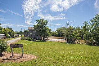
Stockdale Mill, also known as the Roann Roller Mill, is a historic grist mill building located in Paw Paw Township, Wabash County, Indiana. It was built between 1855 and 1857, and is a 3+12-story, post and beam frame mill building. The mill is powered by a 202 foot long dam that spans the Eel River. Also on the property are the contributing storage building and corn crib. The mill remained in operation until 1964 and was restored in 2002.

Snoddy's Mill was a historic grist mill located at Wabash Township, Fountain County, Indiana.

References

  1. "US Board on Geographic Names". United States Geological Survey. October 25, 2007. Retrieved July 5, 2016.
  2. "U.S. Census website". United States Census Bureau . Retrieved January 31, 2008.
  3. "Collamer, Indiana". Geographic Names Information System . United States Geological Survey, United States Department of the Interior . Retrieved July 5, 2016.
  4. "US Gazetteer files: 2010, 2000, and 1990". United States Census Bureau. February 12, 2011. Retrieved April 23, 2011.
  5. 1895 U.S. Atlas
  6. "Collamer, " Bulletin of the Whitley County Historical Society, (June 1964) 3.
  7. "Collamer Mill," Bulletin of the Whitley County Historical Society, (June 1964) 4.
  8. "North Manchester's Neighbors - Towns of This Area," Newsletter of the North Manchester Historical Society, (August 1994) Archived 2007-07-31 at the Wayback Machine
  9. Elmer Griffith Sulzer, Ghost Railroads of Indiana. Bloomington: Indiana University Press, 1998. 152-53.
  10. "Whitley County". Jim Forte Postal History. Retrieved July 5, 2016.
  11. "Collamer Mill," Bulletin of the Whitley County Historical Society, (February 1964) 4.
  12. 1 2 "Collamer Mill," Bulletin of the Whitley County Historical Society, (June 1964) 5.
  13. "Eel Important to Eel," Bulletin of the Whitley County Historical Society, (February 1968) 8.
  14. "Dam At Collamer Giving Way". timesuniononline.com. Retrieved January 8, 2020.
  15. Hatch, Caleb (June 26, 2017). "UPDATE: Kayaker dies after accident in Eel River". WOWO 1190 AM | 107.5 FM. Retrieved January 8, 2020.
  16. "Work begins to remove Whitley dam | Local | Journal Gazette". www.journalgazette.net. Retrieved January 8, 2020.
  17. "Indiana dam demolished that was site of 2017 kayaking death". The Republic. Associated Press. Retrieved January 15, 2020.

Notes