The Sabine River is a 360-mile (580 km) long river in the Southern U.S. states of Texas and Louisiana, From the 32nd parallel north and downstream, it serves as part of the boundary between the two states and empties into Sabine Lake, an estuary of the Gulf of Mexico.

Orange County is a county located in the very southeastern corner of the U.S. state of Texas, sharing a boundary with Louisiana, within the Golden Triangle of Texas. As of the 2020 census, its population was 84,808. The county seat is the city of Orange, and it falls within the Beaumont–Port Arthur metropolitan area.

Newton County is the easternmost county in the U.S. state of Texas. As of the 2020 census, its population was 12,217. Its county seat is Newton. The county is named for John Newton, a veteran of the American Revolutionary War.

Sabine Parish is a parish located in the U.S. state of Louisiana. As of the 2020 census, the population was 22,155. The seat of the parish is Many.

Cameron Parish is a parish in the southwest corner of the U.S. state of Louisiana. As of the 2020 census, the population was 5,617. The parish seat is Cameron. Although it is the largest parish by area in Louisiana, it has the second-smallest population in the state, ahead of only Tensas. Cameron Parish is part of the Lake Charles metropolitan statistical area.

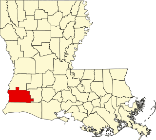
Calcasieu Parish is a parish located on the southwestern border of the U.S. state of Louisiana. As of the 2020 census, the population was 216,785. The parish seat is Lake Charles.

Beauregard Parish is a parish located in the U.S. state of Louisiana. As of the 2020 census, the population was 36,549. The parish seat is DeRidder. The parish was formed on January 1, 1913.
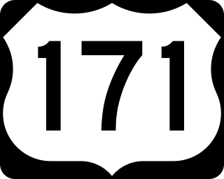
U.S. Highway 171 (US 171) is a part of the United States Numbered Highway System and the only route within that system currently located entirely within the state of Louisiana. It spans 177.44 miles (285.56 km) in a north–south direction from the junction of US 90 and Louisiana Highway 14 (LA 14) in Lake Charles to the junction of US 79/US 80 and LA 3094 in Shreveport.

The Sabine Pass Lighthouse, or Sabine Pass Light as it was referred to by the United States Coast Guard, is a historic lighthouse, as part of a gulf coast light station, on the Louisiana side of the Sabine River, in Cameron Parish, across from the community of Sabine Pass, Texas. It was first lit in 1857 and was deactivated by the Coast Guard in 1952. One of only three built in the United States of similar design, the light was listed on the National Register of Historic Places as "Sabine Pass Lighthouse" on December 17, 1981. It is now abandoned but has long continued to be the subject of preservation efforts.

The National Register of Historic Places in the United States is a register including buildings, sites, structures, districts, and objects. The Register automatically includes all National Historic Landmarks as well as all historic areas administered by the U.S. National Park Service. Since its introduction in 1966, more than 90,000 separate listings have been added to the register.

U.S. Highway 90 (US 90), one of the major east–west U.S. Highways in the Southern United States, runs through southern Louisiana for 297.6 miles (478.9 km), serving Lake Charles, Lafayette, New Iberia, Morgan City, and New Orleans. Much of it west of Lafayette and east of New Orleans has been supplanted by Interstate 10 (I-10) for all but local traffic, but the section between Lafayette and New Orleans runs a good deal south of I-10.

Louisiana Highway 82 (LA 82) is a state highway located in southern Louisiana. It runs 142.87 miles (229.93 km) in a general east–west direction from the Texas state line east of Port Arthur to the Vermilion–Lafayette parish line southwest of Youngsville.

Louisiana Highway 6 (LA 6) is a state highway located in western central Louisiana. It runs 54.52 miles (87.74 km) in an east–west direction from the Texas state line southwest of Many to U.S. Highway 71 (US 71) and U.S. Highway 84 (US 84) in Clarence.
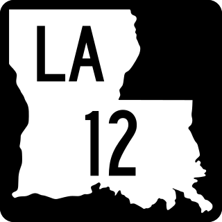
Louisiana Highway 12 (LA 12) is a state highway located in southwestern Louisiana. It runs 34.64 miles (55.75 km) in an east–west direction from the Texas state line west of Starks to a junction with U.S. Highway 171 (US 171) and U.S. Highway 190 (US 190) in Ragley.

Louisiana Highway 109 is a state highway located in southwestern Louisiana that runs 40.0 miles (64.4 km) in a north–south direction from U.S. Highway 90 and LA 3112 southwest of Vinton to LA 27 at Juanita, a point north of DeQuincy. A largely rural route, LA 109 parallels the Texas–Louisiana border and passes through the community of Starks in Calcasieu Parish where it intersects LA 12. The southern terminus of LA 109 is located just north of I-10 between Orange, Texas and Vinton, Louisiana.

Fort Jesup, also known as Fort Jesup State Historic Site or Fort Jesup or Fort Jesup State Monument, was built in 1822, 22 miles (35 km) west of Natchitoches, Louisiana, to protect the United States border with New Spain and to return order to the Neutral Strip. Originally named Cantonment Jesup, the fort operated from 1822 until 1846. After the abandonment of the fort in 1846, the United States federal government continued to own the abandoned fort site until the privatization of the site in 1869.
The Church of the Good Shepherd is an historic Episcopal church building located at 715 Kirkman Street in Lake Charles, Calcasieu Parish, Louisiana, United States. Designed by noted Dallas architect C.W. Bulger in the Gothic Revival style of architecture, it was built of stone in 1896.

The Highway 78 Bridge at the Red River is an eight-span through truss bridge over the Red River between Oklahoma and Texas on Oklahoma State Highway 78/Texas State Highway 78. It was built as a federal relief project during the Great Depression as part of President Franklin Roosevelt's New Deal. Today the bridge and the area retain the look and feel of the time of its construction. As part of Highway 78 the bridge's average daily traffic was 1,700 cars per day.
This is a list of the National Register of Historic Places listings in Calcasieu Parish, Louisiana.

Burr's Ferry Bridge is a bridge on the Sabine River, where Louisiana State Highway 8 meets Texas State Highway 63 at the Louisiana/Texas state border between Burkeville, Texas, and Burr Ferry, Louisiana.