Related Research Articles

Meade County is a county located in the U.S. state of Kentucky. As of the 2020 census, the population was 30,003. Its county seat is Brandenburg. The county was founded December 17, 1823, and named for Captain James M. Meade, who was killed in action at the Battle of River Raisin during the War of 1812. Meade County is part of the Elizabethtown-Fort Knox, KY Metropolitan Statistical Area, which is included in the Louisville/Jefferson County-Elizabethtown-Madison, KY-IN Combined Statistical Area.

Harrison Township is one of thirteen townships in Owen County, Indiana, United States. As of the 2010 census, its population was 444 and it contained 208 housing units.
Pilot Knob is an unincorporated community in Jennings Township, Crawford County, Indiana.
Temple is an unincorporated community in Sterling Township, Crawford County, Indiana, United States.
Bradford is an unincorporated community in Morgan Township, Harrison County, Indiana.

Byrneville is an unincorporated community in Jackson Township, Harrison County, Indiana.
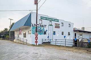
Central Barren is an unincorporated community in Morgan Township, Harrison County, Indiana.
Frenchtown is an unincorporated community in Spencer Township, Harrison County, Indiana.
Mott Station is an unincorporated community in Jackson Township, Harrison County, Indiana.
Ramsey is an unincorporated community in Jackson Township, Harrison County, in the U.S. state of Indiana.

Valley City is an unincorporated community in Washington Township, Harrison County, Indiana.
White Cloud is an unincorporated community in Harrison Township, Harrison County, Indiana.
Moberly is an unincorporated community in Spencer Township, Harrison County, Indiana, in the United States.
Fredonia is an unincorporated community in Crawford County, Indiana, United States.
Breckenridge is an unincorporated community in Harrison County, Indiana, in the United States.
Titus is an unincorporated community in Harrison County, Indiana, in the United States.
Corydon Junction is an unincorporated community in Harrison County, Indiana, in the United States.
Hancock Chapel is an unincorporated community in Harrison County, Indiana, in the United States.
Wynnsboro is a ghost town in Harrison County, Indiana, in the United States.
Lewisville is an unincorporated community in the northeast corner of Harrison Township, Owen County, in the U.S. state of Indiana. It lies near the intersection of County Road 700 East and West Lewisville Road, which is a community about twenty miles northeast of the city of Spencer, the county seat. Its elevation is 771 feet, and it is located at 39°28′16″N86°37′55″W. This community lies on the border of Owen County and Morgan County.
References
- ↑ U.S. Geological Survey Geographic Names Information System: Dixie, Indiana
- ↑ "Harrison County". Jim Forte Postal History. Archived from the original on 24 September 2014. Retrieved 17 September 2014.
Municipalities and communities of Harrison County, Indiana, United States | ||
|---|---|---|
| Towns |  | |
| Townships | ||
| CDP | ||
| Other unincorporated communities |
| |
| Ghost town | ||
| Footnotes | ‡This populated place also has portions in an adjacent county or counties | |
Coordinates: 38°09′36″N86°12′44″W / 38.16007°N 86.21220°W
| | This Harrison County, Indiana location article is a stub. You can help Wikipedia by expanding it. |