Dixie, Washington

Last updated

Dixie, Washington
CDP
Walla Walla County Washington Incorporated and Unincorporated areas Dixie Highlighted.svg
Location of Dixie, Washington
Coordinates: 46°8′27″N118°9′14″W / 46.14083°N 118.15389°W / 46.14083; -118.15389
CountryUnited States
State Washington
County Walla Walla
Area
  Total0.5 sq mi (1.3 km2)
  Land0.5 sq mi (1.3 km2)
  Water0.0 sq mi (0.0 km2)
Elevation
1,539 ft (469 m)
Population
 (2010)
  Total197
  Density428.2/sq mi (165.3/km2)
Time zone UTC-8 (Pacific (PST))
  Summer (DST) UTC-7 (PDT)
ZIP code
99329
Area code 509
FIPS code 53-18055 [1]
GNIS feature ID1504488 [2]

Dixie is a census-designated place (CDP) in Walla Walla County, Washington, United States. The population was 197 at the 2010 census.

Contents

A post office called Dixie has been in operation since 1881. The community has one elementary school, which is administered by the Dixie School District, and feeds older students into Pioneer Middle School and Walla Walla High School [3] in Walla Walla Public Schools.

Dixie derives its name from the eponymous song. [4]

Geography

Dixie is located at 46°8′27″N118°9′14″W / 46.14083°N 118.15389°W / 46.14083; -118.15389 (46.140782, -118.153897). [5]

According to the United States Census Bureau, the CDP has a total area of 0.5 square miles (1.3 km2), all of it land.

Demographics

As of the census [1] of 2000, there were 220 people, 84 households, and 63 families residing in the CDP. The population density was 428.2 people per square mile (166.6/km2). There were 87 housing units at an average density of 169.3/sq mi (65.9/km2). The racial makeup of the CDP was 90.45% White, 3.64% Native American, 4.55% from other races, and 1.36% from two or more races. Hispanic or Latino of any race were 5.91% of the population.

There were 84 households, out of which 26.2% had children under the age of 18 living with them, 67.9% were married couples living together, 4.8% had a female householder with no husband present, and 25.0% were non-families. 20.2% of all households were made up of individuals, and 6.0% had someone living alone who was 65 years of age or older. The average household size was 2.62 and the average family size was 3.00.

In the CDP, the age distribution of the population shows 22.7% under the age of 18, 6.8% from 18 to 24, 25.5% from 25 to 44, 31.4% from 45 to 64, and 13.6% who were 65 years of age or older. The median age was 42 years. For every 100 females, there were 107.5 males. For every 100 females age 18 and over, there were 104.8 males.

The median income for a household in the CDP was $33,125, and the median income for a family was $40,714. Males had a median income of $29,583 versus $19,000 for females. The per capita income for the CDP was $24,650. About 7.1% of families and 9.9% of the population were below the poverty line, including 28.6% of those under the age of eighteen and none of those 65 or over.

Related Research Articles

<span class="mw-page-title-main">Walla Walla County, Washington</span> County in Washington, United States

Walla Walla County is a county located in the U.S. state of Washington. As of the 2020 census, its population was 62,584. The county seat and largest city is Walla Walla. The county was formed on April 25, 1854 and is named after the Walla Walla tribe of Native Americans.

<span class="mw-page-title-main">Tortolita, Arizona</span> Former CDP in Arizona, United States

Tortolita was a census-designated place (CDP) in Pima County, Arizona, United States. The population was 3,740 at the 2000 census. Tortolita was situated between the growing incorporated towns of Oro Valley and Marana with most of the area previously part of the CDP having been annexed by the two towns during the 2000s. The remaining parts of the CDP that have not been annexed continue to be unincorporated portions of Pima County.

<span class="mw-page-title-main">Valencia West, Arizona</span> CDP in Pima County, Arizona

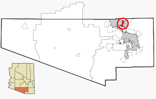
Valencia West is a census-designated place (CDP) in Pima County, Arizona, United States. The population was 9,355 at the 2010 census, a 293% increase over the population of 2,380 in 2000.

<span class="mw-page-title-main">South San Gabriel, California</span> Census-designated place in California, United States

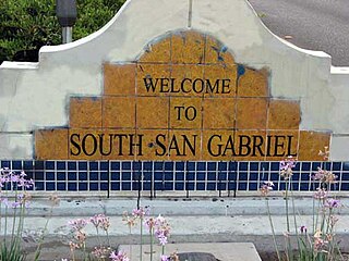
South San Gabriel is a census-designated place (CDP) in Los Angeles County, California, United States. The population was 8,070 at the 2010 census, up from 7,595 at the 2000 census.

<span class="mw-page-title-main">Phelps, Kentucky</span> CDP in Kentucky, United States

Phelps is a census-designated place (CDP) in Pike County, Kentucky, United States. The population was 1,053 at the 2000 census. It is the easternmost census-designated community in Kentucky.

<span class="mw-page-title-main">Toston, Montana</span> Census-designated place in Montana, United States

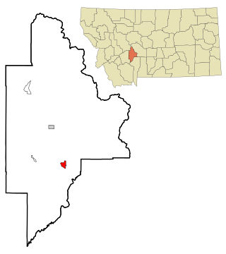
Toston is a census-designated place (CDP) in Broadwater County, Montana, United States. The population was 108 at the 2010 census.

<span class="mw-page-title-main">Custer, Montana</span> Village in Montana, United States

Custer is a village in Yellowstone County, Montana, United States. The population was 145 at the 2000 census.

<span class="mw-page-title-main">Lake Wynonah, Pennsylvania</span> CDP in Pennsylvania, United States

Lake Wynonah is a census-designated place (CDP) in Schuylkill County, Pennsylvania, United States. The population was 1,961 at the 2000 census, and 2,640 at the 2010 census. Lake Wynonah is a gated community with two lakes, Fawn Lake and Lake Wynonah, and as of July 2008, there are over 1200 homes and 1500 members. It is in South Manheim and Wayne Townships.

East Cleveland is a census-designated place (CDP) and community in Bradley County, Tennessee, United States. It is located directly east of the city limits of Cleveland, and is also considered one of the major divisions of the city. The population was 1,725 at the 2020 census. It is included in the Cleveland Metropolitan Statistical Area.

<span class="mw-page-title-main">Cantu Addition, Texas</span> Census-designated place in Texas, United States

Cantu Addition is a census-designated place (CDP) in Brooks County, Texas, United States. Its population was 188 at the 2010 census.

<span class="mw-page-title-main">Grand Acres, Texas</span> Census-designated place in Texas, United States

Grand Acres is a census-designated place (CDP) in Cameron County, Texas, United States. The population was 49 at the 2010 census. It is part of the Brownsville–Harlingen Metropolitan Statistical Area.

<span class="mw-page-title-main">Rancho Banquete, Texas</span> CDP in Texas, United States

Rancho Banquete is a census-designated place (CDP) in Nueces County, Texas, United States. The population was 424 at the 2010 census, down from 469 at the 2000 census.

<span class="mw-page-title-main">Burbank, Washington</span> CDP in Washington, United States

Burbank is a census-designated place (CDP) in Walla Walla County, Washington, United States, where the Snake River meets the Columbia. The population was 3,291 at the 2010 census. Named for Luther Burbank, the city is located just east of Pasco and Kennewick, across the Snake and Columbia Rivers, respectively. Burbank is part of the Tri-Cities, WA urban area, despite being located in the Walla Walla metropolitan area.

<span class="mw-page-title-main">College Place, Washington</span> City in Washington, United States

College Place is a city in Walla Walla County, Washington, United States. It neighbors the larger city of Walla Walla, and had a population of 9,902 at the 2020 census.

<span class="mw-page-title-main">Garrett, Washington</span> CDP in Washington, United States

Garrett is a census-designated place (CDP) in Walla Walla County, Washington, United States. The population was 1,419 at the 2010 census.

<span class="mw-page-title-main">Prescott, Washington</span> City in Washington, United States

Prescott is a city in central Walla Walla County, Washington. The population was 318 at the 2010 census.

<span class="mw-page-title-main">Touchet, Washington</span> CDP in Washington, United States

Touchet is a census-designated place (CDP) in Walla Walla County, Washington, United States. The population was 421 at the 2010 census.

<span class="mw-page-title-main">Walla Walla East, Washington</span> CDP in Washington, United States

Walla Walla East is a census-designated place (CDP) in Walla Walla County, Washington, United States. The population was 1,672 at the 2010 census.

<span class="mw-page-title-main">Wallula, Washington</span> CDP in Washington, United States

Wallula is a census-designated place (CDP) in Walla Walla County, Washington, United States. The population was 179 at the 2010 census.

<span class="mw-page-title-main">Turnerville, Wyoming</span> Census-designated place in Wyoming, United States

Turnerville is a census-designated place (CDP) in Lincoln County, Wyoming, United States. The population was 192 at the 2010 census.

References

  1. 1 2 "U.S. Census website". United States Census Bureau . Retrieved January 31, 2008.
  2. "US Board on Geographic Names". United States Geological Survey. October 25, 2007. Retrieved January 31, 2008.
  3. "Post Offices". Jim Forte Postal History. Archived from the original on March 6, 2016. Retrieved July 29, 2016.
  4. Meany, Edmond S. (1923). Origin of Washington geographic names. Seattle: University of Washington Press. p. 70.
  5. "US Gazetteer files: 2010, 2000, and 1990". United States Census Bureau. February 12, 2011. Retrieved April 23, 2011.