Prescott, Washington

Last updated
Prescott
Prescott, Washington.jpg
Main intersection in Prescott
Walla Walla County Washington Incorporated and Unincorporated areas Prescott Highlighted.svg
Location of Prescott, Washington
Coordinates: 46°17′56″N118°18′52″W / 46.29889°N 118.31444°W / 46.29889; -118.31444 Coordinates: 46°17′56″N118°18′52″W / 46.29889°N 118.31444°W / 46.29889; -118.31444
Country United States
State Washington
County Walla Walla
Government
  MayorSteven Heimbigner
Area
[1]
  Total0.40 sq mi (1.03 km2)
  Land0.40 sq mi (1.03 km2)
  Water0.00 sq mi (0.00 km2)
Elevation
1,056 ft (322 m)
Population
 (2010) [2]
  Total318
  Estimate 
(2019) [3]
305
  Density764.41/sq mi (295.06/km2)
Time zone UTC-8 (Pacific (PST))
  Summer (DST) UTC-7 (PDT)
ZIP code
99348
Area code 509
FIPS code 53-56240
GNIS feature ID1507623 [4]
Website www.prescottwa.com

Prescott is a city in central Walla Walla County, Washington. The population was 318 at the 2010 census.

Contents

History

A post office called Prescott has been in operation since 1881. [5] The city was named after C.H. Prescott, a railroad official. [6]

Prescott was officially incorporated on March 13, 1903.

Geography

Prescott is located at 46°17′56″N118°18′52″W / 46.29889°N 118.31444°W / 46.29889; -118.31444 (46.298872, -118.314408). [7]

According to the United States Census Bureau, the city has a total area of 0.40 square miles (1.04 km2), all of it land. [8]

Climate

According to the Köppen Climate Classification system, Prescott has a semi-arid climate, abbreviated "BSk" on climate maps. [9]

Demographics

Historical population
CensusPop.
1890 313
1900 657109.9%
1910 502−23.6%
1920 55911.4%
1930 275−50.8%
1940 32417.8%
1950 244−24.7%
1960 26910.2%
1970 242−10.0%
1980 34140.9%
1990 267−21.7%
2000 31417.6%
2010 3181.3%
2019 (est.)305 [3] −4.1%
U.S. Decennial Census [10]
2015 Estimate [11]

2010 census

At the 2010 census there were 318 people in 136 households, including 84 families, in the city. The population density was 795.0 inhabitants per square mile (307.0/km2). There were 156 housing units at an average density of 390.0 per square mile (150.6/km2). The racial makeup of the city was 89.9% White, 0.6% African American, 0.9% Native American, 6.0% from other races, and 2.5% from two or more races. Hispanic or Latino of any race were 9.4%. [2]

Of the 136 households 30.1% had children under the age of 18 living with them, 44.9% were married couples living together, 10.3% had a female householder with no husband present, 6.6% had a male householder with no wife present, and 38.2% were non-families. 28.7% of households were one person and 9.6% were one person aged 65 or older. The average household size was 2.34 and the average family size was 2.90.

The median age was 44.8 years. 23.3% of residents were under the age of 18; 8.5% were between the ages of 18 and 24; 18.6% were from 25 to 44; 35.5% were from 45 to 64; and 14.2% were 65 or older. The gender makeup of the city was 50.3% male and 49.7% female.

2000 census

At the 2000 census, there were 314 people in 123 households, including 87 families, in the city. The population density was 919.9 people per square mile (356.6/km2). There were 152 housing units at an average density of 445.3 per square mile (172.6/km2). The racial makeup of the city was 94.59% White, 0.32% African American, 0.96% Native American, 1.59% from other races, and 2.55% from two or more races. Hispanic or Latino of any race were 4.14% of the population.

Of the 123 households 36.6% had children under the age of 18 living with them, 54.5% were married couples living together, 11.4% had a female householder with no husband present, and 28.5% were non-families. 22.8% of households were one person and 5.7% were one person aged 65 or older. The average household size was 2.55 and the average family size was 3.01.

In the city, the age distribution of the population shows 27.4% under the age of 18, 5.4% from 18 to 24, 32.2% from 25 to 44, 22.6% from 45 to 64, and 12.4% 65 or older. The median age was 38 years. For every 100 females, there were 127.5 males. For every 100 females age 18 and over, there were 107.3 males.

The median household income was $39,500 and the median family income was $47,708. Males had a median income of $34,750 versus $23,250 for females. The per capita income for the city was $16,931. About 13.8% of families and 18.4% of the population were below the poverty line, including 24.4% of those under age 18 and 10.3% of those age 65 or over.

Related Research Articles

<span class="mw-page-title-main">Walla Walla County, Washington</span> County in Washington, United States

Walla Walla County is a county located in the U.S. state of Washington. As of the 2020 census, its population was 62,584. The county seat and largest city is Walla Walla. The county was formed on April 25, 1854 and is named after the Walla Walla tribe of Native Americans.

<span class="mw-page-title-main">Pisinemo, Arizona</span> CDP in Pima County, Arizona

Pisinemo is a census-designated place (CDP) in Pima County, Arizona, United States. The population was 340 as of the 2020 census.

<span class="mw-page-title-main">Tobin, California</span> Census-designated place in California, United States

Tobin is a census-designated place (CDP) in Plumas County, California, United States. The population was 12 at the 2010 census, up from 11 at the 2000 census.

<span class="mw-page-title-main">Blackshear, Georgia</span> City in Georgia, United States

The city of Blackshear is the county seat of Pierce County, Georgia, United States. As of the 2020 census, the city had a population of 3,506.

<span class="mw-page-title-main">Prescott, Iowa</span> City in Iowa, United States

Prescott is a city in Prescott Township, Adams County, Iowa, United States. The population was 191 at the time of the 2020 census.

<span class="mw-page-title-main">Prescott, Kansas</span> City in Kansas, United States

Prescott is a city in Linn County, Kansas, United States. As of the 2010 census, the city population was 264.

<span class="mw-page-title-main">Woodsboro, Maryland</span> Town in Maryland

Woodsboro is a town in Frederick County, Maryland, United States that was granted to Joseph Wood in 1693. The population was 1,141 at the 2010 census.

<span class="mw-page-title-main">Prescott, Michigan</span> Village in Michigan, United States

Prescott is a village in Ogemaw County of the U.S. state of Michigan. The population was 266 at the 2010 census. The village is located within Richland Township.

<span class="mw-page-title-main">Bellerive Acres, Missouri</span> City in Missouri, United States

Bellerive Acres is a northern suburban village in St. Louis County, Missouri, United States. The population was 188 at the 2010 census. In April, 2015, the residents voted to change the village of Bellerive to a fourth class city named Bellerive Acres.

<span class="mw-page-title-main">Greendale, Missouri</span> City in Missouri, United States

Greendale is a city in St. Louis County, Missouri, United States. The population was 651 at the 2010 census.

<span class="mw-page-title-main">Ryegate, Montana</span> Town in Montana, United States

Ryegate is a town in, and the county seat of, Golden Valley County, Montana, United States. The population was 223 at the 2020 census. Ryegate is situated on the north bank of the Musselshell River.

<span class="mw-page-title-main">Pleasant Run Farms, Ohio</span> Census-designated place in Ohio, United States

Pleasant Run Farms is a census-designated place (CDP) in Hamilton County, Ohio, United States. The population was 4,654 at the 2010 census.

<span class="mw-page-title-main">Prescott, Oregon</span> City in Oregon, United States

Prescott is a city in Columbia County, Oregon, United States. It was named in 1905 for the owner of the local sawmill. The population was 55 at the 2010 census.

<span class="mw-page-title-main">Eastvale, Pennsylvania</span> Borough in Pennsylvania, United States

Eastvale is a borough in Beaver County, Pennsylvania, United States. The population was 183 at the 2020 census.

<span class="mw-page-title-main">Colonial Park, Pennsylvania</span> Census-designated place in Pennsylvania, United States

Colonial Park is an unincorporated community and census-designated place (CDP) in Lower Paxton Township, Pennsylvania. The population was 13,229 at the 2010 census. It is part of the Harrisburg–Carlisle Metropolitan Statistical Area. It uses the Harrisburg ZIP code of 17109 and hosts a great deal of the area's retail activity, including the Colonial Park Mall.

<span class="mw-page-title-main">Harrington, Washington</span> City in Washington, United States

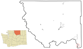
Harrington is a city in Lincoln County, Washington, United States. The population was 424 at the 2010 census. It was named after W.P. Harrington, a banker from Colusa, California, who had heavily invested in local land.

<span class="mw-page-title-main">Sprague, Washington</span> City in Washington, United States

Sprague is a small city in Lincoln County, Washington, United States. The population was 446 at the 2010 census. The city was platted in 1880 and named for former American Civil War Union general John Wilson Sprague.

<span class="mw-page-title-main">Elmer City, Washington</span> Town in Washington, United States

Elmer City is a town in Okanogan County, Washington, United States. The population was 238 at the 2010 census.

<span class="mw-page-title-main">College Place, Washington</span> City in Washington, United States

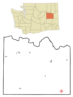
College Place is a town in Walla Walla County, Washington, United States. It neighbors the larger city of Walla Walla, and had a population of 9,902 at the 2020 census.

<span class="mw-page-title-main">Prescott, Wisconsin</span> City in Wisconsin, United States

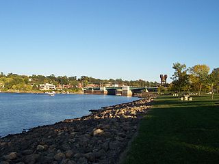
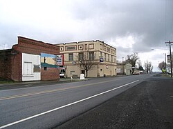
Prescott is a city in Pierce County, Wisconsin at the confluence of the St. Croix River and Mississippi River. The population was 4,258 at the 2010 census, making it the second-largest city in the county after River Falls, and the largest entirely within Pierce County.

References

  1. "2019 U.S. Gazetteer Files". United States Census Bureau. Retrieved August 7, 2020.
  2. 1 2 "U.S. Census website". United States Census Bureau . Retrieved 2012-12-19.
  3. 1 2 "Annual Estimates of the Resident Population for Incorporated Places in Washington: April 1, 2010 to July 1, 2019". United States Census Bureau. May 2020. Retrieved May 27, 2020.
  4. "US Board on Geographic Names". United States Geological Survey. 2007-10-25. Retrieved 2008-01-31.
  5. "Post Offices". Jim Forte Postal History. Retrieved 22 August 2016.
  6. Meany, Edmond S. (1923). Origin of Washington geographic names. Seattle: University of Washington Press. p. 230.
  7. "US Gazetteer files: 2010, 2000, and 1990". United States Census Bureau. 2011-02-12. Retrieved 2011-04-23.
  8. "US Gazetteer files 2010". United States Census Bureau. Archived from the original on 2012-01-25. Retrieved 2012-12-19.
  9. Climate Summary for Prescott, Washington
  10. United States Census Bureau. "Census of Population and Housing" . Retrieved July 21, 2014.
  11. "Population Estimates". United States Census Bureau. Archived from the original on October 19, 2016. Retrieved June 29, 2016.